
Capitol Hill is a neighborhood in Washington, D.C., located in both Northeast D.C. and Southeast D.C.. Dominated by the United States Capitol, which sits on the highest point of Capitol Hill, it is one of the oldest historic districts in Washington. Home to around 35,000 people in just under 2 square miles (5 km2), Capitol Hill is also one of the most densely populated neighborhoods. The name "Capitol Hill" is frequently used as a metonym for the U.S. Congress.

Tenleytown is a historic neighborhood in Northwest, Washington, D.C.

Mount Pleasant is a neighborhood in Washington, D.C., located in Northwest D.C. The neighborhood is primarily residential, with restaurants and stores centered along a commercial corridor on Mt. Pleasant Street. Mount Pleasant is known for its unique identity and multicultural landscape, home to diverse groups such as the punk rock, the Peace Corps and Hispanic Washingtonian communities.

Northwest is the northwestern quadrant of Washington, D.C., the capital of the United States, and is located north of the National Mall and west of North Capitol Street. It is the largest of the four quadrants of the city, and it includes the central business district, the Federal Triangle, and the museums along the northern side of the National Mall, as well as many of the District's historic neighborhoods.

Shepherd Park is a neighborhood in the northwest quadrant of Washington, D.C. In the years following World War II, restrictive covenants which had prevented Jews and African Americans from purchasing homes in the neighborhood were no longer enforced, and the neighborhood became largely Jewish and African American. Over the past 40 years, the Jewish population of the neighborhood has declined but the neighborhood has continued to support a thriving upper and middle class African American community. The Shepherd Park Citizens Association and Neighbors Inc. led efforts to stem white flight from the neighborhood in the 1960s and 1970s, and it has remained a continuously integrated neighborhood, with very active and inclusive civic groups.

Chevy Chase is a neighborhood in northwest Washington, D.C. It borders Chevy Chase, Maryland.
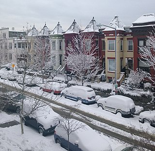
Bloomingdale is a neighborhood in the Northwest quadrant of Washington, D.C., less than two miles (3 km) north of the United States Capitol building. It is a primarily residential neighborhood, with a small commercial center near the intersection of Rhode Island Avenue and First Street NW featuring bars, restaurants, and food markets.

Massachusetts Avenue is a major diagonal transverse road in Washington, D.C., and the Massachusetts Avenue Historic District is a historic district that includes part of it.

Petworth is a neighborhood of Washington, D.C., located in Northwest D.C. While largely residential, Petworth is home to a notable commercial corridor of shops and restaurants, primarily along Georgia Avenue and Upshur Street, as well as a portion of 14th Street. The neighborhood is accessible via the Georgia Ave–Petworth station on the Green Line of the Washington Metro.

Brightwood is a neighborhood in the northwestern quadrant of Washington, D.C. Brightwood is part of Ward 4.
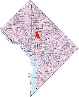
Pleasant Plains is a neighborhood in central Washington, D.C. largely occupied by Howard University. For this reason it is also sometimes referred to as Howard Town or, less frequently, Howard Village.
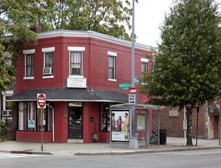
Park View is a neighborhood in Washington, D.C., located in Northwest D.C. The neighborhood is primarily residential with its main commercial corridor of shops and restauarants located along Georgia Avenue.
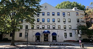
Woodley Park is a neighborhood in Washington, D.C., located in Northwest D.C. Primarily residential, Woodley Park hosts a commercial corridor of restaurants and shops located along Connecticut Avenue. The neighborhood is noted as the home of the National Zoological Park, part of the Smithsonian Institution.

Charles M. Goodman was an American architect who made a name for his modern designs in suburban Washington, D.C., after World War II. While his work has a regional feel, he ignored the colonial revival look so popular in Virginia. Goodman was quoted in the 1968 survey book Architecture in Virginia as saying that he aimed to "get away from straight historical reproduction."
Carole Highlands is an unincorporated community in Prince George's County, Maryland, United States. It is contained between East West Highway to the south, University Boulevard to the north, Larch Avenue, Hopewell Avenue, and 15th Avenue to the west, and Riggs Road to the east. Carole Highlands borders the adjacent neighborhoods of Chillum, Green Meadows, Lewisdale, and Langley Park in Prince George's County, while bordering the city of Takoma Park in Montgomery County. For statistical purposes, it is part of the Langley Park census-designated place (CDP). The community also has a community association and non-profit: Carole Highlands Neighborhood Association

Woodland Normanstone is a small, residential neighborhood in Northwest Washington, D.C., adjoining the larger neighborhoods of Woodley Park, Massachusetts Avenue Heights, and Observatory Circle.

Sixteenth Street Heights is a large neighborhood of rowhouses, duplexes, and American Craftsman and American Foursquare detached houses in Northwest Washington, D.C.

The Kalorama Triangle Historic District is a mostly residential neighborhood and a historic district in the northwest quadrant of Washington, D.C. The entire Kalorama Triangle neighborhood was listed on the District of Columbia Inventory of Historic Sites (DCIHS) and National Register of Historic Places (NRHP) in 1987. In addition to individually listed landmarks in the neighborhood, the district is home to roughly 350 contributing properties. The neighborhood is roughly bounded by Connecticut Avenue to the west, Columbia Road to the east, and Calvert Street on the north.
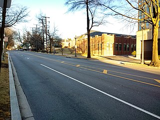
Western Avenue is one of three boundary streets between Washington, D.C., and the state of Maryland. It follows a southwest-to-northeast line, beginning at Westmoreland Circle in the south and ending at Oregon Avenue NW in the north. It is roughly 3.5 miles (5.6 km) in length. First proposed in 1893, it was constructed somewhat fitfully from about 1900 to 1931.

Forest Glen Park is an unincorporated community in Montgomery County, Maryland, United States, and a residential neighborhood within the Silver Spring census-designated place. The community is adjacent to Rock Creek, Rock Creek Regional Park, and to the United States Army's Forest Glen Annex.


