
Congress Heights is an island-platformed Washington Metro station in the Congress Heights neighborhood of Washington, D.C., United States. The station was opened on January 13, 2001, and is operated by the Washington Metropolitan Area Transit Authority (WMATA). Providing service for only the Green Line, the station is located at Alabama Avenue and 13th Street, lying under St. Elizabeths Hospital. Congress Heights is the last Green Line station in the District of Columbia going southeast.

Southeast is the southeastern quadrant of Washington, D.C., the capital of the United States, and is located south of East Capitol Street and east of South Capitol Street. It includes the Capitol Hill and Anacostia neighborhoods, the Navy Yard, the Joint Base Anacostia-Bolling (JBAB), the U.S. Marine Barracks, the Anacostia River waterfront, Eastern Market, the remains of several Civil War-era forts, historic St. Elizabeths Hospital, RFK Stadium, Nationals Park, and the Congressional Cemetery. It also contains a landmark known as "The Big Chair," located on Martin Luther King Jr. Avenue. The quadrant is split by the Anacostia River, with the portion that is west of the river sometimes referred to as "Near Southeast". Geographically, it is the second-smallest quadrant of the city.
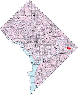
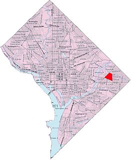
Northeast is the northeastern quadrant of Washington, D.C., the capital of the United States. It encompasses the area located north of East Capitol Street and east of North Capitol Street.

Deanwood is a neighborhood in Northeast Washington, D.C., bounded by Eastern Avenue to the northeast, Kenilworth Avenue to the northwest, Division Avenue to the southeast, and Nannie Helen Burroughs Avenue to the south.

Woodridge is a residential neighborhood located in Ward 5 of Northeast Washington, D.C.. Woodridge is contained between Eastern Avenue N.E. to the east, Taylor Street N.E. to the north, South Dakota Avenue N.E. to the west, and Bladensburg Road N.E. to the south. Its central commercial strips are Rhode Island Avenue NE and Bladensburg Road N.E. Woodridge borders the adjacent neighborhoods of Brookland, Langdon, North Michigan Park, and Fort Lincoln in Northeast Washington D.C. In addition to these neighborhoods in the District of Columbia, Woodridge also borders the city of Mount Rainier and town of Cottage City in Maryland. In terms of public transportation, residents of Woodridge have access to the Brookland-CUA and Rhode Island Avenue Metro stations.
Park View is a neighborhood in central Washington, D.C., immediately north of Howard University.

University Heights is a neighborhood adjacent to The Catholic University of America in Ward 5 of Northeast Washington, D.C. in the Upper Northeast area element. It is located east of the University and west of the Franciscan Monastery, bounded by the tracks for the Red Line of the Washington Metro to the west; 14th Street NE to the east; Taylor Street to the north; and Otis Street to the south. University Heights is in DC Neighborhood Cluster 20 along with the Michigan Park and North Michigan Park neighborhoods.
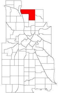
Columbia Park is a neighborhood in the Northeast community in Minneapolis.
Benning Heights is a residential neighborhood located in northeast Washington, D.C. It is bounded by East Capitol Street to the south, Brooks Street NE to the north, 44th Street NE and Benning Road NE to the west, and Division Avenue NE to the east. It is served by the Benning Road Metro Rail station on the Blue Line and Silver Line of the Washington Metro.

Capitol View is a neighborhood located in southeast Washington, D.C., in the United States. It is bounded by East Capitol Street to the north, Central Avenue SE to the southwest and south, and Southern Avenue SE to the southeast. Still overwhelmingly African-American, it is a thriving middle class neighborhood. Parts of the neighborhood became one of the city's most violent and drug-ridden areas in the 1980s and 1990s. The Capitol View neighborhood has seen several large, poorly maintained public housing projects demolished in the 2010s. The government of the District of Columbia partnered with private real estate developers to construct the Capitol Gateway mixed-use development between 2000 and 2010.

Shipley Terrace, formerly known as Randle Heights, is a large residential neighborhood in Southeast Washington, D.C., bordering Prince George's County, Maryland. The neighborhood, named after a former public housing complex in the neighborhood, which was largely occupied by low-income housing – primarily walkup and garden unit apartments. This neighborhood now has a mix of townhome communities, large single-family-home communities, as well as some low-income housing. It is a model neighborhood for the Hope VI revitalization Grant Program.

Northeast Boundary is small neighborhood located in the northeast quadrant of Washington, D.C., in the United States. Along with the Capitol View neighborhood, it is the easternmost neighborhood of the District of Columbia.
Central Northeast, also sometimes called Mahaning Heights, is a small neighborhood located in Northeast Washington, D.C. with Fort Mahan Park at its center. It is bounded by Nannie Helen Burroughs Avenue to the north, Benning Road to the south, the tracks of the Washington Metro and Minnesota Ave station to the west, and 44th Street NE to the east.

Hillbrook is a neighborhood in Northeast Washington, D.C. It is bounded by Nannie Helen Burroughs Avenue to the north, Brooks Street to the south, 44th Street NE to the west, and Division Avenue to the east.

Kenilworth is a residential neighborhood in Northeast Washington, D.C., located on the eastern bank of the Anacostia River and just inside the D.C.-Maryland border. A large public housing complex, Kenilworth Courts, dominates the area. The neighborhood is famous for the Kenilworth Park and Aquatic Gardens, a national park whose centerpiece is a series of ponds carved out of Anacostia River marshland. Visitors come especially during June and July to see the beautiful blooming water lilies and lotus flowers. In 1895 the name “Kenilworth” was first applied to the area by white real estate developer Allen Mallery, who named this neighborhood after Kenilworth Castle in England, the ruins of which can still be seen today in Warwickshire. Kenilworth Park, which includes the Kenilworth-Parkside Recreation Center, also carries the neighborhood name, though most of the park's area is actually located adjacent to the modern neighborhoods of Parkside and Eastland Gardens.

Mayfair or Parkside-Mayfair is a residential neighborhood in Northeast Washington, D.C., United States., on the eastern bank of the Anacostia River. It is bounded by Jay Street NE on the north, Foote Street on the south, Kenilworth Terrace and Anacostia Avenue on the west, and Kenilworth Avenue on the east. Mayfair is encircled by Jay Street and Hayes St., which met at the back of the neighborhood.

Sheridan is a neighborhood in the Northeast community in Minneapolis, Minnesota.

Lincoln Park is a neighborhood and public park close to downtown Denver, Colorado and the location of the Art District on Santa Fe. The neighborhood is one of Denver's oldest and is just to the south of the area where Denver was first settled in the 1850s. Many houses date from about 1900. The neighborhood is sometimes called "La Alma/Lincoln Park" or the West Side.

Douglass is a residential neighborhood in Southeast Washington, D.C., on the eastern side of St. Elizabeths Hospital, on the border of the Congress Heights Metro Station. It is bounded by Suitland Parkway to the north and east, Alabama Avenue to the south, and the St. Elizabeths campus to the west.

Lincoln, Nebraska has many neighborhoods, including 45 recognized by Urban Development, City of Lincoln. A list and description of neighborhoods within Lincoln city limits follows.


