Southwest Waterfront

Last updated
Southwest Waterfront
DC Neighborhoods - Southwest Waterfront.svg
Map of Washington, D.C., with Southwest Waterfront highlighted in maroon.
Country United States
District Washington, D.C.
WardWard 6
Government
  Councilmember Charles Allen

The Southwest Waterfront is a neighborhood in Southwest Washington, D.C. The Southwest quadrant is the smallest of Washington's four quadrants, and the Southwest Waterfront is one of only two residential neighborhoods in the quadrant; the other is Bellevue, which, being east of the Anacostia River, is frequently, if mistakenly, regarded as being in Southeast.

Contents

Southwest Waterfront is bounded by Interstate 395 to the north, Washington Channel to the west, the Anacostia River to the south, and South Capitol Street to the east. [1] Politically, Southwest Waterfront lies in Ward 6.

History

The Thomas Law House built in 1796 Thomas Law House.jpg
The Thomas Law House built in 1796

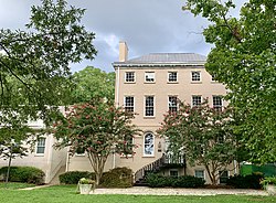
Southwest Waterfront is part of Pierre L'Enfant's original city plans. It includes some of the oldest buildings in the city, including the Wheat Row block of townhouses, built in 1793, the Thomas Law House, built in 1796, and Fort McNair, which was established in 1791 as "the U.S. Arsenal at Greenleaf Point."

Before the federal government's survey and appropriation of the District of Columbia, most of what is now Southwest Waterfront was part of a large slave plantation owned by Notley Young. After the city was established, much of the former Young plantation was purchased by a Bostonian venture capitalist named James Greenleaf, who received a discount on sixty thousand real estate lots in exchange for a promise to build ten new houses on them per year. Greenleaf, however, had not secured the financial backing he had claimed and was unable to finance the promised construction.[ citation needed ] (He declared bankruptcy in 1797.[ citation needed ]) As a result, except for a few scattered buildings such as Thomas Law's (a land speculator who was able to put down pounds sterling) and workers' shanties, settlement of the Southwest Waterfront was extremely slow.[ citation needed ] Despite his crippling of the region's growth, Greenleaf's name was eventually given to the section of land along the bank of the river on which the Arsenal stood.[ citation needed ]

Law himself was the other prominent figure in defining the early character of the Southwest Waterfront. He built its first industrial outpost, a sugar refinery, in 1797. He also initiated the construction in 1802 of the Washington City Canal, which connected Tiber Creek, at the western foot of the National Mall, with the Anacostia River then called the "Eastern Branch"just east of the Arsenal. The canal opened in 1815 but was too shallow and subject to unstable tides to be useful as the industrial pipeline Law had hoped for; instead, it quickly filled with trash and stagnant water, isolating the Southwest from the rest of the city.[ citation needed ]

As a result of Law's canal, the Southwest Waterfront neighborhood was known as The Island. It was further cut off from the city when railroad tracks were built along Maryland Avenue SW. It was known primarily for its brothels, its crime, and its filthy, decrepit alley slums, and was regarded as among the worst neighborhoods in Washington.[ citation needed ]

After the Civil War, with the Canal covered, the Southwest Waterfront became more organized. However, it remained a neighborhood for the poorer classes of Washingtonians. The neighborhood was divided in half by Fourth Street SWthen known as 412 Street with Scottish, Irish, German, and eastern European immigrants to the west and Blacks to the east. Each half was centered on religious establishments: St. Dominic's Catholic Church and Temple Beth Israel on the west and Friendship Baptist Church on the east. Each half of the neighborhood was the childhood residence of a future American musical star; Al Jolson lived on 412 Street and Marvin Gaye was born in a tenement on First Street.)

The Waterfront developed a thriving commercial district with grocery stores, shops, a movie theater, as well as a few large and elaborate housesmostly owned by wealthy blacks but most of the neighborhood was a very poor shantytown of tenements, shacks, and even tents. The latter were frequent subjects of photographs published with captions like, "The Washington that tourists never see."[ citation needed ]

It was also a major traffic hub from Virginia. The Long Bridge connected horse, stagecoach, and foot traffic from Alexandria, VA to Maryland Avenue SW before becoming a railway bridge during the American Civil War. [2] [3] It was also the access point to the Capital for steamboat lines. The following lines operated from there in 1903: the Washington & Potomac Steamboat Company, the Maryland, Delaware & Virginia B.Y. Company and the Norfolk & Washington Steamboat Company . [4]

Urban renewal

Shulman's Market (ca. 1942), one of many Jewish-owned businesses that once operated in Southwest Waterfront. This was a DGS Store. Shulman's Market - Washington, D.C..jpg
Shulman's Market (ca. 1942), one of many Jewish-owned businesses that once operated in Southwest Waterfront. This was a DGS Store.

In the 1950s, city planners working with the Congress decided that the entire Southwest quadrant should undergo significant urban renewal — in this case, the city would acquire nearly all land south of the National Mall (except Bolling Air Force Base and Fort McNair), either through voluntary purchases or through the use of eminent domain, evict virtually all of its residents and businesses, destroy many of its streets and all of its buildings and landscapes, and start again from scratch.

There was some opposition to the plan, notably from the Southwest Civic Association, because of its emphasis on building luxury housing rather than supplying low and moderate-income dwellings to replace the homes slated for demolition. John Ihlder, the director of the Alley Dwelling Authority, also spoke out about the plan's failure to provide enough affordable and public housing. However, the redevelopment plans, which had been crafted by architects Louis Justement and Chloethiel Woodward Smith and included modernist buildings, ample green spaces, and plenty of parking, were popular among many city residents and officials, and their appeal eventually won out. Only a few buildings were left intact, notably the Maine Avenue Fish Market, the Wheat Row townhouses, the Thomas Law House, and the St. Dominic's and Friendship churches. The Southeast/Southwest Freeway section of Interstate 395 was constructed where F Street, SW, separated the quadrant's business district from the residential Waterfront neighborhood.

The heart of the urban renewal of the Southwest Waterfront was Waterside Mall, a small shopping center/office complex mostly occupied by a Safeway grocery store and satellite offices for the United States Environmental Protection Agency. [6] The Arena Stage was built a block west of the Mall, and a number of hotels and restaurants were built on the riverfront to attract tourists. The now closed Southeastern University, a very small college that had been chartered in 1937, also established itself as an important institution in the area. [7] The residential aspect of the project began with a large apartment complex and park called Potomac Place, located on 4th Street between G and I Streets. When Nikita Khrushchev visited Washington in 1959, he pointed out to President Dwight D. Eisenhower the substandard dwellings that stood on the way from Bolling Air Force Base (where Khrushchev had arrived in the city) to the downtown area; Eisenhower, in response, ordered their driver to pass by Potomac Place to show the Soviet Premier that the nation's capital was working to assist its more impoverished citizens.

Present day

Titanic Memorial located beside the Washington Channel in Southwest Waterfront Titanic Memorial (Washington, D.C.).jpg
Titanic Memorial located beside the Washington Channel in Southwest Waterfront

Due to its history of urban redevelopment, most of the Southwest Waterfront neighborhood is composed of large cooperatives or condominiums, often containing both townhouses and apartment buildings. Most of the building projects are examples of Modern Architecture.

The fire pit at the Wharf Wharf fire pit at dusk.jpg
The fire pit at the Wharf

Constructed in 1962, River Park contains townhouses and a glass and aluminum high-rise building that architect Charles Goodman designed. [8] Constructed in 1965 in a pinwheel shape with a large courtyard and with town houses in its quadrants, Tiber Island, which architects Keyes, Lethbridge and Condon designed, received the American Institute of Architects award for Multi-Family Residential design in 1966. [9] Carrollsburg [10] was completed in 1967 and developed as a companion piece to Tiber Island by the same architects.

In 1968, the Titanic Memorial was moved to the Washington Channel, near Fort McNair in Southwest Waterfront. [11]

The Washington Metro built the Waterfront Metro station on its Green Line and opened it in 1991. [12]

The District of Columbia Public Library operates a branch library in the neighborhood. The Southwest Neighborhood Library, currently under construction, has an expected completion date in late 2020 and will cost approximately $18 million for the 21,000 sq ft structure. [13] The new Southwest Library will include an outdoor reading porch and an Innovation Lab with 3D printers [14]

Redevelopment

Construction of The Wharf in 2015 The Wharf construction 2015.jpg
Construction of The Wharf in 2015
The marina at the Wharf Wharf Marina.jpg
The marina at the Wharf

Starting around 2003, the Southwest Waterfront began gentrifying. A number of the neighborhood's apartment buildings began extensive renovations and condominium conversions. Residential and commercial developers started to take a more serious interest in Southwest. In 2004, the city announced that it would build the new Washington Nationals baseball stadium just across South Capitol Street from Southwest.

The Southwest Waterfront has been targeted as a site for the next wave of DC redevelopment. Large development projects include a mixed retail-commercial-residential development at Fourth & M Streets SW (Waterfront Station); the expansion and redesign of Arena Stage; and the redesign and overhaul of the waterfront itself, to include residences, office space, hotels, and retail establishments. [15]

On March 19, 2014, developers PN Hoffman and Madison Marquette broke ground on a massive redevelopment of D.C.’s Southwest Waterfront into a mixed-use complex named "The Wharf". [16] Stretching across 24 acres of land and more than 50 acres of water from the Municipal Fish Market to Fort McNair, The Wharf, when complete, will feature more than 3 million square feet of residential, office, hotel, retail, cultural, and public uses including waterfront parks, promenades, piers and docks. The first phase of the redevelopment project opened with a four-day series of public events during October 2017. [17]

In April 2017, the National Capital Planning Commission (NCPC) approved plans for a staircase and bicycle paths through Benjamin Banneker Park to connect the Mall and L'Enfant Plaza to the Southwest Waterfront. [18] In addition, the project would add lighting and trees to the area. [18] The NCPC and the National Park Service intended the project to be an interim improvement that could be in place for ten years while the area awaited further redevelopment. [18] Hoffman-Madison Waterfront and the District of Columbia government agreed to invest $4 million in the project in an effort to improve neighborhood connectivity in the area. [19] Construction began on the project in September 2017 and was completed during the spring of 2018. [19]

Notable residents

Current and former residents of Southwest D.C. include the late House Representative John Conyers and former Police Chief Charles H. Ramsey [ citation needed ]. Hubert Humphrey lived there while serving as U.S. Vice President, and Thurgood Marshall, Lewis Powell, and David Souter all had homes in Southwest during their tenures on the United States Supreme Court.

See also

Notes

  1. Southwest Business Improvement District (SWBID). "SWBID-Southwest Business Improvement District". Swbid.org. Retrieved 2022-05-18.{{cite web}}: |author= has generic name (help)
  2. An Act authorizing the erection of a bridge over the river Potomac within the District of Columbia - 10th Congress Session I - Chapter 15 - 1808.
  3. National Railway Historical Society - Washington DC Chapter - History of the Long Railroad Bridge Crossing Across the Potomac River by Robert Cohen - http://www.dcnrhs.org/learn/washington-d-c-railroad-history/history-of-the-long-bridge
  4. Baist's real estate atlas of surveys of Washington, District of Columbia - 1903 - Volume 2 - Plate 4
  5. "Capital Jewish Museum". Jhsgw.org. Retrieved 2022-05-18.
  6. Elkins, Chuck (October 2013). "Transcript of "Behind the Scenes at the Creation of the EPA" Video" (PDF). EPA Alumni Association. Retrieved August 20, 2018.
  7. "Southeastern University – At a Glance". College Board . Retrieved May 22, 2007.
  8. (1) "River Park". DC Historic Sites. DC Preservation League. 2018. Archived from the original on January 5, 2018. Retrieved January 5, 2018.
    (2) "River Park". River Park Mutual Homes, Inc. Archived from the original on January 5, 2018. Retrieved January 5, 2018.
  9. (1) Sefton, D.P. (September 2011). "Tiber Island" (PDF). National Park Service: National Register of Historic Places Registration Form. District of Columbia (DC.com) Office of Planning. Archived from the original (PDF) on January 31, 2017. Retrieved January 5, 2018.
    (2) "Tiber Island Cooperative Homes". Archived from the original on March 19, 2012.
  10. "Carrolsburg: A Condominium" . Retrieved January 5, 2018.
  11. "Women's Titanic Memorial". Great Lakes Titanic Society. Retrieved 2014-12-17.
  12. Tousignant, Marylou (December 29, 1991), "After feuds, amid fanfare, Metro rolls into Anacostia", The Washington Post, page B1
  13. Goldchain, Michelle (2018-03-05). "New rendering revealed for Southwest D.C.'s new library - Curbed DC". Dc.curbed.com. Retrieved 2022-05-18.
  14. "New library under construction in Southwest DC". wusa9.com. Retrieved 2022-05-18.
  15. (1) "Project Overview". Waterfront Station. Archived from the original on January 4, 2018. Retrieved January 4, 2018.
    (2) Zongker, Brett (Associated Press) (October 28, 2010). "DC's Arena Stage opens $135M home with big plans". Boston.com . Archived from the original on January 4, 2018. Retrieved January 4, 2018.
    (3) "The Southwest Waterfront — Washington, D.C." Hoffman; Marquette. 2008. Archived from the original on July 2, 2008.
  16. (1) "About District Wharf". District Wharf. PN Hoffman; Madison Marquette. 2018. Archived from the original on January 4, 2018. Retrieved January 4, 2018.
    (2) Freed, Benjamin (March 19, 2014). "The Wharf Breaks Ground in DC's Southwest Waterfront: The first phase of the $2 billion project will include hundreds of new residences, shops and restaurants, and a massive concert venue". Washingtonian . Washingtonian Media Inc. Archived from the original on January 4, 2018. Retrieved January 4, 2017.
  17. (1) Sadon, Rachel (October 2, 2017). "The Wharf's Grand Opening Involves Four Days Of Events, And Kevin Bacon Is Involved". DCist. Gothamist, LLC. Archived from the original on January 4, 2018. Retrieved January 4, 2018.
    (2) Iannelli, Nick (October 12, 2017). "The Wharf opens along DC's Southwest waterfront". WTOP . Archived from the original on January 4, 2018. Retrieved January 4, 2018.
  18. 1 2 3 (1) "Environmental Assessment: Benjamin Banneker Park Connection" (PDF). National Mall and Memorial Parks . Washington, D.C.: National Park Service. March 2016. Archived from the original (PDF) on November 16, 2017. Retrieved November 16, 2017.
    (2) Koster, Julia; Staudigl, Stephen (April 6, 2017). "NCPC Approves Banneker Park Pedestrian and Cyclist Access Improvements" (PDF). Media Release. Washington, D.C.: National Capital Planning Commission. Archived from the original (PDF) on November 13, 2017. Retrieved November 13, 2017.
    (3) "Banneker Park Pedestrian Access Improvements" (PDF). Executive Director's Recommendation: Commission Meeting: April 6, 2017 (NCPC File No. 7551). Washington, D.C.: National Capital Planning Commission. Archived from the original (PDF) on November 13, 2017. Retrieved November 13, 2017.
    (4) Voigt, Eliza. "Benjamin Banneker Park Pedestrian Access Improvements". National Mall and Memorial Parks . Washington, D.C.: National Park Service. Archived from the original on November 13, 2017. Retrieved November 13, 2017.
  19. 1 2 (1) "Construction on Benjamin Banneker Park Pedestrian and Bike Access Project begins ahead of The Wharf's October 12 Launch". Washington, D.C.: Office of the Deputy Mayor for Planning and Economic Development: Government of the District of Columbia (DC.gov). 2017-09-08. Archived from the original on November 13, 2017. Retrieved November 11, 2017.
    (2) Staudigl, Stephen (May 8, 2018). "Banneker Park Connection Helps NCPC Plans Come to Life". News Story. National Capital Planning Commission . Retrieved May 25, 2018. Archived 2018-05-25 at the Wayback Machine

Further reading

38°52′52″N77°00′59″W / 38.8812°N 77.0164°W / 38.8812; -77.0164

Related Research Articles

<span class="mw-page-title-main">Anacostia</span> Neighborhood in Washington, D.C.

Anacostia is a historic neighborhood in Southeast Washington, D.C. Its downtown is located at the intersection of Good Hope Road and Martin Luther King Jr. Avenue. It is located east of the Anacostia River, after which the neighborhood is named.

<span class="mw-page-title-main">Southwest (Washington, D.C.)</span> Southwestern quadrant of Washington, D.C.

Southwest is the southwestern quadrant of Washington, D.C., the capital of the United States, and is located south of the National Mall and west of South Capitol Street. It is the smallest quadrant of the city, and contains a small number of named neighborhoods and districts, including Bellevue, Southwest Federal Center, the Southwest Waterfront, Buzzard Point, and the military installation known as Joint Base Anacostia–Bolling.

<span class="mw-page-title-main">Northwest (Washington, D.C.)</span> Quadrant in the United States

Northwest is the northwestern quadrant of Washington, D.C., the capital of the United States, and is located north of the National Mall and west of North Capitol Street. It is the largest of the four quadrants of the city, and it includes the central business district, the Federal Triangle, and the museums along the northern side of the National Mall, as well as many of the District's historic neighborhoods.

<span class="mw-page-title-main">L'Enfant Plaza</span> Building complex in Washington, D.C.

L'Enfant Plaza is a complex of four commercial buildings grouped around a large plaza in the Southwest section of Washington, D.C., United States. Immediately below the plaza and the buildings is La Promenade shopping mall.

<span class="mw-page-title-main">Constitution Avenue</span> Street in the city of Washington, D.C.

Constitution Avenue is a major east–west street in the northwest and northeast quadrants of the city of Washington, D.C., in the United States. It was originally known as B Street, and its western section was greatly lengthened and widened between 1925 and 1933. It received its current name on February 26, 1931, though it was almost named Jefferson Avenue in honor of Thomas Jefferson.

<span class="mw-page-title-main">DC Circulator</span> Bus system in Washington, D.C

The DC Circulator is a bus system in Washington, D.C. The District of Columbia Department of Transportation operates the service in a public–private partnership with RATP Dev.

<span class="mw-page-title-main">Maine Avenue Fish Market</span>

The Maine Avenue Fish Market, also known as the Municipal Fish Market, the Fish Wharf, or simply, the Wharf, is an open-air seafood market in Southwest Washington, D.C., a local landmark and one of the few that remain on the east coast of the United States. It is the oldest continuously operating fish market in the United States, founded 17 years earlier than New York City's Fulton Fish Market.

<span class="mw-page-title-main">McMillan Plan</span> 1902 planning report for Washington, D.C.

The McMillan Plan is a comprehensive planning document for the development of the monumental core and the park system of Washington, D.C., the capital of the United States. It was written in 1902 by the Senate Park Commission. The commission is popularly known as the McMillan Commission after its chairman, Senator James McMillan of Michigan.

<span class="mw-page-title-main">National Capital Planning Commission</span>

The National Capital Planning Commission (NCPC) is a U.S. government executive branch agency that provides planning guidance for Washington, D.C., and the surrounding National Capital Region. Through its planning policies and review of development proposals, the Commission seeks to protect and enhance the extraordinary resources of the national capital.

<span class="mw-page-title-main">Navy Yard (Washington, D.C.)</span> Place in the United States

Navy Yard is a neighborhood of Washington, D.C., located in Southeast D.C. Navy Yard, situated along the Anacostia Riverfront south of Capitol Hill, takes its name from Washington Navy Yard, the administrative seat of the U.S. Navy. Historically an industrial area, today Navy Yard is a popular entertainment district, home to Nationals Park, a notable nightlife scene, and numerous waterfront esplanades.

<span class="mw-page-title-main">Francis Case Memorial Bridge</span> Bridge in D.C., U.S.

The Francis Case Memorial Bridge is a steel beam bridge carrying Interstate 395 (I-395) over the Washington Channel in Washington, D.C. It is an eight-lane bridge with a bicycle/pedestrian lane on the inbound side. It has two spans that split into three on the north side of the channel. The bridge is often considered to be part of the "14th Street Bridges," but is also not counted among the five bridges in that group.

<span class="mw-page-title-main">Washington Harbour</span> Mixed-use development at 3000 and 3050 K Street, N.W., Washington, D.C., United States

Washington Harbour is a Class-A mixed-use development located at 3000 and 3050 K Street, N.W., in Washington, D.C., in the United States. The southern edge of the development borders the Potomac River on the Georgetown waterfront. Designed by Arthur Cotton Moore, the complex consists of two curved towers and three other buildings attached to them, all of which are in the Postmodern architectural style. The complex contains luxury condominia, offices, retail space, restaurants, and underground parking.

<span class="mw-page-title-main">Quadrants of Washington, D.C.</span> Geographical quadrant

Washington, D.C., is administratively divided into four geographical quadrants of unequal size, each delineated by their ordinal directions from the medallion located in the Crypt under the Rotunda of the Capitol. Street and number addressing, centered on the Capitol, radiates out into each of the quadrants, producing a number of intersections of identically named cross-streets in each quadrant. Originally, the District of Columbia was a near-perfect square but contained more than one settlement; the Capitol was to be the center of the City of Washington. Thus, the Capitol was never located at the geographic center of the whole territory, which was eventually north of the Potomac River, consolidated into one city. As a result, the quadrants are of greatly varying size. Northwest is quite large, encompassing over a third of the city's geographical area, while Southwest is little more than a few neighborhoods, large parks, and a military base.

<span class="mw-page-title-main">Outline of Washington, D.C.</span> Overview of and topical guide to District of Columbia

The following outline is provided as an overview of and topical guide to District of Columbia:

<span class="mw-page-title-main">Buzzard Point</span> Neighborhood in Washington, D.C., US

Buzzard Point, sometimes known as Greenleaf Point, is a peninsula and neighborhood of Washington, D.C., located in Southwest D.C., at the confluence of the Potomac and Anacostia River.

<span class="mw-page-title-main">Anacostia Waterfront Corporation</span> Defunct government-owned corporation in the United States

The Anacostia Waterfront Corporation (AWC) was a government-owned corporation established in 2004 by the government of District of Columbia, in the United States, to revitalize neighborhoods next to the Anacostia River and to coordinate the environmental rehabilitation and use of the river. The corporation was intended to have a 20-year lifespan, during which it would oversee an $8 billion public-private redevelopment plan covering the Anacostia River waterfront and numerous parcels of land in the city east of the river. However, a change in mayoral administrations and frustration with the slow pace of redevelopment resulted in the abolition of the corporation after three years.

<span class="mw-page-title-main">Anacostia Riverwalk Trail</span> 25 mile multi-use trail system in Washington D.C.

The Anacostia Riverwalk Trail is a multi-use trail system in Washington, DC, which, when complete, will be ~25 miles long, spanning both sides of the Anacostia River, the Washington Channel waterfront, and projecting into neighborhoods away from the Anacostia. It has more recently been branded as part of a larger Anacostia Riverwalk Trail Network which includes an additional 8 segments and 15 miles of trail. On the north end it connects to the Anacostia Tributary Trail System; on the south end it will connect to the Oxon Hill Farm Trail and on the west it connects to the Rock Creek Park Trail and the 14th Street Bridge. Of the 19 planned segments, 14 are complete for a combined total of 16 miles.

A United States postage stamp and the names of a number of recreational and cultural facilities, schools, streets and other facilities and institutions throughout the United States have commemorated Benjamin Banneker's documented and mythical accomplishments throughout the years since he lived (1731–1806). Among such memorializations of this free African American almanac author, surveyor, landowner and farmer who had knowledge of mathematics, astronomy and natural history was a biographical verse that Rita Dove, a future Poet Laureate of the United States, wrote in 1983 while on the faculty of Arizona State University.

Hoffman & Associates is a privately-held real estate development company based in Washington D.C. most known for mixed-use and urban developments. The company has completed approximately seventy developments in the Washington D.C. area, including The Wharf development on D.C.'s Southwest Waterfront. The company's headquarters are in Washington D.C., with a second office in Raleigh, North Carolina.

<span class="mw-page-title-main">The Wharf (Washington, D.C.)</span> Mixed-use development in Washington, D.C.

The District Wharf, commonly known simply as The Wharf, is a multi-billion dollar mixed-use development on the Southwest Waterfront in Washington, D.C. It contains the city's historic Maine Avenue Fish Market, hotels, residential buildings, restaurants, shops, parks, piers, docks and marinas, and live music venues. The first phase of The Wharf opened in October 2017 and the second and final phase was completed in October 2022. The neighborhood encompasses 24 acres of land, 50 acres of water, and contain 3.2 million square feet (300,000 m2) of retail, residential, and entertainment space along 1 mile (1.6 km) of the Potomac River shoreline from the Francis Case Memorial Bridge to Fort McNair.