Mount Rainier is a city in Prince George's County, Maryland, United States, bordering Washington D.C. The population was 8,333 at the 2020 census. Mount Rainier is contained between the Northwest Branch Anacostia River, Cedar Lane Alley, and 34th Street to the north, 37th Street and 37th Place to the northeast, Upshur Street and Queens Chapel Road to the west, the CSX Capital Subdivision train tracks to the east, and Eastern Avenue NE to the south. Mount Rainier got its start as a streetcar suburb, when tracks were laid for the 82 Streetcar Line. According to local tradition, surveyors from the Pacific Northwest named the town, giving the streets names such as Shasta and Cascade. Historic U.S. 1 runs through the center of the town and serves as the main street and central business district.

Northeast is the northeastern quadrant of Washington, D.C., the capital of the United States. It encompasses the area located north of East Capitol Street and east of North Capitol Street.

Brookland, also known as Little Rome or Little Vatican, is a neighborhood located in the Northeast (NE) quadrant of Washington, D.C. It is best known for its numerous Catholic institutions, including schools, religious communities, shrines, institutes, and other organizations built and based around the Catholic University of America.

Chevy Chase is a neighborhood in northwest Washington, D.C. It borders Chevy Chase, Maryland, a collection of similarly affluent neighborhoods.
Trinidad is a neighborhood located in Ward 5, in the northeast quadrant of Washington, D.C., and is a largely residential area.

New York Avenue is a diagonal avenue radiating northeast from the White House in Washington, D.C. to the border with Maryland. It is a major east–west route in the city's Northwest and Northeast quadrants and connects downtown with points east and north of the city via Cheverly, Maryland, the John Hanson Highway, the Baltimore–Washington Parkway, and eventually, Interstate 95.

Takoma, Washington, D.C., is a neighborhood in Washington, D.C. It is located in Advisory Neighborhood Commission 4B, in the District's Fourth Ward, within the northwest quadrant. It borders the city of Takoma Park, Maryland.

Rhode Island Avenue is a diagonal avenue in the Northwest and Northeast quadrants of Washington, D.C., and the capital's inner suburbs in Prince George's County, Maryland. Paralleling New York Avenue, Rhode Island Avenue was one of the original streets in Pierre L'Enfant's plan for the capital. It became a major commuter route, carrying U.S. Route 1 traffic into the city from Prince George's County.

Petworth is a residential neighborhood in the Northwest quadrant of Washington, D.C. It is bounded to the east by the Armed Forces Retirement Home and Rock Creek Cemetery, to the west by Arkansas Avenue NW, to the south by Rock Creek Church Road NW and Spring Road NW, and to the north by Kennedy Street NW.

Florida Avenue is a major street in Washington, D.C. It was originally named Boundary Street, because it formed the northern boundary of the Federal City under the 1791 L'Enfant Plan. With the growth of the city beyond its original borders, Boundary Street was renamed Florida Avenue in 1890.

There are two north–south arteries in Washington, D.C. named 7th Street that are differentiated by the quadrants of the city in which they are located.

Queens Chapel is a mostly residential neighborhood with commercial elements located in Ward 5 of Northeast Washington, D.C.

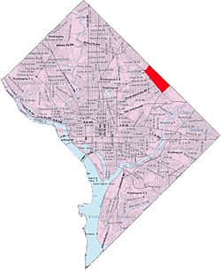
North Michigan Park is a neighborhood located in Ward 5 of Northeast Washington, D.C. North Michigan Park is contained between Eastern Avenue N.E. to the east, Gallatin Street N.E. to the north, Michigan Avenue N.E. to the south, and South Dakota Avenue N.E. to the west. North Michigan Park borders the neighborhoods of Michigan Park, Queens Chapel, and Woodridge, which also are located in Ward 5 of Northeast Washington D.C. In addition to these neighborhoods in Ward 5 of Northeast Washington D.C., North Michigan Park also borders the adjacent neighborhoods of Avondale and Chillum, which are both located in Prince George's County, Maryland. North Michigan Park neighborhood is often confused with the North Michigan Park Civic Association which has boundaries that include both North Michigan Park and Michigan Park. North Michigan Park and Michigan Park neighborhoods have been historically designated as separate neighborhoods due to the fact that they were segregated by race. North Michigan Park was the less desirable neighborhood where African-Americans lived while Michigan Park was a much more desirable neighborhood where the neighborhood where their white counterparts lived. Both neighborhoods are separated from each other by South Dakota Avenue N.E. The Washington Metropolitan Area Green Line train tracks pass through the North Michigan Park neighborhood, notably, through a tunnel when traveling between the West Hyattsville and Fort Totten Metro Stations. The Washington Metropolitan Area Green Line train tracks initially are above ground when traveling between the West Hyattsville Metro Station and a certain portion of the neighborhood of Avondale. The Washington Metropolitan Area Green Line tracks then gradually enter a tunnel, which they use throughout the rest of the Avondale neighborhood, a small portion of the Chillum neighborhood, the North Michigan Park neighborhood, and Queens Chapel neighborhood before entering the lower level portion of the Fort Totten Metro Station, located below the Washington Metropolitan Area Red Line train tracks.
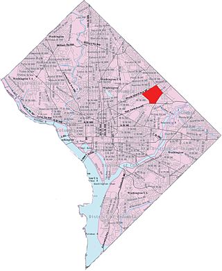
Langdon, is a neighborhood located in Ward 5 of Northeast Washington, D.C. Historical surveys of D.C. recognize Langdon as a neighborhood dating back to at least 1903. Langdon is bounded by Montana Ave. NE to the west/southwest, New York Ave. NE to the south, Bladensburg Rd. NE to the southeast, South Dakota Ave. NE to the northeast, and Rhode Island Ave. NE to the north/northwest. Langdon is adjacent to the Northeast D.C. neighborhoods of Brentwood (west), Woodridge (east), Fort Lincoln (southeast), Gateway (south), and Brookland (north).

Edgewood is a neighborhood located in Ward 5 of Northeast Washington, D.C. Edgewood is bounded by Michigan Avenue NE to the north, Rhode Island Avenue NE to the south, North Capitol Street to the west, and the Washington Metro's Red Line to the east. The eastern boundary originates with the establishment of the former Metropolitan Branch of the Baltimore and Ohio Railroad in 1873, creating the physical barrier which today separates Edgewood from Brookland to the east.

Stronghold is the name of a neighborhood in Ward 5 of Northeast Washington D.C. Stronghold is contained between Michigan Avenue N.E. to the north, North Capitol Street N.W. to the west, and Glenwood Cemetery to both the south and east. Stronghold borders the adjacent neighborhoods of Edgewood, University Heights, and Brookland in Ward 5 of Northeast Washington D.C.

Benning is a residential neighborhood located in Ward 7 of Northeast Washington, D.C. It is bounded by East Capitol Street to the south, Minnesota Avenue to the west, and Benning Road on the north and east. It is served by the Benning Road station on the Blue and Silver Lines of the Washington Metro.
Washington, D.C., is administratively divided into four geographical quadrants of unequal size, each delineated by their ordinal directions from the medallion located in the Crypt under the Rotunda of the Capitol. Street and number addressing, centered on the Capitol, radiates out into each of the quadrants, producing a number of intersections of identically named cross-streets in each quadrant. Originally, the District of Columbia was a near-perfect square. However, even then the Capitol was never located at the geographic center of the territory. As a result, the quadrants are of greatly varying size. Northwest is quite large, encompassing over a third of the city's geographical area, while Southwest is little more than a neighborhood and military base.

The Woodridge Neighborhood Library is a branch of the District of Columbia Public Library in the Woodridge neighborhood of Washington, D.C. It is located at 1801 Hamlin Street NE. A small sub-branch library at 2206 Rhode Island Ave NE served the neighborhood starting in 1929, and a full-fledged library branch opened at the current site in 1958. It was replaced in 2016 by a new, 20,000-square-foot library built at a cost of $16.5 million, after nearly three years of construction. The new building was designed by Wiencek & Associates and Bing Thom Architects.