Civil War Defenses of Washington

Last updated
Civil War Fort Sites
Officers of Companies A and B, 3d Massachusetts Heavy Artillery, and crew of 100-pdr. Parrott gun on iron barbette carriage at Fort Totten.jpg
Location Washington, D.C.
Fairfax County, Virginia
Prince George's County, Maryland
NRHP reference No. 74000274  (original)
78003439  (increase)
Significant dates
Added to NRHPJuly 15, 1974 [1]
Boundary increaseSeptember 13, 1978

The Civil War Defenses of Washington were a group of Union Army fortifications that protected the federal capital city, Washington, D.C., from invasion by the Confederate States Army during the American Civil War.

Contents

Some of these fortifications are part of a grouping of properties now managed by the National Park Service (NPS) and listed on the National Register of Historic Places. Others are parts of state, county, or city parks or are located on privately owned properties. A trail connecting the sites is part of the Potomac Heritage Trail.

Parts of the earthworks of some such fortifications still exist; others have been demolished.

History

Civil War

An 1867 map of U.S. military installations in present-day Delaware Maryland, Northern Virginia, and southeastern Pennsylvania designed to protect the federal capital of Washington, D.C. History of the American Civil War (1867) (14782557933).jpg
An 1867 map of U.S. military installations in present-day Delaware Maryland, Northern Virginia, and southeastern Pennsylvania designed to protect the federal capital of Washington, D.C.
An 1867 map of U.S. military installations east of the federal capital of Washington, D.C. History of the American Civil War (1867) (14762364862).jpg
An 1867 map of U.S. military installations east of the federal capital of Washington, D.C.
General map of the defenses of Washington, D.C. from the History of the American Civil War.

During the American Civil War, Union forces built in the Washington, D.C. area, included 68 major enclosed forts used to house soldiers and store artillery and other supplies. They also built 93 prepared but unarmed batteries for field guns and seven blockhouses. [2] There were also 20 miles of rifle pits and 30 miles of connecting military roads. [3] The Confederacy never captured any of these forts, though some came under enemy fire.

Most were built on the limits of the city, which had remained relatively rural. Most of the land was privately owned and taken over by the military at the beginning of the Civil War.

Some examples include: [4]

The forts in the District of Columbia were temporary structures. They were in most part built of earthen embankments, timber with limited masonry and were surrounded by trenches and flanked with abatis. They were not designed to serve beyond the Civil War as the land was intended to be returned to its owners at that time. [6]

Most of these owners lost possession of their land for the duration of the war and were unable to receive income from it. Only a few received compensation or rent from the land during the war. [4]

Development of the "Fort Circle"

An 1898 map of Fort Drive Fort Driveway - (Washington D.C.). LOC 88690813.jpg
An 1898 map of Fort Drive
A 1901 map reviewed by the Sub-Committee on the Improvement of the Park System Map of the District of Columbia - 1901 LOC 87694449.jpg
A 1901 map reviewed by the Sub-Committee on the Improvement of the Park System
A 1901 map with recommendations for new parks and park connections Map of the District of Columbia showing areas recommended to be taken as necessary for new parks and park connections LOC 87694473.jpg
A 1901 map with recommendations for new parks and park connections

In 1898, an interest in connecting the forts by a road was proposed. Known as the Fort Drive, it would connect all the forts from the east of the city to the west.

In 1919 the Commissioners of the District of Columbia pushed Congress to pass a bill to consolidate the aging forts into a "Fort Circle" system of parks that would ring the growing city of Washington. As envisioned by the Commissioners, the Fort Circle would be a green ring of parks outside the city, owned by the government, and connected by a "Fort Drive" road in order to allow Washington's citizens to easily escape the confines of the capital. However, the bill allowing for the purchase of the former forts, which had been turned back over to private ownership after the war, failed to pass both the House of Representatives and Senate. [7]

Despite that failure, in 1925 a similar bill passed both the House and Senate, which allowed for the creation of the National Capital Parks Commission (NCPC) to oversee the construction of a Fort Circle of parks similar to that proposed in 1919. [8] The NCPC was authorized to begin purchasing land occupied by the old forts, much of which had been turned over to private ownership following the war. Records indicate that the site of Fort Stanton was purchased for a total of $56,000 in 1926. [9] The duty of purchasing land and constructing the fort parks changed hands several times throughout the 1920s and 1930s, eventually culminating with the Department of the Interior and the National Park Service taking control of the project in the 1940s. [10]

During the Great Depression, crews from the Civilian Conservation Corps embarked on projects to improve and maintain the parks, which were still under the control of District authority at that time. At Fort Stanton, CCC members trimmed trees and cleared brush, as well as maintaining and constructing park buildings. [11] Various non-park buildings were also discussed for the land. The City Department of Education proposed building a school on park land, while authorities from the local water utility suggested the construction of a water tower would be suitable for the tall hills of the park. [12] The Second World War interrupted these plans, and post-war budget cuts instituted by President Harry S. Truman postponed the construction of the Fort Drive once more. Though land for the parks had mostly been purchased, construction of the ring road connecting them was pushed back again and again. Other projects managed to find funding, however. In 1949, President Truman approved a supplemental appropriation request of $175,000 to construct "a swimming pool and associated facilities" at Fort Stanton Park. [13]

In 1963, when President John F. Kennedy began pushing Congress to finally build the Fort Circle Drive, [14] many in Washington and the National Park Service were openly questioning whether the plan had outgrown its usefulness. [15] By this time, Washington, D.C. had grown past the ring of forts that had protected it a century earlier, and city surface roads already connected the parks, albeit not in as linear a route as envisioned. [16] The plan to link the fort parks via a grand drive was quietly dropped in the years that followed and replaced by a plan to instead build a Fort Circle Trail.

Administration

The National Capital Parks (NCP) unit of the NPS administers all of the properties that contain the Fort Circle's sites. The National Capital Parks-East unit of the NCP administers Forts Foote, Greble, Stanton, Ricketts, Davis, Dupont, Chaplin, Mahan and Battery Carroll in the District of Columbia and Maryland. The Rock Creek Park unit of the NCP administers Forts Bunker Hill, Totten, Slocum, Stevens, DeRussy, Reno, Bayard, Battery Kemble and Battleground National Cemetery in the District of Columbia. The George Washington Memorial Parkway unit of the NCP administers Fort Marcy in Virginia. [17]

Fortifications

An 1865 map of American Civil War defenses of the national capital of Washington, D.C., including forts, roads, and railroads Defenses of Washington, extract of military map of N.E. Virginia - showing forts and roads LOC 88690675.jpg
An 1865 map of American Civil War defenses of the national capital of Washington, D.C., including forts, roads, and railroads
Fort Stevens in 2006 Fort Stevens.jpg
Fort Stevens in 2006
Battleground National Cemetery Battleground Cemetery.jpg
Battleground National Cemetery

The 1865 map shows the following fortifications, some of which no longer exist. Forts in italic type are included in the National Register of Historic Places listing.

Northwest Quadrant

Northeast Quadrant

An 1863 map showing the Northeast Quadrant forts (West Side) Topographical map, 1st Brigade, defenses north of Potomac, Washington, D.C. (West).jpg
An 1863 map showing the Northeast Quadrant forts (West Side)
An 1863 map showing the Northeast Quadrant forts (East Side) Topographical map, 1st Brigade, defenses north of Potomac, Washington, D.C. LOC 88690656.jpg
An 1863 map showing the Northeast Quadrant forts (East Side)

Eastern Branch

Potomac Approaches

Arlington Line – Virginia

Remains of connections between Fort O'Rourke and Fort Farnsworth still visible in the Huntington area of Fairfax County, Virginia Civil War earthworks in the woods, Mount Eagle Park.jpg
Remains of connections between Fort O'Rourke and Fort Farnsworth still visible in the Huntington area of Fairfax County, Virginia

From North to South:

See also

Notes

  1. "Civil War Fort Sites". July 15, 1974. Retrieved August 10, 2011.
  2. National Park Service. "Civil War Defenses of Washington: History & Culture" . Retrieved 2016-03-11.
  3. Cooling
  4. 1 2 3 4 5 6 7 8 9 10 11 A Historic Resources Study The Civil War Defenses of Washington Parts I and II – The Land and the Owners in the District – http://www.npshistory.com/publications/cwdw/hrs/chap3-1.htm
  5. 1860 US Federal Census for the District of Columbia
  6. The Defenses of Washington during the War – The Evening Star, thursday, October 9, 1902 – page 21
  7. Journal of the House of Representatives of the United States ... 66th Congress, 1st Session (Washington, DC: The Government Printing Office, 1919), p. 594
  8. "Linking of Forts Embodied in Plan," The Evening Star, December 4, 1925
  9. Record Group 328, Records of the National Park Service, National Archives, General Records, Planting Files, 1924–67, 545–100, Fort Drive, #2, T.C. Jeffers, Landscape Architect, "THE FORT DRIVE, A Chronological History of the More Important Actions and Events Relating Thereto," Feb. 7, 1947.
  10. National Capital Park and Planning Commission." In H.S. Wagner and Charles G. Sauers, Study of the Organization of the National Capital Parks (Washington, DC: The National Park Service, National Capital Parks, 1939), p. 40
  11. Record Group 79, Records of the National Park Service, National Archives, Records of the Branch of Recreation, Land Protection, and State Cooperation, Narrative Reports Concerning ECW (CCC) Projects in NPS Areas, 1933–35, District of Columbia, Boxes 11, National Capital Parks, Narrative Report covering Fifth Enrollment Period, ECW Camp N.A. #1, Washington, DC, Apr–Oct 1935
  12. Record Group 66, Records of the National Park Service, National Archives, Entry 17, Project Files, 1910–52, Forts, Fort Stanton
  13. House Executive Document No. 361, 81st Congress, 1st Session, "Supplemental Estimate of Appropriation for the Department of the Interior," October 11, 1949.
  14. Martha Strayer, "JFK Settles Battle Over Ft. Drive," Washington Daily News, May 28, 1963.
  15. National Capital Planning Commission, Fort Park System: A Re-evaluation Study of Fort Drive, Washington, D.C. April 1965 By Fred W. Tuemmler and Associates, College Park, Maryland (Washington, DC: National Capital Planning Commission, 1965), pp. 3–9
  16. "Fort Sites Eyed for Future Use," The Washington Post, Friday, October 2, 1964.
  17. National Park Service. "Civil War Defenses: Contact Us" . Retrieved 2011-07-12.
  18. (1) Cooling, p. 115: Protecting the Northern Flank of the Arlington Lines — Forts Strong and C.F. Smith: Fort Strong.
    (2) Swain, Craig, ed. (March 3, 2008). ""Fort Strong" marker". HMdb.org: The Historical Marker Data Base. Archived from the original on March 6, 2018. Retrieved March 6, 2018.
  19. "Fort Barnard Historical Marker".
  20. "Fort Berry Historical Marker".

Related Research Articles

<span class="mw-page-title-main">Battle of Fort Stevens</span> 1864 battle of the American Civil War

The Battle of Fort Stevens was an American Civil War battle fought July 11–12, 1864, in Washington County, D.C. in present-day Northwest Washington, D.C., during the Valley Campaigns of 1864 between forces under Confederate Lieutenant General Jubal Early and Union Major General Alexander McDowell McCook.

National Capital Parks-East (NACE) is an administrative grouping of multiple National Park Service sites east of the United States Capitol in Washington, D.C., and in the state of Maryland. These sites include:

<span class="mw-page-title-main">Fort Dupont Park</span> Park in Washington, D.C., U.S.

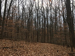
Fort Dupont Park is a 376-acre (1.52 km2) wooded park under the management of the National Park Service located in Washington, DC. The name of the park comes from the old Civil War earthwork fort that lies within the park. The fort was one of several designed to defend Washington from a Confederate attack during the Civil War. There are few remains of the actual fortifications.

<span class="mw-page-title-main">Fort Bunker Hill</span> Historical fort in Washington, D.C., United States

Fort Bunker Hill was one of seven temporary earthwork forts part of the Civil War Defenses of Washington, D.C., during the Civil War built in the Northeast quadrant of the city at the beginning of the Civil War by the Union Army to protect the city from the Confederate Army. From west to east, the forts were: Fort Slocum, Fort Totten, Fort Slemmer, Fort Bunker Hill, Fort Saratoga, Fort Thayer and Fort Lincoln. Unlike other forts, today very little remains of the structure.

<span class="mw-page-title-main">Battery Rodgers</span>

Battery Rodgers was a gun emplacement that composed a portion of the American Civil War defenses of the American capital city of Washington, D.C.

<span class="mw-page-title-main">Fort DeRussy Military Reservation</span> United States historic place

Fort DeRussy is a United States military reservation in the Waikiki area of Honolulu, Hawaii, under the jurisdiction of the United States Army. Unfenced and largely open to public traffic, the installation consists mainly of landscaped greenspace. The former Battery Randolph now houses the U.S. Army Museum of Hawaiʻi, which is open to the public. The Hale Koa Hotel, an Armed Forces Recreation Center, and the Daniel K. Inouye Asia-Pacific Center for Security Studies are also located on Fort DeRussy.

<span class="mw-page-title-main">Fort Kearny (Washington, D.C.)</span>

Fort Kearny was a fort constructed during the American Civil War as part of the defenses of Washington, D.C. Located near Tenleytown, in the District of Columbia, it filled the gap between Fort Reno and Fort DeRussy north of the city of Washington. The fort was named in honor of Maj. Gen. Philip Kearny of the Union Army, who was killed at the Battle of Chantilly on September 1, 1862. Three batteries of guns supported the fort, and are considered part of the fort's defenses.

Fort Greble was an American Civil War-era Union fortification constructed as part of the defenses of Washington, D.C. during that war. Named for First Lieutenant John Trout Greble, the first West Point graduate killed in the U.S. Civil War, it protected the junction of the Anacostia and Potomac rivers, and from its position on a bluff in the Congress Heights, precluded any bombardment of the Washington Navy Yard and southeastern portions of the city. It was supported by Fort Carroll to the northeast and Fort Foote to the south. It never fired a shot during the war, and after a brief stint as a U.S. Army Signal Corps training facility, was abandoned and the land returned to its natural state. As of July 2007, the site of the fort is a community park.

<span class="mw-page-title-main">Fort Stanton (Washington, D.C.)</span> Historical fort in Washington, D.C., US

Fort Stanton was a Civil War-era fortification constructed in the hills above Anacostia in the District of Columbia, USA, and was intended to prevent Confederate artillery from threatening the Washington Navy Yard. It also guarded the approach to the bridge that connected Anacostia with Washington. Built in 1861, the fort was expanded throughout the war and was joined by two subsidiary forts: Fort Ricketts and Fort Snyder. Following the surrender of the Army of Northern Virginia, it was dismantled and the land returned to its original owner. It never saw combat. Abandoned after the war, the site of the fort was planned to be part of a grand "Fort Circle" park system encircling the city of Washington. Though this system of interconnected parks never was fully implemented, the site of the fort is today a park maintained by the National Park Service, and a historical marker stands near the fort's original location.

<span class="mw-page-title-main">Fort Bayard (Washington, D.C.)</span> Historic fort in Washington, D.C.

Fort Bayard was an earthwork fort constructed in 1861 northwest of Tenleytown in the District of Columbia as part of the defenses of Washington, D.C., during the American Civil War. It never faced major opposition during the conflict and was decommissioned following the surrender of Robert E. Lee's Army of Northern Virginia. Named after Brigadier General George Dashiell Bayard, who was killed at the Battle of Fredericksburg, the site of the fort is in Boundary Park, located at the intersection of River Road and Western Avenue NW in Washington, D.C., and is maintained by the U.S. National Park Service. No trace of the fort remains, though a marker commemorating its existence has been erected by the Park Service.

<span class="mw-page-title-main">10th Rhode Island Infantry Regiment</span> Military unit

The 10th Rhode Island Infantry Regiment served for three months in the summer 1862. It served, along with its sister units - the 9th Rhode Island Infantry Regiment and the 10th Rhode Island Battery, in the defenses of Washington D.C.

The 3rd Massachusetts Volunteer Heavy Artillery Regiment was a unit that served in the Union Army during the American Civil War. It was organized from already mustered unattached companies of heavy artillery raised for the defenses of the Massachusetts coast.

<span class="mw-page-title-main">Battery Kemble Park</span> Park in Washington, D.C., U.S.

Battery Kemble Park is a park in Northwest Washington D.C., administered by the National Park Service.

<span class="mw-page-title-main">Fort Totten Park</span> Washington, D.C. Civil War memorial site

Fort Totten Park is an American Civil War memorial on the site of a Union fort in Washington, DC. It is under the management of the National Park Service.

<span class="mw-page-title-main">Fort Lincoln (District of Columbia)</span>

Fort Lincoln was one of seven temporary earthwork forts part of the Civil War Defenses of Washington, DC during the Civil War built in the Northeast quadrant of the city at the beginning of the Civil War by the Union Army to protect the city from the Confederate Army. From west to east, the forts were as follow: Fort Slocum, Fort Totten, Fort Slemmer, Fort Bunker Hill, Fort Saratoga, Fort Thayer and Fort Lincoln.

Shepherd Parkway is part of the Civil War Defenses of Washington. It includes two forts, of which some remains still exist. The parkway runs along the high ground opposite the Anacostia Freeway from Joint Base Anacostia–Bolling in the District of Columbia. Shepherd Parkway is bordered on the north by St. Elizabeths Campus and the District of Columbia neighborhoods of Congress Heights and Bellevue and on the south by Bald Eagle Hill.

<span class="mw-page-title-main">Fort Slocum (Washington, D.C.)</span>

Fort Slocum was one of seven temporary earthwork forts, part of the Civil War Defenses of Washington, D.C., during the Civil War, built in the Northeast quadrant of the city after the beginning of the war by the Union Army to protect the city from the Confederate Army. From west to east, the forts were as follow: Fort Slocum, Fort Totten, Fort Slemmer, Fort Bunker Hill, Fort Saratoga, Fort Thayer and Fort Lincoln.

<span class="mw-page-title-main">Fort Saratoga</span>

Fort Saratoga was one of seven temporary earthwork forts part of the Civil War Defenses of Washington, D.C., during the Civil War built in the Northeast quadrant of the city at the beginning of the Civil War by the Union Army to protect the city from the Confederate Army. From west to east, the forts were as follow: Fort Slocum, Fort Totten, Fort Slemmer, Fort Bunker Hill, Fort Saratoga, Fort Thayer and Fort Lincoln.. Unlike other forts, nothing remains of the structure.

<span class="mw-page-title-main">Fort Thayer</span>

Fort Thayer was one of seven temporary earthwork forts part of the Civil War Defenses of Washington, D.C., during the Civil War built in the Northeast quadrant of the city at the beginning of the Civil War by the Union Army to protect the city from the Confederate Army. From west to east, the forts were as follow: Fort Slocum, Fort Totten, Fort Slemmer, Fort Bunker Hill, Fort Saratoga, Fort Thayer and Fort Lincoln. Unlike other forts, today nothing remains of the structure.

<span class="mw-page-title-main">Fort Slemmer</span>

Fort Slemmer sometimes called Battery Slemmer was one of seven temporary earthwork forts part of the Civil War Defenses of Washington, D.C., during the Civil War built in the Northeast quadrant of the city at the beginning of the Civil War by the Union Army to protect the city from the Confederate Army. From west to east, the forts were as follow: Fort Slocum, Fort Totten, Fort Slemmer, Fort Bunker Hill, Fort Saratoga, Fort Thayer and Fort Lincoln. Unlike other forts, today very little remains of the structure.

References