Related Research Articles

Pennsylvania Avenue is a primarily diagonal street in Washington, D.C., and Prince George's County, Maryland, that connects the United States Capitol with the White House and then crosses northwest Washington, D.C. to Georgetown. Traveling through southeast Washington from the Capitol, it enters Maryland, and becomes MD Route 4 and then MD Route 717 in Upper Marlboro, and finally Stephanie Roper Highway.

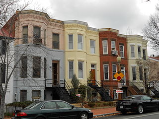
Capitol Hill is the largest historic residential neighborhood in Washington, D.C., stretching easterly in front of the United States Capitol along wide avenues. It is one of the oldest residential neighborhoods in Washington, D.C., and, with roughly 35,000 people in just under 2 square miles (5 km2), it is also one of the most densely populated. The name is also frequently used as a metonym for the United States Congress.

West Potomac Park is a U.S. national park in Washington, D.C., adjacent to the National Mall. It includes the parkland that extends south of the Lincoln Memorial Reflecting Pool, from the Lincoln Memorial to the grounds of the Washington Monument. The park is the site of many national landmarks, including the Korean War Veterans Memorial, Jefferson Memorial, Franklin Delano Roosevelt Memorial, George Mason Memorial, and the Martin Luther King Jr. Memorial.

Capitol South station is a Washington Metro station in the Capitol Hill neighborhood of Washington, D.C., United States. The island-platformed station was opened on July 1, 1977, and is operated by the Washington Metropolitan Area Transit Authority (WMATA). The station currently provides service for the Blue, Orange, and Silver Lines.

Northwest is the northwestern quadrant of Washington, D.C., the capital of the United States, and is located north of the National Mall and west of North Capitol Street. It is the largest of the four quadrants of the city, and it includes the central business district, the Federal Triangle, and the museums along the northern side of the National Mall, as well as many of the District's historic neighborhoods.

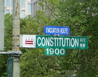
Constitution Avenue is a major east–west street in the northwest and northeast quadrants of the city of Washington, D.C., in the United States. It was originally known as B Street, and its western section was greatly lengthened and widened between 1925 and 1933. It received its current name on February 26, 1931, though it was almost named Jefferson Avenue in honor of Thomas Jefferson.

There are many outdoor sculptures in Washington, D.C. In addition to the capital's most famous monuments and memorials, many figures recognized as national heroes have been posthumously awarded with his or her own statue in a park or public square. Some figures appear on several statues: Abraham Lincoln, for example, has at least three likenesses, including those at the Lincoln Memorial, in Lincoln Park, and the old Superior Court of the District of Columbia. A number of international figures, such as Mohandas Gandhi, have also been immortalized with statues. The Statue of Freedom is a 19½-foot tall allegorical statue that rests atop the United States Capitol dome.

Massachusetts Avenue is a major diagonal transverse road in Washington, D.C., and the Massachusetts Avenue Historic District is a historic district that includes part of it.

The Suitland Parkway is a parkway in Washington, D.C., and Prince George's County, Maryland, administered and maintained by the U.S. National Park Service (NPS), National Capital Parks-East. The road has partial controlled access with a combination of interchanges and at-grade intersections, but without property access for neighboring land-owners. Conceived in 1937, it was built during World War II to provide a road connection between military facilities in the Washington, D.C. metropolitan area. It fully opened on December 9, 1944 as the Camp Springs highway, so called because it connected Camp Springs in Prince George's County with Bolling Air Force Base. However one lane of the highway was opened in mid-October 1944.

Independence Avenue is a major east-west street in the southwest and southeast quadrants of the city of Washington, D.C., in the United States, running just south of the United States Capitol. Originally named South B Street, Independence Avenue SW was constructed between 1791 and 1823. Independence Avenue SE was constructed in pieces as residential development occurred east of the United States Capitol and east of the Anacostia River. Independence Avenue SW received its current name after Congress renamed the street in legislation approved on April 13, 1934. Independence Avenue SW originally had its western terminus at 14th Street SW, but was extended west to Ohio Drive SW between 1941 and 1942. The government of the District of Columbia renamed the portion of the road in the southeast quadrant of the city in 1950.
The National Capital Parks was a unit of the National Park System of the United States, now divided into multiple administrative units. It encompasses a variety of federally owned properties in and around the District of Columbia including memorials, monuments, parks, interiors of traffic circles and squares, triangles formed by irregular intersections, and other open spaces.
National Mall and Memorial Parks is an administrative unit of the National Park Service (NPS) encompassing many national memorials and other areas in Washington, D.C. Federally owned and administered parks in the capital area date back to 1790, some of the oldest in the United States. In 1933, they were transferred to the control of the National Park Service. These parks were known as the National Capital Parks from their inception until 1965. The NPS now operates multiple park groupings in the D.C. area, including National Capital Parks-East, Rock Creek Park, President's Park, and George Washington Memorial Parkway. National Mall and Memorial Parks also provides technical assistance for the United States Navy Memorial.

Stanton Park, previously known as Stanton Square, is a national park in Washington D.C. It is located at the intersection of Maryland Avenue and Massachusetts Avenue in the Capitol Hill neighborhood of Northeast, Washington, D.C. It is bounded by 4th Street to the west and 6th Street to the east. North and south of the park are the respective westbound and eastbound lanes of C Street, NE.

The Pennsylvania Avenue Line, designated Routes 32 and 36, is a daily Metrobus route in Washington, D.C., Operating between the Southern Avenue station or Naylor Road station of the Green Line of the Washington Metro and Potomac Park. Until the 1960s, it was a streetcar line, opened in 1862 by the Washington and Georgetown Railroad as the first line in the city.

Seward Square is a square and park maintained by the National Park Service located at the intersection of Pennsylvania Avenue and North Carolina Avenue in the Capitol Hill neighborhood of Southeast Washington, D.C. The square is bounded by 4th Street to the west and 6th Street to the east. North and south of the park are the respective westbound and eastbound lanes of Seward Square, SE. Because Pennsylvania and North Carolina Avenues intersect in the middle of the square, it divides the square into four unique smaller parks. The park is named after William Henry Seward, the United States Secretary of State under Presidents Abraham Lincoln and Andrew Johnson. Seward is noted for his part in the American purchase of Alaska from the Russian Empire in 1867. The purchase was ridiculed at the time and was colloquially known as "Seward's Folly". There is no statue of William Seward on the site of the park, however there is a statue of his adopted daughter, Olive Risley Seward located at a private residence at the corner of 6th Street and North Carolina Avenue, SE. The statue was sculpted in 1971 by John Cavanaugh.

The Anacostia Historic District is a historic district in the city of Washington, D.C., comprising approximately 20 squares and about 550 buildings built between 1854 and 1930. The Anacostia Historic District was added to the National Register of Historic Places in 1978. "The architectural character of the Anacostia area is unique in Washington. Nowhere else in the District of Columbia does there exist such a collection of late-19th and early-20th century small-scale frame and brick working-class housing."

The L'Enfant Plan for the city of Washington is the urban plan developed in 1791 by Major Pierre (Peter) Charles L'Enfant for George Washington, the first president of the United States.

The Friendship Heights–Southeast Line, designated as Routes 30N or 30S, were daily bus routes operated by the Washington Metropolitan Area Transit Authority between Friendship Heights station of the Red Line of the Washington Metro and Naylor Road station or Southern Avenue station of the Green Line of the Washington Metro. Both lines operated every 60 minutes at all times. Trips were roughly 90 minutes long. This line provided service from Friendship Heights, operating through most of NW and SE DC and ending in Southern Prince Georges County via a one bus ride. Extra services are provided by the 32, 34, and 36 in Southeast and 31 and 33 in Northwest. Service was eliminated on September 5, 2021 due to redundancy.
The Forestville Line, designated as Route K12, is a daily bus route operated by the Washington Metropolitan Area Transit Authority between Suitland station and Branch Avenue station of the Green Line of the Washington Metro. The line operates every 15 – 45 minutes during weekdays and 60 minutes during weekends. Trips are roughly 30 – 40 minutes long. There are a few early morning/late night and rush hour trips that only operate between the Suitland Metro Station & Penn Mar Shopping Center.
References
- ↑ "Reservation List: The Parks of the National Park System, Washington, DC" (PDF). www.nps.gov. National Park Service; Land Resources Program Center; National Capital Region. Retrieved 1 May 2016.
- ↑ "Park Statistics". www.nps.gov. National Park Service; US Department of the Interior. Retrieved 1 August 2014.