
Harewood is a village, civil parish, former manor and ecclesiastical parish, in West Yorkshire, England, today in the metropolitan borough of the City of Leeds. The civil parish population at the 2011 census was 3,734.

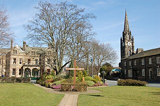
Otley is a market town and civil parish at a bridging point on the River Wharfe, in the City of Leeds metropolitan borough in West Yorkshire, England. Historically a part of the West Riding of Yorkshire, the population was 13,668 at the 2011 census. It is in two parts: south of the river is the historic town of Otley and to the north is Newall, which was formerly a separate township. The town is in lower Wharfedale on the A660 road which connects it to Leeds.

Arthington is a linear village in Wharfedale, in the City of Leeds metropolitan borough in West Yorkshire, England. It is a civil parish which, according to the 2011 census, had a population of 532. It is in the Otley ward of the City of Leeds, and the Leeds North West parliamentary constituency.

Alwoodley is a suburb and civil parish of Leeds in West Yorkshire, England. It is 5 miles (8.0 km) north of central Leeds and is one of the most affluent areas of the county. Alwoodley lies in the LS17 postcode area which was reported to contain the most expensive housing area in Yorkshire and the Humber by The Times.
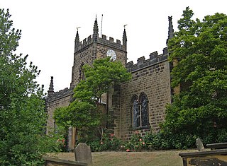
Kirkby Overblow is a village and civil parish in North Yorkshire, England. It is situated between Wetherby and Harrogate and lies to the west of Sicklinghall and the east of Leeds Bradford International Airport. It has a church called All Saints and a Church of England primary school affiliated with the church.
Burley in Wharfedale is a village and civil parish in West Yorkshire, England, in the Wharfedale valley. In 2011, it had a population of 7,041.

Claro was a wapentake of the West Riding of Yorkshire, England. It was split into two divisions. The Upper Division included the parishes of Farnham, Fewston, Hampsthwaite, Kirkby Malzeard and Pannal and parts of Aldborough, Knaresborough, Otley, Little Ouseburn, Ripley, Ripon, Wetherby and Whixley, many of which formed exclaves. The Lower Division included the parishes of Allerton Mauleverer, Goldsborough, Hunsingore, Kirk Deighton, Kirkby Overblow, Leathley, Spofforth with Stockeld, Weston and parts of Addingham, Aldborough, Harewood, Ilkley, Kirk Hammerton, Otley, Ripley and Whixley.

Collingham is a village and civil parish 2 miles (3 km) south-west of Wetherby in West Yorkshire, England. It is in the City of Leeds metropolitan borough. The population of the civil parish as of the 2011 census was 2,991.

East Keswick is a village and civil parish in the City of Leeds metropolitan borough, West Yorkshire, England. It lies four miles south west of Wetherby. The population of the civil parish as of the 2011 census was 1,146.

Minskip is a village in the civil parish of Boroughbridge, in North Yorkshire, England. It is on the A6055 road and 1 mile south-west of Boroughbridge. Minskip appears in the Domesday Book as Minescip, a name derived from the Old English gemaenscipe meaning a community or communal holding.

Leathley is a village and civil parish in the Harrogate district of North Yorkshire, England, the parish includes the townships of both Castley and Leathley. It is near the border with West Yorkshire and the River Wharfe, 1 mile north-east of Otley. The B6161 runs through the village, connecting Leathley with Killinghall in the North and Pool-in-Wharfedale in the south.

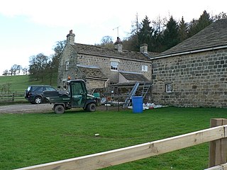
Stainburn is a village and civil parish in the Harrogate district of North Yorkshire, England, 10 miles (16 km) north of Leeds. The population of the civil parish was estimated at 120 in 2015.
Weardley is a village on the Harewood Estate in the parish of Harewood, at the northern edge of the City of Leeds metropolitan borough, West Yorkshire, England. The village is in the Harewood ward of the City of Leeds Metropolitan Council. In 1931 the parish had a population of 94.

Wike is a hamlet and a former civil parish, now in the parish of Harewood, north of Leeds, West Yorkshire, England. It is in the City of Leeds metropolitan borough and is north of Shadwell and Roundhay, west of Scarcroft and south of East Keswick. Many residents use facilities in Leeds as well as in the nearby town of Wetherby. In 1931 the parish had a population of 88.

Eccup is a village in the parish of Alwoodley and north of the City of Leeds, West Yorkshire, England. It is just north of Alwoodley and east of Bramhope and Golden Acre Park. Eccup is at the north-west edge of Eccup Reservoir. On 1 April 1926 Eccup became a civil parish, being formed from part of Adel cum Eccup, on 1 April 1928 the parish was abolished and merged with Leeds.

Bickerton is a village on the B1224 road, in the civil parish of Bilton-in-Ainsty with Bickerton, in North Yorkshire, England. The nearest town is Wetherby. There is a plantation nearby called Bickerton Plantation.

Chapel Allerton is an inner suburb of north-east Leeds, West Yorkshire, England, 2 miles (3.2 km) from the city centre.
Dallowgill is a village in Harrogate district in North Yorkshire, England. It consists of a number of scattered settlements in the western part of the civil parish of Laverton.

Kearby with Netherby is a civil parish in North Yorkshire, England. The parish includes the hamlets of Barrowby, Netherby and Kearby Town End. The parish had a population of 204 in the 2011 census.

