East Point, Georgia | |
---|---|
City of East Point | |
Location of East Point in Metro Atlanta | |
Coordinates: 33°40′11″N84°28′12″W / 33.66972°N 84.47000°W | |
Country | United States |
State | Georgia |
County | Fulton |
Area | |
• Total | 14.70 sq mi (38.08 km2) |
• Land | 14.69 sq mi (38.04 km2) |
• Water | 0.01 sq mi (0.04 km2) |
Elevation | 961 ft (293 m) |
Population (2020) | |
• Total | 38,358 |
• Density | 2,611.34/sq mi (1,008.24/km2) |
Time zone | UTC-5 (Eastern (EST)) |
• Summer (DST) | UTC-4 (EDT) |
ZIP codes | 30344, 30364 |
Area code | 404 |
FIPS code | 13-25720 [3] |
GNIS feature ID | 2403534 [2] |
Website | eastpointcity.org |
East Point is a suburban city located southwest of Atlanta in Fulton County, Georgia, United States. As of the 2020 census, the city had a population of 38,358. The city name is derived from being at the opposite end of the former Atlanta and West Point Railroad from West Point.
The name "East Point" derives from the fact that this is the terminus of the Atlanta & West Point Railroad in the east; [4] West Point, Georgia, is the terminus where the rail line ends in the west.
This settlement was founded as a railroad terminus with 16 families in 1870, but grew quickly after it became an inviting place for industry to develop. Soon it boasted the railway, two gristmills, and a government distillery located on Connally Drive. One of the earliest buildings was the factory of the White Hickory Manufacturing Company, built by B.M. Blount and L.M. Hill (who became the first chairman of the board of aldermen of the city).[ citation needed ]
By 1880 the town had two churches, a common school, a steam-cotton gin, a sawmill, a post office (founded in 1851), a telegraph office and its own newspaper weekly, The Plow Boy. East Point ranked as a grain and cotton-growing center. With its pleasant upland climate and proximity to the railway, it was a popular summer resort for people from the city of Atlanta.[ citation needed ]
In 1884 the first telephone rang in East Point, and in 1887 the city received its first charter. In 1890 a major portion of property along East Point Avenue was subdivided and developed, opening the way for more homes, more churches, more people, and more places of employment. By 1892 Main Street was completed, despite protests from a few progress-shy early settlers who maintained that one major thoroughfare, Newnan Road, was more than sufficient.[ citation needed ]
By the start of the 20th century, the adolescent town was poised to grow into the city it eventually would become.[ citation needed ]
In late 2015 and early 2016, some scenes for the Netflix series Stranger Things were filmed at the exterior of the First Baptist Church (standing in for a hospital exterior in a fictional Indiana town). [5]
The recording studio of Dungeon Family was originally located in East Point, and contributed to the development of Atlanta hip hop. [6] [7]
East Point is bordered to the north, east, and west by the city of Atlanta, to the southeast by Hapeville, and to the south by College Park. Downtown Atlanta is 7 miles (11 km) northeast of the center of East Point.
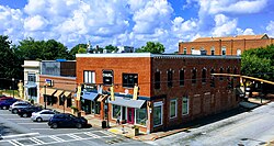
According to the United States Census Bureau, East Point has a total area of 14.7 square miles (38.1 km2), of which 0.02 square miles (0.05 km2), or 0.12%, is water. [8]
Census | Pop. | Note | %± |
---|---|---|---|
1880 | 195 | — | |
1890 | 738 | 278.5% | |
1900 | 1,315 | 78.2% | |
1910 | 3,682 | 180.0% | |
1920 | 5,241 | 42.3% | |
1930 | 9,512 | 81.5% | |
1940 | 12,403 | 30.4% | |
1950 | 21,080 | 70.0% | |
1960 | 35,633 | 69.0% | |
1970 | 39,315 | 10.3% | |
1980 | 37,486 | −4.7% | |
1990 | 34,402 | −8.2% | |
2000 | 39,595 | 15.1% | |
2010 | 33,712 | −14.9% | |
2020 | 38,358 | 13.8% | |
U.S. Decennial Census [9] 1850-1870 [10] 1880 [11] 1890-1910 [12] 1920-1930 [13] 1930-1940 [14] 1940-1950 [15] 1960-1980 [16] 1980-2000 [17] |
Race | Num. | Perc. |
---|---|---|
White (non-Hispanic) | 3,527 | 9.19% |
Black or African American (non-Hispanic) | 29,156 | 76.01% |
Native American | 74 | 0.19% |
Asian | 250 | 0.65% |
Pacific Islander | 11 | 0.03% |
Other/Mixed | 1,296 | 3.38% |
Hispanic or Latino | 4,044 | 10.54% |
As of the 2020 United States census, there were 38,358 people, 14,216 households, and 6,721 families residing in the city.
As of the census [3] of 2000, there were 39,595 people, 14,553 households, and 9,430 families residing in the city. The population density was 2,878.9 inhabitants per square mile (1,111.5/km2). There were 15,637 housing units at an average density of 1,137.0 per square mile (439.0/km2). The racial makeup of the city was 78.16% African American, 16.10% White, 0.20% Native American, 0.62% Asian, 0.09% Pacific Islander, 3.40% from other races, and 1.42% from two or more races. Hispanic or Latino of any race were 7.57% of the population.
There were 14,553 households there in 2000, out of which 34.5% had children under the age of 18 living with them, 28.7% were married couples living together, 28.9% had a female householder with no husband present, and 35.2% were non-families. 27.4% of all households were made up of individuals, and 5.5% had someone living alone who was 65 years of age or older. The average household size was 2.69 and the average family size was 3.27.
In the city, the population was spread out, with 29.3% under the age of 18, 11.9% from 18 to 24, 31.3% from 25 to 44, 19.5% from 45 to 64, and 7.9% who were 65 years of age or older. The median age was 30 years. For every 100 females, there were 89.5 males. For every 100 females age 18 and over, there were 84.8 males.
The median income for a household in the city was $31,874, and the median income for a family was $36,099. Males had a median income of $27,114 versus $25,839 for females. The per capita income for the city was $15,175. About 17.2% of families and 20.7% of the population were below the poverty line, including 30.0% of those under age 18 and 13.6% of those age 65 or over.
The National Archives and Records Administration regional repository for data collected by the U.S. Census was originally located in the Colonial Hills area of East Point, before moving to Morrow, Georgia. [19]
The Southeast Region Office of the Federal Bureau of Prisons is in East Point. [20] [21]
In the late 20th century, East Point suffered a loss of jobs due to railroad and industrial restructuring. In the 21st century, its economy expanded, and new businesses and residences developed. [22] The city states that "several Fortune 500 companies" are located in East Point. [23]
East Point Historic Civic Block consists of three historically significant buildings and one memorial park in downtown East Point. [24]
Opened in 2003, Camp Creek Marketplace is a 309,089-square-foot (29,000 m2) retail space, containing 39 stores and 14 restaurants. [25] [26]
The Commons is a $150 million, 79,000-square-foot (7,300 m2), retail, restaurant, and residential development expected to bring over 1,500 jobs to East Point, with an estimated completion between 2027 and 2029. [27] [28]
Atlanta–Fulton Public Library System operates the East Point Branch. [29]
East Point has 23 parks, a recreation center, playgrounds, tennis courts, sand volleyball, basketball courts, trails, and recreational activities and programs. [30]
Connally Nature Park is a 27-acre (11 ha) green space that features pink lady slipper orchids which blossom in spring, and white oak trees. [31]
Dick Lane Velodrome in Sumner Park, built in 1974, is one of 22 velodromes in the United States, and was a training facility for the 1996 Summer Olympics in Atlanta. It hosts cycling events and competitions.[ citation needed ]
The city has a city council-city manager form of government, with a professional city manager hired by the council. The manager is approved by the eight-member city council, headed by the mayor who has veto power. [32] The city is divided into four wards (A, B, C, & D), each electing two city council members. [33]
Fulton County School System operates East Point's public schools. Schools located in East Point include: [34]
Russell High School is a former high school in East Point.
Part of the Fear Street horror film series were shot in East Point in 2019. [35]
Paulding County is a county located in the northwestern part of the U.S. state of Georgia. Part of Metro Atlanta, it had an estimated population of 168,661 in 2020. The county seat is Dallas.
Lumpkin County is a county located in the northeast portion of the U.S. state of Georgia. As of the 2020 census, the population was 33,488. Its county seat is Dahlonega. Lumpkin County is included in the Atlanta-Sandy Springs-Roswell, Georgia Metropolitan Statistical Area.
Fayette County is a county located in the north central portion of the U.S. state of Georgia. As of the 2020 census, the population was 119,194, an increase from 106,567 in 2010. Fayette County was established in 1821. The county seat, Fayetteville, was established in 1823. Much of Fayette County is bordered on the east side by the Flint River.
Douglas County is a county located in the north central portion of the U.S. state of Georgia. As of the 2020 U.S. Census, the population was 144,237, having more than doubled since 1990. The county seat is Douglasville. The City of Villa Rica, and a small portion of Austell are both also located in Douglas County. Douglas County is included in the Atlanta-Sandy Springs-Roswell, GA Metropolitan Statistical Area. It has attracted new residents as jobs have increased in the Atlanta area.
Canton is a city in and the county seat of Cherokee County, Georgia, United States. As of the 2010 census, the city had a population of 22,958, up from 7,709 in 2000.
Morrow is a city in Clayton County, Georgia, United States. It is part of the Atlanta metropolitan area. Its population was 6,445 at the 2010 census, up from 4,882 in 2000. It is the home of Clayton State University and the Georgia Archives.
Belvedere Park is an unincorporated community and census-designated place (CDP) in DeKalb County, Georgia, United States. The population was 15,113 at the 2020 census.
Candler-McAfee is an unincorporated community and census-designated place (CDP) in DeKalb County, Georgia, United States. It is located east of Atlanta approximately 10 miles (16 km) east of Downtown Atlanta and to the south of Decatur, Georgia The population was 23,025 at the 2010 census.
Gresham Park is an unincorporated community and census-designated place (CDP) in DeKalb County, Georgia, United States. The population was 7,700 at the 2020 census.
North Druid Hills, also known as Briarcliff or Toco Hills, is an unincorporated community and census-designated place in DeKalb County, Georgia, United States. The population was 18,947 at the 2010 census. The commercial center of the area is the Toco Hill Shopping Center, located near the intersection of North Druid Hills Road and LaVista Road.
Alpharetta is a city in northern Fulton County, Georgia, United States, and part of the Atlanta metropolitan area. As of the 2020 US Census, Alpharetta's population was 65,818; in 2010, the population had been 57,551.
Hapeville, established 1891, is a city in Fulton County, Georgia, United States. Hapeville is 2.5 square miles wide and located inside I-285 between the city of Atlanta to its north and the Atlanta International Airport to its south. The population was 6,553 at the 2020 census, an increase of 180 residents from the 2010 census. Hapeville is named for Dr. Samuel Hape, one of the area's original landowners and its first mayor. Dr. Hape and other members of his family are buried in Atlanta's Oakland Cemetery.
Roswell is a city in northern Fulton County, Georgia, United States. At the official 2020 census, the city had a population of 92,883, making Roswell the state's ninth largest city. A close suburb of Atlanta, Roswell has an affluent historic district.
Sandy Springs is a city in northern Fulton County, Georgia, United States, and a suburb of Atlanta. The city's population was 108,080 at the 2020 census, making it Georgia's 7th most populous city. It is the site of several corporate headquarters, including UPS, Newell Brands, Inspire Brands, Focus Brands, Cox Enterprises, and Mercedes-Benz USA's corporate offices.
Lilburn is a city in Gwinnett County, Georgia, United States. The population was 14,502 at the 2020 census. The estimated population was 12,810 in 2019. It is a part of the Atlanta metropolitan area.
Hampton is a city in southwestern Henry County, Georgia, United States. The 2020 census was 8,368. As of the 2010 census, the city had a population of 6,987, up from 3,857 at the 2000 census. By 2018 the estimated population was 7,922. "Hampton" mailing addresses outside the city limits reach into rural parts of eastern Clayton County and northern Spalding County. It is a southeastern suburb in the Atlanta metropolitan area.
Jasper is a city in Pickens County, Georgia, United States. The population was 3,684 at the 2010 census. The city is the county seat of Pickens County.
Atlanta is a city in Macon County, Missouri, United States. The population was 379 at the 2020 census.
Brookhaven is a city in the northeastern suburbs of Atlanta that is located in western DeKalb County, Georgia, United States, directly northeast of Atlanta. On July 31, 2012, Brookhaven was approved in a referendum to become DeKalb County's 11th city. Incorporation officially took place on December 17, 2012, on which date municipal operations commenced. With a population of around 55,366 as of 2021, it is the largest city in DeKalb County. The new city stretches over 12 square miles (31 km2).
Johns Creek is a city in Fulton County, Georgia, United States. According to the 2020 census, the population was 82,453. The city is a northeastern suburb of Atlanta.
Georgia's small towns outside of Atlanta, including Douglasville, Conyers, Jackson, Winston and Fayetteville, easily pass for the Midwest, and Jackson's intact downtown isn't a far stretch from 1983 Hawkins on film.