Alpharetta, Georgia | |
---|---|
Location of Alpharetta in Metro Atlanta | |
Coordinates: 34°04′31″N84°17′39″W / 34.07528°N 84.29417°W [1] | |
Country | United States |
State | Georgia |
County | Fulton |
Incorporated | December 11, 1858 |
Government | |
• Mayor | Jim Gilvin (R) |
Area | |
• Total | 27.27 sq mi (70.62 km2) |
• Land | 26.90 sq mi (69.67 km2) |
• Water | 0.37 sq mi (0.95 km2) |
Elevation | 1,135 ft (346 m) |
Population | |
• Total | 65,818 |
• Density | 2,447/sq mi (945/km2) |
Time zone | UTC−5 (EST) |
• Summer (DST) | UTC−4 (EDT) |
ZIP codes | 30004, 30005, 30009, 30022 |
Area codes | 770, 404, 678 |
FIPS code | 13-01696 |
GNIS feature ID | 0310497 [1] |
Website | alpharetta.ga.us |
Alpharetta is a city in northern Fulton County, Georgia, United States, and part of the Atlanta metropolitan area. As of the 2020 US Census, Alpharetta's population was 65,818; [4] [5] in 2010, the population had been 57,551.
In the 1830s, the Cherokee people in Georgia and elsewhere in the South were forcibly relocated to the Indian Territory (present-day Oklahoma) under the Indian Removal Act. Pioneers and farmers later settled on the newly vacated land, situated along a former Cherokee trail stretching from the North Georgia mountains to the Chattahoochee River. [6]
One of the area's first permanent landmarks was the New Prospect Camp Ground (also known as the Methodist Camp Ground), beside a natural spring near what is now downtown Alpharetta. [6] It later served as a trading post for the exchanging of goods among settlers. [6]
Known as the town of Milton through July 1858, the city of Alpharetta was chartered on December 11, 1858, with boundaries extending in a 0.5-mile (0.8 km) radius from the city courthouse. [6] It served as the county seat of Milton County until 1931, when Milton County merged with Fulton County to avoid bankruptcy during the Great Depression. [6]
The city's name may be a variation of a fictional Indian girl, Alfarata, in the 19th-century song "The Blue Juniata"; it may also be derived from alpha, the first letter of the Greek alphabet. [7]
The Simeon and Jane Rucker Log House, built in 1833, was listed on the National Register of Historic Places in 1997. [8]
Alpharetta is in northern Fulton County and is bordered to the southeast by Johns Creek, to the south and west by Roswell, to the north by Milton, and to the northeast by unincorporated land in Forsyth County. Downtown Alpharetta is 26 miles (42 km) north of downtown Atlanta.
According to the United States Census Bureau, Alpharetta has an area of 27.3 square miles (70.7 km2), of which 26.9 square miles (69.7 km2) is land and 0.39 square miles (1.0 km2), or 1.37%, is water. [4]
Alpharetta has a humid subtropical climate (Köppen climate classification: Cfa) and is part of USDA hardiness zone 7b.
Climate data for Alpharetta, GA | |||||||||||||
---|---|---|---|---|---|---|---|---|---|---|---|---|---|
Month | Jan | Feb | Mar | Apr | May | Jun | Jul | Aug | Sep | Oct | Nov | Dec | Year |
Mean daily maximum °F (°C) | 50.4 (10.2) | 54.7 (12.6) | 63.4 (17.4) | 71.5 (21.9) | 77.9 (25.5) | 85.0 (29.4) | 87.1 (30.6) | 86.6 (30.3) | 80.9 (27.2) | 71.6 (22.0) | 62.0 (16.7) | 52.9 (11.6) | 70.3 (21.3) |
Mean daily minimum °F (°C) | 29.6 (−1.3) | 32.1 (0.1) | 38.6 (3.7) | 45.5 (7.5) | 54.6 (12.6) | 63.6 (17.6) | 67.0 (19.4) | 66.8 (19.3) | 59.5 (15.3) | 48.1 (8.9) | 38.1 (3.4) | 32.0 (0.0) | 48.0 (8.9) |
Average precipitation inches (mm) | 3.96 (101) | 5.08 (129) | 4.54 (115) | 3.63 (92) | 4.28 (109) | 3.91 (99) | 4.84 (123) | 4.54 (115) | 4.38 (111) | 3.52 (89) | 4.15 (105) | 4.58 (116) | 51.41 (1,304) |
Average snowfall inches (cm) | 0.6 (1.5) | 0.2 (0.51) | 0.1 (0.25) | 0 (0) | 0 (0) | 0 (0) | 0 (0) | 0 (0) | 0 (0) | 0 (0) | 0 (0) | 0 (0) | 0.9 (2.26) |
Average precipitation days (≥ 0.01 in) | 9.8 | 9.5 | 9.0 | 8.0 | 9.0 | 8.5 | 10.2 | 8.7 | 6.4 | 6.4 | 7.8 | 9.6 | 102.9 |
Average snowy days (≥ 0.1 in) | 0.4 | 0.4 | 0.1 | 0 | 0 | 0 | 0 | 0 | 0 | 0 | 0 | 0.1 | 1.0 |
Source: NOAA [9] |
Census | Pop. | Note | %± |
---|---|---|---|
1860 | 261 | — | |
1870 | 126 | −51.7% | |
1880 | 164 | 30.2% | |
1890 | 256 | 56.1% | |
1900 | 310 | 21.1% | |
1910 | 356 | 14.8% | |
1920 | 379 | 6.5% | |
1930 | 477 | 25.9% | |
1940 | 647 | 35.6% | |
1950 | 917 | 41.7% | |
1960 | 1,349 | 47.1% | |
1970 | 2,455 | 82.0% | |
1980 | 3,128 | 27.4% | |
1990 | 13,002 | 315.7% | |
2000 | 34,854 | 168.1% | |
2010 | 57,551 | 65.1% | |
2020 | 65,818 | 14.4% | |
U.S. Decennial Census [10] 1850-1870 [11] 1880 [12] 1890-1910 [13] 1920-1930 [14] 1930-1940 [15] 1940-1950 [16] 1960-1980 [17] 1980-2000 [18] |
Race | Num. | Perc. |
---|---|---|
White (non-Hispanic) | 36,473 | 55.41% |
Black or African American (non-Hispanic) | 6,667 | 10.13% |
Native American | 101 | 0.15% |
Asian | 13,181 | 20.03% |
Pacific Islander | 22 | 0.03% |
Other/Mixed | 3,254 | 4.94% |
Hispanic or Latino | 6,120 | 9.3% |
As of the 2020 United States census, there were 65,818 people, 25,391 households, and 18,167 families residing in the city.
According to the 2010 census, the racial composition of the city of Alpharetta was as follows:
There were 13,911 households, out of which 36.2% had children under the age of 18 living with them, 54.1% were married couples living together, 7.3% had a female householder with no husband present, and 35.9% were non-families. 27.7% of all households were made up of individuals, and 4.2% had someone living alone who was 65 or older. The average household size was 2.50 and the average family size was 3.13.
In the city, 27.0% of the population was under the age of 18, 7.2% from 18 to 24, 40.5% from 25 to 44, 19.4% from 45 to 64, and 5.8% who were 65 years of age or older. The median age was 33. For every 100 females, there were 98.3 males. For every 100 females age 18 and over, there were 94.9 males.
The median income for a household in the city was $95,888, and the median income for a family was $111,918. The per capita income for the city was $42,431. [20] Males had a median income of $79,275 versus $59,935 for females. About 2.9% of families and 1.2% of the population were below the poverty line, including 0.3% of those under age 18 and 0.6% of those age 65 or over.
As of the census of 2000, there were 34,854 people, 13,911 households, and 8,916 families residing in the city. The population density was 1,632 inhabitants per square mile (630/km2). There were 14,670 housing units at an average density of 687 per square mile (265/km2). The population has been gradually increasing over the last decade. During the workday, the city swells to more than 120,000 residents, workers, and visitors, due to the more than 3,600 businesses that are located in the city. [21]
According to the City's 2022 Annual Comprehensive Financial Report, [22] the city's top private sector employers are:
# | Employer | # of Employees |
---|---|---|
1 | ADP, Inc. | 2,231 |
2 | Fiserv, Inc. | 2,088 |
3 | Equifax | 1,669 |
4 | LexisNexis | 1,384 |
5 | MCI Inc. (Verizon) | 1,095 |
6 | ET Securities, LLC | 878 |
7 | Ernst & Young | 806 |
8 | Hewlett Packard Enterprise | 738 |
9 | Synchrony Financial | 600 |
10 | LocumTenens.com | 496 |
Complexes in the area include:
Tech Alpharetta (formerly known as the Alpharetta Technology Commission [23] or simply ATC) is an advisory organization established by the City of Alpharetta in 2012. [24] The organization is an independent, 501(c)(6) nonprofit organization [24] that aims to help Alpharetta lead in technology innovation. [25] Tech Alpharetta runs an advisory board of technology companies based in the city, holds monthly technology events for technology executives, [26] and operates the Tech Alpharetta Innovation Center, a technology startup incubator. [25] [27] As of early 2020 about ten companies have "graduated" from Tech Alpharetta's incubator and were hiring employees in the North Fulton County region. [28]
Cynergy Data is headquartered in Alpharetta, as was NetBank when it existed. [29]
Alpharetta is governed by a city council composed of six members and a mayor. The mayor and council members serve staggered four-year terms:
City council [30] | |||
---|---|---|---|
Post | Council member | Term | Notes |
Post 1 | Donald Mitchell | 2022–2025 | |
Post 2 | Brian Will | 2022–2025 | |
Post 3 | Douglas DeRito | 2022–2025 | |
Post 4 | John Hipes | 2020–2023 | |
Post 5 | Jason Binder | 2020–2023 | |
Post 6 | Dan Merkel | 2020–2023 | Mayor pro tem (2022) |
Alpharetta is not directly served by MARTA trains, but is connected by multiple bus routes. Connecting Alpharetta to the rest of Metro Atlanta via heavy rail has been studied. [34] [35]
The Downtown Alpharetta Welcome Center is at 178 South Main Street and offers more than 200 complimentary brochures providing information on the surrounding area. The center is open Monday to Friday from 9 a.m. to 5 p.m., and a Virtual Information Kiosk is available on Saturdays from 10 a.m. to 4 p.m. [36]
The Downtown Alpharetta Historic District is in the center of Alpharetta, at the intersection of North & South Streets with Milton Avenue and Academy Street. Around this area are several historic buildings from the late 19th century and earlier. The downtown area, providing dining and shopping, has been restored with widened brick sidewalks. Modern buildings have been replaced with period structures.[ citation needed ]
The Alpharetta Family Skate Center (aka The Cooler) is at 10800 Davis Drive. It is also home to the Atlanta Sparks special needs hockey team.[ citation needed ]
The Alpharetta Arboretum at Wills Park was established in September 2008 and includes 26 trees. A brochure about the arboretum guides readers through a walking tour of the trees and is available at the Downtown Alpharetta Welcome Center. [37]
The Alpharetta Arboretum at Cogburn Road Park was established in December 2008 and showcases seven trees. A complimentary brochure for the arboretum is available at the Downtown Alpharetta Welcome Center and provides a starting point for a self-guided walking tour. [38]
The Alpharetta Farmers Market is a weekly farmers' market in the downtown area that opens every Saturday from 8 AM to 12:30 PM from April to October, and features farmers and gardeners from the surrounding area selling fresh vegetables, flowers, and edible goods such as jam. The market was named "Best Saturday Morning Excursion" in 2007 by Atlanta magazine. [39]
The Mansell House and Gardens is a 1912 Queen Anne style home that serves as a special event facility in Alpharetta. It is home to the Alpharetta Historical Society.[ citation needed ]
The Milton Log Cabin was built by Future Farmers of America students during the 1934–35 school year and resembles life during the late 19th century.[ citation needed ]
The Alpharetta Brew Moon Fest is held the first Saturday in October in downtown Alpharetta. [40]
The Scarecrow Harvest is held the first Saturday in October in downtown Alpharetta. The streets are lined with 100 scarecrows to celebrate its fall spirit.[ citation needed ]
Ameris Bank Amphitheatre is a 12,000-capacity outdoor venue that serves as the summer home of the Grammy Award-winning Atlanta Symphony Orchestra and hosts acts like the Dave Matthews Band, Rod Stewart, Phish, Steve Miller Band and the Eagles. [41]
North Point Community Church is based in Alpharetta. It is the main campus of North Point Ministries, the nation's largest church organization, run by evangelical preacher Andy Stanley. The campus welcomes more than 5,000 people every Sunday.[ citation needed ]
The Alpharetta Symphony is an orchestra based in Alpharetta.
The Walk of Memories is at American Legion Post 201 and pays tribute to veterans of the U.S. Armed Forces, community and friends, with a brick walk inscribed with names of all Georgia residents killed in service during and after World War II. A separate section is reserved for survivors. A tank and helicopter are on display.[ citation needed ]
The Alpharetta Big Creek Greenway is a 6.1-mile-long (9.8 km), 12-foot-wide (3.7 m) concrete path that meanders through the woods along Big Creek, offering a place to walk, jog, inline skate and bike. The path includes additional mountain bike trails. [42]
The Taste of Alpharetta is an annual food festival featuring food from local restaurants, live music, and art exhibits during May. Admission is free; food ticket purchases are required. (Cash is not accepted.) Restaurants charge $2 to $8 per food sample. [43]
The Wire and Wood Alpharetta Songwriters Festival in downtown Alpharetta is held in October with free admission. [44]
Avalon is a multi-use development on the east side of downtown adjacent to State Route 400. It includes 500,000 square feet (46,000 m2) of retail space, a 12-screen Regal Cinemas theater, 105,000 square feet (9,800 m2) of office space over retail, 101 single-family residences and 250 luxury rental homes.[ citation needed ]
The Alpharetta Bulls Rugby Football Club is a Men's Division 3 Rugby Team competing in the Georgia Rugby Union and USA Rugby competitions.[ citation needed ]
North Park, Wills Park, and Webb Bridge Park feature 15 lighted tennis courts along with 8 asphalt pickleball courts at North Park. [45] Tennis lessons, clinics, camps, and leagues are available. [46]
The city is served by Fulton County Schools. [47]
Elementary schools (Grades K-5) [48]
Middle schools (Grades 6-8) [49]
High schools (Grades 9-12) [54]
The Roman Catholic Archdiocese of Atlanta operates Holy Redeemer Catholic School (K-8). Although it is in Johns Creek, the school's location is often stated to be in Alpharetta. [55]
Perimeter College at Georgia State University, Gwinnett Technical College and Reinhardt University have campuses in Alpharetta.
Atlanta-Fulton Public Library System operates the Alpharetta Branch. [56]
Fulton County is a county in the north-central portion of the U.S. state of Georgia. As of the 2020 United States census, the population was 1,066,710, making it the state's most populous county and its only one with over one million inhabitants. Its county seat and most populous city is Atlanta, the state capital. About 90% of the City of Atlanta is within Fulton County; the remaining portion is in DeKalb County. Fulton County is part of the Atlanta–Sandy Springs–Roswell, GA Metropolitan Statistical Area.
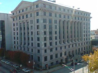
DeKalb County is located in the north central portion of the U.S. state of Georgia. As of the 2020 census, the population was 764,382, making it Georgia's fourth-most populous county. Its county seat is Decatur.
Coweta County is a county located in the west central portion of the U.S. state of Georgia. It is part of Metro Atlanta. As of the 2020 census, the population was 146,158. The county seat is Newnan.
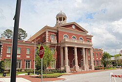
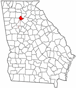
Cherokee County is located in the US state of Georgia. As of the 2020 Census, the population was 266,620. The county seat is Canton. The county Board of Commissioners is the governing body, with members elected to office. Cherokee County is included in the Atlanta Metropolitan Area.
Chamblee is a city in northern DeKalb County, Georgia, United States, northeast of Atlanta. The population was 30,164 as of the 2020 census.
Cumming is a city in Forsyth County, Georgia, United States, and the sole incorporated area in the county. It is a suburban city, and part of the Atlanta metropolitan area. In the 2020 census, the population is 7,318, up from 5,430 in 2010. Surrounding unincorporated areas with a Cumming mailing address have a population of approximately 100,000. Cumming is the county seat of Forsyth County.
East Point is a suburban city located southwest of Atlanta in Fulton County, Georgia, United States. As of the 2020 census, the city had a population of 38,358. The city name is derived from being at the opposite end of the former Atlanta and West Point Railroad from West Point.
Roswell is a city in northern Fulton County, Georgia, United States. At the official 2020 census, the city had a population of 92,883, making Roswell the state's ninth largest city. A close suburb of Atlanta, Roswell has an affluent historic district.
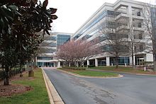
Sandy Springs is a city in northern Fulton County, Georgia, United States, and a suburb of Atlanta. The city's population was 108,080 at the 2020 census, making it Georgia's 7th most populous city. It is the site of several corporate headquarters, including UPS, Newell Brands, Inspire Brands, Focus Brands, Cox Enterprises, and Mercedes-Benz USA's corporate offices.
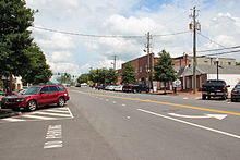
Loganville is a city in Walton and Gwinnett counties, Georgia, United States. The population was 10,458 at the 2010 census. Loganville is located about 36 mi (58 km) east of Atlanta and is part of the Atlanta metropolitan area.
Milton County was a county of the U.S. state of Georgia from 1857 to 1931. It was created on December 18, 1857, from parts of northeastern Cobb, southeastern Cherokee, and southwestern Forsyth counties. The county was named for John Milton, Secretary of State of Georgia from 1777 to 1799. Alpharetta was the county seat until the end of 1931, when Milton was merged with Fulton County to save it from bankruptcy during the Great Depression. At that time, Campbell County, which had already gone bankrupt, was also ceded to Fulton, giving it its 70-mile (110 km) long irregular shape along the Chattahoochee River.
The Fulton County School System is a school district headquartered in Sandy Springs, Georgia, United States. The system serves the area of Fulton County outside the Atlanta city limits. Fulton County Schools serve the cities of Alpharetta, Johns Creek, Milton, Mountain Park, Roswell, and Sandy Springs north of Atlanta, and Chattahoochee Hills, College Park, East Point, Fairburn, Hapeville, Palmetto, Union City, South Fulton, and Fulton's remaining unincorporated areas in the south. Fulton County is the fourth-largest school system in Georgia.
Roswell High School (RHS) is a public high school in Roswell, Georgia, United States which opened in 1949. It serves the entire city of Roswell west of Georgia State Route 400 and the city of Mountain Park, as well as small portions of Alpharetta and Milton. Roswell High School neighbors both Fellowship Christian School and Blessed Trinity Catholic High School. It is also the second oldest of Fulton County's schools in the northern portion of the county, opening between Milton High School (1921), and Chattahoochee High School (1991). Roswell is currently on its third campus, which opened in 1990. The current building is the oldest in-use high school building in north Fulton.
North Springs is an elevated metro station in Sandy Springs, Georgia, and the northern terminus for the Red Line of the Metropolitan Atlanta Rapid Transit Authority (MARTA) rail system. North Springs is primarily a commuter station for Atlanta workers and university students, featuring a large parking deck and direct access on and off State Route 400, a major highway for commuters, so that drivers can avoid surface roads. North Springs attracts commuters from Roswell, Alpharetta and other towns north on State Route 400. As the northern terminus, this station is a hub for buses that continue on north, with connecting bus services to Sandy Springs, the city of Alpharetta, North Point Mall, the city of Roswell, the Ameris Bank Amphitheatre at Encore Park, the Mansell Road and Windward Parkway park-and-rides, and even as far north as the city of Milton. This station also provides bus assistance from North Springs High School via MARTA bus route 87.
Milton is a city in Fulton County, Georgia, United States. Located about 30 miles due north of Atlanta, Milton is known for its rural and equestrian heritage. The City was incorporated on December 1, 2006, out of the unincorporated northernmost part of northern Fulton County. As of the 2010 census, Milton's population was 32,661, with an estimated population of 39,587 in 2019. Milton is named in honor of the former Milton County, which was named after Revolutionary War hero John Milton. The portion of north Fulton County generally north of the Chattahoochee River comprises most of the territory of the former Milton County.
Johns Creek is a city in Fulton County, Georgia, United States. According to the 2020 census, the population was 82,453. The city is a northeastern suburb of Atlanta.
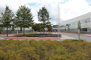
Alpharetta High School is a public high school located in Alpharetta, Georgia, United States within the Fulton County School System. Atlanta Magazine named Alpharetta High School one of the metro Atlanta area's best all-around high schools. In 2020, the U.S. News & World Report ranked the school #7 in Georgia and #281 nationally.
There were several historic bridges around the metro Atlanta, Georgia area, for which many of its current-day roads are named. Many of them originated as ferries, dating back to the 1820s and 1830s, and carrying travelers across the Chattahoochee River and several other smaller rivers. Several were also covered bridges, very few of which remain as historic sites.
Metro Atlanta, designated by the United States Office of Management and Budget as the Atlanta–Sandy Springs–Roswell metropolitan statistical area, is the most populous metropolitan statistical area in the U.S. state of Georgia and the sixth-largest in the United States, based on the July 1, 2023 metropolitan area population estimates from the U.S. Census Bureau. Its economic, cultural, and demographic center is Atlanta, and its total population was 6,307,261 in the 2023 estimate from the U.S. Census Bureau.
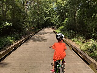
The Big Creek Greenway is a multi-use trail with two completed sections along Big Creek in the state of Georgia, United States. The first section begins at Big Creek Park in Roswell, GA and currently runs 8 miles (13 km) to Marconi Drive in Alpharetta. A second completed section of the trail begins in Forsyth County at McFarland Parkway and runs 11 miles (15.4 km). Once complete, the trail will be 12 feet wide and traverse the cities of Roswell, Alpharetta and Cumming.