Englewood, Tennessee

Last updated

Englewood, Tennessee
Englewood-Main-Street-tn2.jpg
Main Street (SR 39)
McMinn County Tennessee Incorporated and Unincorporated areas Englewood Highlighted 4724040.svg
Location of Englewood in McMinn County, Tennessee.
Coordinates: 35°25′35″N84°29′13″W / 35.42639°N 84.48694°W / 35.42639; -84.48694
Country United States
State Tennessee
County McMinn
Incorporated1919 [1]
Named for Inglewood Forest
Area
[2]
  Total1.91 sq mi (4.95 km2)
  Land1.91 sq mi (4.95 km2)
  Water0.00 sq mi (0.00 km2)
Elevation
860 ft (262 m)
Population
 (2020) [3]
  Total1,550
  Density776.44/sq mi (299.77/km2)
Time zone UTC-5 (Eastern (EST))
  Summer (DST) UTC-4 (EDT)
ZIP code
37329
Area code 423
FIPS code 47-24040 [4]
GNIS feature ID1283789 [5]
Website www.townofenglewood.com

Englewood is a town in McMinn County, Tennessee, United States. The population was 1,550 in 2020.

Contents

History

In 1857, businessman John Dixon established the Eureka Cotton Mills near what is now Englewood where they used regionally-grown cotton to produce yarn. The small mill community that developed around the mill became known as Eureka Mills. By 1875, Elisha Brient, a partner of Dixon, and several of Brient's relatives had acquired Eureka Cotton Mills, and in 1894 the Brients renamed the town of Eureka Mills "Englewood". [6] The name was suggested by Nancy Chestnutt, a sister-in-law of James Brient, who thought the area resembled the English forests of the Robin Hood tales she had read about as a child. [7]

Englewood in 1907 Englewood-tennessee-1907.jpg
Englewood in 1907

In the late 19th century, the Brients began building shops and gristmills approximately 2 miles (3.2 km) northeast of their milltown at a railroad stop called Tellico Junction, where the Atlanta, Knoxville & Northern Railroad (which roughly followed modern U.S. 411) intersected the Tellico Railroad (which connected Athens and Tellico Plains). [7] The Brients also expanded their Englewood operation, establishing a flour and feed mill in partnership with J.W. Chestnutt. [7] In 1907, the entire Englewood operation was moved to Tellico Junction to take advantage of the railroad. The following year, Tellico Junction was renamed Englewood and the original milltown subsequently became known as "Old Englewood". [6]

Display at the Englewood Textile Museum Englewood-textile-museum-tn1.jpg
Display at the Englewood Textile Museum

In 1917, Chestnutt formed the Englewood Manufacturing Company, which built a hosiery mill at Englewood. [6] [7] Englewood grew to include housing for 300 workers, and had its own company stores, sawmill, and school. [6] The tenement section associated with the Eureka Cotton Mill became known as "Yellow Top", the section associated with the hosiery mill became known as "Socktown", and the section associated with the flour mill was called "Onion Hill". [7] Women worked at the mills in large numbers, mainly as weavers, while most supervisory positions were held by men. [6]

During the Great Depression, the Englewood mills were forced to close, and many of the town's residents joined various federal work programs. During World War II, the Eureka Cotton Mill was refurbished by the United National Clothing Center, which made clothing for donations to wartorn countries. Several mills and factories established operations at Englewood over subsequent decades, but most had shut down by the late 1990s. [6] The last of the Englewood mills, Allied Hosiery, closed its doors in 2008. [8] The Englewood Textile Museum, near the corner of Niota Street and Main Street, interprets the town's manufacturing history.

Geography

According to the United States Census Bureau, the town has a total area of 1.7 square miles (4.4 km2), all land. The town is situated in the Chestuee Creek Valley, a broad valley carved by a tributary of the Hiwassee River, which passes a few miles to the southwest. The Unicoi Mountains, part of the greater Blue Ridge Range, dominate the horizon to the south. U.S. Route 411 connects Englewood to Madisonville to the northeast and Etowah to the south. Tennessee State Highway 39 (South Niota Road and West Athens Street) connects Englewood to Athens, opposite the hills to the west and as Tellico Street, connects Englewood to Tellico Plains to the east.

Demographics

Historical population
CensusPop.Note
1920 1,271
1930 1,47115.7%
1940 1,342−8.8%
1950 1,54515.1%
1960 1,5741.9%
1970 1,87819.3%
1980 1,840−2.0%
1990 1,611−12.4%
2000 1,590−1.3%
2010 1,532−3.6%
2020 1,483−3.2%
Sources: [9] [10] [3]

2020 census

Englewood racial composition [11]
RaceNumberPercentage
White (non-Hispanic)1,35587.42%
Black or African American (non-Hispanic)60.4%
Native American 40.27%
Asian 20.13%
Other/Mixed 815.22%
Hispanic or Latino 1026.58%

As of the 2020 United States census, there were 1,550 people, 703 households, and 493 families residing in the town. The population density was 934.4 inhabitants per square mile (360.8/km2). There were 760 housing units at an average density of 446.6 per square mile (172.4/km2). There were 703 households, out of which 31.8% had children under the age of 18 living with them, 51.5% were married couples living together, 14.0% had a female householder with no husband present, and 31.8% were non-families. 29.9% of all households were made up of individuals, and 14.9% had someone living alone who was 65 years of age or older. The average household size was 2.37 and the average family size was 2.94.

In the town, the population was spread out, with 25.9% under the age of 18, 8.0% from 18 to 24, 27.0% from 25 to 44, 22.1% from 45 to 64, and 16.9% who were 65 years of age or older. The median age was 36 years. For every 100 females, there were 94.4 males. For every 100 females age 18 and over, there were 83.8 males.

The median income for a household in the town was $24,000, and the median income for a family was $29,792. Males had a median income of $29,000 versus $22,583 for females. The per capita income for the town was $13,752. About 17.0% of families and 20.1% of the population were below the poverty line, including 24.7% of those under age 18 and 14.7% of those age 65 or over.

Education

McMinn County Schools operates public schools, including Englewood Elementary School, [12] and McMinn Central High School. It was served by Englewood High School until a fire destroyed it in December 1963. McMinn Central opened in fall 1966, with students from Englewood and Etowah. [13]

Related Research Articles

<span class="mw-page-title-main">Monroe County, Tennessee</span> County in Tennessee, United States

Monroe County is a county located on the eastern border of the U.S. state of Tennessee. As of the 2020 census, the population was 46,250. Its county seat is Madisonville, and its largest city is Sweetwater.

<span class="mw-page-title-main">McMinn County, Tennessee</span> County in Tennessee, United States

McMinn County is a county in the U.S. state of Tennessee. It is located in East Tennessee. As of the 2020 census, the population was 53,794. The county has a total area of 432 square miles (1,120 km2). Most of the county is within the Ridge and Valley area of the Appalachian Mountains. Its county seat is Athens. McMinn County, along with Meigs County comprises the Athens, TN Micropolitan Statistical Area.

<span class="mw-page-title-main">Loudon County, Tennessee</span> County in Tennessee, United States

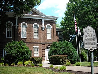
Loudon County is a county in the U.S. state of Tennessee. It is located in the central part of East Tennessee. As of the 2020 census, the population was 54,886. Its county seat is Loudon. Loudon County is included in the Knoxville, TN Metropolitan Statistical Area.

<span class="mw-page-title-main">Attalla, Alabama</span> City in Alabama, United States

Attalla is a city in Etowah County, Alabama, United States. As of the 2010 census, the population was 6,048.

<span class="mw-page-title-main">Boaz, Alabama</span> City in Alabama, United States

Boaz is a city in Marshall and Etowah counties in the U.S. state of Alabama. The Marshall County portion of the city is part of the Albertville Micropolitan Statistical Area. As of the 2020 census, the city's population was 10,107. Boaz was known for its outlet shops.

<span class="mw-page-title-main">Gadsden, Alabama</span> City in Alabama, United States

Gadsden is a city in and the county seat of Etowah County in the U.S. state of Alabama. It is located on the Coosa River about 56 miles (90 km) northeast of Birmingham and 90 miles (140 km) southwest of Chattanooga, Tennessee. It is the primary city of the Gadsden Metropolitan Statistical Area, which has a population of 103,931. The population 33,945 at the 2020 census.

<span class="mw-page-title-main">Etowah, Arkansas</span> Town in Arkansas, United States

Etowah is a town in Mississippi County, Arkansas, United States. The population was 254 at the 2020 census, down from 351 in 2010.

<span class="mw-page-title-main">Canton, Georgia</span> City in Georgia, United States

Canton is a city in and the county seat of Cherokee County, Georgia, United States. As of the 2010 census, the city had a population of 22,958, up from 7,709 in 2000.

<span class="mw-page-title-main">Bonner-West Riverside, Montana</span> CDP in Montana, United States

Bonner-West Riverside is a census-designated place (CDP) in Missoula County, Montana, United States, including the unincorporated communities of Bonner, Milltown, West Riverside, and Pinegrove. It is part of the Missoula, Montana Metropolitan Statistical Area. The population was 1,663 at the 2010 census, a decline from its population of 1,693 in 2000.

<span class="mw-page-title-main">Halls, Tennessee</span> Town in Tennessee, United States

Halls is a town in Lauderdale County, Tennessee, United States. The population was 2,255 at the 2010 census.

<span class="mw-page-title-main">Greenback, Tennessee</span> City in Tennessee, United States

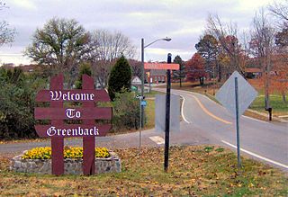
Greenback is a city in Loudon County, Tennessee, United States. Its population was at 1,102, according to the 2020 census. It is included in the Knoxville Metropolitan Statistical Area.

<span class="mw-page-title-main">Athens, Tennessee</span> City in Tennessee, United States

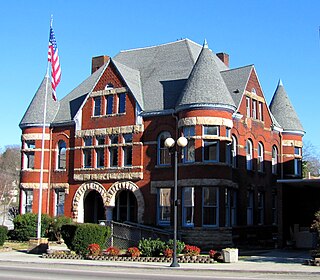
Athens is the county seat of McMinn County, Tennessee, United States and the principal city of the Athens Micropolitan Statistical Area has a population of 53,569. The city is located almost equidistantly between the major cities of Knoxville and Chattanooga. The population was 14,084 at the 2020 census. The population of the zipcode area is at 23,726

<span class="mw-page-title-main">Calhoun, Tennessee</span> Town in Tennessee, United States

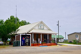
Calhoun is a town in McMinn County, Tennessee, United States. It is part of the Athens Micropolitan Statistical Area. The population was estimated at 536 in 2020.

<span class="mw-page-title-main">Etowah, Tennessee</span> City in McMinn County, Tennessee, United States

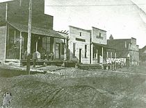
Etowah is a city in McMinn County in the U.S. state of Tennessee. The population was 3,613 at the 2020 census.

<span class="mw-page-title-main">Niota, Tennessee</span> City in Tennessee, United States

Niota is a city in McMinn County, Tennessee, United States. The population was estimated at 772 in 2020 by the U.S. Census Bureau.

<span class="mw-page-title-main">Madisonville, Tennessee</span> City in Tennessee, United States

Madisonville is the county seat of Monroe County, Tennessee, United States. It is located in East Tennessee on the eastern border of the state. As of the 2020 census, the city's population was 5,132.

<span class="mw-page-title-main">Vonore, Tennessee</span> Town in Tennessee, United States

Vonore is a town in Monroe County, Tennessee, which is located on the southeast border of the state. The population was 1,574 as of the 2020 census. The city hall, library, community center, police department, and fire department are located on Church Street.

<span class="mw-page-title-main">Sweetwater, Tennessee</span> City in Tennessee, United States

Sweetwater is a city in Monroe and McMinn counties in the U.S. state of Tennessee, and the most populous city in Monroe County. As of the 2020 census, its population was 6,312. Sweetwater is the home of the Craighead Caverns which contains the Lost Sea, the United States' largest underground lake. In 2022, TravelMag named Sweetwater one of Tennessee’s Ten Most Charming Cities.

<span class="mw-page-title-main">Harriman, Tennessee</span> City in Tennessee, United States

Harriman is a city located primarily in Roane County, Tennessee, with a small extension into Morgan County. The population of Harriman was 5,892 at the time of the 2020 census.

McMinn County School District or McMinn County Schools is a school district headquartered in Athens, Tennessee.

References

  1. Tennessee Blue Book , 2005-2006, pp. 618-625.
  2. "ArcGIS REST Services Directory". United States Census Bureau. Retrieved October 15, 2022.
  3. 1 2 "Census Population API". United States Census Bureau. Retrieved October 15, 2022.
  4. "U.S. Census website". United States Census Bureau . Retrieved January 31, 2008.
  5. "US Board on Geographic Names". United States Geological Survey. October 25, 2007. Retrieved January 31, 2008.
  6. 1 2 3 4 5 6 Jenny Burney, "Englewood Mills". Tennessee Encyclopedia of History and Culture (Nashville, Tenn.: Rutledge Hill Press, 1998), pp. 256-257.
  7. 1 2 3 4 5 C. Stephen Byrum, McMinn County (Memphis, Tenn.: Memphis State University Press, 1984), pp. 48-50.
  8. McMinn County Mill Shuts Down, Leaving 45 Jobless. WBIR.com, October 6, 2008. Retrieved: July 23, 2009.
  9. "Census of Population and Housing: Decennial Censuses". United States Census Bureau . Retrieved March 4, 2012.
  10. "Incorporated Places and Minor Civil Divisions Datasets: Subcounty Resident Population Estimates: April 1, 2010 to July 1, 2012". Population Estimates. U.S. Census Bureau. Archived from the original on June 11, 2013. Retrieved December 11, 2013.
  11. "Explore Census Data". data.census.gov. Retrieved December 27, 2021.
  12. "Home". Englewood Elementary School. Retrieved January 28, 2022.
  13. "First Central High class came together from Englewood, Etowah, and Cook high schools". Daily Post-Athenian . June 6, 2017. Retrieved January 28, 2022.