
Roane County is a county of the U.S. state of Tennessee. As of the 2020 census, the population was 53,404. Its county seat is Kingston. Roane County is included in the Knoxville, TN Metropolitan Statistical Area.

McNairy County is a county located in the U.S. state of Tennessee. As of the 2020 census, the population was 25,866. Its county seat and largest city is Selmer. McNairy County is located along Tennessee's border with the state of Mississippi.

McMinn County is a county in the U.S. state of Tennessee. It is located in East Tennessee. As of the 2020 census, the population was 53,794. The county has a total area of 432 square miles (1,120 km2). Most of the county is within the Ridge and Valley area of the Appalachian Mountains. Its county seat is Athens. McMinn County, along with Meigs County comprises the Athens, TN Micropolitan Statistical Area.
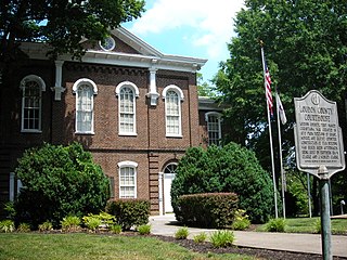
Loudon County is a county in the U.S. state of Tennessee. It is located in the central part of East Tennessee. As of the 2020 census, the population was 54,886. Its county seat is Loudon. Loudon County is included in the Knoxville, TN Metropolitan Statistical Area.

Hamblen County is a county located in the U.S. state of Tennessee. As of the 2020 census, the population was 64,499. Its county seat and only incorporated city is Morristown. Hamblen County is the core county of the Morristown, Tennessee Metropolitan Statistical Area, which includes Hamblen, Jefferson, and Grainger counties. The county and the Morristown MSA are included in the Knoxville-Morristown-Sevierville, TN Combined Statistical Area.

Maryville is a city in and the county seat of Blount County, Tennessee. Its population was 31,907 at the 2020 census.
Mascot is a census-designated place (CDP) in Knox County, Tennessee. The population was 2,760 at the 2020 census up from 2,411 at the 2010 census.

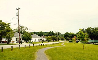
Lenoir City is a suburban city located in Loudon County, Tennessee. The population was 10,117 at the 2020 census. It is included in the Knoxville metropolitan area in East Tennessee, along the Tennessee River southwest of Knoxville.
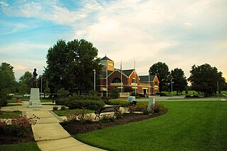
Athens is the county seat of McMinn County, Tennessee, United States and the principal city of the Athens Micropolitan Statistical Area has a population of 53,569. The city is located almost equidistantly between the major cities of Knoxville and Chattanooga. The population was 14,084 at the 2020 census. The population of the zipcode area is at 23,726

Calhoun is a town in McMinn County, Tennessee, United States. It is part of the Athens Micropolitan Statistical Area. The population was estimated at 536 in 2020.

Englewood is a town in McMinn County, Tennessee, United States. The population was 1,550 in 2020.

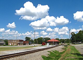
Etowah is a city in McMinn County in the U.S. state of Tennessee. The population was 3,613 at the 2020 census.
Niota is a city in McMinn County, Tennessee, United States. The population was estimated at 772 in 2020 by the U.S. Census Bureau.
Farragut is a suburban town located in Knox and Loudon counties in the State of Tennessee, United States. The town's population was 23,506 at the 2020 census. It is included in the Knoxville Metropolitan Area. The town is named in honor of Union Admiral David Farragut, who was born just east of Farragut at Campbell's Station in 1801, and fought in the American Civil War.

Sweetwater is a city in Monroe and McMinn counties in the U.S. state of Tennessee, and the most populous city in Monroe County. As of the 2020 census, its population was 6,312. Sweetwater is the home of the Craighead Caverns which contains the Lost Sea, the United States' largest underground lake. In 2022, TravelMag named Sweetwater one of Tennessee’s Ten Most Charming Cities.

Powell, formerly known as Powell Station, is a census-designated place in Knox County, Tennessee. The area is located in the Emory Road corridor, just north of Knoxville, southeast of Clinton, and east of Oak Ridge. It had a population of 13,802 during the 2020 census. It is included in the Knoxville, TN Metropolitan Statistical Area.

Karns is an unincorporated community and census-designated place in northwest Knox County, Tennessee, about 11 miles (18 km) northwest of the center of Knoxville. The population of the CDP was 3,536 at the 2020 census.

Strawberry Plains is an unincorporated community and census-designated place (CDP) in Jefferson, Knox, and Sevier counties in the State of Tennessee, United States. Before 2010, it was treated by the United States Census Bureau as a census county division. It is included in both the Knoxville Metropolitan Statistical Area and the Morristown Metropolitan Statistical Area.
McMinn County School District or McMinn County Schools is a school district headquartered in Athens, Tennessee.
Etowah City Elementary School District is a school district of Etowah, Tennessee. It operates a single K-8 school, Etowah Elementary School a.k.a. Etowah City School (ECS).


