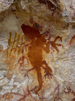
West Papua, formerly Irian Jaya Barat, is a province of Indonesia. It covers most of the two western peninsulas of the island of New Guinea, the eastern half of the Bird's Head Peninsula and the whole of the Bomberai Peninsula, along with nearby smaller islands. The province is bordered to the north by the Pacific Ocean, to the west by Southwest Papua Province, the Halmahera Sea and the Ceram Sea, to the south by the Banda Sea, and to the east by the province of Central Papua and the Cenderawasih Bay. Manokwari is the province's capital and largest city. With an estimated population of 561,403 in mid-2022, West Papua is the least populous province in Indonesia after Southwest Papua, which was a part of West Papua until separated off in 2022.

Western New Guinea, also known as Papua, Indonesian New Guinea, Indonesian Papua, is the western, Indonesian half of the island of New Guinea. Since the island is alternatively named Papua, the region is also called West Papua.

Commodore Yosaphat "Yos" Sudarso was an Indonesian naval officer killed at the Battle of Arafura Sea. At the time of his death, Yos Sudarso was deputy chief of staff of the Indonesian Navy and in charge of an action to infiltrate Dutch New Guinea. He was promoted to vice admiral posthumously.

The Mairasi languages, also known as Etna Bay are a small independent family of Papuan languages in the classifications of Malcolm Ross and Timothy Usher, that had been part of Stephen Wurm's Trans–New Guinea proposal. They are named after Etna Bay, located in the southeastern corner of West Papua province, in Indonesia.

Yos Sudarso Bay, known as Humboldt Bay from 1827 to 1968, is a small bay on the north coast of New Guinea, about 50 kilometers west of the border between Indonesia's province of Papua and the country of Papua New Guinea. The Indonesian provincial capital Jayapura is situated on the bay.

The Bird's Head Peninsula or Doberai Peninsula, is a large peninsula that makes up the northwest portion of the island of New Guinea, comprising the Indonesian provinces of Southwest Papua and West Papua. It is often referred to as The Vogelkop, and is so named because its shape looks like a bird's head on the island of New Guinea. The peninsula at the opposite end of the island is called the Bird's Tail Peninsula. The peninsula just to the south is called the Bomberai Peninsula.

Cenderawasih Bay, also known as Sarera Bay and formerly Geelvink Bay, is a large bay in northern Province of Papua, Central Papua and West Papua, New Guinea, Indonesia.
Bomberai Peninsula, is located in the Western New Guinea region, opposite to and to the south of the Bird's Head Peninsula. To the west lies the Sebakor Bay and to the south Kamrau Bay. Sabuda island lies off the western tip of the peninsula, and is separated from the mainland by Berau and Bintuni straits.

Teluk Cenderawasih National Park is the largest marine national park of Indonesia, located in Cenderawasih Bay, south-east of Bird's Head Peninsula. It includes the islands of Mioswaar, Nusrowi Island, Roon, Rumberpon, Anggrameos and Yoop. The park protects a rich marine ecosystem, with over 150 recorded coral species, for which it is considered a potential World Heritage Site.

Kaimana is a district and a small port town in West Papua, Indonesia and capital of the Kaimana Regency. The district had a population of 44,332 in mid 2022, while the town had 16,718 and Krooy had 12,416 inhabitants.

Kaimana Regency is a regency in the south of West Papua province of Indonesia. It covers an area of 18,500 sq. km, and had a population of 46,249 at the 2010 Census and 62,256 at the 2020 Census; the official estimate as at mid 2022 was 63,633. The administrative centre is the town of Kaimana. The Mairasi languages are spoken in the regency, among other languages.

Teluk Bintuni Regency is a regency of West Papua Province of Indonesia. It covers an area of 18,637 km2, comprising administrative districts on three sides of Bintuni Bay, a gulf that separates the Bird's Head Peninsula and Bomberai Peninsula which together form the main geographical constituents of the province; it had a population of 52,422 at the 2010 Census and 87,083 at the 2020 Census; the official estimate as at mid 2022 was 92,236. The administrative centre is the town of Bintuni.
Mairasi is a Papuan language of the Bomberai Peninsula of West Papua, Indonesia.
Semimi, or Etna Bay, is a Papuan language spoken in Kaimana Regency, West Papua, Indonesia.
Kowiai (Kuiwai) is an Austronesian language of the Bomberai Peninsula in New Guinea. According to the Atlas of Languages of Intercultural Communication in the Pacific and Asia, Kowiai is spoken in the coastal regions between Arguni and Etna bay.
Irarutu, Irahutu, or Kasira, is an Austronesian language of most of the interior of the Bomberai Peninsula of north-western New Guinea in Teluk Bintuni Regency. The name Irarutu comes from the language itself, where ira conjoins with ru to create 'their voice'. When put together with tu, which on its own means 'true', the meaning of the name becomes 'Their true voice' or 'The people's true language'.
Kuri, or Nabi, is a small Austronesian language of the Bomberai Peninsula of New Guinea. Lexically it is very close to Irarutu.

The Berau Gulf, formerly the MacCleur Gulf, separates the Vogelkop (Doberai) and Bomberai Peninsulas of Western New Guinea. It opens on the Ceram Sea to the west and ends in Bintuni Bay to the east.

The Kingdom of Kaimana or Kingdom of Sran is one of the oldest Muslim kingdoms in West Papua, Indonesia. The kingdom was established by Imaga, with the title Rat Sran Nati Pattimuni, traditionally in 1309.


