
Belconnen is a district in the Australian Capital Territory in Australia. The district is subdivided into 27 divisions (suburbs), sections and blocks. As at the 2021 census, the district had a population of 106,061 people; and was the most populous district within the Australian Capital Territory (ACT).

Florey is a residential suburb of the Belconnen district of Canberra, located within the Australian Capital Territory, Australia. Florey was gazetted on 5 August 1975 and most houses were constructed in the mid-1980s.

Charnwood is a suburb in the Belconnen district of Canberra located within the Australian Capital Territory, Australia.
Melba is a residential suburb in the Belconnen district of Canberra, located within the Australian Capital Territory, Australia. The suburb of Melba is named after Dame Nellie Melba (1861–1931), the first internationally recognised Australian opera soprano. The streets are named after composers, singers and other musically notable Australians or people with strong Australian connections.
Kinlyside is a rural locality in the Australian Capital Territory. It was gazetted in 1991 as a planned outer suburb of Gungahlin. It was never released for development, and the governing Labor Party campaigned at the 2004 election and 2008 election on the policy of making Kinlyside a nature reserve instead. In 2013, it was set aside as a protected area that would remain undeveloped under an environmental offsets plan associated with increased development in Gungahlin. As of 2019, it remains a gazetted locality in the Territory Plan.

Page is a residential suburb in the Belconnen district of Canberra, located within the Australian Capital Territory, Australia. The suburb is named in honour of Sir Earle Page, a Prime Minister. Streets in Page are named in honour of Australian scientists. Page was established in 1968.

Belconnen is the most inner suburb of the larger district of Belconnen in Canberra, Australia. Sharing its name with the larger district which encapsulates it, the suburb is surrounded with well developed infrastructure, and planning which allows it sunset views from the Brindabellas on its western side. The suburb contains important amenities for the District of Belconnen including the Belconnen Town Centre and Lake Ginninderra as well as its own well populated residential areas. It is bounded by Ginninderra Drive, Aikman Drive, Eastern Valley Way, Belconnen Way and Coulter Drive. It has a number of parks such as Margaret Timpson Park, Eastern Valley Oval and on the foreshores of Lake Ginninberra, Diddams Close Park and John Knight Memorial Park.

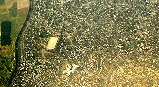
Dunlop is a suburb of the Belconnen district of Canberra, located within the Australian Capital Territory, Australia. Dunlop is at the far north-west edge of Canberra, near the border with the state of New South Wales. Approximately 11.6 kilometres (7.2 mi) north-west of the city, Dunlop is next to the suburbs of Fraser, Charnwood and Macgregor. At the edge and within Dunlop lies the Canberra Nature Park called Dunlop Grasslands Nature Reserve, West Belconnen Ponds, Jarramlee Pond and Fassifern Pond which are part of the Ginninderra Catchment.
Evatt is a suburb in the Belconnen district of Canberra, located within the Australian Capital Territory, Australia. Evatt lies between the suburbs of McKellar, Belconnen, Florey, Melba and Spence.
Fraser is a suburb in the Belconnen district of Canberra, located within the Australian Capital Territory, Australia. Fraser lies at the north west end of Belconnen.
Flynn is a suburb in the Belconnen district of Canberra, located within the Australian Capital Territory, Australia.
Higgins is a suburb in the Belconnen district of Canberra, in the Australian Capital Territory, Australia. The suburb is named after politician and judge Henry Bournes Higgins (1851–1929). It was gazetted on 6 June 1968. The streets of Higgins are named after judges.
Holt is a suburb in the Belconnen district of Canberra, located within the Australian Capital Territory, Australia. It was gazetted on 2 July 1970 and was named after Harold Holt, Prime Minister of Australia 1966–67. Streets are named after sportsmen and sportswomen.
Latham is a residential suburb in the Belconnen district of Canberra, located within the Australian Capital Territory, Australia. The suburb is named for John Latham, Chief Justice of the High Court of Australia from 1935 to 1952. Streets in Latham have the names of Australian judges.

Scullin is a residential suburb in the Belconnen district of Canberra, located within the Australian Capital Territory, Australia. The suburb is named after Prime Minister of Australia James Scullin. It was gazetted on 6 June 1968. In the city of Canberra, suburbs are assigned street names that reflect a distinct sub-group of cultural or historical Australian significance. The streets in the suburb of Scullin are named after aviators. Scullin is located adjacent to the suburbs of Higgins, Florey, Page and Hawker. Southern Cross Early Childhood School and Scullin neighbourhood oval are located within the suburb. It is bordered by Kingsford Smith Drive, Belconnen Way, Southern Cross Drive and Chewings Street. Scullin is approximately 20 minutes walk and 5 minutes by car from the Belconnen Town Centre and 15 minutes walk and 3 minutes by car from the Hawker Shopping Centre. It is approximately 10 to 15 minutes by car from Canberra City and 30 minutes from Canberra Airport.
Spence is a residential suburb in the Belconnen district of Canberra, located within the Australian Capital Territory, Australia. It was gazetted on 2 November 1972, and streets are named after trade unionists.

Amaroo is a suburb in the Canberra, Australia district of Gungahlin and was gazetted on 18 October 1991. Amaroo means 'a beautiful place' in Nyoongar. Place names in Amaroo such as Shoalhaven Avenue are named after Australian rivers and lakes. Amaroo is adjacent to the suburbs of Ngunnawal, Gungahlin, Moncrieff, Forde, Bonner and Jacka. The suburb is bounded by Mirrabei Drive and Horse Park Drive and Gundaroo Drive. The suburb is located approximately 1 km from the Gungahlin Town Centre and 15 km from the centre of Canberra.

Nicholls is a suburb in the Canberra, Australia district of Gungahlin. It was named after Sir Douglas Nicholls (1906–1988) who was born at Cummeragunja Aboriginal mission, New South Wales. Nicholls was a footballer, pastor, activist, and Governor of South Australia, 1976–1977. In line with the philosophy of naming Canberra's streets, those of Nicholls are named after sportspeople. The suburb incorporates a large shallow body of water, designated Gungahlin Pond, with The Lakes golf course and the greatest number of residential streets on one side and a small cluster of residential streets, the "pondside promenade", named after birds, on the other. There is no direct connecting road between the two.

The geology of the Australian Capital Territory includes rocks dating from the Ordovician around 480 million years ago, whilst most rocks are from the Silurian. During the Ordovician period the region—along with most of eastern Australia—was part of the ocean floor. The area contains the Pittman Formation consisting largely of quartz-rich sandstone, siltstone and shale; the Adaminaby Beds and the Acton Shale.

Ginninderra is the name of the former agricultural lands surrendered to urban development on the western and north-western fringes of Canberra, the capital of Australia. Ginninderra corresponds with the watershed of Ginninderra Creek, which is now in part occupied by the Canberra districts of Belconnen and Gungahlin.

