India's remote sensing program was developed with the idea of applying space technologies for the benefit of humankind and the development of the country. The program involved the development of three principal capabilities. The first was to design, build and launch satellites to a Sun-synchronous orbit. The second was to establish and operate ground stations for spacecraft control, data transfer along with data processing and archival. The third was to use the data obtained for various applications on the ground.

Cartosat-1 is a stereoscopic Earth observation satellite in a Sun-synchronous orbit, and the first one of the Cartosat series of satellites. The eleventh satellite of ISRO in Indian Remote Sensing Satellite (IRS) series. The satellite was launched by Indian Space Research Organisation and is operated by NTRO. Weighing around 1560 kg at launch, its applications will mainly be towards cartography in India.
Resourcesat-1 is an advanced remote sensing satellite built by Indian Space Research Organization (ISRO). The tenth satellite of ISRO in IRS series, Resourcesat-1 is intended to not only continue the remote sensing data services provided by IRS-1C and IRS-1D, both of which have far outlived their designed mission lives, but also vastly enhance the data quality.
Cartosat-2 is an Earth observation satellite in a Sun-synchronous orbit and the second of the Cartosat series of satellites. The satellite was built, launched and maintained by the Indian Space Research Organisation (ISRO). Weighing around 680 kg at launch, its applications will mainly be towards cartography in India. It was launched by the Polar Satellite Launch Vehicle PSLV C7 launch vehicle on 10 January 2007.

Cartosat-3 is an advanced Indian Earth observation satellite built and developed by Indian Space Research Organisation (ISRO), which replaces the Indian Remote Sensing Satellite (IRS) series. It has a panchromatic resolution of 0.25 metres making it one of the imaging satellite with highest resolution in the world at the time of launch and MX of 1 metre with a high quality resolution which is a major improvement from the previous payloads in the Cartosat series.

Oceansat-2 is the second Indian satellite built primarily for ocean applications. It was a part of the Indian Remote Sensing Programme satellite series. Oceansat-2 is an Indian satellite designed to provide service continuity for operational users of the Ocean Colour Monitor (OCM) instrument on Oceansat-1. It will also enhance the potential of applications in other areas. The OceanSat-2 mission was approved by the government of India on 16 July 2005.
Cartosat-2B is an Earth observation satellite in a Sun-synchronous orbit and the fourth of the Cartosat series of satellites. The satellite is the seventeenth satellite in the Indian Remote Sensing (IRS) satellite series to be built by the Indian Space Research Organisation (ISRO).
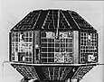
IRS-P2 was an Earth observation satellite launched under the National Natural Resources Management System (NNRMS) programme undertaken by Indian Space Research Organisation (ISRO). The objectives of the mission were to provide spaceborne capability to India in observing and managing natural resources and utilizing them in a productive manner. The satellite carried imaging multi-spectral radiometers on board for radio sensing of the resources.
IRS-1C was the fifth remote sensing Indian satellite built, and designed by Indian Space Research Organization (ISRO). IRS-1C is first second-generation operational Remote Sensing Satellite. The satellite carries payloads with enhanced capabilities like better spatial resolution additional spectral bands, improved repeatability and augment the remote sensing capability of the existing IRS-1A and IRS-1B.
The Cartosat is a series of Indian optical Earth observation satellites built and operated by the Indian Space Research Organisation (ISRO). The Cartosat series is a part of the Indian Remote Sensing Program. They are used for Earth's resource management, defence services and monitoring.
IRS-1E was an Earth observation mission launched under the National Natural Resources Management System (NNRMS) programme by Indian Space Research Organisation (ISRO). Sometimes written IRS-P1. The objective of the mission was to develop Earth imagery using instruments carried on board. Due to a malfunction of the launch vehicle, the satellite deviated from its path and plunged into the Indian Ocean.
IRS-1A, Indian Remote Sensing satellite-1A, the first of the series of indigenous state-of-art remote sensing satellites, was successfully launched into a polar Sun-synchronous orbit on 17 March 1988 from the Soviet Cosmodrome at Baikonur. IRS-1A carries two sensors, LISS-1 and LISS-2, with resolutions of 72 m (236 ft) and 36 m (118 ft) respectively with a swath width of about 140 km (87 mi) during each pass over the country. Undertaken by the Indian Space Research Organisation (ISRO). It was a part-operational, part-experimental mission to develop Indian expertise in satellite imagery.
IRS-1B, Indian Remote Sensing satellite-1B, the second of the series of indigenous state-of-art remote sensing satellites, was successfully launched into a polar Sun-synchronous orbit on 29 August 1991 from the Soviet Cosmodrome at Baikonur. IRS-1B carries two sensors, LISS-1 and LISS-2, with resolutions of 72 m (236 ft) and 36 m (118 ft) respectively with a swath width of about 140 km (87 mi) during each pass over the country. It was a part-operational, part-experimental mission to develop Indian expertise in satellite imagery. It was a successor to the remote sensing mission IRS-1A, both undertaken by the Indian Space Research Organisation (ISRO).
Oceansat-1 or IRS-P4 was the first Indian satellite built primarily for ocean applications. It was a part of the Indian Remote Sensing Programme satellite series. The satellite carried an Ocean Colour Monitor (OCM) and a Multi-frequency Scanning Microwave Radiometer (MSMR) for oceanographic studies. Oceansat-1 thus vastly augment the IRS satellite system of Indian Space Research Organisation (ISRO) comprising four satellites, IRS-1B, IRS-1C, IRS-P3 and IRS-1D and extend remote sensing applications to several newer areas.
PSLV-C1 was the overall fourth mission of the Polar Satellite Launch Vehicle (PSLV) program by Indian Space Research Organisation (ISRO). The vehicle carried IRS-1D satellite which was deployed in the Sun-synchronous orbit (SSO). This was India's first launch vehicle built without Russian assistance and PSLV's first operational flight placed IRS-1D into a polar orbit. However, it could not place the satellite in the desired circular orbit but in an elliptical orbit due to a leak of helium gas from one of the components. The mission was termed partial failure since the satellite could not be placed at the desired altitude.
PSLV-C2 was the second operational launch and overall fifth mission of the Polar Satellite Launch Vehicle (PSLV) program. This launch was also the forty-third launch by Indian Space Research Organisation (ISRO) since its first mission on 1 January 1962. The vehicle carried three satellites which were deployed in the Sun-synchronous low Earth orbit. The vehicle carried India's first remote sensing satellite Oceansat-1 (IRS-P4) as the main payload. It also carried South Korean satellite KITSAT-3 and German satellite DLR-Tubsat as auxiliary payloads. PSLV-C2 was the first Indian Expendable launch vehicle to carry and deploy more than one satellite in a mission. This was also India's and ISRO's first commercial spaceflight where South Korea and Germany each paid US$1.0 million to ISRO for launching their satellites.
PSLV-C3 was the third operational launch and overall sixth mission of the PSLV program. This launch was also the forty-sixth launch by Indian Space Research Organisation since its first mission on 1 January 1962. The vehicle carried three satellites which were deployed in the Sun-synchronous Low Earth orbit. The vehicle carried Technology Experiment Satellite, BIRD and PROBA. This was India's and ISRO's second commercial spaceflight. PSLV-C3 was launched at 10:23 a.m. IST on 22 October 2001 from Satish Dhawan Space Centre.
PSLV-C5 was the fifth operational launch and overall eighth mission of the Polar Satellite Launch Vehicle program. This launch was also the fifty-second launch by the Indian Space Research Organisation (IRSO) since its first mission on 1 January 1962. The vehicle carried and injected India's remote sensing satellite Resourcesat-1 into a Sun-synchronous orbit; this was the heaviest and most sophisticated satellite built by IRSO through 2003. PSLV-C5 was launched at 04:52 hours Coordinated Universal Time on 17 October 2003 from Satish Dhawan Space Centre.

PSLV-C6 was the sixth operational launch and overall ninth mission of the PSLV program. This launch was also the fifty-fourth launch by Indian Space Research Organisation since its first mission on 1 January 1962. The vehicle carried and injected India's two satellites; Cartosat-1 and HAMSAT into the Sun-synchronous orbit. PSLV-C6 was launched at 04:44 hours Coordinated Universal Time on 5 May 2005 from the second launch pad of the Satish Dhawan Space Centre.