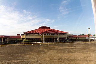
Patillas Airport was a public airport 1.5 miles (2.4 km) south of the small town of Patillas, in Puerto Rico.
Cabo Rojo Airport is a Caribbean coastal airport in the Dominican Republic 16 kilometres (9.9 mi) southeast of Pedernales, a port city on the border with Haiti. The airport offers domestic flights to destinations within the Dominican Republic.

Arroyo Barril International Airport is an airport 10 kilometres (6.2 mi) west of Samaná, the capital of Samaná Province in the Dominican Republic. The airport is on the southern shore of the Samaná Peninsula, facing Samaná Bay to the south.
Osvaldo Virgil National Airport is an airport in the province of Monte Cristi on the north coast of the Dominican Republic. The airport was opened in 2006 for tourism with flights from other Dominican airports. The runway is just north of the city of Monte Cristi. The airport is named after baseball player Ozzie Virgil Sr.
Baigua Airport was an agricultural airstrip near the hamlet of Baigue, in the La Altagracia Province of the Dominican Republic. Baigue is 7 kilometres (4.3 mi) southeast of Higüey.
Walterio Airport is a rural airport 10 kilometres (6.2 mi) south of the coastal city of Monte Cristi, Dominican Republic. It serves private aviation and air sports. Now with the Osvaldo Virgil Airport replacing most of its operations, this airport has been reverted as only a runway.
Los Montones Airport is an airstrip 11 kilometres (7 mi) north of San Cristóbal, Dominican Republic.
Lombo Airport was an airstrip serving Lombo, a hamlet in the Nord-Ubangi Province of the Democratic Republic of the Congo.
Junín Airport was a domestic airport serving Junín, a city in the Buenos Aires Province of Argentina. It is located 2 kilometres (1 mi) north of the city.
Villa María de Río Seco Airport was a rural airstrip 8 kilometres (5 mi) east of Villa de María del Río Seco, a town in the Córdoba Province of Argentina.
San Alfonso Airport was a rural airstrip 14 kilometres (8.7 mi) west of Alhué, a town in the Santiago Metropolitan Region of Chile.
Rucamelen Airport Spanish: Aeropuerto de Rucamelen, was a rural airstrip 14 kilometres (8.7 mi) east of Bulnes, a town in the Bío Bío Region of Chile.
Chépica Airport was an airstrip 4 kilometres (2.5 mi) west of Chépica, a town in the O'Higgins Region of Chile.
La Vertiente Airport Spanish: Aeropuerto de La Vertiente, was a public use airport located near Chillán, Bío Bío, Chile.
Papageno Airport, was an airstrip 1 kilometre (0.6 mi) west of Calafquén Lake. Panguipulli, a city in the Los Ríos Region of Chile, is 11 kilometres (6.8 mi) to the south.
Bosondjo Airport was an airstrip serving Bosondjo, a town in Mongala Province, Democratic Republic of the Congo.
Katumbi Airport was an airport 2 kilometres (1.2 mi) southwest of the village of Katumbi, Republic of Malawi.
Kala Airport was an airstrip near Monganzu, a hamlet on the Ubangi River in Sud-Ubangi Province, Democratic Republic of the Congo.
Kempa Airport was an airstrip serving the village of Kempa in Mai-Ndombe Province, Democratic Republic of the Congo.
General Villegas Airport is an airport serving the town of General Villegas in the Buenos Aires Province of Argentina. The airport is 3 kilometres (2 mi) north of General Villegas.

