Route 21 is a highway in Northern New Jersey, running 14.35 mi (23.09 km) from the Newark Airport Interchange with U.S. Route 1/9 and U.S. Route 22 in Newark, Essex County to an interchange with U.S. Route 46 in Clifton, Passaic County. The route is a four- to six-lane divided highway known as McCarter Highway on its southern portion in Newark that serves as a connector between the Newark and Paterson areas, following the west bank of the Passaic River for much of its length. It also serves as the main north–south highway through the central part of Newark, connecting attractions in Downtown Newark with Newark Airport. The portion of Route 21 through Newark is a surface arterial that runs alongside the elevated Northeast Corridor rail line through the southern part of the city and continues north through Downtown Newark while the portion north of Downtown Newark is a freeway. Route 21 intersects many major roads including Interstate 78, Route 27, and Interstate 280 in Newark, Route 7 in Belleville, and Route 3 in Clifton.
Route 7 is a state highway in the northern part of New Jersey in the United States. It has two sections, an east–west alignment running from U.S. Route 1/9 Truck in Jersey City to Route 21 in Belleville, and a north–south alignment running from the Newark/Belleville to the Nutley/Clifton border. The New Jersey Department of Transportation (NJDOT) lists Route 7 as a single north–south highway with a small gap between the alignments. The entire highway has a combined length of 9.46 mi (15.22 km).
Route 17 is a state highway in Bergen County, New Jersey, United States, that provides a major route from the George Washington Bridge, Lincoln Tunnel and other northeast New Jersey points to the New York State Thruway at Suffern, New York. It runs 27.20 mi (43.77 km) from an intersection with Route 7 and County Route 507 (CR 507) in North Arlington north to the New York border along Interstate 287 (I-287) in Mahwah, where New York State Route 17 (NY 17) continues into New York. Between Route 7 and Route 3 in Rutherford, Route 17 serves as a local road. From Route 3 north to the junction with U.S. Route 46 (US 46) in Hasbrouck Heights, the road is a suburban arterial with jughandles. The portion of Route 17 from US 46 to I-287 near the state line in Mahwah is a limited-access road with all cross traffic handled by interchanges, and many driveways and side streets accessed from right-in/right-out ramps from the right lane. For three miles (5 km) north of Route 4, well over a hundred retail stores and several large shopping malls line the route in the borough of Paramus. The remainder of this portion of Route 17 features lighter suburban development. The northernmost portion of Route 17 in Mahwah runs concurrently with I-287 to the New York border.

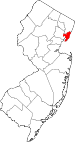
Kearny is a town in the western part of Hudson County, New Jersey, United States and a suburb of Newark. As of the 2010 United States Census, the town's population was 40,684, reflecting an increase of 171 (+0.4%) from the 40,513 counted in the 2000 Census, which had in turn increased by 5,639 (+16.2%) from the 34,874 counted in the 1990 Census.

The Passaic River is a river, approximately 80 mi (129 km) long, in northern New Jersey in the United States. The river in its upper course flows in a highly circuitous route, meandering through the swamp lowlands between the ridge hills of rural and suburban northern New Jersey, called the Great Swamp, draining much of the northern portion of the state through its tributaries. In its lower portion, it flows through the most urbanized and industrialized areas of the state, including along downtown Newark. The lower river suffered from severe pollution and industrial abandonment in the 20th century. In April 2014, the U.S. Environmental Protection Agency (EPA) announced a $1.7 billion plan to remove 4.3 million cubic yards of toxic mud from the bottom of lower eight miles (13 km) of the river. It is considered one of the most polluted stretches of water in the nation and the project one of the largest clean-ups ever undertaken.
Interstate 280 (I-280) is a 17.85-mile (28.73 km) Interstate Highway in the U.S. state of New Jersey. It provides a spur from I-80 in Parsippany-Troy Hills, Morris County to Newark, and I-95 in Kearny, Hudson County. In Kearny, access is provided toward the Holland Tunnel and Lincoln Tunnel to New York City. The western part of the route runs through suburban areas of Morris and Essex counties, crossing the Watchung Mountains. Upon reaching The Oranges, the setting becomes more urbanized and I-280 runs along a depressed alignment before ascending again in Newark. I-280 includes a lift bridge, the William A. Stickel Memorial Bridge over the Passaic River between Newark and East Newark/Harrison. The highway is sometimes called the Essex Freeway. I-280 interchanges with several roads, including the Garden State Parkway in East Orange and Route 21 in Newark.
The Newark Plank Road was a major artery between Hudson Waterfront at Paulus Hook and city of Newark further inland across the New Jersey Meadows. As its name suggests, a plank road was constructed of wooden planks laid side-to-side on a roadbed. Similar roads, the Bergen Point Plank Road, the Hackensack Plank Road and Paterson Plank Road, travelled to the locales for which they are named. The name is no longer used, the route having been absorbed into other streets and freeways.
County Route 508 is a county highway in the U.S. state of New Jersey. The highway extends 16.14 miles (25.97 km) from Mount Pleasant Avenue in Livingston to Belleville Turnpike in Kearny.
County Route 507 is a county highway in the U.S. state of New Jersey. The highway extends 28.37 mi (45.66 km) from Harrison Avenue on the Kearny-Harrison town line to the New York state line in Mahwah. Between Ho-Ho-Kus and Mahwah, this highway is known as Franklin Turnpike. At its northern terminus, County Route 507 continues north into New York as Orange Avenue, which is a portion of U.S. Route 202 (US 202).

South Kearny is an industrial district and distinct area of the western part of Hudson County, New Jersey at the northern end of Newark Bay in the town of Kearny, New Jersey. It is on the larger peninsula once called New Barbadoes Neck, which also include the other Kearny districts of the Uplands and the Kearny Meadows. It has been known as Kearny Point and, along Droyer's Point in Jersey City, marks the mouth of the Hackensack River to the east. The Passaic River flows along its western border opposite a similarly industrial portion of the Ironbound district of Newark. Most of the point is part of Foreign-Trade Zone 49

New Barbadoes Neck is the name given in the colonial era for the peninsula in northeastern New Jersey, USA between the lower Hackensack and Passaic Rivers, in what is now western Hudson County and southern Bergen County. The neck begins in the south at Kearny Point in the Newark Bay and is characterized by a ridge along the west and part of the New Jersey Meadowlands on the east.

West Hudson is the western part of Hudson County, New Jersey comprising the contiguous municipalities of Kearny, Harrison and East Newark, which lies on the peninsula between the Hackensack River and Passaic River.
The Uplands district of Kearny, New Jersey is the residential area in the northwestern portion of town, on a ridge between the Kearny Meadows and the Passaic River, along which runs Riverbank Park. Arlington is located within the Kearny Uplands.

Arlington is a neighborhood in Kearny in the western part of Hudson County, New Jersey, United States. Kearny Riverbank Park runs along the neighborhood's Passaic River shore. Arlington Memorial Park cemetery is located on Schuyler Avenue.

Riverbend is the name of two sections of Hudson County, New Jersey.

The Newark and New York Railroad was a passenger rail line that ran between Downtown Newark and the Communipaw Terminal at the mouth of the North River in Jersey City, bridging the Hackensack River and Passaic River just north of their mouths at the Newark Bay in northeastern New Jersey. The Central Railroad of New Jersey operated it from its opening in 1869. Though operations ended in 1946; portions remained in use until 1967.

Arlington Memorial Park is a cemetery located mostly within the Arlington section of Kearny in Hudson County, New Jersey, on Schuyler Avenue.

WR Draw is an out-of-service railroad bridge crossing the Passaic River between Newark and the Arlington section of Kearny, New Jersey. The plate girder rim-bearing swing bridge, originally built in 1897 and modified in 1911 and 1950, is the 14th bridge from the river's mouth at Newark Bay and is 8.1 miles (13.0 km) upstream from it. Last used for regular passenger service in 2002, it is welded in closed position as its height is not considered a hazard to navigation.

The Belleville Turnpike Bridge is a vehicular moveable bridge spanning the Passaic River in northeastern New Jersey 8.9 miles (14.3 km) from its river mouth at Newark Bay. Also known as Rutgers Street Bridge and Route 7 Bridge, it is the fourth fixed crossing to be built at the location, today the tripoint of the municipal and county lines of Belleville in Essex, Kearny in Hudson, and North Arlington in Bergen. Commissioned by the New Jersey Department of Transportation, which owns and operates it, the vertical lift bridge opened in 2002.
North Arlington Jewish Cemetery is a cemetery dating to the turn of the 19th century, and located in North Arlington, New Jersey, along Belleville Turnpike. It is situated on a roughly triangular four-acre piece of land, between the gritty industrial park of Porete Avenue and the much larger Arlington Memorial Park grounds on the other side of the Route 7. Porete Ave, which borders the Kearny landfill and the New Jersey Meadowlands, surrounds most of the cemetery. At the time the cemetery was formed, however, it was situated among woods and farmland.