Route 3 is a major state highway in the northeastern part of New Jersey. The route runs 10.84 miles (17.45 km) from U.S. Route 46 (US 46) in Clifton, Passaic County to US 1/9 in North Bergen, Hudson County. The route is a divided highway for its entire length, and intersects many major roads, including US 46, which takes travelers to Interstate 80 (I-80) west for commuting out of the city-area, Garden State Parkway and Route 21 in Clifton, Route 17 and the Western Spur of the New Jersey Turnpike (I-95) in East Rutherford, the Eastern Spur of the New Jersey Turnpike in Secaucus, and Route 495 in North Bergen, for traffic going to the Lincoln Tunnel into New York City. Route 3 serves as the main artery to the Lincoln Tunnel from I-80, in conjunction with a portion of US 46 and Route 495. Portions of the route are not up to interstate highway or freeway standards; with businesses, bus stops, and narrow lanes. Despite this, many construction projects over the years have been underway to alleviate this issue. Route 3 also provided access to Hoffmann La Roche's former American headquarters in Nutley, the Meadowlands Sports Complex and American Dream Meadowlands in East Rutherford. The road inspired a story in The New Yorker in 2004 by Ian Frazier due to its views of the Manhattan skyline. Route 3 was originally the Lincoln Tunnel Approach and ended at the state line in the Hudson River, though it was scaled back following the construction of I-495; which is now Route 495 due to also not meeting interstate highway standards.

Secaucus is a town in Hudson County, New Jersey, United States. As of the 2010 United States Census, the town's population was 16,264, reflecting an increase of 333 (+2.1%) from the 15,931 counted in the 2000 Census, which had in turn increased by 1,870 (+13.3%) from the 14,061 counted in the 1990 Census.

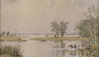
New Jersey Meadowlands, also known as the Hackensack Meadowlands after the primary river flowing through it, is a general name for the large ecosystem of wetlands in northeastern New Jersey in the United States, a few miles to the west of New York City. In the 20th century, much of the Meadowlands area was urbanized, and it became known for being the site of large landfills and decades of environmental abuse. A variety of projects are underway to restore and conserve the remaining ecological resources in the Meadowlands.

The New York–New Jersey Harbor Estuary, also known as the Hudson-Raritan Estuary, is in the northeastern states of New Jersey and New York on the East Coast of the United States. The system of waterways of the Port of New York and New Jersey forms one of the most intricate natural harbors in the world and one of the busiest ports of the United States. The harbor opens onto the New York Bight in the Atlantic Ocean to the southeast and Long Island Sound to the northeast.

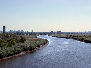
The Hackensack River is a river, approximately 45 miles (72 km) long, in the U.S. states of New York and New Jersey, emptying into Newark Bay, a back chamber of New York Harbor. The watershed of the river includes part of the suburban area outside New York City just west of the lower Hudson River, which it roughly parallels, separated from it by the New Jersey Palisades. It also flows through and drains the New Jersey Meadowlands. The lower river, which is navigable as far as the city of Hackensack, is heavily industrialized and forms a commercial extension of Newark Bay. Once believed to be among the most polluted watercourses in the United States, it staged a modest revival by the late 2000s.

The New Jersey Sports and Exposition Authority (NJSEA) is an independent authority established by the State of New Jersey in 1971 to oversee the Meadowlands Sports Complex, but which now contains the New Jersey Meadowlands Commission, a regulatory, planning, and zoning agency, in addition to its original duties. Originally consisting of Giants Stadium and the Meadowlands Racetrack in 1976, Meadowlands Arena was added to the complex in 1981 and New Meadowlands Stadium replaced Giants Stadium in 2010. Its first Chairman and CEO was David A. "Sonny" Werblin. Its present Chairman is Carl Goldberg and its CEO is Vincent Prieto.

Overpeck Creek is a tributary of the Hackensack River, approximately 8 miles (13 km) long, in Bergen County in northeastern New Jersey in the United States. The lower broad mouth of the creek is part of the extended tidal estuary of the lower Hackensack and of the adjacent wetland region known as the New Jersey Meadowlands.

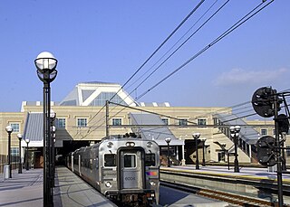
The Bergen County Line is a commuter rail line and service owned and operated by New Jersey Transit in the U.S. state of New Jersey. The line loops off the Main Line between the Meadowlands and Glen Rock, with trains continuing in either direction along the Main Line. It is colored on NJT system maps in grey, and its symbol is a cattail, which are commonly found in the Meadowlands where the line runs.

Berry's Creek is a tributary of the Hackensack River in the New Jersey Meadowlands in Bergen County, New Jersey. The creek watershed contains a diverse array of wetlands, marshes, and wildlife. The creek runs through a densely populated region and has been subject to extensive industrial pollution during the 19th and 20th centuries. Several companies discharged toxic chemicals into the creek in the 20th century, and these chemicals have remained in the sediment. The creek has the highest concentrations of methyl mercury of any fresh-water sediment in the world. Portions of the creek watershed are Superfund sites and cleanup projects began in the late 20th century.

The New Jersey Meadowlands Commission was a regional zoning, planning and regulatory agency in northern New Jersey. Its founding mandates were to protect the delicate balance of nature, provide for orderly development, and manage solid waste activities in the New Jersey Meadowlands District. The Commission operated as an independent state agency between 1969 and 2015, loosely affiliated with the New Jersey Department of Community Affairs. NJMC was merged with the New Jersey Sports and Exposition Authority through legislative action.

Snake Hill is an igneous rock intrusion jutting up from the floor of the Meadowlands in southern Secaucus, New Jersey, at a bend in the Hackensack River. It was largely obliterated in the 1960s by quarrying that reduced the height of some sections by one-quarter and the area of its base by four fifths. The diabase rock was used as building material in growing areas like Jersey City. The remnant of the hill is the defining feature of Laurel Hill County Park. The high point, a 203-foot graffiti-covered inselberg rock formation, is a familiar landmark to travelers on the New Jersey Turnpike's Eastern Spur, which skirts the hill's southern edge. The crest of the hill's unusual, sloping ridge is about 150 feet high.
Paterson Plank Road is a road that runs through Passaic, Bergen and Hudson Counties in northeastern New Jersey. The route, originally laid in the colonial era, connects the city of Paterson and the Hudson River waterfront. It has largely been superseded by Route 3, but in the many towns it passes it has remained an important local thoroughfare, and in some cases been renamed.

The Plaza at Harmon Meadow is a shopping complex in the Meadowlands of Secaucus, New Jersey, approximately six miles from New York City. It was developed by Hartz Mountain Industries, whose corporate offices are located in the Plaza. The Plaza, which Hartz refers to as a “mixed-use community”, encompasses 175 acres (0.71 km2), and consists of over 3,500,000 square feet (330,000 m2) of hotel, office, retail, and restaurants space. It was purchased by Howard Michaels's Carlton Group in 2015.

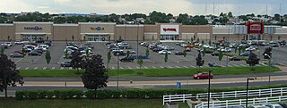
The Mall at Mill Creek, formerly known as Mill Creek Mall, is a strip mall located in Secaucus, New Jersey in the New Jersey Meadowlands. It is situated in the Harmon Meadow Plaza complex, approximately 6 miles (9.7 km) from New York City, and is owned by Hartz Mountain Industries. The International Council of Shopping Centers lists the mall as having a Gross leasable area (GLA) of 400,000 sq ft (37,000 m2).

The Gateway Region is the primary urbanized area of the northeastern section of New Jersey, United States. It is anchored by Newark, the state's most populous city. While sometimes known as the Newark metropolitan area, it is part of the New York metropolitan area.

Hackensack RiverWalk, also known as the Hackensack River Greenway, a is partially constructed greenway along the Newark Bay and Hackensack River in Hudson County, New Jersey, United States. The 18-mile (29 km) linear park, which closely follows the contour of the water's edge where possible, runs along the west side of Bergen Neck peninsula between its southern tip at Bergen Point, where it would connect to the Hudson River Waterfront Walkway, and the Eastern Brackish Marsh in the north. The walkway passes through the contiguous municipalities of Bayonne, Jersey City, and Secaucus with a potential connection to a walkway in North Bergen. It passes through new and established residential neighborhoods, county and municipal parks, brownfields, industrial areas, commercial districts, and wetland preserves. While existing parks and promenades have been incorporated and new sections have been built there remain gaps. It will pass under sixteen bridges and cross over eight natural creeks. Since 1988, in accordance with the public trust doctrine New Jersey law requires new construction built within 100 feet (30 m) of the water must provide 30 feet (9.1 m) of public space along the water's edge. In September 2022, the Lower Hackensack was declared a federal superfund site, triggering a process to remediate and restore the water and shoreline.

Riverbend is the name of two sections of Hudson County, New Jersey.

Harmon Cove is an abandoned train station in the Harmon Cove section of Secaucus, New Jersey. The station was a former stop on the Bergen County Line which runs from Hoboken Terminal to Suffern. Train service was discontinued in 2003 when Secaucus Junction was opened.

Hudson Regional Hospital (HRH) is an acute care hospital, located on the Hackensack River, in Secaucus, New Jersey, in the middle of the New Jersey Turnpike and busy Route 3 traffic flow. HRH has a helipad for transporting injured persons from the scene of an accident to the hospital and/or for transferring patients in critical need of specialized services from HRH to another hospital having that capability.
The Hudson County Park System owns and operates several county parks in Hudson County, New Jersey. It has its roots in the City Beautiful movement around the turn of the twentieth century. The system comprises eight parks comprising 716.52 acres (290.0 ha). Additionally, the county owns acreage in preservation areas in the New Jersey Meadowlands


