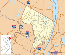
Englewood is a city in Bergen County, New Jersey, United States. As of the 2010 United States Census, the city had a total population of 27,147, reflecting an increase of 944 (+3.6%) from the 26,203 counted in the 2000 Census, which had in turn increased by 1,353 (+5.4%) from the 24,850 counted in the 1990 Census.

Lyndhurst is a township in Bergen County, New Jersey, United States. As of the 2010 United States Census, the township's population was 20,554, reflecting an increase of 1,171 (+6.0%) from the 19,383 counted in the 2000 Census, which had in turn increased by 1,121 (+6.1%) from the 18,262 counted in the 1990 Census.

Wyckoff is a township in Bergen County, New Jersey, United States. As of the 2010 United States Census, the township's population was 16,696, reflecting an increase of 188 (+1.1%) from the 16,508 counted in the 2000 Census, which had in turn increased by 1,136 (+7.4%) from the 15,372 counted in 1990. As of the 2010 Census, Wyckoff ranked 55th in highest-income places in the United States with a population of at least 10,000 at $103,614 HHI. Statewide, Wyckoff ranked 41st among New Jersey locations by per capita income, with a per capita money income of $49,375 as of 1999, an increase of 49.1% from the $33,124 recorded in 1989.

Washington Township, also known as the Township of Washington, is a township in Bergen County, New Jersey, United States. As of the 2010 United States Census, the township's population was 9,102, reflecting an increase of 164 (+1.8%) from the 8,938 counted in the 2000 Census, which had in turn declined by 307 (-3.3%) from the 9,245 counted in the 1990 Census.
Ridgefield Township was a township that existed in Bergen County, New Jersey. The township was created in 1871, when Hackensack Township was trisected to form Palisades Township in the northernmost third, Englewood Township in the central strip and Ridgefield Township encompassing the southernmost portion, stretching from the Hudson River on the east to the Hackensack River, with Hudson County to the south. Much of the area had been during the colonial area known as the English Neighborhood. As described in the 1882 book, History of Bergen and Passaic counties, New Jersey,
Ridgefield is the first township in Bergen County which the traveler enters in passing up the Palisades. His first impressions are much like those of old Hendrick Hudson in speaking of a wider extent of country: "A very good land to fall in with, and a pleasant land to see." The valley of the Hackensack invited early settlers in the seventeenth century, and the valley of the Overpeck Creek, a navigable arm of the Hackensack, also attracted settlers quite as early in this direction. Sloops and schooners can pass up this creek nearly to the northern boundary of the township. Ridgefield is bounded on the north by Englewood, on the east by the Hudson, on the south by Hudson County, and on the west by the Hackensack River. The southern boundary is less than two miles in extent, and the northern less than four, and the length of the township from north to south does not exceed four miles. Bellman's Creek, forming part of the southern boundary, the Hackensack, the Overpeck, the Hudson, with more than a dozen other smaller streams and rivulets, bountifully supply the whole township with water. From the western border of the Palisades the land descends to the Overpeck, forming a most beautiful valley, with the land again rising to a high ridge midway between the Overpeck and the Hackensack. From this long ridge, extending far to the north beyond this township, it took its name of Ridgefield.
The New York, Susquehanna and Western, formerly the Midland Railroad, the Jersey City and Albany Railroad, and the Northern Railway of New Jersey—all running northward through the township— afford ample railroad accommodations. The Susquehanna enters the township at Bellman's Creek, and the Northern at about one hundred feet south of the creek, and at a point north and east of the Susquehanna. The Albany road in this locality is not yet constructed, diverging at present from the track of the Susquehanna between Little Ferry and Bogota stations. It has, however, an independent line projected and now under construction to New York City.
Early Settlements. Ridgefield embraces the earliest settlements in the ancient township of Hackensack, antedating even the organization of that township in 1693, and of the county of Bergen in 1675. There seems to have been no town or village compactly built, like the village of Bergen, but there were settlements both of Dutch and English in and about what was subsequently known as English Neighborhood prior to 1675. The Westervelts, the Zimcrmans, the Bantas, and the Blauvelts, all coming from Holland, settled in the middle of the seventeenth century in that locality. The ancestors of Jacob P. Westervelt, now of Hackensack Village, with himself, were born in English Neighborhood. His father was born there in 1776, and was the son of Christopher Westervelt, who was born there certainly as early as 1690, and he was the son of the original ancestor of this family, who came from Holland and settled on Overpeck Creek, within the present limits of Ridgefield township, probably about 1670.
Hackensack Township was a township that was formed in 1693 within Bergen County, New Jersey, United States. The township was created by the New Jersey Legislature as one of the first group of townships in New Jersey. Bergen County, which had been created in 1682, was thus split into two parts: Hackensack Township to the north, and Bergen Township to the south.

Netcong is an NJ Transit station in Netcong, in Morris County, New Jersey, United States. Located on Route 46 at Main Street in downtown Netcong, the small, 1-low level side platform station service passengers for the Morristown Line and the Montclair-Boonton Line. These lines provide service to Hoboken or to New York City via Midtown Direct on the Morristown Line at Dover station and Montclair-Boonton at Montclair State University station. Midtown Direct service can also be transferred at Newark Broad Street station in Newark. There is one track and one platform on the north side, adjacent to the station. NJ Transit maintains a substantial train servicing yard east of the Netcong station at Port Morris in Roxbury Township. Port Morris Yard is proposed to return as the junction of the Montclair-Boonton and Morristown lines for the Lackawanna Cut-Off line to Scranton. Transfers would be provided at Lake Hopatcong station in Landing.

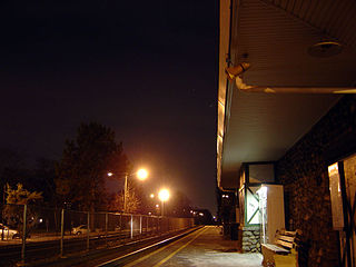
Kingsland is a railroad station on New Jersey Transit's Main Line. It is located under Ridge Road (Route 17) between New York and Valley Brook Avenues in Lyndhurst, New Jersey, and is one of two stations in Lyndhurst. The station is not staffed, and passengers use ticket vending machines (TVMs) located at street level to purchase tickets. The station is not handicapped-accessible. Originally part of the Delaware, Lackawanna and Western Railroad's Boonton Branch, Kingsland station was built in 1903.

Lyndhurst is a New Jersey Transit rail station located off of New York Avenue in Lyndhurst, New Jersey. The station is one of two in Lyndhurst, the other being Kingsland station. The Lyndhurst station is located at milepost 8.2 on the Main Line.

Hawthorne is a railroad station operated by New Jersey Transit in the borough of Hawthorne, Passaic County, New Jersey, United States. It is the northernmost station in Passaic County along New Jersey Transit's Main Line. Trains coming through Hawthorne service Waldwick, Suffern and Port Jervis to the north and Hoboken Terminal to the south, where connections are available to New York City via Port Authority Trans-Hudson and ferries. The station, accessible only by Washington Place in Hawthorne, contains only two low-level platforms connected by a grade crossing. As a result, the station is not compliant with the Americans with Disabilities Act of 1990.
Glen Rock is one of two railroad stations operated by New Jersey Transit in the borough of Glen Rock, Bergen County, New Jersey, United States. Located on the Main Line, the station is signed as Glen Rock – Main Line to differentiate it between the station on the Bergen County Line three blocks east on Rock Road.

Ramsey is one of two railroad stations operated by New Jersey Transit in the borough of Ramsey, Bergen County, New Jersey, United States. Located on the Main Line and Bergen County Line, Ramsey station is also unofficially known as Ramsey – Main Street due to the opening of Ramsey Route 17 station to the north in 2004.

Rutherford is a New Jersey Transit railroad station served by the Bergen County Line. The station straddles the border between Rutherford and East Rutherford in Bergen County, New Jersey, United States. The station building and Hoboken Terminal-bound platform is located near a traffic circle at the junction of Park Avenue, Union Avenue, Erie Avenue and Orient Way known as Station Square, with a grade crossing on Park Avenue. The tracks serve as the border between the two municipalities and the Suffern-bound platform is actually located in East Rutherford along with its parking lot.
Radburn is a New Jersey Transit train station in the Dutch Colonial Revival style, served by the Bergen County Line. It is on Fair Lawn Avenue in the Radburn section of Fair Lawn, in Bergen County, New Jersey, United States. It is one of two New Jersey Transit train stations in Fair Lawn, the other being Broadway.

New Barbadoes Neck is the name given in the colonial era for the peninsula in northeastern New Jersey, USA between the lower Hackensack and Passaic Rivers, in what is now western Hudson County and southern Bergen County. The neck begins in the south at Kearny Point in the Newark Bay and is characterized by a ridge along the west and part of the New Jersey Meadowlands on the east.

Jutland is an unincorporated community located within Union Township in Hunterdon County, New Jersey, United States.

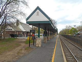
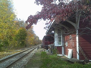
Demarest station is located in Demarest, Bergen County, New Jersey, United States. The station's depot was added to the National Register of Historic Places on July 7, 2004.

Wheatland is an unincorporated community within Manchester Township in Ocean County, New Jersey, United States.

Daretown is an unincorporated community within Upper Pittsgrove Township in Salem County, New Jersey, United States.
Wortendyke is a residential and commercial unincorporated community located within Midland Park, in Bergen County, New Jersey, United States.