Route 5 is a 3.18-mile (5.12 km) state highway located entirely in Bergen County, New Jersey, United States. It runs from U.S. Route 1/9 (US 1-9) in Ridgefield east down the New Jersey Palisades to end at County Route 505 at the Hudson River in Edgewater, forming a “wavy” path. The route is a two- to four-lane undivided highway its entire length, passing mostly through wooded residential neighborhoods. The route passes under Route 63 in Palisades Park, with access to that route provided by Bergen Boulevard, and intersects the southern terminus of Route 67 in Fort Lee.
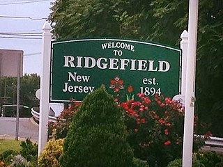
Ridgefield is a borough in Bergen County, in the U.S. state of New Jersey. As of the 2020 United States census, the borough's population was 11,501, an increase of 469 (+4.3%) from the 2010 census count of 11,032, which in turn reflected an increase of 202 (+1.9%) from the 10,830 counted in the 2000 census.

Route 93 is a state highway in the U.S. state of New Jersey. It is a north–south highway that runs 3.50 miles (5.63 km) from an intersection with U.S. Route 1/9 in Ridgefield on Grand Avenue in Ridgefield, Palisades Park, Leonia, and Englewood before ending at an intersection with Van Nostrand Avenue just north of Route 4. The route originated as Route S5 in 1927, running along the Bergen Turnpike until 1929, when it was moved onto the southern portion of Grand Avenue. It remained the same until 1954, after the alignment of Route 93 had been designated that the route was extended along Grand Avenue.

Overpeck Creek is a tributary of the Hackensack River, approximately 8 miles (13 km) long, in Bergen County in northeastern New Jersey in the United States. The lower broad mouth of the creek is part of the extended tidal estuary of the lower Hackensack and of the adjacent wetland region known as the New Jersey Meadowlands.

For the purposes of this article, the Jersey City area extends North to Edgewater, South to Bayonne and includes Kearny Junction and Harrison but not Newark. Many routes east of Newark are listed here.
The New Jersey Midland Railway was a 19th-century predecessor to the New York, Susquehanna and Western Railway (NYS&W) that operated in Northern New Jersey and Orange County, New York.
Ridgefield Township was a township that existed in Bergen County, New Jersey. The township was created in 1871, when Hackensack Township was trisected to form Palisades Township in the northernmost third, Englewood Township in the central strip and Ridgefield Township encompassing the southernmost portion, stretching from the Hudson River on the east to the Hackensack River, with Hudson County to the south. Much of the area had been during the colonial area known as the English Neighborhood. As described in the 1882 book, History of Bergen and Passaic counties, New Jersey,
Ridgefield is the first township in Bergen County which the traveler enters in passing up the Palisades. His first impressions are much like those of old Hendrick Hudson in speaking of a wider extent of country: "A very good land to fall in with, and a pleasant land to see." The valley of the Hackensack invited early settlers in the seventeenth century, and the valley of the Overpeck Creek, a navigable arm of the Hackensack, also attracted settlers quite as early in this direction. Sloops and schooners can pass up this creek nearly to the northern boundary of the township. Ridgefield is bounded on the north by Englewood, on the east by the Hudson, on the south by Hudson County, and on the west by the Hackensack River. The southern boundary is less than two miles in extent, and the northern less than four, and the length of the township from north to south does not exceed four miles. Bellman's Creek, forming part of the southern boundary, the Hackensack, the Overpeck, the Hudson, with more than a dozen other smaller streams and rivulets, bountifully supply the whole township with water. From the western border of the Palisades the land descends to the Overpeck, forming a most beautiful valley, with the land again rising to a high ridge midway between the Overpeck and the Hackensack. From this long ridge, extending far to the north beyond this township, it took its name of Ridgefield.
The New York, Susquehanna and Western, formerly the Midland Railroad, the Jersey City and Albany Railroad, and the Northern Railway of New Jersey—all running northward through the township— afford ample railroad accommodations. The Susquehanna enters the township at Bellman's Creek, and the Northern at about one hundred feet south of the creek, and at a point north and east of the Susquehanna. The Albany road in this locality is not yet constructed, diverging at present from the track of the Susquehanna between Little Ferry and Bogota stations. It has, however, an independent line projected and now under construction to New York City.
Early Settlements. Ridgefield embraces the earliest settlements in the ancient township of Hackensack, antedating even the organization of that township in 1693, and of the county of Bergen in 1675. There seems to have been no town or village compactly built, like the village of Bergen, but there were settlements both of Dutch and English in and about what was subsequently known as English Neighborhood prior to 1675. The Westervelts, the Zimcrmans, the Bantas, and the Blauvelts, all coming from Holland, settled in the middle of the seventeenth century in that locality. The ancestors of Jacob P. Westervelt, now of Hackensack Village, with himself, were born in English Neighborhood. His father was born there in 1776, and was the son of Christopher Westervelt, who was born there certainly as early as 1690, and he was the son of the original ancestor of this family, who came from Holland and settled on Overpeck Creek, within the present limits of Ridgefield township, probably about 1670.
Bergen Hill refers to the lower Hudson Palisades in New Jersey, where they emerge on Bergen Neck, which in turn is the peninsula between the Hackensack and Hudson Rivers, and their bays. In Hudson County, it reaches a height of 260 feet.

The Hudson River Waterfront Walkway, also known as the Hudson River Walkway, is a promenade along the Hudson Waterfront in New Jersey. The ongoing and incomplete project located on Kill van Kull and the western shore of Upper New York Bay and the Hudson River was implemented as part of a New Jersey state-mandated master plan to connect the municipalities from the Bayonne Bridge to the George Washington Bridge with an urban linear park and provide contiguous unhindered access to the water's edge.

The Passaic–Bergen–Hudson Transit Project is a project under study by NJ Transit to reintroduce passenger service on a portion of the New York, Susquehanna and Western Railway (NYSW) right-of-way (ROW) in Passaic, Bergen and Hudson counties using newly built, FRA-compliant diesel multiple unit rail cars. Plans call for service to run from Hawthorne south through Paterson, east to Hackensack and then southeast to North Bergen, where it would join the Hudson-Bergen Light Rail (HBLR).
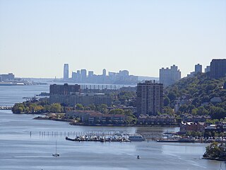
The Hudson Waterfront is an urban area of northeastern New Jersey along the lower reaches of the Hudson River, the Upper New York Bay and the Kill van Kull. Though the term can specifically mean the shoreline, it is often used to mean the contiguous urban area between the Bayonne Bridge and the George Washington Bridge that is approximately 19 miles (31 km) long. Historically, the region has been known as Bergen Neck, the lower peninsula, and Bergen Hill, lower Hudson Palisades. It has sometimes been called the Gold Coast.
The English Neighborhood was the colonial-era name for the towns in eastern Bergen County, New Jersey, along the Hudson Palisades between the Hudson River and the Hackensack River, particularly around its main tributary, Overpeck Creek. The region had been part of the Dutch New Netherland colony of Bergen, whose main town was located at Bergen Square in modern Jersey City. The name refers to the geography of the region, bergen being the Dutch word for hills. Earlier attempts at settlement at Achter Col and Vriessendael had been compromised in conflicts with the precolonial population, bands of the Lenape known by their exonyms, the Hackensacks and the Tappans.

Bulls Ferry is an area along the Hudson River, just north of Weehawken Port Imperial in the towns of West New York, Guttenberg and North Bergen in New Jersey. It takes its name from a pre-Revolutionary settlement belonging to the Bull family, who operated a row-and-sail ferry to the burgeoning city of New York across the river.

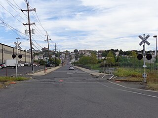
The Edgewater Branch was a branch of the New York, Susquehanna and Western Railway (NYS&W) that ran about 3.174 miles (5.108 km) through eastern Bergen County, New Jersey in the United States. Starting from a rail junction at the Little Ferry Yard, it went east through the Edgewater Tunnel to Undercliff to the Hudson Waterfront.
Grantwood is an unincorporated community straddling the boroughs of Cliffside Park and Ridgefield, just south of Fort Lee, in eastern Bergen County, New Jersey, United States.

Ridgefield Park station, also known as West Shore Station, was a railroad station in Ridgefield Park, New Jersey, at the foot of Mount Vernon Street served by the New York, Susquehanna and Western Railroad (NYSW) and the West Shore Railroad, a division of New York Central (NYCRR). The New York, Ontario and Western Railway (NYO&W) had running rights along the West Shore and sometimes stopped at Ridgefield Park. First opened in 1872 it was one of three passenger stations in the village, the others being the Little Ferry station to the south and Westview station to the north. Service on the West Shore Railroad began in 1883. The station house, built at a cost $100,000 opened in 1927. Southbound service crossed Overpeck Creek and continued to terminals on the Hudson River waterfront where there was connecting ferry service across the Hudson River to Manhattan. Northbound near Bogota the parallel NYSW and West Shore lines diverge and continue into northern New Jersey, Pennsylvania, and upstate New York. Passenger service ended in 1966.

Englewood is a former railroad station at Depot Square in Englewood, New Jersey. Once served by the Erie Railroad's Northern Branch, the building is located in the city's town center along the ROW now used as a branch line by CSX Transportation. The station at Depot Plaza was one of the original stations upon opening of the Northern Railroad of New Jersey, which included two others in the town, Van Brunts and Highwood. The building has undergone various incarnations as restaurants, a recording studio, and a performing arts school. The proposed Northern Branch Corridor Project extension the Hudson–Bergen Light Rail would pass the station along the line.
91st Street is a proposed station along the Northern Branch Corridor Project extension of Hudson-Bergen Light Rail in the Babbitt Section of North Bergen, New Jersey.

Ridgefield is a proposed station along NJ Transit's (NJT) Northern Branch Corridor Project extension of Hudson-Bergen Light Rail (HBLR) in Ridgefield, New Jersey.

North Bergen was a railroad station in North Bergen, New Jersey, United States known Homestead for most of its existence. It as built in the mid 19th century and served by the New York, Susquehanna and Western Railway (#1059) and the Erie Railroad's Northern Branch (#1903).