Lake Providence, Louisiana

Last updated

Lake Providence, Louisiana
Town
Louisiana State Cotton Museum in Lake Providence, LA IMG 7379.JPG
East Carroll Parish Louisiana Incorporated and Unincorporated areas Lake Providence Highlighted.svg
Location of Lake Providence in East Carroll Parish, Louisiana.
Louisiana in United States (US48).svg
Location of Louisiana in the United States
Coordinates: 32°48′19″N91°10′46″W / 32.80528°N 91.17944°W / 32.80528; -91.17944
CountryUnited States
StateLouisiana
Parish East Carroll
Government
  MayorBobby Amacker
Area
[1]
  Total3.62 sq mi (9.36 km2)
  Land3.60 sq mi (9.31 km2)
  Water0.02 sq mi (0.05 km2)
Elevation
105 ft (32 m)
Population
 (2020)
  Total3,587
  Density997.77/sq mi (385.28/km2)
Time zone UTC-6 (CST)
  Summer (DST) UTC-5 (CDT)
ZIP Code
71254
Area code 318
FIPS code 22-41400
Website Town of Lake Providence

Lake Providence is a town in, and the parish seat of, East Carroll Parish in northeastern Louisiana. [2] The population was 5,104 at the 2000 census and declined by 21.8 percent to 3,991 in 2010. The town's poverty rate is approximately 55 percent; the average median household income is $16,500, and the average age is 31. [3]

Contents

The town shares its name with the oxbow lake of the Mississippi River, also called Lake Providence. This area was historically developed as cotton plantations before and after the Civil War, and remains largely rural. The Union Army developed a supply depot near the lake during the Civil War, and its camp was crowded with refugee slaves seeking their freedom. The town grew larger at this site.

History

In the late 18th century goods such as animal pelts, indigo, and cotton were transported on the Mississippi River by people commonly known as longboat men, named for the type of craft that carried the goods. These were eventually replaced by steamboats. Thieves and pirates raided the longboats, killing the crew and selling the goods. Bunch's Bend is named for a pirate who would raid the boats at this place, where they had to maneuver the bend in the river. If the longboat men made it past Bunch's Bend without being robbed, they would say they, "made it to Providence."

The trading town of Providence developed at the bend. It later was renamed as Lake Providence when the town was moved to its current location surrounding a natural oxbow lake. The Lake Providence area first opened for European-American settlement in the late 1830s, after the federal government enforced Indian Removal to Indian Territory further west of the Mississippi River, and extinguished their land titles. Settlers drained the cypress swamps along the Mississippi River and used enslaved African Americans to clear the land for cultivation.

Civil War

By the start of the American Civil War in 1861, the region consisted mostly of large cotton plantations along the river, which were worked by thousands of slave laborers.

The town of Lake Providence developed after the arrival of the Union Army in the spring of 1862. Under the direction of General Ulysses S. Grant, the area by Lake Providence was established as a supply depot and base of operations for the Vicksburg Campaign. The soldiers dug a canal between the Mississippi River and Lake Providence. The area was called "Soldiers' Rest". Grant subsequently moved his troops south for temporary residence at Winter Quarters south of Newellton in Tensas Parish. As slaves crowded into the camp at Lake Providence to gain freedom from surrounding plantations, the population quickly soared from a few hundred to several thousand. What began as a simple military supply camp quickly transformed into a city with a large population of African-American refugees.

By the time Vicksburg, Mississippi fell to the Union in 1863, most planters in the Lake Providence area had fled, and their plantations lay empty. The Union Army determined that they should be productive again.

20th century

Residence of African-American tenant farmer beside the Mississippi River levee near Lake Providence (June 1940) African American's tenant's home beside the Mississippi River levee. Near Lake Providence, Louisiana, June 1940.jpg
Residence of African-American tenant farmer beside the Mississippi River levee near Lake Providence (June 1940)

After white Democrats regained power in the state legislature after the Reconstruction Era, they worked to reimpose white supremacy. Many blacks worked as sharecroppers or tenant farmers in the region. In 1898, Louisiana, like other southern states, enacted a new constitution, designed to maintain Democratic Party dominance and forestall any alliances such as the Populist-Republican alliance that had won seats in the 1890s. They included provisions that raised barriers to voter registration and elections, effectively disfranchising most blacks despite their constitutional 15th Amendment right to vote. Their exclusion from the political system made them second-class citizens.

The civil rights movement of the post-World War II period from the 1940s through the 1960s brought efforts of a new generation to make constitutional rights more equitable. Until 1962, no African Americans had been allowed to register to vote in Lake Providence or East Carroll Parish in forty years when U.S. District Judge Edwin Ford Hunter, Jr., based in Lake Charles in the far southwestern corner of the state, personally registered twenty-eight African Americans in Lake Providence under a provision of the Civil Rights Act of 1960, which had been signed into law by U.S. President Dwight D. Eisenhower. Hunter was challenged by Louisiana 6th Judicial District Judge Frank Voelker Sr., who was based in Lake Providence, in a dispute over the powers of the national government. The case attracted national attention, as the civil rights movement highlighted the constitutional infringement of the rights of African Americans in the South. [4]

Following national Democratic support for the passage of civil rights legislation in the mid-1960s, most African Americans allied with that party. With a majority African-American electorate, Lake Providence voters in the 21st century continue to support Democratic Party candidates. Conservative whites tended to leave the Democratic Party after the 1960s, and have overwhelmingly joined the Republican Party. In the 2008 and 2012 presidential elections, East Carroll Parish voted handily for Democrat Barack H. Obama of Illinois, rather than his Republican opponents, John McCain of Arizona and Mitt Romney of Massachusetts. [5] [6]

Geography

Lake Providence City Hall is located across from the U.S. Post Office. Lake Providence, LA, City Hall IMG 7406.JPG
Lake Providence City Hall is located across from the U.S. Post Office.

According to the United States Census Bureau, the town has a total area of 3.6 square miles (9.3 km2), of which 3.6 square miles (9.3 km2) is land and 0.04 square miles (0.10 km2) (0.55%) is water.

The existing boundaries of the town constitute the third location of the community. Lake Providence is located adjacent to the Mississippi River. Prior to the building of the current levee system by the United States Army Corps of Engineers, the meandering river would overflow its bank and take valuable lands. It was such flooding that the lake of Lake Providence was created and the town was washed away by the river. Each time the town was taken by the river, the citizens moved.

Historian John D. Winters describes Lake Providence as "a beautiful oxbow lake some six miles (10 km) long, an old Mississippi river bed with an outlet through Baxter Bayou into Bayou Macon and thus into the Tensas, Ouachita, Black, and Red rivers. [7]

Climate

Climate data for Lake Providence, Louisiana (1991–2020 normals, extremes 1893–1903, 1926–2019)
MonthJanFebMarAprMayJunJulAugSepOctNovDecYear
Record high °F (°C)86
(30)
89
(32)
93
(34)
95
(35)
99
(37)
108
(42)
109
(43)
109
(43)
110
(43)
98
(37)
98
(37)
88
(31)
110
(43)
Mean daily maximum °F (°C)53.7
(12.1)
58.2
(14.6)
66.4
(19.1)
74.4
(23.6)
81.9
(27.7)
88.4
(31.3)
91.2
(32.9)
91.1
(32.8)
86.8
(30.4)
77.1
(25.1)
65.2
(18.4)
56.3
(13.5)
74.2
(23.4)
Daily mean °F (°C)44.8
(7.1)
48.6
(9.2)
56.2
(13.4)
64.2
(17.9)
72.6
(22.6)
79.5
(26.4)
82.3
(27.9)
81.8
(27.7)
76.7
(24.8)
66.1
(18.9)
54.7
(12.6)
47.3
(8.5)
64.6
(18.1)
Mean daily minimum °F (°C)35.8
(2.1)
39.0
(3.9)
45.9
(7.7)
54.0
(12.2)
63.4
(17.4)
70.6
(21.4)
73.4
(23.0)
72.5
(22.5)
66.5
(19.2)
55.0
(12.8)
44.3
(6.8)
38.4
(3.6)
54.9
(12.7)
Record low °F (°C)−5
(−21)
−8
(−22)
16
(−9)
32
(0)
40
(4)
50
(10)
41
(5)
55
(13)
35
(2)
29
(−2)
18
(−8)
3
(−16)
−8
(−22)
Average precipitation inches (mm)5.61
(142)
5.49
(139)
5.16
(131)
6.59
(167)
4.98
(126)
4.26
(108)
3.93
(100)
4.03
(102)
3.29
(84)
4.99
(127)
4.72
(120)
5.74
(146)
58.79
(1,493)
Average snowfall inches (cm)0.2
(0.51)
0.2
(0.51)
trace0.0
(0.0)
0.0
(0.0)
0.0
(0.0)
0.0
(0.0)
0.0
(0.0)
0.0
(0.0)
0.0
(0.0)
0.0
(0.0)
0.1
(0.25)
0.5
(1.3)
Average precipitation days (≥ 0.01 in)9.69.09.28.08.68.28.17.55.56.58.410.198.7
Average snowy days (≥ 0.1 in)0.10.20.10.00.00.00.00.00.00.00.00.00.4
Source: NOAA [8] [9]

Demographics

Historical population
CensusPop.Note
1860 582
1870 320−45.0%
1890 642
1900 1,25695.6%
1910 1,56824.8%
1920 1,91722.3%
1930 2,86749.6%
1940 3,71129.4%
1950 4,12311.1%
1960 5,78140.2%
1970 6,1837.0%
1980 6,3612.9%
1990 5,380−15.4%
2000 5,104−5.1%
2010 3,991−21.8%
2020 3,587−10.1%
U.S. Decennial Census [10]
U.S. Post Office in Lake Providence contains a 1942 mural by Ethel Edwards titled Life on the Lake U.S. Post Office in Lake Providence, LA IMG 7407.JPG
U.S. Post Office in Lake Providence contains a 1942 mural by Ethel Edwards titled Life on the Lake
Lake Providence racial composition as of 2020 [11]
RaceNum.Perc.
White (non-Hispanic)59716.64%
Black or African American (non-Hispanic)2,88380.37%
Asian 40.11%
Other/Mixed 732.04%
Hispanic or Latino 300.84%

As of the 2020 United States census, there were 3,587 people, 1,221 households, and 695 families residing in the town.

Education

Public schools operated by the East Carroll Parish School Board include Southside Elementary School (PK-5), Lake Providence Junior High School (grades 6–8), and Lake Providence Senior High School (9-12). The private school Briarfield Academy is grades PK to 12.

Representation in other media

Several episodes of the 1959 NBC television series Riverboat , starring Darren McGavin, deal with pirates on the Mississippi River or the shipment of cotton. It is set in the middle 19th century, rather than the 18th.

Notable people

First Baptist Church at 304 Davis Street in Lake Providence Revised, First Baptist Ch., Lake Providence, LA IMG 7415 1.jpg
First Baptist Church at 304 Davis Street in Lake Providence

Related Research Articles

<span class="mw-page-title-main">Chicot County, Arkansas</span> County in Arkansas, United States

Chicot County is a county located in the southeastern corner of the U.S. state of Arkansas. As of the 2020 census, the population was 10,208. The county seat is Lake Village. Chicot County is Arkansas's 10th county, formed on October 25, 1823, and named after Point Chicot on the Mississippi River. It is part of the Arkansas Delta, lowlands along the river that have been historically important as an area for large-scale cotton cultivation.

<span class="mw-page-title-main">West Carroll Parish, Louisiana</span> Parish in Louisiana, United States

West Carroll Parish is a parish located in the northeastern part of the U.S. state of Louisiana. As of the 2020 census, the population was 9,751. The parish seat is Oak Grove. The parish was founded in 1877, when Carroll Parish was divided.

<span class="mw-page-title-main">Tensas Parish, Louisiana</span> Parish in Louisiana, United States

Tensas Parish is a parish located in the northeastern section of the State of Louisiana; its eastern border is the Mississippi River. As of the 2020 census, the population was 4,147. It is the least populated parish in Louisiana. The parish seat is St. Joseph. The name Tensas is derived from the historic indigenous Taensa people. The parish was founded in 1843 following Indian Removal.

<span class="mw-page-title-main">St. John the Baptist Parish, Louisiana</span> Parish in Louisiana, United States

St. John the Baptist Parish is a parish located in the U.S. state of Louisiana. At the 2020 census, the population was 42,477. The parish seat is Edgard, an unincorporated area, and the largest city is LaPlace, which is also unincorporated.

<span class="mw-page-title-main">Ouachita Parish, Louisiana</span> Parish in Louisiana, United States

Ouachita Parish is located in the northern part of the U.S. state of Louisiana. As of the 2020 census, the population was 160,368. The parish seat is Monroe. The parish was formed in 1807.

<span class="mw-page-title-main">East Carroll Parish, Louisiana</span> Parish in Louisiana, United States

East Carroll Parish is a parish located in the Mississippi Delta in northeastern Louisiana. As of 2020, its population was 7,459. The parish seat is Lake Providence. An area of cotton plantations in the antebellum era, the parish in the early 21st century has about 74% of its land devoted to agriculture.

<span class="mw-page-title-main">Concordia Parish, Louisiana</span> Parish in Louisiana, United States

Concordia Parish borders the Mississippi River in eastern central Louisiana. As of the 2020 census, the population was 18,687. The parish seat is Vidalia. The parish was formed in 1807.

<span class="mw-page-title-main">Harrisonburg, Louisiana</span> Village in Louisiana, United States

Harrisonburg is a village in and the parish seat of Catahoula Parish, Louisiana, United States. The population was 348 as of the 2010 census, down from 746 in 2000.

<span class="mw-page-title-main">Tallulah, Louisiana</span> City in Louisiana, United States

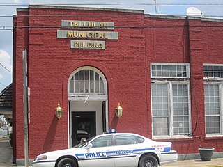
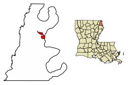
Tallulah is a city in, and the parish seat of, Madison Parish in northeastern Louisiana, United States. As of the 2020 census, the population was 6,286, down from 7,335 in 2010.

<span class="mw-page-title-main">Newellton, Louisiana</span> Town in Louisiana, United States

Newellton is a town in northern Tensas Parish in the northeastern part of the U.S. state of Louisiana. The population is 1,187 in the 2010 census, a decline of 255 persons, or 17 percent, from the 2000 tabulation of 1,482. The average age of the population there is 41 years.

<span class="mw-page-title-main">St. Joseph, Louisiana</span> Town in Louisiana, United States

St. Joseph, often called St. Joe, is a town in, and the parish seat of, rural Tensas Parish in northeastern Louisiana, United States, in the delta of the Mississippi River. The population was 1,176 at the 2010 census. The town had an African-American majority of 77.4 percent in 2010.

The Natchez District was one of two areas established in the Kingdom of Great Britain's West Florida colony during the 1770s – the other being the Tombigbee District. The first Anglo settlers in the district came primarily from other parts of British America. The district was recognized to be the area east of the Mississippi River from Bayou Sara in the south and Bayou Pierre in the north.

<span class="mw-page-title-main">Joseph E. Ransdell</span> American lawyer

Joseph Eugene Ransdell was an attorney and politician from Louisiana. Beginning in 1899, he was elected for seven consecutive terms as United States representative from Louisiana's 5th congressional district. He subsequently served for three terms in the United States Senate from Louisiana before being defeated in the 1930 Democratic primary for the seat by Governor Huey Long.

Edward Sparrow was an American politician who served as a Confederate States Senator from Louisiana from 1862 to 1865.

The Battle of Richmond was fought on June 15, 1863, near Richmond, Louisiana, during the Vicksburg campaign of the American Civil War. Major General John George Walker's division of Confederate troops, known as Walker's Greyhounds had attacked Union forces in the Battle of Milliken's Bend and the Battle of Lake Providence earlier that month in hopes of relieving some of the pressure on the Confederate troops besieged in Vicksburg, Mississippi. While both of Walker's strikes were failures and the Confederates withdrew to Richmond, Union Major General Ulysses S. Grant still viewed the presence of Walker's men at Richmond to be a threat. On June 14, the Mississippi Marine Brigade and the infantry brigade of Brigadier General Joseph A. Mower were sent to attack the Confederates at Richmond.

<span class="mw-page-title-main">U.S. Route 65 in Louisiana</span> Section of U.S. Highway in Louisiana, United States

U.S. Highway 65 (US 65) is a part of the United States Numbered Highway System that spans 966 miles (1,555 km) from Clayton, Louisiana to Albert Lea, Minnesota. Within the state of Louisiana, the highway travels 100.77 miles (162.17 km) from the national southern terminus at US 425/LA 15 in Clayton to the Arkansas state line north of Lake Providence.

Jefferson B. Snyder, was a lawyer and politician from the Mississippi River delta country of northeastern Louisiana. Snyder became a virtual political boss of Madison, Tensas, and East Carroll parishes; his leadership was rarely challenged, and politicians courted his endorsements.

<span class="mw-page-title-main">Norris C. Williamson</span> American politician

Norris Charles Craft Williamson was a Democrat who served from 1924 to 1932 in the Louisiana State Senate. A resident of Lake Providence, Williamson represented the delta parishes: Tensas, Madison, East Carroll, and Concordia, a rich farming region along the Mississippi River. Included in his district were Vidalia, Ferriday, St. Joseph, and Tallulah. At the time, two state senators represented the four-parish district.

George Henry Clinton was a chemist, lawyer, and Democratic politician from St. Joseph in Tensas Parish in the northeastern Mississippi River delta of the U.S. state of Louisiana.

References

  1. "2020 U.S. Gazetteer Files". United States Census Bureau. Retrieved March 20, 2022.
  2. "Find a County". National Association of Counties. Retrieved June 7, 2011.
  3. "Quick Facts". louisiana-demographics.com. Retrieved May 20, 2013.
  4. "State Judge Restrains Federal Judge's Order", Sumter Daily Item, Sumter, South Carolina, July 21, 1962, p. 1
  5. "East Carroll Parish presidential election returns, November 4, 2008". staticresults.sos.la.govlaccessdate=November 19, 2012.
  6. "East Carroll Parish presidential election returns, November 6, 2012". staticresults.sos.la.gov. Retrieved November 19, 2012.
  7. Winters, p. 176
  8. "NOWData - NOAA Online Weather Data". National Oceanic and Atmospheric Administration. Retrieved October 18, 2023.
  9. "Summary of Monthly Normals 1991-2020". National Oceanic and Atmospheric Administration. Retrieved October 18, 2023.
  10. "Census of Population and Housing". Census.gov. Retrieved June 4, 2015.
  11. "Explore Census Data". data.census.gov. Retrieved December 19, 2021.
  12. Henry E. Chambers, History of Louisiana, Vol. 2 (Chicago and New York City: The American Historical Society, Inc., 1925, p. 71)
  13. "William Denis Brown, III". Monroe News-Star, March 9, 2012. Retrieved July 13, 2013.
  14. "KERR, Joseph, (1765 - 1837)". Biographical Directory of the United States Congress. Retrieved March 7, 2014.
  15. Groneman, Bill (June 15, 2010). "KERR, JOSEPH". Texas State Historical Association.
  16. John Henry Scott, with Cleo Scott Brown, Witness to the Truth: My Struggle for Human Rights in Louisiana, University of South Carolina Press, 2003
  17. "David Voelker, 'one of the great saints of the recovery,' dies at 60". New Orleans Times-Picayune . Archived from the original on June 20, 2013. Retrieved June 2, 2013.
  18. "East Carroll Parish, Louisiana, Genealogy, August 24, 2010". eastcarrollparishlouisianagenealogy.blogspot.com. Retrieved May 31, 2013.
  19. Frederick W. Williamson and George T. Goodman, eds. Eastern Louisiana: A History of the Watershed of the Ouachita River and the Florida Parishes, 3 vols. (Monroe: Historical Record Association, 1939), pp. 770–773
  20. "WILMANS, EDITH EUNICE THERREL". tshaonline.org. Retrieved September 14, 2015.