Related Research Articles

North Decatur is a census-designated place (CDP) in DeKalb County, Georgia, United States. The population was 16,698 at the 2010 census.

Shrewsbury is an inner-ring suburb of St. Louis, located in St. Louis County, Missouri, United States. The population was 6,254 at the 2010 census.

Drexel Hill is a neighborhood and census-designated place (CDP) located in Upper Darby Township, Pennsylvania, United States. The population was 29,181 at the 2020 census, an increase over 28,043 in 2010, and accounting for over one-third of Upper Darby Township's population.
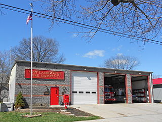
East Lansdowne is a borough in Delaware County, Pennsylvania, United States. The population was 2,668 at the 2010 census.

Lansdowne is a borough in Delaware County, Pennsylvania, United States, located 6 miles (10 km) southwest of Center City Philadelphia. It was named for the Marquess of Lansdowne. As of the 2010 census, the borough had a population of 10,620.

Upper Darby Township, often shortened to Upper Darby, is a home rule township in Delaware County, Pennsylvania, United States. As of the 2020 census, the township had a total population of 85,681, making it the state's sixth-most populated municipality after Philadelphia, Pittsburgh, Allentown, Reading, and Erie. Upper Darby borders Philadelphia, the nation's sixth-most populous city, and constitutes part of the Delaware Valley, also known as the Philadelphia metropolitan area, the nation's seventh-largest metropolitan area.
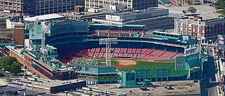
Fenway–Kenmore is an officially recognized neighborhood of Boston, Massachusetts. While it is considered one neighborhood for administrative purposes, it is composed of numerous distinct sections that, in casual conversation, are almost always referred to as "Fenway", "the Fenway", "Kenmore Square", or "Kenmore". Furthermore, the Fenway neighborhood is divided into two sub-neighborhoods commonly referred to as East Fenway/Symphony and West Fenway.

Overbrook is an historic neighborhood that is located in the Commonwealth of Pennsylvania, United States. It is situated northwest of West Philadelphia, Philadelphia.

Lansdowne is a census-designated place in southern Baltimore County, Maryland, United States, located just south of Baltimore. As of the 2010 census, it had a population of 8,409. At the 2000 census and earlier, the area was delineated as part of the Lansdowne-Baltimore Highlands CDP.
Lansdowne is a census-designated place and planned community located near Leesburg, Virginia in Loudoun County, Virginia. The population as of the 2010 United States Census was 11,253. It is north of State Route 7 and south of the Potomac River. Before the Revolutionary War, the Lee family established Coton Manor here. A section of the Potomac Heritage Trail runs through Lansdowne. It is the home of Inova Loudoun Hospital, the Jack Kent Cooke Foundation, Lansdowne Resort, Prison Fellowship, and Lansdowne Woods of Virginia, a gated, age-restricted community.

Harrison West is a historic urban neighborhood located northwest of downtown Columbus, Ohio. It sits on several blocks along the Olentangy River and includes the western part of the Near Northside Historic District, which was placed on the National Register of Historic Places in 1975. The character of the neighborhood is similar to Victorian Village, which sits just to the east and is more well-known.
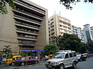
Sarat Bose Road, previously known as Lansdowne Road, is a 3.5 km long stretch of road that connects Southern Avenue with AJC Bose Road and separates two major localities of Ballygunge and Bhawanipore in South Kolkata, India. South of Southern Avenue crossing, Sarat Bose Road becomes Deboki Kumar Bose Sarani.

Barton Hills is a neighborhood in Austin, Texas. It is located in south Austin, and encompasses part of ZIP code 78704.
Garden Springs is a neighborhood in Southwestern Lexington, Kentucky, United States. Its boundaries are Georgian Way to the west, Lane Allen Road to the north, Harrodsburg Road to the east, and New Circle Road to the south. Turfland Mall and the Lexington campus of Sullivan University are located in the neighborhood.
Beaumont Park is a neighborhood in southwestern Lexington, Kentucky, United States. Its boundaries are Parkers Mill Road to the west, Lane Allen Road to the north, Lansill Dr to the east, and New Circle Road to the south.
Rabbit Run is a neighborhood in southwestern Lexington, Kentucky, United States. Its boundaries are Harrodsburg Road to the west, Man O War Boulevard to the south, and a combination that includes both Bleinheim Way and Gladman Way to the east.
Cardinal Valley is a neighborhood in northwestern Lexington, Kentucky, United States. Its boundaries are Versailles Road to the south, Norfolk Southern railroad tracks to the north, Forbes Road to the east, and Cambridge Drive/Oxford Circle to the west.
Zandale is a neighborhood in southeastern Lexington, Kentucky, United States. Its boundaries are Nicholasville Road to the west, Zandale Drive to the north, Bellefonte Drive to the east, and a combination of Larkin Road, Heather Way, Melbourne Way, and Lowry Lane to the south.
Brigadoon is a neighborhood in southeastern Lexington, Kentucky, United States. its boundaries are Reynolds Road to the north, Lansdowne Drive to the east, Wilson Downing Road to the south, and Nicholasville Road to the west.
Pasadena is a neighborhood in southwestern Lexington, Kentucky, United States. Its name is derived from its location just south of Pasadena Drive. All streets in the neighborhood are named after western American cities. Its boundaries are a combination of New Circle Road, Waco Road, and Nakomi Drive to the south, Harrodsburg Road to the west, Pasadena Drive to the north, and a combination of Waco Road and Clays Mill Road to the east.
References
- 1 2 Lansdowne Neighborhood Profile Retrieved 2013-06-04.


| | This Fayette County, Kentucky state location article is a stub. You can help Wikipedia by expanding it. |