Lewistown, Talbot County, Maryland

Last updated

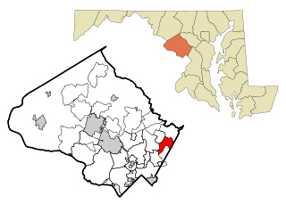
Lewistown is an unincorporated community in Talbot County, Maryland, United States. [1]

Unincorporated area Region of land not governed by own local government

In law, an unincorporated area is a region of land that is not governed by a local municipal corporation; similarly an unincorporated community is a settlement that is not governed by its own local municipal corporation, but rather is administered as part of larger administrative divisions, such as a township, parish, borough, county, city, canton, state, province or country. Occasionally, municipalities dissolve or disincorporate, which may happen if they become fiscally insolvent, and services become the responsibility of a higher administration. Widespread unincorporated communities and areas are a distinguishing feature of the United States and Canada. In most other countries of the world, there are either no unincorporated areas at all, or these are very rare; typically remote, outlying, sparsely populated or uninhabited areas.

Talbot County, Maryland County in the United States

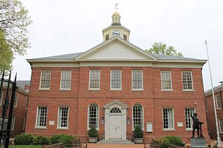
Talbot County is a county located in the heart of the Eastern Shore of Maryland in the U.S. state of Maryland. As of the 2010 census, the population was 37,782. Its county seat is Easton. The county was named for Lady Grace Talbot, the wife of Sir Robert Talbot, an Anglo-Irish statesman, and the sister of Lord Baltimore.

Maryland State of the United States of America

Maryland is a state in the Mid-Atlantic region of the United States, bordering Virginia, West Virginia, and the District of Columbia to its south and west; Pennsylvania to its north; and Delaware to its east. The state's largest city is Baltimore, and its capital is Annapolis. Among its occasional nicknames are Old Line State, the Free State, and the Chesapeake Bay State. It is named after the English queen Henrietta Maria, known in England as Queen Mary.

Related Research Articles

Fairland, Maryland census-designated place in Maryland, United States

Fairland is a census-designated place and an unincorporated area in Montgomery County, Maryland, United States.

Ibex Valley, Yukon human settlement

Ibex Valley is a hamlet in Canada's Yukon. The hamlet is considered a local advisory area with an advisory council providing local government. Its population in 2001 according to the Canada 2001 Census was 315.

Beatton Provincial Park

Beatton Provincial Park is a provincial park in the Peace River Country of northeastern British Columbia, Canada.

WNER

WNER is a sports/talk radio station in Watertown, New York. The station broadcasts at 1410 kHz and is owned by Stephens Media Group.

Hoagland, Indiana Census-designated place in Indiana, United States

Hoagland is an unincorporated census-designated place (CDP) in Madison Township, Allen County, Indiana, United States. As of the 2010 census, it had a population of 821.

Poluvsie municipality of Slovakia

Poluvsie is a village and municipality in Prievidza District in the Trenčín Region of western Slovakia.

Berlin Center is an unincorporated community in Mahoning County, in the U.S. state of Ohio.

WVNW

WVNW is a country music formatted radio station in the Lewistown, Pennsylvania market. The station is owned by WVNW, Inc.

Vanini is a municipality in the state of Rio Grande do Sul, Brazil.

Rutersville, Texas human settlement in Texas, United States of America

Rutersville is an unincorporated community in central Fayette County, Texas, United States.

Woods Mill, Virginia human settlement in Virginia, United States of America

Woods Mill is an unincorporated community in Nelson County, Virginia, United States. It was among the communities severely affected by flash flooding from Hurricane Camille in 1969.

Tuckahoe Creek

Tuckahoe Creek is a 21.5-mile-long (34.6 km) tributary of the Choptank River on Maryland's Eastern Shore. It is sometimes (erroneously) referred to as the Tuckahoe River. Upstream of Hillsboro, it forms the boundary between Caroline County and Queen Anne's County, passing through Tuckahoe State Park and dividing the small towns of Queen Anne and Hillsboro. Downstream of Hillsboro, it forms the boundary between Caroline County and Talbot County, before flowing into the Choptank.

Witinski Villa is a community or populated place located in Luzerne County, Pennsylvania, at latitude 41.18 and longitude -75.948. The elevation is 1,004 feet. Witinski Villa appears on the Wilkes-Barre West U.S. Geological Survey Map. Luzerne County is in the Eastern time zone.

Bartodzieje, Greater Poland Voivodeship Village in Greater Poland, Poland

Bartodzieje is a village in the administrative district of Gmina Wągrowiec, within Wągrowiec County, Greater Poland Voivodeship, in west-central Poland. It lies approximately 6 kilometres (4 mi) north of Wągrowiec and 53 km (33 mi) north of the regional capital Poznań.

Aboso Town & District in Western Region, Ghana

Aboso is a town near Tarkwa, and is the capital of Wassa West district, a district in the Western Region of Ghana. Aboso is the 78th most populous settlement in Ghana, with a population of 9,945 people. At the Ghana census of 18 March 1984, there were 4,700 inhabitants living in the town.

Hannasville is a census-designated place located in Canal Township, Venango County, in the state of Pennsylvania. The community is located along U.S. Route 322. As of the 2010 census the population was 176.

Cavia, Province of Burgos Municipality and town in Castile and León, Spain

Cavia is a municipality located in the province of Burgos, Castile and León, Spain.

KQLB

KQLB 106.9 FM is a radio station licensed to Los Banos in the San Joaquin Valley and Merced County, California.

Hunter is an unincorporated community in Belmont County, in the U.S. state of Ohio.

Overton is an unincorporated community in Cooper County, in the U.S. state of Missouri.

References

  1. "Geographic Names Information System". Lewistown (Populated Place). U.S. Geological Survey. 2009-01-29.

Coordinates: 38°50′42″N75°56′52″W / 38.84500°N 75.94778°W / 38.84500; -75.94778

Geographic coordinate system Coordinate system

A geographic coordinate system is a coordinate system that enables every location on Earth to be specified by a set of numbers, letters or symbols. The coordinates are often chosen such that one of the numbers represents a vertical position and two or three of the numbers represent a horizontal position; alternatively, a geographic position may be expressed in a combined three-dimensional Cartesian vector. A common choice of coordinates is latitude, longitude and elevation. To specify a location on a plane requires a map projection.