Tilghman Island, Maryland

Last updated

Tilghman Island, Maryland
CDP
Maryland - St. Jerome Creek through Wicomico River - NARA - 23941225 (cropped).jpg
Aerial view, 1930s
Talbot County Maryland Incorporated and Unincorporated areas Tilghman Island Highlighted.svg
Location of Tilghman Island, Maryland
Coordinates: 38°42′32″N76°20′6″W / 38.70889°N 76.33500°W / 38.70889; -76.33500
CountryUnited States
State Maryland
County Talbot
Area
[1]
  Total2.54 sq mi (6.57 km2)
  Land2.40 sq mi (6.21 km2)
  Water0.14 sq mi (0.36 km2)
Elevation
7 ft (2 m)
Population
 (2020)
  Total807
  Density336.67/sq mi (130.00/km2)
Time zone UTC−5 (Eastern (EST))
  Summer (DST) UTC−4 (EDT)
ZIP code
21671
Area code(s) 410, 443, and 667
FIPS code 24-77912
GNIS feature ID1852602
Website www.tilghmanisland.com

Tilghman Island is an island in the Chesapeake Bay. It is part of Talbot County, Maryland, United States.

Contents

History

Initially known as Great Choptank Island, the island became identified with a series of local families. It was owned by Matthew Tilghman's family from 1752 and has been known as Tilghman Island ever since. During the War of 1812 the island was briefly occupied by the British, who obtained provisions for their military forces. The community of Tilghman appeared in the 1840s. The economy shifted from farming to greater reliance on oystering and fishing as markets developed in Baltimore and Washington, aided by steamboat service in the 1890s. [2]

Historic places

The E.C. Collier , the Elsworth , the Hilda M. Willing , the Kathryn , the Maggie Lee , the Minnie V , the Nellie L. Byrd , the Paw Paw Cove Site, the Ralph T. Webster , the Rebecca T. Ruark , the Reliance , the Ruby G. Ford , Sharps Island Light, the Sigsbee , and the Virginia W are listed on the National Register of Historic Places. [3]

Geography

Drawbridge over Knapps Narrows to Tilghman Island Maryland Route 33 Drawbridge, Tilghman Island, Maryland.jpg
Drawbridge over Knapps Narrows to Tilghman Island

Tilghman Island is located at 38°42′32″N76°20′6″W / 38.70889°N 76.33500°W / 38.70889; -76.33500 (38.708795, 76.335016). [4]

According to the United States Census Bureau, the CDP has a total area of 2.8 square miles (7.3 km2), of which 2.7 square miles (7.0 km2) is land and 0.1 square miles (0.26 km2) (4.91%) is water.

Demographics

Historical population
CensusPop.Note
2020 807
U.S. Decennial Census [5]

As of the census [6] of 2010, there were 784 people, 357 households, and 246 families residing in the CDP. The population density was 315.9 inhabitants per square mile (122.0/km2). There were 560 housing units at an average density of 207.1 per square mile (80.0/km2). The racial makeup of the CDP was 97.3% White, 1.4% African American, 0.5% Native American, 0.5% Asian, and 0.3% from two or more races. Hispanic or Latino of any race were 0.6% of the population.

There were 368 households, out of which 24.7% had children under the age of 18 living with them, 64.9% were married couples living together, 3.8% had a female householder with no husband present, and 28.8% were non-families. 23.9% of all households were made up of individuals, and 11.1% had someone living alone who was 65 years of age or older. The average household size was 2.32 and the average family size was 2.72.

In the CDP, the population was spread out, with 19.2% under the age of 18, 5.3% from 18 to 24, 23.8% from 25 to 44, 29.7% from 45 to 64, and 22.0% who were 65 years of age or older. The median age was 46 years. For every 100 females, there were 104.3 males. For every 100 females age 18 and over, there were 100.0 males.

The median income for a household in the CDP was $32,763, and the median income for a family was $38,304. Males had a median income of $21,213 versus $24,286 for females. The per capita income for the CDP was $13,851. About 8.7% of families and 17.7% of the population were below the poverty line, including 24.4% of those under age 18 and 8.9% of those age 65 or over.

Related Research Articles

<span class="mw-page-title-main">Brickerville, Pennsylvania</span> Census-designated place in Pennsylvania, United States

Brickerville is an unincorporated community and census-designated place (CDP) in Elizabeth Township, Lancaster County, Pennsylvania, United States, with a ZIP code of 17543. The population was 1,309 at the 2010 census.

<span class="mw-page-title-main">Meridianville, Alabama</span> Census-designated place in Alabama, United States

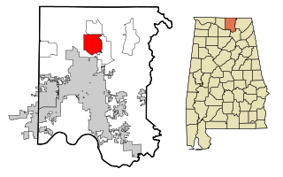
Meridianville is an unincorporated community and census-designated place (CDP) in Madison County, Alabama, United States, and is included in the Huntsville-Decatur Combined Statistical Area. As of the 2020 census, the population of the CDP was 8,209.

<span class="mw-page-title-main">Kaʻaʻawa, Hawaii</span> Census-designated place in the United States

Kaʻaʻawa is a small community and census-designated place (CDP) located in the windward district of Koʻolauloa, City & County of Honolulu on the island of Oʻahu, Hawaiʻi, United States. As of the 2010 Census, the total population for Kaʻaʻawa was 1,379. In Hawaiian, kaʻaʻawa means "the wrasse (fish)". From the Hawaiian spelling Kaʻaʻawa it is seen that each a is pronounced separately and distinctly, set apart by the two ʻokinas: or.

Rock Island Arsenal is a census-designated place (CDP) in Rock Island County, Illinois, United States. The population was 149 at the 2010 census. The island contains the Rock Island National Cemetery.

<span class="mw-page-title-main">Hillsmere Shores, Maryland</span> Former census-designated place in Maryland, United States

Hillsmere Shores was a census-designated place (CDP) in Anne Arundel County, Maryland, United States. It is a suburb of Annapolis. The population was 2,977 at the 2000 census. It was included in the Annapolis Neck CDP at the 2010 census. Built in phases, beginning in 1960, the community has been home to The Key School, a non-sectarian private school, since the 1960s.

<span class="mw-page-title-main">Selby-on-the-Bay, Maryland</span> Former census-designated place in Maryland, United States

Selby-on-the-Bay is a census-designated place (CDP) in Anne Arundel County, Maryland, United States, for the 2000 census, at which time its population was 3,674. It was added to the Mayo CDP for the 2010 census.

<span class="mw-page-title-main">Algonquin, Maryland</span> Census-designated place in Maryland, United States

Algonquin is a census-designated place (CDP) in Dorchester County, Maryland, United States. The population was 1,241 at the 2010 census. The community was named for the Algonquin people, one of the Native American tribes in the East.

<span class="mw-page-title-main">Chester, Maryland</span> CDP in Maryland, United States

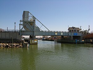
Chester is a census-designated place on Kent Island in Queen Anne's County, Maryland, United States. The population was 3,723 at the 2000 census.

<span class="mw-page-title-main">Charlotte Hall, Maryland</span> CDP in Maryland, United States

Charlotte Hall is a census-designated place (CDP) in Charles and St. Mary's counties, Maryland, United States. The population was 1,420 at the 2010 census. The Maryland Veterans Home for disabled veterans, is located on the site of the former Charlotte Hall Military Academy. The Academy site was declared the Charlotte Hall Historic District, and listed on the National Register of Historic Places in 1975. Since 1940, a sizable Amish farming community has existed nearby, along with a farmers' market and large flea market complex on Maryland Route 5, which is also the site of numerous strip-mall businesses continuing into the adjacent community of Mechanicsville. A U.S. Veterans Affairs clinic is across the highway from the Veterans Home.

<span class="mw-page-title-main">West Ocean City, Maryland</span> CDP in Maryland, United States

West Ocean City is a census-designated place (CDP) in Worcester County, Maryland, United States. The population was 4,375 at the 2010 census. It is part of the Salisbury, Maryland-Delaware Metropolitan Statistical Area.

<span class="mw-page-title-main">South Woodbridge, California</span> Unincorporated community in California, United States

South Woodbridge was a former census-designated place (CDP) in San Joaquin County, California, United States. The population was 2,825 at the 2000 census. For the 2010 census, the CDP's of South Woodbridge and North Woodbridge were merged into Woodbridge.

<span class="mw-page-title-main">St. Pierre, Montana</span> Census-designated place in Montana, United States

St. Pierre is a census-designated place (CDP) in Hill County, Montana, United States, within the Rocky Boy Indian Reservation. The population of St. Pierre was 350 at the 2010 census, up from 289 in 2000.

Arlington Heights is a census-designated place (CDP) in Monroe County, Pennsylvania, United States. The population was 6,331 at the 2020 census. One notable location in Arlington Heights is the Stroud Mall.

<span class="mw-page-title-main">Edgewood, Northumberland County, Pennsylvania</span> CDP in Pennsylvania, United States

Edgewood is a census-designated place (CDP) located in Coal Township, in Northumberland County, Pennsylvania, United States. The population was 2,619 at the 2000 census.

<span class="mw-page-title-main">Buck Run, Pennsylvania</span> CDP in Pennsylvania, United States

Buck Run is a census-designated place (CDP) in Schuylkill County, Pennsylvania, United States. The population was 176 at the 2010 census.

<span class="mw-page-title-main">Lake Wynonah, Pennsylvania</span> CDP in Pennsylvania, United States

Lake Wynonah is a census-designated place (CDP) in Schuylkill County, Pennsylvania, United States. The population was 1,961 at the 2000 census, and 2,640 at the 2010 census. Lake Wynonah is a gated community with two lakes, Fawn Lake and Lake Wynonah, and as of July 2008, there are over 1200 homes and 1500 members. It is in South Manheim and Wayne Townships.

<span class="mw-page-title-main">Newtown, Schuylkill County, Pennsylvania</span> CDP in Pennsylvania, United States

Newtown is a census-designated place (CDP) in Reilly Township, Schuylkill County in the U.S. state of Pennsylvania. The population was 244 at the 2000 census.

<span class="mw-page-title-main">Gloucester Point, Virginia</span> Census-designated place in Virginia, United States

Gloucester Point is a census-designated place (CDP) in Gloucester County, Virginia, United States. The population was 9,402 at the 2010 census. It is home to the College of William & Mary's Virginia Institute of Marine Science, a graduate school for the study of oceanography.

<span class="mw-page-title-main">Erlands Point-Kitsap Lake, Washington</span> Former CDP in Washington, United States

Erlands Point-Kitsap Lake is an unincorporated area and former census-designated place (CDP) in Kitsap County, Washington, United States. The population was 2,935 at the 2010 census. For the 2020 census, the area was split into two CDPs, Erlands Point and Kitsap Lake.

<span class="mw-page-title-main">Skowhegan (CDP), Maine</span> CDP in Maine, United States

Skowhegan is a census-designated place (CDP) in the town of Skowhegan in Somerset County, Maine, United States. The population was 6,404 at the 2020 census.

References

  1. "2020 U.S. Gazetteer Files". United States Census Bureau. Retrieved April 26, 2022.
  2. "Tilghman Island". Saint Michaels. Retrieved July 17, 2017.
  3. "National Register Information System". National Register of Historic Places . National Park Service. July 9, 2010.
  4. "US Gazetteer files: 2010, 2000, and 1990". United States Census Bureau. February 12, 2011. Retrieved April 23, 2011.
  5. "Census of Population and Housing". Census.gov. Retrieved June 4, 2016.
  6. "U.S. Census website". United States Census Bureau . Retrieved January 31, 2008.