List of European cities by population within city limits

Last updated

Cityscape of Istanbul Istanbul asv2021-11 img60 Yedikule.jpg
Cityscape of Istanbul

The largest cities in Europe have populations over one million inhabitants within their city boundary. In this article, cities are sorted by official population. Capital cities are in bold. The rankings are based on populations contained within city administrative boundaries, as opposed to urban areas or metropolitan areas, which necessarily have larger populations than the cities embedded within them.

Contents

As some cities have narrow boundaries and others wide ones, the list may not give an accurate view of the comparative magnitude of different places, and the figures in the list should be treated with caution: for example, Paris is the second most populous urban area in Europe, but the strict definition of the administrative limits of the City of Paris results in a far lower[ and plain silly ] population shown in the table.

Largest cities

  Cities within the European Union

(Capital cities are in bold.)

Map

See also

Notes

  1. Istanbul is a transcontinental city, with its commercial and historical centre and two-thirds of the population in Europe, the rest in Asia (see Districts of Istanbul for details).
  2. Istanbul total (2023) = 15,655,924
    Europe (25 districts) = 10,030,990
    Asia (14 districts) = 5,624,934
  3. Moscow is the most populous city entirely within Europe.
  4. 1 2 3 Continental placement may vary depending on geographic convention being followed.

Related Research Articles

<span class="mw-page-title-main">Metropolitan area</span> Administrative unit of a dense urban core and its satellite cities

A metropolitan area or metro is a region consisting of a densely populated urban agglomeration and its surrounding territories sharing industries, commercial areas, transport network, infrastructures and housing. A metropolitan area usually comprises multiple principal cities, jurisdictions and municipalities: neighborhoods, townships, boroughs, cities, towns, exurbs, suburbs, counties, districts and even states and nations in areas like the eurodistricts. As social, economic and political institutions have changed, metropolitan areas have become key economic and political regions.

<span class="mw-page-title-main">Urban area</span> Human settlement with high population density and infrastructure of built environment

An urban area, built-up area or urban agglomeration is a human settlement with a high population density and an infrastructure of built environment. This is the core of a metropolitan statistical area in the United States, if it contains a population of more than 50,000.

<span class="mw-page-title-main">Zhukovsky, Moscow Oblast</span> City in Moscow Oblast, Russia

Zhukovsky is a city in Moscow Oblast, Russia, located on the Moskva River, 40 kilometers (25 mi) southeast of Moscow. Population: 104,736 (2010 Russian census); 101,328 (2002 Census); 100,609 (1989 Soviet census).

<span class="mw-page-title-main">Kamensk-Shakhtinsky</span> Town in Rostov Oblast, Russia

Kamensk-Shakhtinsky is a town in Rostov Oblast, located on the Seversky Donets River. Population: 95,296 (2010 Russian census); 75,632 (2002 Census); 72,379 (1989 Soviet census).

<span class="mw-page-title-main">Sudzha</span> Town in Kursk Oblast, Russia

Sudzha is a town and the administrative center of Sudzhansky District in Kursk Oblast, Russia, located on the Sudzha and Olyoshnya Rivers 105 kilometers (65 mi) southwest of Kursk, the administrative center of the oblast. It has a population of 5,127 people.

<span class="mw-page-title-main">Kotelniki</span> Town in Moscow Oblast, Russia

Kotelniki is a town of Moscow Oblast, Russia, located 22 km (14 mi) southeast of the center of Moscow. Population: 63,728 (2021 Census); 32,338 (2010 Russian census); 17,747 (2002 Census); 17,456 (1989 Soviet census).

<span class="mw-page-title-main">Akhvakhsky District</span> District in Republic of Dagestan, Russia

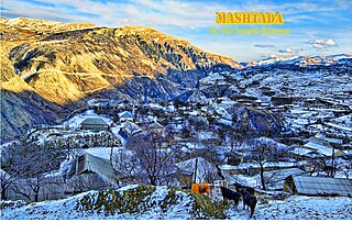
Akhvakhsky District is an administrative and municipal district (raion), one of the forty-one in the Republic of Dagestan, Russia. It is located in the west of the republic. The area of the district is 291.1 square kilometers (112.4 sq mi). Its administrative center is the rural locality of Karata. As of the 2010 Census, the total population of the district was 22,014, with the population of Karata accounting for 18.9% of that number.

<span class="mw-page-title-main">Akushinsky District</span> District in Republic of Dagestan, Russia

Akushinsky District is an administrative and municipal district (raion), one of the forty-one in the Republic of Dagestan, Russia. It is located in the southern central part of the republic. The area of the district is 622.8 square kilometers (240.5 sq mi). Its administrative center is the rural locality of Akusha. As of the 2010 Census, the total population of the district was 52,558, with the population of Akusha accounting for 8.8% of that number.

<span class="mw-page-title-main">Dakhadayevsky District</span> District in Republic of Dagestan, Russia

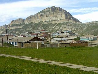
Dakhadayevsky District is an administrative and municipal district (raion), one of the forty-one in the Republic of Dagestan, Russia. It is located in the southern central part of the republic. The area of the district is 1,450 square kilometers (560 sq mi). Its administrative center is the rural locality of Urkarakh. As of the 2010 Census, the total population of the district was 36,709, with the population of Urkarakh accounting for 12.0% of that number.

<span class="mw-page-title-main">Derbentsky District</span> District in Republic of Dagestan, Russia

Derbentsky District is an administrative and municipal district (raion), one of the forty-one in the Republic of Dagestan, Russia. It is located in the southeast of the republic. The area of the district is 822.72 square kilometers (317.65 sq mi). Its administrative center is the city of Derbent. As of the 2010 Census, the total population of the district was 99,054.

<span class="mw-page-title-main">Tabasaransky District</span> District in Republic of Dagestan, Russia

Tabasaransky District is an administrative and municipal district (raion), one of the forty-one in the Republic of Dagestan, Russia. It is located in the southeast of the republic. The area of the district is 801 square kilometers (309 sq mi). Its administrative center is the rural locality of Khuchni. As of the 2010 Census, the total population of the district was 52,886, with the population of Khuchni accounting for 6.1% of that number.

<span class="mw-page-title-main">Untsukulsky District</span> District in Republic of Dagestan, Russia

Untsukulsky District is an administrative and municipal district (raion), one of the forty-one in the Republic of Dagestan, Russia. It is located in the center of the republic. The area of the district is 560 square kilometers (220 sq mi). Its administrative center is the rural locality of Untsukul. As of the 2010 Census, the total population of the district was 29,547, with the population of Untsukul accounting for 21.2% of that number.

<span class="mw-page-title-main">Novosibirsky District</span> District in Novosibirsk Oblast, Russia

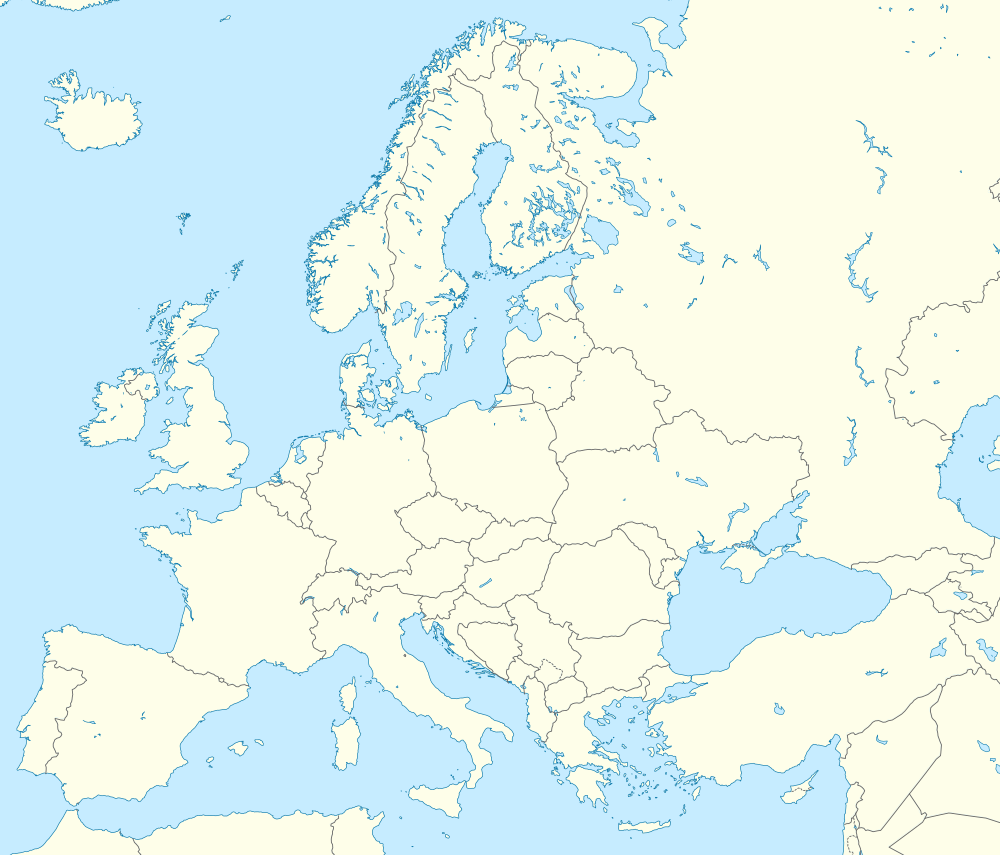
Novosibirsky District is an administrative and municipal district (raion), one of the thirty in Novosibirsk Oblast, Russia. It is located in the east of the oblast. The area of the district is 2,900 square kilometers (1,100 sq mi). Its administrative center is the city of Novosibirsk. Population: 127,891 ; 113,047 (2002 Census); 130,300 (1989 Soviet census).

Sulak is an urban locality under the administrative jurisdiction of Kirovsky City District of the City of Makhachkala in the Republic of Dagestan, Russia. As of the 2010 Census, its population was 8,565.

References

  1. "The Results of Address Based Population Registration System, 2023". Turkish Statistical Institute. 6 February 2024. Retrieved 6 February 2024.
  2. 1 2 3 4 5 6 7 8 9 10 11 "Численность постоянного населения Российской Федерации по муниципальным образованиям на 1 января 2024 года" (in Russian). Russian Federal State Statistics Service . Retrieved 29 April 2024.
  3. 1 2 "Admin-based population estimates for local authorities in England and Wales". Office for National Statistics. 18 December 2023. Retrieved 29 December 2023.
  4. 1 2 3 4 "Städte (Alle Gemeinden mit Stadtrecht) nach Fläche, Bevölkerung und Bevölkerungsdichte am 31.12.2022" (in German). Federal Statistical Office of Germany. 21 September 2023. Retrieved 24 October 2023.
  5. 1 2 "Municipal breakdown". Instituto Nacional de Estadística . Retrieved 26 January 2024.
  6. 1 2 3 "Number of Present Population of Ukraine, as of January 1" (PDF). State Statistics Service of Ukraine. 2022. pp. 35–47. Retrieved 10 April 2023.
  7. 1 2 "Resident population on 1st January". Italian National Institute of Statistics . Retrieved 17 May 2024.
  8. "Population: Administrative – territorial divisions, number and structure of population". State Statistics Committee. 28 November 2023. Retrieved 23 March 2024.
  9. "Estimation de la population au 1er janvier 2023" (in French). Institut national de la statistique et des études économiques. 24 January 2023. Retrieved 11 April 2023.
  10. "Population at beginning of year/quarter". Statistics Austria . Retrieved 14 April 2024.
  11. "Численность населения на 1 января 2024 г. и среднегодовая численность населения за 2023 год по Республике Беларусь в разрезе областей, районов, городов, поселков городского типа" (in Russian). National Statistical Committee of the Republic of Belarus. 28 March 2024. Retrieved 13 April 2024.
  12. "Population. Size and structure and vital statistics in Poland by territorial division in 2022. As of 30 June (Table III)". Statistics Poland. 16 October 2023. Retrieved 24 October 2023.
  13. "POP105A - Populația rezidentă la 1 Ianuarie pe grupe de vârste, sexe și medii de rezidență, macroregiuni, regiuni de dezvoltare și județe" (in Romanian). National Institute of Statistics. 5 September 2023. Retrieved 23 September 2023.
  14. "Ethnicity: Data by municipalities and cities" (PDF). Statistical Office of the Republic of Serbia. April 2023. p. 30. Retrieved 18 March 2024.
  15. "Population by type of settlement, 1 January". Hungarian Central Statistical Office . Retrieved 24 October 2023.
  16. "Population of Municipalities – 1 January 2024". Czech Statistical Office. 17 May 2024.
  17. "Population by districts, municipalities, place of residence and sex". National Statistical Institute. 28 April 2023. Retrieved 24 October 2023.
  18. "Population: Population by cities and boroughs, as of 1 January". National Statistics Office of Georgia . Retrieved 2 January 2024.
  19. "On the preliminary results of 2022 Population Census conducted in the Republic of Armenia" (PDF). Statistical Committee of Armenia. 5 September 2023. Retrieved 2 January 2024.