List of Ramsar sites in the United States

Last updated

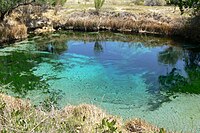
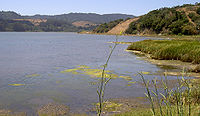
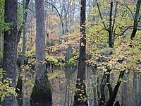
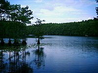
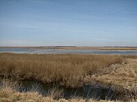
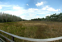
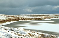
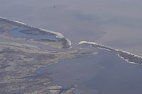
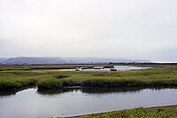
This list of Ramsar sites in the United States are those wetlands that are considered to be of international importance, protected under the Ramsar Convention. The United States as of 2020, has 41 sites designated as "Wetlands of International Importance" with a surface area of 1,884,551 hectares (7,276.29 sq mi; 18,845.51 km2). [1] [2] For a full list of all Ramsar sites worldwide, see List of Ramsar wetlands of international importance.

Contents

Map all coordinates using: OpenStreetMap

List of Ramsar sites

Name [2] LocationArea [2] DesignatedDescriptionImage
Ash Meadows National Wildlife Refuge Nevada
36°25′N116°20′W / 36.417°N 116.333°W / 36.417; -116.333 (Ash Meadows National Wildlife Refuge)
36.71 sq mi18 December 1986 Ash Meadows Crystal Spring 1.jpg
Bolinas Lagoon California
37°55′N122°41′W / 37.917°N 122.683°W / 37.917; -122.683 (Bolinas Lagoon)
1.72 sq mi1 September 1998A tidal estuary located on the Pacific Flyway, the lagoon provides habitat for migratory birds as well as ducks, geese, and shorebirds. Bolinas Lagoon 2794.jpg
Cache-Lower White Rivers Arkansas
34°40′N91°11′W / 34.667°N 91.183°W / 34.667; -91.183 (Cache-Lower White Rivers)
314.19 sq mi21 November 1989 Bayou DeView watershed - Cache River National Wildlife Refuge.jpg
Cache River-Cypress Creek Wetlands Illinois
37°13′N89°8′W / 37.217°N 89.133°W / 37.217; -89.133 (Cache River-Cypress Creek Wetlands)
93.75 sq mi1 November 1994 Heron Pond in Cache River State Natural Area.jpg
Caddo Lake Texas, Louisiana
32°45′N94°8′W / 32.750°N 94.133°W / 32.750; -94.133 (Caddo Lake)
30.80 sq mi23 October 1993 Caddo Lake- Cypress.jpg
Catahoula Lake Louisiana
31°30′N92°6′W / 31.500°N 92.100°W / 31.500; -92.100 (Catahoula Lake)
46.9 sq mi18 June 1991
Chesapeake Bay Estuarine Complex Maryland, Virginia
38°0′N76°20′W / 38.000°N 76.333°W / 38.000; -76.333 (Chesapeake Bay Estuarine Complex)
170 sq mi4 June 1987 Chesapeakelandsat.jpeg
Cheyenne Bottoms Kansas
38°29′N98°40′W / 38.483°N 98.667°W / 38.483; -98.667 (Cheyenne Bottoms)
42.39 sq mi19 October 1988 Cheyenne Bottoms.jpg
Chiwaukee Illinois Beach Lake Plain Illinois
Wisconsin
42°25′02″N87°48′42″W / 42.41722°N 87.81167°W / 42.41722; -87.81167 (Chiwaukee Prairie Illinois Beach Lake Plain)
6.12 sq mi6 October 2015Bi-state, lake-coast lands, including Chiwaukee Prairie and Illinois Beach State Park Gfp-illinois-beach-state-park-left-shoreline.jpg
Congaree National Park South Carolina
33°47′22″N80°45′34″W / 33.78944°N 80.75944°W / 33.78944; -80.75944 (Congaree National Park)
40.69 sq mi2 February 2012 Congaree swamp.jpg
Connecticut River Estuary and Tidal Wetlands Complex Connecticut
41°15′N72°18′W / 41.250°N 72.300°W / 41.250; -72.300 (Connecticut River Estuary and Tidal Wetlands Complex)
25.03 sq mi14 October 1994 Sediment from Connecticut River.jpg
Corkscrew Swamp Sanctuary Florida
26°24′N81°31′W / 26.400°N 81.517°W / 26.400; -81.517 (Corkscrew Swamp Sanctuary)
20.31 sq mi23 March 2009 Corkscrew swap sanctuary, Florida.jpg
Delaware Bay Estuary Delaware, New Jersey
39°11′N75°14′W / 39.183°N 75.233°W / 39.183; -75.233 (Delaware Bay Estuary)
197.89 sq mi20 May 1992 Delaware Bay Villas NJ.JPG
Door Peninsula Coastal Wetlands Wisconsin
45°13′20″N85°00′00″W / 45.22222°N 85.00000°W / 45.22222; -85.00000
17.880 sq mi6 October 2014
Edwin B. Forsythe National Wildlife Refuge New Jersey
39°36′N74°17′W / 39.600°N 74.283°W / 39.600; -74.283 (Edwin B. Forsythe National Wildlife Refuge)
50.5 sq mi18 December 1986 Marina at Edwin B. Forsythe National Wildlife Refuge (14848485047).jpg
Elkhorn Slough California
36°49′33″N121°45′25″W / 36.8259°N 121.7569°W / 36.8259; -121.7569 (Elkhorn Slough)
2.80 sq mi25 June 2018 Moss Landing California aerial view.jpg
Everglades National Park Florida
25°33′N80°55′W / 25.550°N 80.917°W / 25.550; -80.917 (Everglades National Park)
2,357.14 sq mi4 June 1987 Everglades57(js).jpg
Francis Beidler Forest South Carolina
33°15′N80°22′W / 33.250°N 80.367°W / 33.250; -80.367 (Francis Beidler Forest)
24.86 sq mi30 May 2008 Cypress Knees Beidler Forest.jpg
Grassland Ecological Area California
37°10′N120°50′W / 37.167°N 120.833°W / 37.167; -120.833 (Grassland Ecological Area)
250 sq mi2 February 2005
Horicon Marsh Wisconsin
43°30′N88°38′W / 43.500°N 88.633°W / 43.500; -88.633 (Horicon Marsh)
49.85 sq mi4 December 1990 HoriconMarshBoardwalk.jpg
Humbug Marsh Michigan
42°6′N83°11′W / 42.100°N 83.183°W / 42.100; -83.183 (Humbug Marsh)
0.73 sq mi20 January 2010
Izembek Lagoon National Wildlife Refuge Alaska
55°45′N162°41′W / 55.750°N 162.683°W / 55.750; -162.683 (Izembek Lagoon National Wildlife Refuge)
650.32 sq mi18 December 1986 Izembek National Wildlife Refuge.jpg
Kakagon and Bad River Sloughs Wisconsin
46°39′N90°41′W / 46.650°N 90.683°W / 46.650; -90.683 (Kakagon and Bad River Sloughs)
16.81 sq mi2 February 2012 Bad River mouth.jpg
Kawainui and Hamakua Marsh Complex Hawaii
21°24′N157°45′W / 21.400°N 157.750°W / 21.400; -157.750 (Kawainui and Hamakua Marsh Complex)
1.60 sq mi2 February 2005 KAWAINUIMARSH.jpg
Laguna de Santa Rosa Wetland Complex California
38°24′N122°47′W / 38.400°N 122.783°W / 38.400; -122.783 (Laguna de Santa Rosa Wetland Complex)
6.08 sq mi16 April 2010 Lagunadesantarosa.jpg
Lower Wisconsin Riverway Wisconsin
43°09′N90°21′W / 43.150°N 90.350°W / 43.150; -90.350 (Lower Wisconsin Riverway)
68 sq mi14 February 2020
Niagara River Corridor New York
43°5′N79°4′W / 43.083°N 79.067°W / 43.083; -79.067 (Niagara River Corridor)
20.261 sq mi3 October 2019 DSCN4390 americanfalls e.jpg
Okefenokee National Wildlife Refuge Georgia, Florida
30°48′N82°20′W / 30.800°N 82.333°W / 30.800; -82.333 (Okefenokee National Wildlife Refuge)
627.94 sq mi18 December 1986 Alligators au refuge national d'Okefenokee.JPG
Palmyra Atoll National Wildlife Refuge Line Islands
5°52′N162°6′W / 5.867°N 162.100°W / 5.867; -162.100 (Palmyra Atoll National Wildlife Refuge)
788.14 sq mi1 April 2011 Coral reef at palmyra.jpg
Pelican Island National Wildlife Refuge Florida
27°48′N80°25′W / 27.800°N 80.417°W / 27.800; -80.417 (Pelican Island National Wildlife Refuge)
7.37 sq mi14 March 1993 Aerial of Pelican Island National Willdife Refuge.jpg
Quivira National Wildlife Refuge Kansas
38°5′N98°29′W / 38.083°N 98.483°W / 38.083; -98.483 (Quivira National Wildlife Refuge)
34.59 sq mi12 February 2002The refuge has 34 wetlands and includes two shallow lakes, Big Salt Marsh and Little Salt Marsh. More than half of the refuge is Tallgrass and Shortgrass prairies. Quivirabirds.jpg
Roswell Artesian Wetlands New Mexico
33°27′N104°23′W / 33.450°N 104.383°W / 33.450; -104.383 (Roswell Artesian Wetlands)
3.54 sq mi7 September 2010 Bitter Lakes New Mexico.jpg
San Francisco Bay and Estuary California
37°52′N122°23′W / 37.867°N 122.383°W / 37.867; -122.383 (San Francisco Bay and Estuary)
612.79 sq mi2 February 2013 Hunterspoint.jpg
Sand Lake National Wildlife Refuge South Dakota
45°45′N98°15′W / 45.750°N 98.250°W / 45.750; -98.250 (Sand Lake National Wildlife Refuge)
34 sq mi3 August 1998 Sand Lake National Wildlife Refuge.jpg
Sue and Wes Dixon Waterfowl Refuge at Hennepin and Hopper Lake Illinois
41°13′20″N89°20′17″W / 41.22222°N 89.33806°W / 41.22222; -89.33806 (Dixon Waterfowl Refuge)
4.31 sq mi2 February 2012 Nelumbo lutea, American lotus at Dixon Waterfowl Refuge.jpg
The Emiquon Complex Illinois
40°21′22″N90°3′10″W / 40.35611°N 90.05278°W / 40.35611; -90.05278 (The Emiquon Complex)
22.12 sq mi2 February 2012 Emiquon National Wildlife Refuge.jpg
Tijuana River National Estuarine Research Reserve California
32°33′N117°7′W / 32.550°N 117.117°W / 32.550; -117.117 (Tijuana River National Estuarine Research Reserve)
3.94 sq mi2 February 2005 Tijuana River Estuary.jpg
Tomales Bay California
38°9′N123°23′W / 38.150°N 123.383°W / 38.150; -123.383 (Tomales Bay)
28.5 km2 (11.0 sq mi)30 September 2002 Former North Pacific Coast Railroad grade adjacent to Tomales Bay.JPG
Upper Mississippi River Floodplain Wetlands Minnesota, Wisconsin, Iowa, Illinois
43°3′N91°10′W / 43.050°N 91.167°W / 43.050; -91.167 (Upper Mississippi River Floodplain Wetlands)
472.42 sq mi5 January 2010 MerrickStateParkWisconsinMississippiRiver2.jpg
Wilma H. Schiermeier Olentangy River Wetland Research Park Ohio
40°1′N83°1′W / 40.017°N 83.017°W / 40.017; -83.017 (Olentangy River Wetland Research Park)
0.081 sq mi18 April 2008 OSUWetland1.JPG

See also

Related Research Articles

<span class="mw-page-title-main">Ramsar Convention</span> International treaty for the conservation and sustainable utilization of wetlands

The Ramsar Convention on Wetlands of International Importance Especially as Waterfowl Habitat is an international treaty for the conservation and sustainable use of Ramsar sites (wetlands). It is also known as the Convention on Wetlands. It is named after the city of Ramsar in Iran, where the convention was signed in 1971.

<span class="mw-page-title-main">Ramsar site</span> Wetland site as designated by the Ramsar Convention

A Ramsar site is a wetland site designated to be of international importance under the Ramsar Convention, also known as "The Convention on Wetlands", an international environmental treaty signed on 2 February 1971 in Ramsar, Iran, under the auspices of UNESCO. It came into force on 21 December 1975, when it was ratified by a sufficient number of nations. It provides for national action and international cooperation regarding the conservation of wetlands, and wise sustainable use of their resources. Ramsar identifies wetlands of international importance, especially those providing waterfowl habitat.

<span class="mw-page-title-main">Important Bird Area</span> Area recognized as a habitat for bird population conservation

An Important Bird and Biodiversity Area (IBA) is an area identified using an internationally agreed set of criteria as being globally important for the conservation of bird populations.

The Society of Wetland Scientists is an international, professional non-profit organization whose mission is to promote best practices in wetland research, education, conservation, preservation, restoration, and management. The SWS vision is to ensure that wetlands are understood, their importance recognized, and sound wetland science is used as a guide for wetland professionals and the general public to collaborate on research, conservation, preservation, restoration, and management of wetlands in our changing environment. Based in Washington DC, United States, SWS has 3000+ members worldwide, and the membership is open to anyone with an interest in wetlands.

References

  1. "United States". Ramsar.org. Retrieved 12 November 2022.
  2. 1 2 3 "The Annotated Ramsar List: United States of America". Ramsar.org. Archived from the original (PDF) on 4 September 2013. Retrieved 13 February 2020.