List of earthquakes in Texas

Last updated

Map of seismic hazard in Texas as of 2014
, as determined using the peak ground acceleration with 2% probability of exceedance in 50 years Texas seismic hazard map with cities.png
Map of seismic hazard in Texas as of 2014, as determined using the peak ground acceleration with 2% probability of exceedance in 50 years

Earthquakes intense enough to be perceptible occur annually in the U.S. state of Texas. Most earthquakes in the state have been small or have produced minimal impacts. No earthquake-related fatalities have been reported in the state, though one earthquake in Texas caused a death in the neighboring Mexican state of Chihuahua in 1923. The earliest recorded earthquake in Texas occurred near Seguin and New Braunfels on February 13, 1847. [1] Information on the intensities of early Texas earthquakes mainly arose from reports of personal experiences; more seismograph stations were installed in Texas after around 1970. [2] In the 20th century, over 100 earthquakes strong enough to be felt occurred in the state, with epicenters in 40  Texas counties. [3] :37 While many earthquakes in Texas have natural origins, many have been induced by petroleum extraction beginning with the Texas oil boom of the early 20th century. The average number of earthquakes per year with magnitudes greater than 3 increased from roughly 2 to 12 between 2008 and 2016. [2]

The regions within the state with the greatest seismic hazard include West Texas, the Texas Panhandle, North Texas, and South Central Texas. Among these areas, West Texas experiences the strongest and most frequent earthquakes, with El Paso featuring the greatest risk from earthquakes among sizable urban areas in Texas. [3] :18–19 There are several geologic features in West Texas of interest to seismology, including the Central Basin Platform, the Hueco Bolson, and the Marathon Uplift. [3] :20–23 Several faultlines are also located in West Texas. The strongest and most destructive earthquake in state history was the 1931 Valentine earthquake, [3] :20 which had an estimated magnitude of mb 5.66.4. [4] :1171 The second strongest earthquake in Texas history also occurred in West Texas, registering as a magnitude 5.7 tremor near Alpine in 1995. [1]

The Texas Panhandle exhibits the second highest seismic risk among regions in the state. The earthquakes in this area primarily occur on buried faults between the Amarillo Uplift and the Anadarko Basin. [3] :24 An earthquake with a magnitude of 5.5–6.0 is expected to occur every 50–100 years in the Texas Panhandle, while an earthquake with a magnitude greater than 6.0 is expected to occur every 300 years. [5] The strongest earthquake in this region was a magnitude 4.9 earthquake that occurred in 1925. [5] [6] Some of the seismic activity in the Texas Panhandle may be caused or influenced by the extraction of petroleum. [3] :27 [5] The northern and northeastern parts of Texas, including the Dallas–Fort Worth metroplex, are another region of seismic risk. Though the area does experience some minor earthquakes, including induced earthquakes naturally-occurring tremors potentially along buried faults, shaking from distant earthquakes presents the primary seismic hazard for the region. [3] :29–31 Some earthquakes of mostly minor strength also occur in South Central Texas and the Texas Coastal Plain. Some of these earthquakes may be associated with geological features produced by the Ouachita orogeny, and many have been attributed to petroleum production. [3] :32–34

Notable earthquakes

Relief map of Texas.png
Orange pog.svg
Valentine earthquake
Gold pog.svg
Marathon earthquake
Gold pog.svg
Gold pog.svg
Yellow pog.svg
SpringGreen pog.svg
Yellow pog.svg
SpringGreen pog.svg
Yellow pog.svg
SpringGreen pog.svg
Gray pog.svg
Yellow pog.svg
SpringGreen pog.svg
SpringGreen pog.svg
SpringGreen pog.svg
SpringGreen pog.svg
SpringGreen pog.svg
Yellow pog.svg
SpringGreen pog.svg
SpringGreen pog.svg
SpringGreen pog.svg
SpringGreen pog.svg
Earthquakes in Texas (magnitude 4.5+)
Date and time (UTC)LocationEpicenter Mag. MMI DepthNotesCasualtiesRef
DeadInjured
August 16, 1931
11:40:22
Presidio County 30°30′07″N104°34′30″W / 30.502°N 104.575°W / 30.502; -104.575 (1931-08-16) 5.8 mbLg VIII (Severe) 1.0 km (0.62 mi)All buildings in Valentine aside from wood-frame houses were damaged. Property damage was reported in Brewster, Culberson, Jeff Davis, and Presidio counties with landslides triggered as far as the Big Bend of Texas. [7]
April 14, 1995
00:32:56
Brewster County 30°23′06″N103°20′49″W / 30.385°N 103.347°W / 30.385; -103.347 (1995-04-14) 5.7 Mw VII (Very strong) 17.8 km (11.1 mi)Slight damage occurred in Alpine and Fort Davis. Two people suffered minor injuries in Brewster County. Shaking was felt as far east as the Dallas–Fort Worth metroplex and San Antonio.2 [8]
November 16, 2022
21:32:44
Reeves County 31°38′13″N103°59′56″W / 31.637°N 103.999°W / 31.637; -103.999 (2022-11-16) 5.4 ML VII (Very strong) 6.9 km (4.3 mi)Possibly the main shock of a sequence of 881 earthquakes. [9]
November 8, 2023
10:27:49
Reeves County 31°37′19″N103°58′55″W / 31.622°N 103.982°W / 31.622; -103.982 (2023-11-08) 5.2 ML VII (Very strong) 7.4 km (4.6 mi)Possibly the main shock of a sequence of 278 earthquakes. [10]
December 16, 2022
23:35:27
Martin County 32°11′28″N102°08′28″W / 32.191°N 102.141°W / 32.191; -102.141 (2022-12-16) 5.2 ML VI (Strong) 8.2 km (5.1 mi) [11]
March 26, 2020
15:16:27
Reeves County 31°43′01″N104°02′31″W / 31.717°N 104.042°W / 31.717; -104.042 (2020-03-26) 5.0 Mww V (Moderate) 9.5 km (5.9 mi)Research published in Geophysical Research Letters in December 2020 concluded that stress introduced by wastewater injection likely triggered the earthquake. [12] [13]
July 30, 1925
12:17:00
Carson County 35°24′00″N101°18′00″W / 35.400°N 101.300°W / 35.400; -101.300 (1925-07-30) 4.9 Mfa VI (Strong) The earthquake was the strongest on record in the Texas Panhandle and caused minor damage. [6] [3] :140–144
July 21, 2022
13:35:58
Culberson County 31°40′48″N104°25′16″W / 31.680°N 104.421°W / 31.680; -104.421 (2022-07-21) 4.9 ML V (Moderate) 5.9 km (3.7 mi) [14]
October 20, 2011
12:24:41
Karnes County 28°51′54″N98°04′44″W / 28.865°N 98.079°W / 28.865; -98.079 (2011-10-20) 4.8 Mwr VI (Strong) 5.0 km (3.1 mi)Felt throughout South Central Texas and South Texas. [15]
May 17, 2012
08:12:00
Shelby County 31°55′34″N94°22′08″W / 31.926°N 94.369°W / 31.926; -94.369 (2012-05-17) 4.8 Mwr V (Moderate) 5.0 km (3.1 mi) [16]
August 1, 1975
07:27:57
Reeves County 31°25′30″N104°00′43″W / 31.425°N 104.012°W / 31.425; -104.012 (1975-08-01) 4.8 mb 5.0 km (3.1 mi) [17]
February 17, 2024
06:32:54
Karnes County 28°57′14″N98°00′04″W / 28.954°N 98.001°W / 28.954; -98.001 (2024-02-17) 4.7 ML VI (Strong) 6.8 km (4.2 mi) [18]
February 16, 2023
10:29:04
Scurry County 32°44′46″N100°39′32″W / 32.746°N 100.659°W / 32.746; -100.659 (2023-02-16) 4.7 ML V (Moderate) 7.8 km (4.8 mi) [19]
November 24, 2022
19:19:28
Reeves County 31°37′37″N104°00′11″W / 31.627°N 104.003°W / 31.627; -104.003 (2022-11-24-mentone) 4.7 ML V (Moderate) 8.5 km (5.3 mi) [20]
June 1, 2022
15:46:10
Culberson County 31°42′54″N104°33′04″W / 31.715°N 104.551°W / 31.715; -104.551 (2022-06-01) 4.6 ML V (Moderate) 6.2 km (3.9 mi) [21]
March 25, 2022
03:01:58
Culberson County 31°40′08″N104°25′12″W / 31.669°N 104.420°W / 31.669; -104.420 (2022-03-25) 4.6 ML V (Moderate) 6.8 km (4.2 mi) [22]
December 28, 2021
01:55:43
Martin County 32°17′10″N101°46′26″W / 32.286°N 101.774°W / 32.286; -101.774 (2021-12-28) 4.6 ML V (Moderate) 8.4 km (5.2 mi) [23]
March 12, 1948
04:29:06
Dallam County 36°13′16″N102°28′41″W / 36.221°N 102.478°W / 36.221; -102.478 (1948-03-12) 4.5 Mfa VI (Strong) 5.0 km (3.1 mi)Minor damage was reported in the Texas Panhandle. [24] [25] [3] :166–168
November 24, 2022
19:14:19
Reeves County 31°38′02″N103°59′17″W / 31.634°N 103.988°W / 31.634; -103.988 (2022-11-24-westerntexas) 4.5 ML V (Moderate) 7.4 km (4.6 mi) [26]
August 11, 2022
07:17:16
Culberson County 31°40′59″N104°25′30″W / 31.683°N 104.425°W / 31.683; -104.425 (2022-08-11) 4.5 ML V (Moderate) 6.6 km (4.1 mi) [27]
March 17, 2021
04:19:28
Culberson County 31°39′14″N104°21′25″W / 31.654°N 104.357°W / 31.654; -104.357 (2021-03-17) 4.5 ML V (Moderate) 6.2 km (3.9 mi) [28]
February 15, 1974
13:33:49
Ochiltree County 36°30′00″N100°41′35″W / 36.500°N 100.693°W / 36.500; -100.693 (1974-02-15) 4.5 mb V (Moderate) 24.0 km (14.9 mi)Damage to the plaster walls of buildings occurred in Oklahoma and Kansas. [29] [3] :197–198

Related Research Articles

<span class="mw-page-title-main">Earthquake</span> Sudden movement of the Earths crust

An earthquake – also called a quake, tremor, or temblor – is the shaking of the Earth's surface resulting from a sudden release of energy in the lithosphere that creates seismic waves. Earthquakes can range in intensity, from those so weak they cannot be felt, to those violent enough to propel objects and people into the air, damage critical infrastructure, and wreak destruction across entire cities. The seismic activity of an area is the frequency, type, and size of earthquakes experienced over a particular time. The seismicity at a particular location in the Earth is the average rate of seismic energy release per unit volume.

The Modified Mercalli intensity scale measures the effects of an earthquake at a given location. This is in contrast with the seismic magnitude usually reported for an earthquake.

<span class="mw-page-title-main">Lists of earthquakes</span>

Earthquakes are caused by movements within the Earth's crust and uppermost mantle. They range from events too weak to be detectable except by sensitive instrumentation, to sudden and violent events lasting many minutes which have caused some of the greatest disasters in human history. Below, earthquakes are listed by period, region or country, year, magnitude, cost, fatalities and number of scientific studies.

<span class="mw-page-title-main">New Madrid Seismic Zone</span> Major seismic zone in the southern and midwestern United States

The New Madrid Seismic Zone (NMSZ), sometimes called the New Madrid Fault Line, is a major seismic zone and a prolific source of intraplate earthquakes in the Southern and Midwestern United States, stretching to the southwest from New Madrid, Missouri.

Peak ground acceleration (PGA) is equal to the maximum ground acceleration that occurred during earthquake shaking at a location. PGA is equal to the amplitude of the largest absolute acceleration recorded on an accelerogram at a site during a particular earthquake. Earthquake shaking generally occurs in all three directions. Therefore, PGA is often split into the horizontal and vertical components. Horizontal PGAs are generally larger than those in the vertical direction but this is not always true, especially close to large earthquakes. PGA is an important parameter for earthquake engineering, The design basis earthquake ground motion (DBEGM) is often defined in terms of PGA.

<span class="mw-page-title-main">2003 Alabama earthquake</span> Earthquake near Fort Payne, Alabama in 2003

The 2003 Alabama earthquake took place on April 29 at 3:59 A.M. Central Daylight Time eight miles (13 km) east-northeast of Fort Payne, Alabama. The number of people who felt this quake was exceptionally high as the earthquake could be felt in 11 states across the East Coast and as far north as southern Indiana. The earthquake was strongly felt throughout metropolitan Atlanta. The Georgia Building Authority was called out to inspect the historic Georgia State Capitol in downtown Atlanta and other state-owned buildings but found no problems. However, this is not out of the ordinary as earthquakes east of the Rocky Mountains can be felt several times the area felt on West Coast earthquakes. The earthquake was given a magnitude 4.6 on the moment magnitude scale by the USGS and reports of the duration of the shaking range from 10 seconds to as long as 45 seconds. It is tied with a 1973 earthquake near Knoxville, Tennessee as the strongest earthquake ever to occur in the Eastern Tennessee Seismic Zone, which is the second most active seismic zone east of the Rocky Mountains, with the New Madrid Seismic Zone the most active.

The 2006 Gulf of Mexico earthquake occurred in the eastern Gulf of Mexico on September 10 at 10:56 AM Eastern Daylight Time. The intraplate earthquake measured 5.9 on the moment magnitude scale and its epicenter was located about 250 miles (400 km) west-southwest of Anna Maria, Florida. The event was felt throughout much of the Gulf Coast of the United States and was the second earthquake of magnitude 5 or greater in the Gulf during 2006. Felt intensities, as measured on the Mercalli intensity scale, were as high as IV (Light) in Florida, with parts of Georgia at III (Weak).

The 2003 Colima earthquake occurred on 21 January with a moment magnitude of 7.6 and a maximum Mercalli intensity of VIII (Severe). The epicenter was located on the Pacific coast in the Mexican state of Colima. The earthquake was felt as far away as Mexico City and in southern parts of the United States.

The Eastern Tennessee Seismic Zone (ETSZ), also known as the East Tennessee Seismic Zone and the Southern Appalachian Seismic Zone, is a geographic band stretching from northeastern Alabama to southwestern Virginia that is subject to frequent small earthquakes. The ETSZ is one of the most active earthquake zones in the eastern United States.

The 2008 Dodecanese earthquake occurred near Kattavia on the island of Rhodes in the eastern Mediterranean Sea on 15 July. The quake struck at 06:26 a.m. local time (UTC+3) and one woman was killed when she slipped and fell as she tried to flee her home. However, the earthquake did not cause any major damage. The earthquake was felt across the entire eastern Mediterranean, as far west as Libya, and inland as far as Damascus.

<span class="mw-page-title-main">1931 Valentine earthquake</span> Most powerful earthquake in Texas history

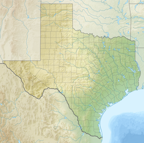
In the early morning hours of August 16, 1931, a powerful earthquake occurred in West Texas with a maximum Mercalli intensity of VIII (Severe). Estimates of its magnitude range between 5.8–6.4 mb, making it the most powerful earthquake ever recorded in Texas history. Its epicenter was near the town of Valentine, Texas; there, the earthquake caused damage to many homes and buildings. The earthquake may have been caused by movement along oblique-slip faulting in West Texas, the most seismically-active region in the state. Shaking from the earthquake was perceptible within a 400 mi (640 km) radius of the epicenter, affecting four U.S. states and northern Mexico. Several foreshocks and aftershocks accompanied the primary temblor, with the aftershocks continuing until at least November 3, 1931. The main earthquake caused no fatalities, though several people sustained minor injuries; the damage in Valentine amounted to $50,000–$75,000.

<span class="mw-page-title-main">Western Quebec Seismic Zone</span>

The Western Quebec Seismic Zone is a seismically active area in the Ottawa Valley in Eastern Ontario and Western Quebec. The zone stretches from Montreal to Témiscaming and from Cornwall up along the Laurentian Mountains.

The 1940 El Centro earthquake occurred at 21:35 Pacific Standard Time on May 18 in the Imperial Valley in southeastern Southern California near the international border of the United States and Mexico. It had a moment magnitude of 6.9 and a maximum perceived intensity of X (Extreme) on the Mercalli intensity scale. It was the first major earthquake to be recorded by a strong-motion seismograph located next to a fault rupture. The earthquake was characterized as a typical moderate-sized destructive event with a complex energy release signature. It was the strongest recorded earthquake in the Imperial Valley, causing widespread damage to irrigation systems and killing nine people.

<span class="mw-page-title-main">2011 Oklahoma earthquake</span> 2011 earthquake near Prague, Oklahoma

The 2011 Oklahoma earthquake was a 5.7 magnitude intraplate earthquake which occurred near Prague, Oklahoma on November 5 at 10:53 p.m. CDT in the U.S. state of Oklahoma. The epicenter of the earthquake was in the vicinity of several active wastewater injection wells. According to the United States Geological Survey (USGS), it was the most powerful earthquake ever recorded in Oklahoma until the 2016 Oklahoma earthquake. The previous record was a 5.5 magnitude earthquake that struck near the town of El Reno in 1952. The quake's epicenter was approximately 44 miles (71 km) east-northeast of Oklahoma City, near the town of Sparks and was felt in the neighboring states of Texas, Arkansas, Kansas and Missouri and even as far away as Tennessee and Wisconsin. The quake followed several minor quakes earlier in the day, including a 4.7 magnitude foreshock. The quake had a maximum perceived intensity of VIII (Severe) on the Mercalli intensity scale in the area closest to the epicenter. Numerous aftershocks were detected after the main quake, with a few registering at 4.0 magnitude.

<span class="mw-page-title-main">2014 Guerrero earthquake</span> Earthquake in Mexico

The 2014 Guerrero earthquake occurred with a moment magnitude of 7.2 that hit the state of Guerrero, close to Acapulco, Mexico, on 18 April at 14:27:26 UTC. The epicenter occurred 265 kilometers southwest of Mexico City and at a depth of 24 kilometers. Thrust motion at shallow depths is what caused the earthquake. This was broadly consistent with a slip on or near the Guerrero Seismic Gap, a boundary between the Cocos and North American plates along the Pacific Coast approximately 200 kilometers long. The shaking was felt in states as far away as Puebla and Tlaxcala.

<span class="mw-page-title-main">Oklahoma earthquake swarms (2009–present)</span> Series of earthquakes in central Oklahoma, southern Kansas, and northern Texas

The Oklahoma earthquake swarms are an ongoing series of human activity-induced earthquakes affecting central Oklahoma, southern Kansas, northern Texas since 2009. Beginning in 2009, the frequency of earthquakes in the U.S. state of Oklahoma rapidly increased from an average of fewer than two 3.0+ magnitude earthquakes per year since 1978 to hundreds each year in the 2014–17 period. Thousands of earthquakes have occurred in Oklahoma and surrounding areas in southern Kansas and North Texas since 2009. Scientific studies attribute the rise in earthquakes to the disposal of wastewater produced during oil extraction that has been injected more deeply into the ground.

The 2020 Central Idaho earthquake occurred in the western United States on March 31, 2020, at 5:52 PM MDT, near Ruffneck Peak in the Sawtooth Mountains of central Idaho, 72 miles (116 km) northeast of Boise and 19 miles (31 km) northwest of Stanley. It had a magnitude of 6.5 and was felt with a maximum intensity of VIII.

The 2021 South Sandwich Islands earthquakes were a pair of powerful earthquakes, followed by many strong aftershocks which struck along the South Sandwich Trench in August 2021. The quakes measured 7.5 and 8.1 on the moment magnitude scale, according to the United States Geological Survey. The mainshock is tied with another event in 1929 as the largest earthquake ever recorded in the South Atlantic region, and is tied with the 2021 Kermadec Islands earthquake as the second largest earthquake of 2021.

References

  1. 1 2 Murr, Erika (September 1, 1995) [1976]. "Earthquakes". The Handbook of Texas. Texas State Historical Association. Retrieved February 23, 2024.
  2. 1 2 Frohlich, Cliff; DeShon, Heather; Stump, Brian; Hayward, Chris; Hornbach, Matt; Walter, Jacob I. (July 2016). "A Historical Review of Induced Earthquakes in Texas". Seismological Research Letters. 87 (4): 1022–1038. Bibcode:2016SeiRL..87.1022F. doi:10.1785/0220160016.
  3. 1 2 3 4 5 6 7 8 9 10 11 Frolich, Cliff; Davis, Scott D. (2002). Texas Earthquakes. Austin, Texas: University of Texas Press. ISBN   0-292-72550-7.
  4. Dumas, David B.; Dorman, H. James; Latham, Gary V. (August 1980). "A reevaluation of the August 16, 1931 Texas earthquake". Bulletin of the Seismological Society of America. 70 (4): 1171–1180. doi:10.1785/BSSA0700041171 (inactive January 31, 2024).{{cite journal}}: CS1 maint: DOI inactive as of January 2024 (link)
  5. 1 2 3 "Texas Panhandle Earthquakes" (PDF). Amarillo, Texas: National Weather Service Amarillo, Texas. August 16, 2022. Retrieved February 23, 2024.
  6. 1 2 "M 4.9 - 9 km NE of Panhandle, Texas". Earthquake Hazards Program. United States Geological Survey. Retrieved November 15, 2023.
  7. "M 5.8 - 12 km SW of Valentine, Texas". Earthquake Hazards Program. United States Geological Survey. Retrieved November 15, 2023.
  8. "M 5.7 - 13 km NW of Marathon, Texas". Earthquake Hazards Program. United States Geological Survey. Retrieved November 15, 2023.
  9. "M 5.4 - Coalson Draw, Texas". Earthquake Hazards Program. United States Geological Survey. Retrieved November 15, 2023.
  10. "M 5.2 - Coalson Draw, Texas". Earthquake Hazards Program. United States Geological Survey. Retrieved November 15, 2023.
  11. "M 5.2 - Range Hill, Texas". Earthquake Hazards Program. United States Geological Survey. Retrieved November 15, 2023.
  12. "M 5.0 - 41 km W of Mentone, Texas". Earthquake Hazards Program. United States Geological Survey. Retrieved November 15, 2023.
  13. Tung, Sui; Zhai, Guang; Shirzaei, Manoochehr (December 28, 2020). "Potential Link Between 2020 Mentone, West Texas M5 Earthquake and Nearby Wastewater Injection: Implications for Aquifer Mechanical Properties". Geophysical Research Letters. 48 (3). doi: 10.1029/2020GL090551 . hdl: 10919/103345 .
  14. "M 4.9 - 55 km S of Whites City, New Mexico". Earthquake Hazards Program. United States Geological Survey. Retrieved February 12, 2024.
  15. "M 4.8 - 14 km SSW of Falls City, Texas". Earthquake Hazards Program. United States Geological Survey. Retrieved November 15, 2023.
  16. "M 4.8 - 3 km NE of Timpson, Texas". Earthquake Hazards Program. United States Geological Survey. Retrieved November 15, 2023.
  17. "M 4.8 - 24 km WNW of Toyah, Texas". Earthquake Hazards Program. United States Geological Survey. Retrieved November 15, 2023.
  18. "M 4.7 - 3 km SSE of Falls City, Texas". Earthquake Hazards Program. United States Geological Survey. Retrieved February 17, 2024.
  19. "M 4.7 - 15 km NE of Hermleigh, Texas". Earthquake Hazards Program. United States Geological Survey. Retrieved November 15, 2023.
  20. "M 4.7 - 34 km WSW of Mentone, Texas". Earthquake Hazards Program. United States Geological Survey. Retrieved November 15, 2023.
  21. "M 4.6 - 53 km SSW of Whites City, New Mexico". Earthquake Hazards Program. United States Geological Survey. Retrieved February 12, 2024.
  22. "M 4.6 - 56 km S of Whites City, New Mexico". Earthquake Hazards Program. United States Geological Survey. Retrieved February 12, 2024.
  23. "M 4.6 - 17 km N of Stanton, Texas". Earthquake Hazards Program. United States Geological Survey. Retrieved November 15, 2023.
  24. "M 4.5 - 18 km N of Dalhart, Texas". Earthquake Hazards Program. United States Geological Survey. Retrieved November 15, 2023.
  25. "Earthquakes in Texas". Texas Almanac. 2021. Retrieved February 23, 2024.
  26. "M 4.5 - western Texas". Earthquake Hazards Program. United States Geological Survey. Retrieved November 15, 2023.
  27. "M 4.5 - 54 km S of Whites City, New Mexico". Earthquake Hazards Program. United States Geological Survey. Retrieved February 12, 2024.
  28. "M 4.5 - 57 km S of Whites City, New Mexico". Earthquake Hazards Program. United States Geological Survey. Retrieved February 12, 2024.
  29. "M 4.5 - 14 km NE of Perryton, Texas". Earthquake Hazards Program. United States Geological Survey. Retrieved November 15, 2023.