This is a list of protected areas in Belize.
This is a list of protected areas in Belize.
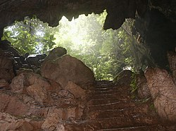
In Belize, national parks are areas designed for the protection and preservation of natural and aesthetic features of national significance for the benefit and enjoyment of the people. Therefore, they are areas of recreatitourism, as well as environmental protection. National parks are gazetted under the National Parks System Act of 1981. [1] They are administered by the Forest Department and managed through partnership agreements with community-based non-governmental organisations.
| Reserve | District | Size (ha) | Size (acres) | IUCN | Co-management | Est. | Description |
|---|---|---|---|---|---|---|---|
| Aguas Turbias | Orange Walk | 3,541 | 8,750 | II | — [note 1] | 1994 | [2] |
| Bacalar Chico | Belize | 4,510 | 11,100 | V | Green Reef Environmental Institute [note 2] | 1996 | Excludes adjacent marine reserve. [3] [4] |
| Billy Barquedier | Stann Creek | 663 | 1,640 | II | Steadfast Tourism and Conservation Association | 2001 | [5] |
| Chiquibul | Cayo | 106,839 | 264,000 | II | Friends for Conservation and Development | 1995 | Excludes adjacent forest reserve. [6] [7] |
| Five Blues Lake | Cayo | 1,643 | 4,060 | II | Friends of Five Blues Lake National Park | 1994 | [8] |
| Gra Gra Lagoon | Stann Creek | 534 | 1,320 | II | Friends of Gra Gra Lagoon | 2002 | [9] |
| Guanacaste | Cayo | 23 | 57 | II | Belize Audubon Society | 1994 | [10] [11] |
| Honey Camp | Corozal / Orange Walk | 3,145 | 7,770 | II | Corozal Sustainable Future Initiative [note 3] | 2001 | [12] |
| Laughing Bird Caye | Stann Creek | 4,095 | 10,120 | II | Southern Environmental Association | 1996 | [13] [14] |
| Mayflower Bocawina | Stann Creek | 2,868 | 7,090 | II | Friends of Mayflower Bocawina National Park | 2001 | [15] [16] |
| Monkey Bay | Belize | 859 | 2,120 | II | Guardians of the Jewel [note 2] | 1994 | [17] [18] |
| Nojkaaxmeen Elijio Panti | Cayo | 5,130 | 12,700 | II | Belize Development Foundation [note 4] | 2001 | [19] [20] [21] |
| Payne's Creek | Toledo | 14,739 | 36,420 | II | Toledo Institute for Development and Environment | 1994 | [22] [23] |
| Peccary Hills | Belize | 4,260 | 10,500 | II | Gracie Rock Reserve for Adventure, Culture and Ecotourism | 2007 | [24] [25] |
| Río Blanco | Toledo | 38 | 94 | II | Río Blanco Mayan Association | 1994 | [26] |
| Sarstoon-Temash | Toledo | 16,938 | 41,850 | II | Sarstoon Temash Institute for Indigenous Management | 1994 | Ramsar site. [27] [28] |
| St. Herman's Blue Hole | Cayo | 269 | 660 | II | Belize Audubon Society | 1986 | [29] [30] |

A natural monument is designated for the preservation of unique geographic features of the landscape. The designation is primarily based on a feature's high scenic value, but may also be regarded as a cultural landmark that represents or contributes to a national identity.
Natural monuments are gazetted under the National Parks System Act of 1981; [1] marine-based monuments additionally come under the Fisheries Act. Of the five natural monuments in the country, three are terrestrial, administered by the Forest Department, while the remaining two are marine-based and come under the authority of the Fisheries Department.
| Image | Reserve | District | Size (ha) | Size (acres) | IUCN | Co-management | Est. | Description |
|---|---|---|---|---|---|---|---|---|
 | Actun Tunichil Muknal | Cayo | 185 | 460 | Ia | Belize Audubon Society; Institute of Archaeology | 2004 | Terrestrial. [31] [32] |
 | Blue Hole | Belize | 414 | 1,020 | III | Belize Audubon Society | 1996 | Marine. [33] [34] [35] |
 | Half Moon Caye | Belize | 3,954 | 9,770 | II | Belize Audubon Society | 1982 | Marine. [36] [37] |
 | Thousand Foot Falls | Cayo | 522 | 1,290 | III | — [note 5] | 2004 | Terrestrial. [38] |
 | Victoria Peak | Stann Creek | 1,959 | 4,840 | III | Belize Audubon Society | 1998 | Terrestrial. [39] [40] |

The country's three nature reserves enjoy the highest level of protection within the National Protected Areas System Plan. The designation was created for the strict protection of biological communities or ecosystems, and the maintenance of natural processes in an undisturbed state. They are typically pristine, wilderness ecosystems.
Nature reserves are legislated under the National Parks System Act of 1981. [1] It is the strictest designation of all categories within the country's national protected areas system, with no extractive use or tourism access permitted. Permits are required to enter the area and are restricted to researchers only. The nature reserves are under the authority of the Forest Department.
The oldest of these, Bladen Nature Reserve, forms the centrepiece of the Maya Mountains biological corridor, and is considered one of the most biodiversity-rich, and topographically unique areas within the Mesoamerican biodiversity hotspot.
| Reserve | District | Size (ha) | Size (acres) | IUCN | Co-management | Est. | Description |
|---|---|---|---|---|---|---|---|
| Bladen | Toledo | 40,411 | 99,860 | Ia | Ya’axché Conservation Trust; Bladen Management Consortium | 1990 | [41] [42] |
| Burdon Canal | Belize | 2,126 | 5,250 | Ia | — [note 6] | 1992 | [43] |
| Tapir Mountain | Cayo | 2,550 | 6,300 | Ia | Belize Audubon Society | 1994 | Formerly known as Society Hall Nature Reserve. [44] [45] |
Wildlife sanctuaries are created for the preservation of an important keystone species in the ecosystem. By preserving enough area for them to live in, many other species receive the protection they need as well.
Wildlife sanctuaries are gazetted under the National Parks System Act of 1981, and are the responsibility of the Forest Department. [1] There are currently seven wildlife sanctuaries, three of which are being managed under co-management partnerships, whilst the other four are managed under informal arrangements. Two of the following wildlife sanctuaries are considered to be marine protected areas, and may also have collaborative agreements with the Fisheries Department in place.
| Reserve | District | Size (ha) | Size (acres) | IUCN | Co-management | Est. | Description |
|---|---|---|---|---|---|---|---|
| Aguacaliente | Toledo | 2,213 | 5,470 | IV | Aguacaliente Management Team [note 2] | 1998 | Terrestrial. [46] [47] |
| Cockscomb Basin | Stann Creek / Toledo | 49,477 | 122,260 | IV | Belize Audubon Society | 1997 | Terrestrial. [48] |
| Corozal Bay | Belize / Corozal | 73,049 | 180,510 | IV | Sarteneja Alliance for Conservation and Development [note 2] | 1998 | Marine. [49] [50] |
| Crooked Tree | Belize / Orange Walk | 15,372 | 37,990 | IV | Belize Audubon Society | 1984 | Ramsar site. Boundaries ill-defined. Terrestrial. [51] |
| Gales Point | Belize | 3,681 | 9,100 | IV | Gales Point Wildlife Sanctuary Community Management Committee [note 2] | 1998 | Terrestrial. [52] [53] |
| Spanish Creek | Belize / Orange Walk | 2,428 | 6,000 | IV | Rancho Dolores Development Group [note 2] | 2002 | Terrestrial. [54] |
| Swallow Caye | Belize | 3,631 | 8,970 | IV | Friends of Swallow Caye | 2002 | Marine. [55] [56] |
Forest reserves, overseen by the Forest Department, are designed for the sustainable extraction of timber without destroying the biodiversity of the location. These are gazetted under the Forests Act of 1927, [57] which allows the department to grant permits to logging companies after extensive review. There are currently 16 forest reserves with a combined acreage of 380,328 hectares (939,810 acres), making up 9.3% of total national territory. [58]
| Reserve | District | Size (ha) | Size (acres) | IUCN | Est. | Description |
|---|---|---|---|---|---|---|
| Caye Caulker | Belize | 38 | 94 | VI | 1998 | Excludes adjacent marine reserve. [59] |
| Chiquibul | Cayo | 59,822 | 147,820 | VI | 1995 | Excludes adjacent national park. [60] |
| Columbia River | Cayo / Toledo | 60,016 | 148,300 | VI | 1997 | [61] |
| Deep River | Toledo | 27,232 | 67,290 | VI | [62] | |
| Fresh Water Creek | Corozal / Orange Walk | 13,513 | 33,390 | VI | 1926 | [63] |
| Grants Work | Stann Creek | 3,199 | 7,900 | VI | 1989 | [64] |
| Machaca | Toledo | 1,253 | 3,100 | VI | 1998 | [65] |
| Manatee | Belize / Stann Creek | 36,621 | 90,490 | VI | 1959 | [66] |
| Mango Creek | Stann Creek / Toledo | 12,090 | 29,900 | VI | 1989 | Comprises two separate segments. [67] [68] |
| Monkey Caye | Toledo | 669 | 1,650 | VI | 1996 | [69] |
| Mountain Pine Ridge | Cayo | 43,372 | 107,170 | VI | 1944 | [70] [71] |
| Maya Mountain | Stann Creek | 16,887 | 41,730 | VI | 1997 | [72] |
| Sibun | Cayo | 32,849 | 81,170 | VI | 1959 | [73] [71] |
| Sittee River | Stann Creek | 37,360 | 92,300 | VI | [74] | |
| Swasey Bladen | Toledo | 5,980 | 14,800 | VI | 1989 | [75] |
| Vaca | Cayo | 14,118 | 34,890 | VI | 1991 | [76] |
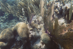
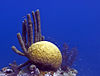
Marine reserves are designed for the conservation of aquatic ecosystems, including marine wildlife and its environment. The majority of these reserves contribute to the conservation of Belize's Barrier Reef, which provides a protective shelter for pristine atolls, seagrass meadows and rich marine life. The preservation of the Barrier Reef system has been recognised as a global interest through the collective designation of seven protected areas, including four of the following marine reserves, as a World Heritage Site.
Marine reserves are legislated under the Fisheries Act, and are administered by the Fisheries Department. One of the department's key responsibilities is to ensure the sustainable extraction of marine resources. There are currently eight marine reserves, management of which is either direct, by the department, or in partnership with non-governmental agencies.
| Reserve | District | Size (ha) | Size (acres) | IUCN | Co-management | Est. | Description |
|---|---|---|---|---|---|---|---|
| Bacalar Chico | Belize | 6,391 | 15,790 | IV | Green Reef Environmental Institute [note 2] | 1996 | Excludes adjacent national park. Divided into two zones: a conservation zone, [77] and a general use zone. [78] [4] |
| Caye Caulker | Belize | 3,913 | 9,670 | VI | Forest & Marine Reserves Association of Caye Caulker | 1998 | Excludes adjacent forest reserve. [79] |
| Gladden Spit and Silk Cayes | Stann Creek | 10,514 | 25,980 | IV | Southern Environmental Association | 2000 | Divided into two zones: a general use zone, [80] and a conservation zone. [81] [82] [83] |
| Glover's Reef | Belize | 86,653 | 214,120 | IV | — | 1993 | In 2001, the reserve was divided into four zones: a general use zone, [84] a conservation zone, [85] a seasonal closure zone, [86] and a wilderness zone. [87] A spawning aggregation zone was broken off in 2003 and comes under separate management (see below). |
| Hol Chan | Belize | 1,444 | 3,570 | II | Hol Chan Trust Fund | 1987 | Divided into four zones: Mangrove, [88] Seagrass, [89] Shark Ray Alley, [90] and Coral Reef. [91] [92] |
| Port Honduras | Toledo | 40,470 | 100,000 | IV | Toledo Institute for Development and Environment | 2000 | Divided into two zones: a general use zone, [93] and a conservation zone. [94] |
| Sapodilla Cayes | Toledo | 15,618 | 38,590 | IV | Southern Environmental Association | 1996 | [95] |
| South Water Caye | Stann Creek | 47,702 | 117,870 | IV | — | 1996 | [96] [97] |
| Aggregation zone | District | Size (ha) | Size (acres) | IUCN | Est. | Description |
|---|---|---|---|---|---|---|
| Dog Flea | Belize | 576 | 1,420 | IV | 2003 | [98] |
| Emily or Glory Caye | Belize | 0 | 0 | IV | 2003 | [99] |
| Gladden Spit | Belize | 1,617 | 4,000 | IV | 2003 | Managed as part of Gladden Spit and Silk Cayes Marine Reserve. [100] |
| Nicholas Caye | Belize | 673 | 1,660 | IV | 2003 | Managed as part of Sapodilla Marine Reserve. [101] |
| Northern Glover's Reef | Belize | 621 | 1,530 | IV | 2003 | Managed as part of Glover's Reef Marine Reserve. [102] |
| Rise and Fall Bank | Belize | 1,721 | 4,250 | IV | 2003 | [103] |
| Rocky Point | Belize | 570 | 1,400 | IV | 2003 | Managed as part of Bacalar Chico Marine Reserve. [104] |
| Sandbore | Belize | 521 | 1,290 | IV | 2003 | [105] |
| Seal Caye | Toledo | 648 | 1,600 | IV | 2003 | [106] |
| South Point Lighthouse | Belize | 533 | 1,320 | IV | 2003 | [107] |
| South Point Turneffe | Belize | 558 | 1,380 | IV | 2003 | [108] |

The seven bird sanctuaries are some of the country's oldest protected areas established for the purpose of biodiversity conservation. They were gazetted in 1977 as crown reserves for the protection of waterfowl nesting and roosting colonies. [58] They were later reorganised under the National Parks System Act in 1981. [1] They are under the jurisdiction of the Forest Department. All of them are tiny islands with a combined surface area of 6 hectares (15 acres). [58]
All the sanctuaries are nesting and roosting sites for wading birds, though the species vary.
| Reserve | District | Size (ha) | Size (acres) | IUCN | Est. | Description |
|---|---|---|---|---|---|---|
| Bird Caye | Belize | 0.5 | 1.2 | IV | 1977 | [109] |
| Doubloon Bank | Orange Walk | 1.5 | 3.7 | IV | 1977 | [110] |
| Little Guana Caye | Belize | 1 | 2.5 | IV | 1977 | [111] |
| Los Salones | Belize | 1 | 2.5 | IV | 1977 | [112] |
| Monkey Caye | Toledo | 0.5 | 1.2 | IV | 1977 | [113] |
| Man of War Caye | Stann Creek | 1 | 2.5 | IV | 1977 | [114] |
| Unnamed Caye | Belize | 0.5 | 1.2 | IV | 1977 | [115] |

Before the arrival of Europeans in America, Belize lay in the heartland of the Maya civilisation, and consequently contains some of the earliest and most important Maya ruins. [117] Archaeological findings at Caracol, in the southern end of the country, have suggested that it formed the centre of political struggles in the southern Maya lowlands. [117] The complex covered an area much larger than present-day Belize City and supported more than twice the modern city's population. [116] Meanwhile, Lamanai, in the north, is known for being the longest continually-occupied site in Mesoamerica, settled during the early Preclassic era and continuously occupied up to and during the area's colonisation. [117]
While the majority of reserves under this category are related to the pre-colonial era, Serpon Sugar Mill and Yarborough Cemetery, both designated in 2009, only date from the 19th century and are alternatively described as historical reserves. [118]
The country's 15 archaeological sites are managed by the Institute of Archaeology, a branch of the National Institute of Culture and History (NICH), [58] which comes under the authority of the Ministry of Culture. [119] This type of protected area was gazetted under the Ancient Monuments and Antiquities Act, 1 May 1972. [58] [120] All of the following reserves are open to the public. Many other sites, such as Cuello and Uxbenka, are located on private land and can only be visited if prior permission is obtained from the landowner. [117]
| Image | Reserve | District | Size (ha) | Size (acres) | IUCN | Est. | Description |
|---|---|---|---|---|---|---|---|
 | Altun Ha | Belize | 15.5 | 38 | II | 1995 | [121] [122] |
 | Barton Creek | Belize | 2.0 | 4.9 | II | 2003 | [123] [124] |
 | Cahal Pech | Cayo | 9.0 | 22 | II | 1995 | [125] [126] |
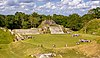
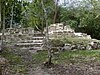
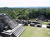 | Caracol | Cayo | 10,339 | 25,550 | II | 1995 | [127] [128] |
 | Cerro Maya | Corozal | 10 | 25 | II | 1976 | [129] [130] |
 | El Pilar | Cayo | 771 | 1,910 | II | 1998 | [131] [132] |
 | Lamanai | Orange Walk | 396 | 980 | II | 1985 | [133] [134] |
 | Lubaantun | Toledo | 16 | 40 | II | 1995 | [135] [136] |
| Marco Gonzalez | Belize | 3.1 | 7.7 | II | 2011 | [117] [137] | |
 | Nim Li Punit | Toledo | 24 | 59 | II | 1985 | [138] [139] |
| Nohoch Che'en | Cayo | 7 | 17 | II | 2010 | Also known as Caves Branch. Formerly a private reserve owned by Jaguar Paw. [140] [141] | |
| Santa Rita | Corozal | 0.1 | 0.25 | II | 1995 | [142] [143] | |
| Serpon Sugar Mill | Stann Creek | 13 | 32 | II | 2009 | [118] [144] | |
 | Xunantunich | Cayo | 3 | 7.4 | II | 1995 | [145] [146] |
 | Yarborough Cemetery | Belize | 0.5 | 1.2 | II | 2009 | [147] |
Private reserves are owned and operated by non-governmental conservation initiatives, and enjoy various levels of protection. Most of them are essentially multiple-use reserves, and include managed extraction of resources. [58]
In 2003, the Belize Association of Private Protected Areas (BAPPA) was formed to assist in the co-ordinatation of private conservation initiatives as a cohesive group, and to represent and assist landowners in attaining recognition from the Belizean government and integration into the national protected areas system. [148] It maintains a directory of landowners that are attempting to manage their land holdings for conservation purposes. [58]
A total of eight private reserves have so far been officially recognised as national protected areas. [148] While most of these recognised reserves have no formal or legal commitment to remain under conservation management, there are additional private landholdings which are considered to be very effective in biodiversity conservation and critical to the national protected areas system, but which are not yet recognised within the system. Formal adoption and implementation of proposed legislation to manage and regulate such areas is required to attain such recognition.
As of January 2005, a total of eight private reserves were officially recognised as being part of the country's national protected areas system. [148] Two have a standing agreement with the government, while the remaining six have their own management system in place. [58] Of the following, Aguacate Lagoon is the only non-participatory reserve, its management expressing little interest in being part of the system.
They cover a combined total area of approximately 131,663 hectares (325,350 acres). [58]
| Reserve | District | Size (ha) | Size (acres) | IUCN | Management | Est. | Description |
|---|---|---|---|---|---|---|---|
| Aguacate Lagoon | Cayo | 115 | 280 | IV | Aguacate Park | 1987 | [149] |
| Block 127 | Toledo | 3,736 | 9,230 | IV | Toledo Institute for Development and Environment | 2001 | Forms one block of the TIDE Private Protected Lands, which total 12,000 hectares (30,000 acres). [150] [151] |
| Community Baboon Sanctuary | Belize | 5,253 | 12,980 | IV | Women's Conservation Group | 1985 | [152] [153] |
| Golden Stream | Toledo | 6,085 | 15,040 | IV | Ya’axché Conservation Trust; Fauna & Flora International | 1998 | Formally known as Golden Stream Corridor Preserve. [154] [155] |
| Monkey Bay | Belize | 465 | 1,150 | IV | Monkey Bay Wildlife Sanctuary | 1987 | Formally known as Monkey Bay Wildlife Sanctuary. [156] [157] |
| Río Bravo | Orange Walk | 104,897 | 259,210 | IV | Programme for Belize | 1988 | Formally known as Río Bravo Conservation and Management Area. [158] [159] [160] |
| Runaway Creek | Belize | 2,431 | 6,010 | IV | Foundation for Wildlife Conservation; Birds Without Borders | 1998 | [161] [162] |
| Shipstern | Corozal | 8,228 | 20,330 | IV | International Tropical Conservation Foundation; Papiliorama-Nocturama Foundation | 1987 | Formally known as Shipstern Nature Reserve. [163] [164] |
| Reserve | District | Size (ha) | Size (acres) | IUCN | Management | Est. | Description |
|---|---|---|---|---|---|---|---|
| Balam Na | Corozal | 166 | 410 | IV | Wildtracks; Tropical Rainforest Coalition | 2000 | [165] [166] |
| BFREE | Toledo | 572 | 1,410 | IV | Belize Foundation for Research & Environmental Education | 1995 | [167] [168] |
| Boden Creek | Toledo | 5,447 | 13,460 | IV | Belize Lodge and Excursions | 1998 | Formally known as Boden Creek Ecological Preserve. [169] [170] |
| Fireburn | Corozal | 745 | 1,840 | IV | Wildtracks; Fireburn Community | [171] [172] | |
| Gallon Jug | Orange Walk | 54,154 | 133,820 | IV | Gallon Jug Estate | [173] [174] | |
| Green Hills | Cayo | 43 | 110 | IV | Meerman, Jan | 1996 | Formally known as Green Hills Private Conservation Management Area. [175] [176] |
| Hidden Valley | Cayo | 2,925 | 7,230 | IV | Hidden Valley Institute | [177] [178] |

A nature reserve is a protected area of importance for flora, fauna, funga, or features of geological or other special interest, which is reserved and managed for purposes of conservation and to provide special opportunities for study or research. They may be designated by government institutions in some countries, or by private landowners, such as charities and research institutions. Nature reserves fall into different IUCN categories depending on the level of protection afforded by local laws. Normally it is more strictly protected than a nature park. Various jurisdictions may use other terminology, such as ecological protection area or private protected area in legislation and in official titles of the reserves.
There are four categories of protected areas in India, constituted under the Wildlife Protection Act, 1972. Tiger reserves consist of areas under national parks and wildlife sanctuaries. There are 53 tiger reserves in India. As of January 2023, the protected areas of India cover 173,629.52 square kilometres (67,038.73 sq mi), roughly 5.28% of the total geographical area of the country.
The flora of Belize is highly diverse by regional standards, given the country's small geographical extent. Situated on the Caribbean coast of northern Central America the flora and vegetation have been intimately intertwined with Belize's history. The nation itself grew out of British timber extraction activities from the 17th century onwards, at first for logwood and later for mahogany, fondly called "red gold" because of its high cost and was much sought after by European aristocracy. Central America generally is thought to have gained much of it characteristic flora during the "Great American interchange" during which time South American elements migrated north after the geological closure of the isthmus of Panama. Few Amazonian elements penetrate as far north as Belize and in species composition the forests of Belize are most similar to the forests of the Petén (Guatemala) and the Yucatán (Mexico).

The Programme for Belize is a private initiative, the first project undertaken in 1988. Financial and management assistance was generously given by the Massachusetts Audubon Society. After the project was identified and started, loans were provided by the Nature Conservancy and donations provided by the World Land Trust. The goal of the project was to purchase and protect tropical rainforests in Belize to prevent them from being sold and cleared to make way for ranching. The project was launched at the London Butterfly House in May 1989. The famous naturalists Gerald Durrell and his wife Lee Durrell were guests of honour, and also visited Belize in 1989 to help with in-situ conservation efforts there. By 1996, more than 250,000 acres (1,000 km2) of land had been purchased and was under the ownership and protection of PfB. The World Land Trust then initiated Friends of Belize to help raise funds to cover costs of continuing protection of the purchased lands, as well as to aid in-situ conservation efforts. Since 2006 World Land Trust has organised regular symposia for the decision-makers of their project partners, and in 2008 PfB hosted the event at their La Milpa ecolodge.
The Cockscomb Basin Wildlife Sanctuary is a nature reserve in the Stann Creek District of south-central Belize. It was established to protect the forests, fauna and watersheds of an approximately 400 square kilometres (150 sq mi) area of the eastern slopes of the Maya Mountains.
Conservation Areas in India refer to well-demarcated large geographical entities with an established conservation plan, and were part of a joint Indo-US project on "landscape management and protection". The project ran from 1996 to 2002. These areas are home to many Conservation reliant species.
Since declaring independence in 1981, Belize has enacted many environmental protection laws aimed at the preservation of the country's natural and cultural heritage, as well as its wealth of natural resources. These acts have established a number of different types of protected areas, with each category having its own set of regulations dictating public access, resource extraction, land use and ownership.
Chiquibul National Park is Belize's largest national park. It is 1,073 km2 (414 sq mi) in size. The park is located in Belize's Cayo District. The national park surrounds Caracol, a Mayan city. Caracol has been designated as an archaeological reserve and is not included within the park's total area. Chiquibul Forest Reserve is adjacent to the park.

Tourism in Belize has grown considerably recently, and it is now the second largest industry in the nation. Belizean Prime Minister Dean Barrow has stated his intention to use tourism to combat poverty throughout the country. The growth in tourism has positively affected the agricultural, commercial, and finance industries, as well as the construction industry. The results for Belize's tourism-driven economy have been significant, with the nation welcoming almost one million tourists in a calendar year for the first time in its history in 2012.
Protected areas of Sri Lanka are administrated by Department of Forest Conservation and Department of Wildlife Conservation of Sri Lanka.There are 501 protected areas in Sri Lanka. The protected areas that fall under supervision of the Department of Forest Conservation include forests defined in National Heritage Wilderness Area Act in 1988, forest reservations, and forests managed for sustainability. Sinharaja Forest Reserve is an example for a National Heritage forest. There are 32 forests categorized as conservation forests including Knuckles Mountain Range. Strict nature reserves, national parks, nature reserves, forest corridors, and sanctuaries recognized under the Flora and Fauna Protection Ordinance are managed by Department of Wildlife Conservation. Total of all protected areas is 1,767,000 ha. Protected areas in Sri Lanka account for 26.5 percent of the total area. This is a higher percentage of protected areas than in all of Asia and much of the World.
Janet Patricia Gibson is a biologist and zoologist from Belize. She was awarded the Goldman Environmental Prize in 1990 for her efforts on conservation of the marine ecosystems along the Belizean coast, in particular the barrier reef system. The Belize Barrier Reef was granted UNESCO World Heritage status in 1996, through efforts of Gibson and others. She is the current director of the Belize Wildlife Conservation Society.
Bacalar Chico National Park and Marine Reserve (BCNPMR) is a protected area and UNESCO World Heritage Site on the northern part of Ambergris Caye in Belize.
Bladen Nature Reserve in Belize is a landscape of caves, sinkholes, streams and rivers, old growth rainforest and an abundance of highly diverse flora and fauna which includes a great deal of rare and endemic species.
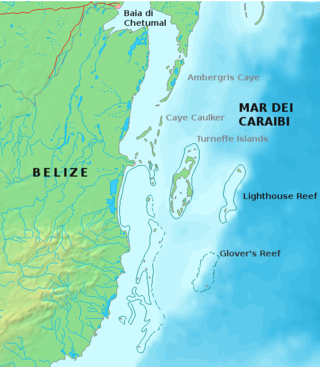
Glover's Reef is a partially submerged atoll located off the southern coast of Belize, approximately 45 kilometres from the mainland. It forms part of the outermost boundary of the Belize Barrier Reef, and is one of its three atolls, besides Turneffe Atoll and Lighthouse Reef.
The Belize Audubon Society is a conservation group in Belize, formed in 1969. Like similar societies elsewhere, it is named in honor of ornithologist and naturalist John James Audubon.

Half Moon Caye is an island and natural monument of Belize located at the southeast corner of Lighthouse Reef Atoll. This natural monument was the first nature reserve to have been established in Belize under the National Park Systems Act in 1981 and first marine protected area in Central America. This is also Belize's oldest site of wildlife protection since it was first designated as a bird sanctuary in 1924 to protect the habitat of the red-footed booby birds.

Gladden Spit and Silk Cayes Marine Reserve (GSSCMR) is a protected marine reserve in the central part of Belize's Barrier Reef. It covers approximately 25,980 acres (10,510 ha) lying 36 kilometres (22 mi) off the coast of Placencia. Established in 2003, The reserve comes under the authority of the government's Fisheries Department, but is managed by the Southern Environmental Association, a community-based organisation.

Shipstern Conservation and Management Area is a protected area located in the Corozal District of northeastern Belize.
The Chiquibul Forest Reserve (CFR) lies within Belize's Greater Mayan Mountains. The Forest Reserve lies adjacent to the Belize-Guatemalan border and as such had been the focus of illegal harvesting of Xate by Guatemalan Xateros. The Chiquibul forest reserve consists of 59,822 hectares. The Chiquibul Forest Reserve is bordered to the southwest, east, and south by the hiquibul National Park, on the northwest edge by the w:Caracol Archaeological ReserveCaracol Archaeological Reserve (CAR), and on the north side by the Mountain Pine Ridge. The Chiquibul Forest Reserve along with the Chiquibul Park and the Caracol Archeological Reserve compose the Chiquibul Forest.
The Maya Golden Landscape is an area in Belize of approximately 275,000 hectares consisting of protected areas, agriculture, private lands and many small communities that is under the management of the Ya'axché Conservation Trust in Toledo District. The Landscape area encompasses the Bladen Nature Reserve, Colombia River Forest Reserve, Cockscomb Basin Wildlife Sanctuary, Deep River Forest River Reserve, Port Honduras Marine Reserve, along with commercial and subsistence farmland. Most of the area is dominated with various types of broadleaf forests which varies with topography, soil type and the disturbance history. One disturbance that affect the area, as well, is fires caused by agricultural farming due to the slash and burn practice.
{{cite web}}: Missing or empty |url= (help){{cite web}}: CS1 maint: unfit URL (link)| National parks | |
|---|---|
| Natural monuments | |
| Nature reserves | |
| Wildlife sanctuaries | |
| Forest reserves | |
| Marine reserves | |
| Archaeological reserves | |
| Other reserves | |