Limuru is a town in central Kenya. It is also the name of a parliamentary constituency and an administrative division. The population of the town, as of 2004, was about 4,800. In a census taken in 2019 the population had increased to 159,314.

Trans-Nzoia County is a county in the former Rift Valley Province, Kenya, located between the Nzoia River and Mount Elgon, 380 km northwest of Nairobi. At its centre is the town of Kitale which is the capital and largest town. The county borders Bungoma to the west, Uasin Gishu and Kakamega to the south, Elgeyo-Marakwet to the east, West Pokot to the north and the Republic of Uganda to the Northwest. Trans Nzoia covers an area of 2495.5 square kilometres.

Uasin Gishu County is one of the 47 counties of Kenya located in the former Rift Valley Province. Eldoret has the county's largest population centre as well as its administrative and commercial centre. "It lies between longitudes 34 degrees 50' east and 35 degrees 37' West and latitudes 0 degrees 03' South and 0 degrees 55' North. It is a highland plateau with altitudes falling gently from 2,700 meters above sea level to about 1,500 meters above sea level. The topography is higher to the east and declines gently towards the western border".
Vihiga is a town in Kenya located on the eastern side of the Kakamega Forest.

Meru County is one of the 47 counties of Kenya. It borders Isiolo County to the north, Tharaka-Nithi County to the South, Nyeri County to the southwest and Laikipia County to the west. The home of the Meru people, Meru County has a population of 1.35 million people.

Busia is a county in the former Western Province of Kenya. It borders Kakamega County to the east, Bungoma County to the north, Lake Victoria and Siaya County to the south and Uganda's Busia District to the west. The county population was 893,861, as of 2019. It spans about 1,700 square kilometers, making it one of the smallest counties in Kenya. Busia is inhabited by the Luhya tribe and the Teso of Kenya, and small groups of the Luo. The Luhya communities include the Abakhayo, Marachi, Samia and Abanyala communities.

Siaya County is one of the counties in the former Nyanza Province in western Kenya. It is bordered by Busia County to the north, Kakamega County, and Vihiga County to the northeast and Kisumu County to the southeast. It shares a water border with Homa Bay County which is located south of Siaya County. The total area of the county is approximately 2,496.1 km2. The county lies between latitude 0° 26' to 0° 18' north and longitude 33° 58' east and 34° 33' west. Siaya has been split up into six new districts. Under the 2010 Constitution, the role of the districts is still unclear as much of the administrative authority was transferred to the county. The capital is Siaya, although the largest town is Bondo.

Kiambu County is a county in the former Central Province of Kenya. Its capital is Kiambu and its largest town is Thika town. Kiambu County is the second most populous county in Kenya after Nairobi County. Kiambu County borders Nairobi and Kajiado Counties to the South, Machakos to the East, Murang'a to the North and North East, Nyandarua to the North West, and Nakuru to the West. It has a population of 2,417,735.

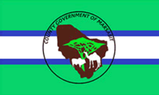
Marsabit County is a county in Kenya. Covering a surface area of 66,923.1 square kilometres. Marsabit is the second largest county by size in Kenya after Turkana county which has an area of 71,597.8 km2. Its capital is Marsabit and its largest town is Moyale. According to the 2019 census, the county has a population of 459,785. It is bordered to the North by Ethiopia, to the West by Turkana County to the South by Samburu County and Isiolo County, and to the East by Wajir County.

Kajiado County is a county in the former Rift Valley Province of Kenya. As of 2019, Kajiado county spanned an area of 21,292.7 km2, with a recorded population of 1,117,840. The county borders Nairobi and to its south it borders the Tanzanian regions of Arusha and Kilimanjaro. The county capital is Kajiado, but the largest town is Ongata Rongai. Its main tourist attraction is its wildlife.

Westlands is a mixed-use neighbourhood in Upper Parklands in Nairobi. Located 3.0 kilometres (2 mi) from Nairobi's central business district, it sits on the westerly areas of the larger Parklands area of Nairobi.

Kitui County is a county in the former Eastern Province of Kenya with its capital and largest town being Kitui, although Mwingi is also another major urban centre. The county has a population of 1,136,187. and an area of 30,496 km2. It lies between latitudes 0°10 South and 3°0 South and longitudes 37°50 East and 39°0 East.

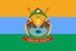
Homa Bay County is a county in the former Nyanza Province of Kenya. Its capital and largest town is Homa Bay. The county has a population of 1,131,950 and an area of 3,154.7 km2. Lake Victoria is a major source of livelihood for Homa Bay County. It has 40 wards, each represented by an MCA in the Homa Bay county assembly located in Homa Bay town, which is the county headquarters.

Baringo County is one of the 47 counties in Kenya. It is located in the former Rift Valley Province. Its headquarters and largest town is Kabarnet. The county is home to Lake Baringo, Lake Bogoria and Lake Kamnarok.
The subdivisions of Kenya have been in place since 2010, replacing the old system. Under the Constitution of 2010 and other reforms to Provincial Administration the country acquired a new system of Counties. The previous Provinces were scrapped and the 46 Districts, in existence since 1992, were turned into Counties with elected governments.
Makadara Constituency is an electoral constituency in Nairobi City County, Kenya. It is one of the seventeen constituencies in the county. It was renamed prior to the 1997 elections, but was also known as Doonholm Constituency for the 1963 and 1969 elections, then as Bahati Constituency. It consists of some central and southern of central areas of Nairobi County. The entire constituency is located within Nairobi City County, and has an area of 13 km2. The current constituency boundaries were revised prior to the 2013 elections. It has a population of 189,536 people from the 2019 census report.
Mtito Andei is a town in Makueni County, Kenya.

Lari Constituency is an electoral constituency in Kenya, located forty kilometers from Nairobi along the Nairobi-Nakuru highway. Lari is located in the Western part of Kiambu County. The constituency was established in 1966. Lari borders Kinangop to the North, Limuru to the South, Githunguri and Gatundu North constituencies to the east and Naivasha Constituency to the west. Lari is one of the 12 sub-counties in Kiambu County, and is further divided to five wards each electing a representative to the Kiambu County Assembly.

Kisii County is a county in the former Nyanza Province in southwestern Kenya. Its capital and largest town is Kisii. The county has a population of 1,266,860 people. It borders Nyamira County to the North East, Narok County to the South, and Homa bay and Migori Counties to the West. The county covers an area of 1,318 km2.

Sub-counties, also known as Districts, are the decentralised units through which government of Kenya provides functions and services. At national level, sub-counties take a more administrative function like security, statistical purposes, provision of government services, etc. Even though the sub-counties are divisions of counties, powers to create new national sub-counties lies with the national government. As of 2023, there are 314 sub-counties, compared to 290 constituencies. A deputy county commissioner is appointed by the state to lead each sub-county. The sub-counties are further divided into divisions, locations and sub-locations.


