Los Angeles County Metropolitan Transportation Authority

Last updated

Los Angeles County Metropolitan Transportation Authority
Lametro.svg
LA Metro ElDorado Axess (cropped).jpg
Metro Liner from the Surfliner.jpg
KinkisharyoP3010.jpg
Metro subway train.jpg
Four Metro-operated modes of service, clockwise from top left: Metro Bus, Metro Busway (bus rapid transit), Metro Rail subway and Metro Rail light rail
Overview
Locale Los Angeles County, California
Transit type
Number of lines
  • Bus: 117
  • Bus rapid transit: 2
  • Light rail: 4
  • Subway: 2
Number of stationsRail: 101
Bus: 11,980 [1]
Daily ridership907,500 (weekdays, Q4 2023) [2]
Annual ridership284,901,000 (2023) [3]
Chief executiveStephanie Wiggins
Headquarters Metro Headquarters Building
One Gateway Plaza
Los Angeles, California
Website www.metro.net
Operation
Began operationFebruary 1, 1993;31 years ago (February 1, 1993)
Technical
System lengthRail: 109 miles (175 km)
Bus: 1,447 miles (2,329 km) [1]

The Los Angeles County Metropolitan Transportation Authority (LACMTA), branded as Metro, is the county agency that plans, operates, and coordinates funding for most of the public transportation system in Los Angeles County, California, the most populated county in the United States.

Contents

The agency directly operates a large transit system that includes bus, light rail, heavy rail (subway), and bus rapid transit services. Metro also provides funding for transit it does not operate, including Metrolink commuter rail, municipal bus operators and paratransit services. The agency also provides funding and directs planning for railroad and highway projects within Los Angeles County.

In 2023, the Metro system had a total ridership of 284,901,000, and had a ridership of 907,500 per weekday as of the fourth quarter of 2023. It is the largest transit agency by ridership in the state of California, and the third-largest in the United States.

Background

Metro Headquarters Building, a high-rise office tower located next to Union Station Los Angeles MTA Headquarters Building.jpg
Metro Headquarters Building, a high-rise office tower located next to Union Station

The Los Angeles County Metropolitan Transportation Authority was formed on February 1, 1993, by the California State Legislature which merged two rival agencies: the Southern California Rapid Transit District (SCRTD or more often, RTD) and the Los Angeles County Transportation Commission (LACTC). [4]

The RTD was founded on August 18, 1964, to operate most public transportation in the urbanized Southern California region, including Los Angeles, San Bernardino, Orange, and Riverside counties. RTD replaced the major predecessor public agency, the Los Angeles Metropolitan Transit Authority, and took over eleven failing other bus companies and services in the Southern California region. [5] Services outside of Los Angeles County began to be divested in the early 1980s.

The LACTC began operation in 1977 after a state requirement that all counties form local transportation commissions. Its main objective was to be the guardian of all transportation funding, both transit and highway, for Los Angeles County. [6]

The bickering between the two agencies came to a head in the 1980s. At that time, the LACTC was building the Blue Line (now A Line) light rail line between Los Angeles and Long Beach, while the RTD was building the Red Line (now B Line) subway in Downtown Los Angeles. It was revealed that due to disputes between the agencies, the LACTC was planning to end the Blue Line at Pico Station, instead of serving the 7th Street/Metro Center station being built by the RTD six blocks north.

LA Metro has assumed the functions of both agencies and now develops and oversees transportation plans, policies, funding programs, and both short-term and long-range solutions to mobility, accessibility and environmental needs in the county. The agency is also the primary public transit provider for the city of Los Angeles, the second largest city in the United States, providing the bulk of such services. even though the city's own Los Angeles Department of Transportation LADOT operates a smaller bus only public transit system of its own called DASH within the MTA service area in the city of Los Angeles, often overlapping with some Metro Bus routes and stops in several neighborhoods primarily in the central part of the city.

Since 1995 the agency has been based out of the Metro Headquarters Building, a 26-story high-rise office tower located next to Union Station, a major transportation hub and the main train station for the Los Angeles metropolitan area, which it has also owned since purchasing it in 2011. [7]

The Los Angeles County Metropolitan Transportation Authority operates the third-largest public transportation system in the United States by ridership with a 1,433 mi2 (3,711 km2) operating area and 2,000 peak hour buses on the street any given business day. Metro also operates 109 miles (175 km) of urban rail service. [1] The authority has 10,290 employees, making it one of the region's largest employers. [1]

The authority also partially funds sixteen municipal bus operators and an array of transportation projects including bikeways and pedestrian facilities, local roads and highway improvements, goods movement, Metrolink regional commuter rail, Freeway Service Patrol and freeway call boxes within the County of Los Angeles.

To increase sustainability in transportation services, Metro also provides bike and pedestrian improvements for the over 10.1 million residents of Los Angeles County. [8]

Security and law enforcement services on Metro property (including buses and trains) are currently provided by the Transit Services Bureau via contract, in conjunction with Metro Transit Enforcement Department, Los Angeles Police Department (Union Station and all LACMTA rail services within the City of Los Angeles) in the City of Long Beach, the Long Beach Police Department and in the City of Santa Monica, California the Santa Monica Police Department.

Services

Metro Rail and Busway system map Los Angeles Metro System Map.png
Metro Rail and Busway system map

Interactive Metro Rail and Busway map

Metro Rail

Metro Rail is a rail mass transit system with two subway and four light rail lines. As of June 2023, the system runs a total of 109 miles (175 km), with 101 stations. [1]

LACMTA Circle A Line.svg  A Line is a light rail line running between Azusa and Long Beach via Downtown Los Angeles.
LACMTA Circle B Line.svg  B Line is a subway line running between North Hollywood and Downtown Los Angeles.
LACMTA Circle C Line.svg  C Line is a light rail line running between Redondo Beach and Norwalk, largely in the median of the 105 freeway. It provides indirect access to Los Angeles International Airport via a shuttle bus.
LACMTA Circle D Line.svg  D Line is a subway line running between the Mid-Wilshire district and Downtown Los Angeles. Most of its route is shared with the B Line. The line is currently being extended westward.
LACMTA Circle E Line.svg  E Line is a light rail line running between Santa Monica and East Los Angeles via Downtown Los Angeles. [9]
LACMTA Circle K Line.svg  K Line is a light rail line running between South Los Angeles and Inglewood, with a connection to the C Line and the LAX Automated People Mover opening in 2025.

Metro Bus

Metro Bus on Line 81 MetroLocalnew.JPG
Metro Bus on Line 81

Metro is the primary bus operator in the Los Angeles Basin, the San Fernando Valley, and the western San Gabriel Valley. Other regions of Los Angeles County, including the Antelope Valley and the eastern San Gabriel Valley, are served by separate bus operators, which receive some funding from Metro.

As of June 2023, the Metro Bus system includes 117 routes, serving over 11,000 bus stops. [10] Most Metro Bus lines are local services, stopping at marked stops approximately every two blocks. Limited-stop Metro Rapid services stop only at major intersections, and Metro Express services utilize the extensive Southern California freeways to provide nonstop service between regional destinations. [11]

Metro Busway

A Metro Liner vehicle at the North Hollywood station on the Orange Line. LA metro liner with bicycle rack.jpg
A Metro Liner vehicle at the North Hollywood station on the Orange Line.

Metro Busway is a bus rapid transit system with two lines operating on dedicated or shared-use busways. The system runs a total of 55.7 miles (89.6 km), with 29 stations and over 42,000 daily weekday boardings as of May 2016.

The Metro Busway system is meant to mimic the Metro Rail system, both in the vehicle's design and in the operation of the line. Vehicles stop at dedicated stations (except for the portion of the Metro J Line in Downtown Los Angeles), vehicles receive priority at intersections and are painted in a silver livery similar to Metro Rail vehicles.

LACMTA Square G Line.svg  G Line is a bus rapid transit line running between Chatsworth and North Hollywood.
LACMTA Square J Line.svg  J Line is a bus rapid transit line running between El Monte, Downtown Los Angeles, and Harbor Gateway, with some trips continuing to San Pedro.

Busways

The Metro Busway J Line operates over two busways, semi-exclusive roadways built into the Southern California freeway system. These busways are also used by other bus routes to speed up their trips.

Other services

Fares and fare collection

The base fare for Metro services, including local and express buses and Metro Rail, is $1.75. Metro introduced daily and weekly fare caps in July 2023, replacing daily, weekly, and monthly passes. With fare capping, the cost of each trip is credited towards the cost of a daily or weekly unlimited pass, automatically ensuring that all passengers pay the lowest fare possible. [16] Discounted or free fares are available for seniors, disabled individuals, Medicare recipients, low-income individuals, and students. [17]

The primary method of payment for Metro fares is the TAP card, a contactless stored-value card. TAP cards are valid on Metro buses and trains, and on 25 other transit agencies in Los Angeles County. [18] TAP cards are required for Metro Rail trips, free bus transfers, and fare capping; however, single-ride bus fares can still be paid in cash. TAP cards can be purchased at station fare machines, local vendors, online, and at Metro Customer Care Centers. [19]

Fare gates are installed at all B, C, D and K Line stations, along with select A and E Line stations. Fare gates were added after 2007 to reduce fare evasion. [20] At the time, the decision was criticized for its cost and perceived ineffectiveness. [21]

Fare typeRegularSenior (62+)

Disabled Medicare

Student K-12/

College

Vocational

Low Income (LIFE)
Base fare$1.75$0.35 (off-peak)

$0.75 (peak)

$0.7520 Free Rides then Regular fare
1-Day Cap$5$2.50$2.50
7-Day Cap$18$5$6
Metro-to-Muni Transfer$0.50$0.25

Ridership

Weekday mode share in 2018

   LACMTA Circle B Line.svg   LACMTA Circle D Line.svg  B & D Lines (11.3%)
  LACMTA Circle A Line.svg  A Line (5.3%)
  LACMTA Circle C Line.svg  C Line (2.5%)
  LACMTA Circle E Line.svg  E Line (5%)
  LACMTA Circle L Line.svg  L Line (4.2%)
  LACMTA Square G Line.svg  G Line (1.9%)
  LACMTA Square J Line.svg  J Line (1.2%)
  Metro Bus (72.3%)

The Metro B Line has the highest ridership of all Metro Rail lines and also the lowest operational cost because of its high ridership. The Metro Busway Metro J Line has the lowest ridership of all color-branded lines. Average daily boardings and passenger miles for all of 2018 are as follows: [22]

ServiceWeekdaysSaturdaysSundays and HolidaysAverage Weekday Passenger Miles
Heavy Rail
LACMTA Circle B Line.svg  B Line
LACMTA Circle D Line.svg  D Line
137,14281,83770,250648,132
Light Rail
LACMTA Circle A Line.svg  A Line 64,64832,07529,013482,659
LACMTA Circle C Line.svg  C Line 30,83916,50413,588219,700
LACMTA Circle E Line.svg  E Line 61,02437,32132,966424,643
LACMTA Circle L Line.svg  L Line 50,52331,28024,937441,140
Bus and BRT
Metro Bus878,862550,391423,7713,739,826
LACMTA Square G Line.svg  G Line 22,57312,69810,212148,944
LACMTA Square J Line.svg  J Line 15,0596,3465,127152,706
Total Bus and Rail1,214,893752,462601,2005,824,359

Governance

Day-to-day operations of Metro is overseen by Chief Executive Officer Stephanie Wiggins. Metro is a joint powers authority governed by a board of directors with 14 members, 13 of whom are voting members. [23] The Board is composed of:

While the Metro board makes decisions on large issues, they rely on Service Councils to advise on smaller decisions, such as on bus stop placement and over bus service changes. [24] To enable this work, the councils call and conduct public hearings, evaluate Metro programs in their area, and meet with management staff. There are five Service Councils, each representing a different region: Gateway Cities, San Fernando Valley, San Gabriel Valley, South Bay, and Westside/Central. Each council is led by a board composed of a political appointees.

Members of Metro staff also sit on the boards of other joint powers authorities across the region, including the LOSSAN Rail Corridor Agency, the Alameda Corridor Transportation Authority, the Foothill Gold Line Construction Authority, the Southern California Regional Rail Authority, the High Desert Corridor Joint Powers Agency, [25] and the Inglewood Transit Connector Joint Powers Authority.

Board of Directors

Chair
Karen Bass, Mayor of Los Angeles

Vice Chair
Janice Hahn, Los Angeles County Board Supervisor, District 4

2nd Vice Chair
Fernando Dutra, Appointee of Los Angeles County City Selection Committee, Southeast Long Beach sector

Executive Board Members


Non-voting Board Member
Gloria Roberts, Appointee of the Governor of California, Caltrans District 7 Director

Funding

A complex mix of federal, state, county and city tax dollars as well as bonds and fare box revenue funds Metro.

The Metro budget for 2020 is $7.2 billion. Below is the funding breakdown from Metro's fiscal year 2020 budget:

RevenuesUS$ in Millions 2020 [26]
Proposition A (0.5% sales tax)873
Proposition C (0.5% sales tax)873
Measure R (0.5% sales tax)873
Measure M (0.5% sales tax)873
Transportation Development Act (0.25% sales tax)436.5
State Transit Assistance ("Diesel Tax")215.8
SB 1 State of Good Repair Funding ("Gas Tax")30.1
Metro Passenger Fares284.5
Metro ExpressLanes Tolls58.4
Advertising25.6
Other Revenues71.2
Grants Reimbursements1,184.8
Bond Proceeds & Prior Year Carryover1,408.6
Total Resources (US$ millions)7,207.6

Jurisdiction

The agency is a public transportation and planning agency that lies under the jurisdiction of the State of California. Although it falls under State regulations, it can also partake in regional and municipal levels of rule during a transportation development project. [27] For example, it can play a role in policies regarding a state's housing policies, since the living situation of one affects the methods of transportation its residents will take. [28]

This transit agency can measure successful projects through key pointers such as low income ridership increase and an increase of favorable environmental and health factors for its public community. [29] Increased low income ridership is a significant factor because that focus group tends to makes up the majority of public transit ridership. [29] Favorable environmental and health factors are also relevant factors because they indicate a positive relationship within the space developed and its residents. [27]

Fleet

E Line train arriving at La Cienega/Jefferson station. La Cienega & Jefferson- Metro Expo Line Station 15.JPG
E Line train arriving at La Cienega/Jefferson station.

Most of Metro's bus fleet is powered by compressed natural gas (CNG), the largest such fleet in the United States. [30] Using CNG reduces emissions of particulates by 90%, carbon monoxide by 80%, and greenhouse gases by 20% compared to diesel powered buses. The agency is also operating a substantial number of battery electric buses, notably on the G Line busway which has seen all CNG buses replaced with battery electric ones, [31] and has plans to convert into a fully electric bus system. [32] Buses feature on-board visual displays and automatic voice announcement systems that announce the next stop.

The Metro Rail fleet is broken down into two main types: light rail vehicles and rapid transit cars (commonly called subway cars in Los Angeles). Metro's light rail vehicles, used on the A, C, E, and K Lines, are 87-foot (26.52 m) articulated, high-floor double-ended cars, powered by overhead catenary lines, which typically run in two or three car consists. Metro's subway cars, used on the B and D Lines, are 75-foot (22.86 m) electric multiple unit, married-pair cars, powered by electrified third rail, that typically run in four or six car consists.

Future

NextGen Bus Plan

Metro is currently implementing its "NextGen Bus Plan," a major restructuring of the agency's routes. The plan eliminates most of the Metro Rapid routes and low-performing Metro Local lines to invest in the remaining routes. Metro says the plan will double the number of frequent bus lines (defined as a bus every 10 minutes or better) and expand midday, evening, and weekend service while ensuring that 99% of current riders continue to have a less than 14-mile walk to their bus stop.

D Line Extension

Section 1 of the D Line Extension will add three new subway stations to the D Line at Wilshire/La Brea, Wilshire/Fairfax, and Wilshire/La Cienega. Construction on Section 1 began in 2014 and is expected to be complete in 2025. [33] Section 2 to Century City is expected to be completed in 2026, [34] followed by Section 3 to Westwood in 2027. [35]

Foothill Extension

Metro is constructing an extension of the A Line to Pomona–North station. The first phase of this extension, to Azusa, opened on March 5, 2016. Groundbreaking for the second phase to Pomona occurred on December 2, 2017, with construction starting in July 2020. The project is expected to be completed in December 2024. [36]

Aerial Rapid Transit

Metro, in partnership with LA Aerial Rapid Transit Technologies LLC, is currently proposing to construct an aerial gondola system to connect Dodger Stadium and the stadium's surrounding communities to Union Station in Downtown Los Angeles. When completed, the approximate 5,000 people per hour, per direction aerial gondola is expected to transport visitors from Union Station to Dodger Stadium in approximately seven minutes. Additionally, the proposed project would also include several improvements to the nearby Los Angeles State Historic Park. [37]

Long-range Measure M plans

Measure M, passed in November 2016, extends and increases the Measure R 30-year half-cent sales tax to a permanent one-cent sales tax. This tax is expected to fund $120 billion in highway and transit projects over 40 years. [38] The tax is also expected to support over 778,000 jobs in the Los Angeles area and $79.3 billion in economic output. [39]

Projects to be funded by Measure M, not previously mentioned above, include: [38] [40]

See also

People

Related Research Articles

<span class="mw-page-title-main">Orange County Transportation Authority</span> Transportation planning commission for Orange County, California

The Orange County Transportation Authority (OCTA) is the transportation planning commission for Orange County, California in the Los Angeles metropolitan area. OCTA is responsible for funding and implementing transit and capital projects for the transportation system in the county, including freeway expansions, express lane management, bus and rail transit operation, and commuter rail funding and oversight.
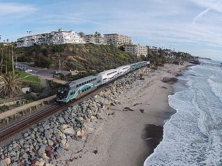
<span class="mw-page-title-main">Metrolink (California)</span> Commuter rail system in Southern California

Metrolink is a commuter rail system in Southern California, serving Los Angeles, Orange, Riverside, San Bernardino, and Ventura counties, as well as to Oceanside in San Diego County. The system consists of eight lines and 69 stations operating on 545.6 miles (878.1 km) of track. Arrow is operated under a contract with the San Bernardino County Transportation Authority (SBCTA).

<span class="mw-page-title-main">Transportation in Los Angeles</span> Complex multimodal regional, national and international hub for passenger and freight traffic

Los Angeles has a complex multimodal transportation infrastructure, which serves as a regional, national and international hub for passenger and freight traffic. The system includes the United States' largest port complex; an extensive freight and passenger rail infrastructure, including light rail lines and rapid transit lines; numerous airports and bus lines; vehicle for hire companies; and an extensive freeway and road system. People in Los Angeles rely on cars as the dominant mode of transportation, but since 1990 the Los Angeles County Metropolitan Transportation Authority has built over one hundred miles (160 km) of light and heavy rail serving more and more parts of Los Angeles and the greater area of Los Angeles County. As a result, Los Angeles was the last major city in the United States to get a permanent rail system installed.

<span class="mw-page-title-main">Los Angeles Metro Rail</span> Urban rail transit system serving Los Angeles County, California

The Los Angeles Metro Rail is an urban rail transit system serving Los Angeles County, California in the United States. It consists of six lines: four light rail lines and two rapid transit lines, serving a total of 101 stations. It connects with the Metro Busway bus rapid transit system, the Metrolink commuter rail system, as well as several Amtrak lines. Metro Rail is owned and operated by the Los Angeles County Metropolitan Transportation Authority (Metro).

<span class="mw-page-title-main">G Line (Los Angeles Metro)</span> Bus rapid transit line in Los Angeles, California

The G Line is a bus rapid transit line in Los Angeles, California, operated by the Los Angeles County Metropolitan Transportation Authority (Metro). It operates between Chatsworth and North Hollywood stations in the San Fernando Valley. The 17.7-mile (28.5 km) G Line uses a dedicated, exclusive right-of-way for the entirety of its route with 17 stations located at approximately one-mile (1.6 km) intervals; fares are paid via TAP cards at vending machines on station platforms before boarding to improve performance. It is one of the two lines in the Los Angeles Metro Busway system.
<span class="mw-page-title-main">Southern California Rapid Transit District</span> Defunct public transportation agency in Los Angeles, California

The Southern California Rapid Transit District was a public transportation agency established in 1964 to serve the Greater Los Angeles area. It was the successor to the original Los Angeles Metropolitan Transit Authority (MTA). California State Senator Thomas M. Rees sponsored the bill that created the RTD, which was meant to correct some deficiencies of the LAMTA, and took over all of the bus service operated by MTA on November 5, 1964. RTD was merged into the Los Angeles County Metropolitan Transportation Authority in 1993.

<span class="mw-page-title-main">Harbor Transitway</span> Roadway in Interstate Highway 110 in Los Angeles County, California

The Harbor Transitway is a 10.3-mile (16.6 km) shared-use express bus corridor and high occupancy toll (HOT) lanes running in the median of Interstate 110 between Downtown Los Angeles and the Harbor Gateway Transit Center in Gardena, California. Buses also make intermediate stops at 37th Street/USC, Slauson, Manchester, Harbor Freeway, and Rosecrans stations. The facility opened for two-person carpools on June 26, 1996, for buses on August 1, 1996 and was converted to HOT lanes as part of the Metro ExpressLanes project on November 10, 2012.

<span class="mw-page-title-main">El Monte Busway</span> Los Angeles Metro Busway

The El Monte Busway is a 12-mile (19 km) shared-use express bus corridor (busway) and high occupancy toll (HOT) lanes running along Interstate 10 between Union Station in Downtown Los Angeles and Interstate 605 or El Monte Station in El Monte, California. Buses also make intermediate stops at Cal State LA station and LA General Medical Center station. The busway opened in January 1973 to buses only, three-person carpools were allowed to enter in 1976, and the facility was converted to HOT lanes as part of the Metro ExpressLanes project on February 22, 2013.

<span class="mw-page-title-main">Harbor Freeway station</span> Light rail and bus rapid transit station in Los Angeles, California

Harbor Freeway station is a transport hub located on the Harbor Transitway, within the Judge Harry Pregerson Interchange of Interstate 105 and Interstate 110 near Figueroa Street in the neighborhood of South Los Angeles. The station is served by the light rail C Line, the bus rapid transit J Line and other bus services. The station is owned by the California Department of Transportation (Caltrans) and operated by the Los Angeles County Metropolitan Transportation Authority (Metro).
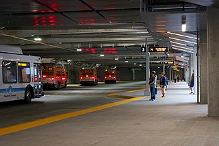
<span class="mw-page-title-main">Los Angeles Metro bus fleet</span> Transit bus fleet operated and contracted by LACMTA

The Los Angeles County Metropolitan Transportation Authority operates a vast fleet of buses for its Metro Bus and Metro Busway services. As of September 2019, Metro has the third largest bus fleet in North America with 2,320 buses.
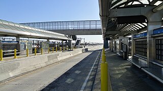
<span class="mw-page-title-main">Slauson station (J Line)</span> Bus rapid transit station in Los Angeles, California

Slauson station is a busway station located in Los Angeles, California. It is situated between the 37th Street/USC and Manchester stations on the J Line, a bus rapid transit route which runs between El Monte, Downtown Los Angeles and San Pedro as part of the Metro Busway system. The station consists of two side platforms in the center of Interstate 110 above Slauson Avenue. The station serves the Vermont-Slauson, South Park and Florence neighborhoods of Los Angeles.

<span class="mw-page-title-main">Manchester station (Los Angeles Metro)</span> Bus rapid transit station in Los Angeles, California

Manchester station is a busway station located in Los Angeles, California. It is situated between the Slauson and Harbor Freeway stations on the J Line, a bus rapid transit route which runs between El Monte, Downtown Los Angeles and San Pedro as part of the Los Angeles Metro Busway system. The station consists of two side platforms in the center of Interstate 110 above Manchester Avenue. The station serves the Vermont Knolls, Vermont Vista, Florence, and Broadway-Manchester neighborhoods of Los Angeles.

<span class="mw-page-title-main">Rosecrans station</span> Bus rapid transit station in Los Angeles, California

Rosecrans station is a busway station located in Los Angeles, California. It is situated between the Harbor Freeway station and the Harbor Gateway Transit Center on the J Line, a bus rapid transit route which runs between El Monte, Downtown Los Angeles and San Pedro as part of the Metro Busway system. The station consists of two side platforms in the center of Interstate 110 under Rosecrans Avenue. The station serves the Harbor Gateway neighborhoods of Los Angeles.

<span class="mw-page-title-main">Harbor Gateway Transit Center</span> Public transit hub in Los Angeles, California

Harbor Gateway Transit Center, formerly Artesia Transit Center, is a large bus station at the southern end of the Harbor Transitway that serves as a transport hub for the South Bay region of Los Angeles County including the Harbor Gateway neighborhood of Los Angeles and cities of Carson, Gardena, and Torrance. The station consists of one large island platform with 12 bus bays and a 980 space park and ride parking lot located in the southwest corner of Interstate 110 and California State Route 91.

<span class="mw-page-title-main">El Monte Station</span> Transit center in Los Angeles, California

El Monte Station is a large regional bus station in the city of El Monte, California, United States, adjacent to Interstate 10, serving the Metro J Line, Foothill Transit, Greyhound Lines, and El Monte Transit. It is the Metro J Line's eastern terminus.

<span class="mw-page-title-main">J Line (Los Angeles Metro)</span> Bus rapid transit line in Los Angeles County, California

The J Line is a 38-mile (61.2 km) bus rapid transit line that runs between El Monte, Downtown Los Angeles and the Harbor Gateway, with some trips continuing to San Pedro. It is one of the two lines in the Metro Busway system operated by the Los Angeles County Metropolitan Transportation Authority (Metro).

This article discusses the history of the Los Angeles County Metropolitan Transportation Authority, the regional transportation planning agency for Los Angeles County, California.

<span class="mw-page-title-main">Los Angeles Metro Busway</span> Bus rapid transit system in Los Angeles County, California

Metro Busway is a system of bus rapid transit (BRT) routes that operate primarily along exclusive or semi-exclusive roadways known locally as a busway or transitway. There are currently two lines serving 29 stations in the system: the G Line in the San Fernando Valley, and the J Line, serving El Monte, Downtown Los Angeles, Gardena, and San Pedro. The Los Angeles County Metropolitan Transportation Authority (Metro) operates the Metro Busway system.

The history of the Los Angeles Metro Rail and Busway system begins in the early 1970s, when the traffic-choked region began planning a rapid transit system. The first dedicated busway opened along I-10 in 1973, and the region's first light rail line, the Blue Line opened in 1990. Today the system includes over 160 miles (260 km) of heavy rail, light rail, and bus rapid transit lines, with multiple new lines under construction as of 2019.

The North Hollywood to Pasadena Transit Corridor is a proposed 18-mile (29 km) bus rapid transit line in the Los Angeles Metro Busway system in Los Angeles, California. It is planned to operate between Pasadena and the North Hollywood station in the San Fernando Valley, where it will connect with the B Line in the Los Angeles Metro Rail system and the G Line in the Los Angeles Metro Busway system. The project completed its scoping phase in 2019, was approved by the Metro board on April 28, 2022 and is estimated to be completed by 2027. It is part of Metro's Twenty-eight by '28 initiative.

References

  1. 1 2 3 4 5 "Facts At A Glance". Los Angeles County Metropolitan Transportation Authority. June 2023. Archived from the original on March 19, 2023. Retrieved June 22, 2023.
  2. "Transit Ridership Report Fourth Quarter 2023" (PDF). American Public Transportation Association. March 4, 2024. Retrieved March 14, 2024.
  3. "Transit Ridership Report Fourth Quarter 2023" (PDF). American Public Transportation Association. March 4, 2024. Retrieved March 14, 2024.
  4. "California Code, Public Utilities Code – PUC § 130051.10". Findlaw. Archived from the original on November 16, 2021. Retrieved November 16, 2021.
  5. metro.net history. Retrieved April 4, 2004. Archived September 28, 2007, at the Wayback Machine
  6. Hebert, Ray (December 27, 1976). "New Agencies to Face Task of Unifying Jumbled Transit Plans". Los Angeles Times . p. 16. Archived from the original on January 26, 2023. Retrieved January 26, 2023.
  7. "Help & Contacts Archived October 22, 2015, at the Wayback Machine ." Los Angeles County Metropolitan Transportation Authority. Retrieved on March 18, 2010.
  8. "Sustainability". Archived from the original on January 27, 2023. Retrieved January 27, 2023.
  9. Nelson, Laura J. (February 25, 2016). "Metro Expo Line to begin service to Santa Monica on May 20". Los Angeles Times. Archived from the original on March 2, 2016. Retrieved March 1, 2016.
  10. "Metro Facts At A Glance". Metro. June 2023. Archived from the original on March 19, 2023. Retrieved June 22, 2023.
  11. "How to Ride Metro Bus". Metro. Retrieved May 9, 2024.
  12. "Metro Bike Share: About". January 27, 2015. Archived from the original on October 21, 2018. Retrieved October 21, 2018.
  13. Uranga, Rachel (September 14, 2023). "The $1 ride that costs Metro $43. Why some want to keep it going". Los Angeles Times. Retrieved January 22, 2024.
  14. "Board of Directors - LOSSAN Rail Corridor Agency". Orange County Transportation Authority. Retrieved September 27, 2023.
  15. "LOSSAN Rail Corridor Agency Business Plan FY 2022-23 - FY 2023-24" (PDF). Orange County Transportation Authority. Retrieved September 27, 2023.
  16. Linton, Joe (June 7, 2023). "L.A. Metro Fare Capping Starts July 1". Streetsblog California. Retrieved July 1, 2023.
  17. "Fare Capping". LA Metro. Retrieved July 1, 2023.
  18. "TAP Agencies". www.taptogo.net. Retrieved July 2, 2023.
  19. "Fares". LA Metro. Retrieved July 2, 2023.
  20. "Metro Rail Gating Study" (PDF). November 15, 2007. Archived (PDF) from the original on November 12, 2020. Retrieved March 7, 2019.
  21. "Archived copy" (PDF). Archived from the original (PDF) on February 25, 2012. Retrieved October 21, 2015.{{cite web}}: CS1 maint: archived copy as title (link)
  22. "Ridership Statistics". www.metro.net. Archived from the original on June 12, 2018. Retrieved August 17, 2020.
  23. "California Code, Public Utilities Code – PUC § 130051". Findlaw. Archived from the original on March 2, 2019. Retrieved March 2, 2019.
  24. "Metro in Transition". Streetsblog Los Angeles. December 2, 2009. Archived from the original on November 12, 2016. Retrieved September 13, 2016.
  25. High Desert Corridor JPA Homepage
  26. "FY20 Adopted Budget" (PDF). Los Angeles County Metropolitan Transportation Authority. July 1, 2019. Archived (PDF) from the original on February 14, 2020. Retrieved February 10, 2020.
  27. 1 2 Pegrum, Dudley F. (1961). "The Los Angeles Metropolitan Transit Authority". Land Economics. 37 (3): 247–255. doi:10.2307/3159723. ISSN   0023-7639. JSTOR   3159723. Archived from the original on July 20, 2021. Retrieved July 20, 2021.
  28. "Twenty-First Century Urbanism", Street Level: Los Angeles in the Twenty-First Century, Routledge, pp. 97–123, April 1, 2016, doi:10.4324/9781315611051-6, ISBN   978-1-315-61105-1, archived from the original on March 23, 2023, retrieved July 20, 2021
  29. 1 2 Mohiuddin, Hossain (February 19, 2021). "Planning for the First and Last Mile: A Review of Practices at Selected Transit Agencies in the United States". Sustainability. 13 (4): 2222. doi: 10.3390/su13042222 . ISSN   2071-1050.
  30. "Metro Gets Grant For Purchase of More Clean-Air Buses". Los Angeles County Metro. April 26, 2006. Retrieved January 7, 2007.[ permanent dead link ]
  31. Sotero, Dave (October 13, 2021). "L.A. Metro Now Running all Zero-Emission Electric Buses on the G (Orange) Line in the San Fernando Valley". LA Metro. Retrieved September 14, 2023.
  32. "Fresh Air". Archived from the original on March 8, 2018. Retrieved March 7, 2018.
  33. @numble (November 27, 2023). "October 2023 status report for LA Metro's D Line Extension Section 1. 88.66% as of 10/27/23, +0.6% since 9/29/23. Contractor's forecast completion date is 6/17/25, 25 days later than last forecast" (Tweet). Retrieved November 28, 2023 via Twitter.
  34. @numble (November 27, 2023). "October 2023 status report for LA Metro's D Line Extension Section 2. 61.9% as of 10/27/23, +1.3% since 9/29/23. Contractor forecasts completion to be 6 days later than prior forecast (now late September 2026)" (Tweet). Retrieved November 28, 2023 via Twitter.
  35. @numble (November 27, 2023). "October 2023 status report for LA Metro's D Line Extension Section 3. 50.85% as of 10/27/23, +0.5% since 9/29/23" (Tweet). Retrieved November 28, 2023 via Twitter.
  36. @numble (November 27, 2023). "October 2023 status report for LA Metro's Foothill Gold Line Extension. 79.4% as of 10/31/23, +~1.4% since 9/30/23. Forecast completion on 12/14/24" (Tweet). Retrieved November 28, 2023 via Twitter.
  37. "Aerial Rapid Transit". Los Angeles Metro . Archived from the original on November 15, 2022. Retrieved November 15, 2022.
  38. 1 2 "Measure M: Metro's Plan to Transform Transportation in LA". The Plan. Archived from the original on November 9, 2016. Retrieved November 11, 2016.
  39. "Fresh Air". Archived from the original on March 8, 2018. Retrieved March 7, 2018.
  40. "Measure M project descriptions". The Source. November 9, 2016. Archived from the original on November 11, 2016. Retrieved November 11, 2016.
  41. "Editorial: It was a terrible idea to build a new freeway in Los Angeles County. Now it's on hold for good". Los Angeles Times . October 6, 2019. Archived from the original on October 17, 2019. Retrieved October 17, 2019.