Lutherville-Timonium, Maryland

Last updated
Lutherville-Timonium, Maryland
Baltimore County Maryland Incorporated and Unincorporated areas Lutherville-Timonium Highlighted.svg
Location of Lutherville-Timonium, Maryland
Coordinates: 39°26′11″N76°37′6″W / 39.43639°N 76.61833°W / 39.43639; -76.61833 Coordinates: 39°26′11″N76°37′6″W / 39.43639°N 76.61833°W / 39.43639; -76.61833
CountryFlag of the United States.svg United States
State Flag of Maryland.svg  Maryland
County Flag of Baltimore County, Maryland.svg Baltimore
Area
  Total7.4 sq mi (19.1 km2)
  Land7.4 sq mi (19.1 km2)
  Water0.0 sq mi (0.0 km2)
Population
 (2000)
  Total15,814
  Density2,142.1/sq mi (827.1/km2)
Time zone UTC−5 (Eastern (EST))
  Summer (DST) UTC−4 (EDT)
ZIP codes
21093-21094
Area code(s) 410, 443
FIPS code 24-48900

Lutherville-Timonium was a census-designated place (CDP) in Baltimore County, Maryland, United States, for the 2000 census. At that time the population was 15,814. For the 2010 census the area was split into two CDPs, the unincorporated communities of Lutherville and Timonium. Within its borders lies the Lutherville Historic District. The Maryland State Fair is held in Timonium each year near Labor Day.

Contents

Geography

Lutherville-Timonium is located at 39°26′11″N76°37′6″W / 39.43639°N 76.61833°W / 39.43639; -76.61833 (39.436456, −76.618461). [1]

According to the United States Census Bureau, the CDP had a total area of 7.4 square miles (19.1 km2), all of it land.

Demographics

Historical population
CensusPop.
1960 12,265
1970 24,05596.1%
1980 16,871−29.9%
1990 16,442−2.5%
2000 15,814−3.8%
source: [2]

As of the census [3] of 2000, there were 15,814 people, 6,485 households, and 4,461 families residing in the CDP. The population density was 2,142.1 people per square mile (827.3/km2). There were 6,614 housing units at an average density of 895.9 per square mile (345.9/km2). The racial makeup of the CDP was 90.10% White, 3.22% African American, 0.15% Native American, 5.27% Asian, 0.01% Pacific Islander, 0.24% from other races, and 1.01% from two or more races. Hispanic or Latino of any race were 1.22% of the population.

There were 6,485 households, out of which 24.7% had children under the age of 18 living with them, 59.4% were married couples living together, 7.1% had a female householder with no husband present, and 31.2% were non-families. 26.3% of all households were made up of individuals, and 14.7% had someone living alone who was 65 years of age or older. The average household size was 2.36 and the average family size was 2.86.

In the CDP, the population was spread out, with 19.7% under the age of 18, 4.9% from 18 to 24, 24.6% from 25 to 44, 27.0% from 45 to 64, and 23.7% who were 65 years of age or older. The median age was 46 years. For every 100 females there were 90.1 males. For every 100 females age 18 and over, there were 87.5 males.

The median income for a household in the CDP was $61,573, and the median income for a family was $74,464. Males had a median income of $52,401 versus $35,132 for females. The per capita income for the CDP was $32,369. About 0.8% of families and 3.6% of the population were below the poverty line, including 0.6% of those under age 18 and 5.1% of those age 65 or over.

Related Research Articles

<span class="mw-page-title-main">Kykotsmovi Village, Arizona</span> CDP in Navajo County, Arizona

Kykotsmovi Village is a census-designated place (CDP) in Navajo County, Arizona, United States, and the home of the Hopi tribal government. The Hopi Tribe is a sovereign nation located in northeastern Arizona. The population was 776 at the 2000 census. The Hopi reservation occupies part of Coconino and Navajo counties, encompasses more than 1.5 million acres, and is made up of 12 villages on three mesas. Kykotsmovi is one of the 12 villages located in third mesa. Third Mesa includes Hotvela (Hotevilla), Paaqavi (Bacavi), Munqapi (Moencopi), Kiqotsmovi (Kykotsmovi), and Orayvi (Oraibi).

<span class="mw-page-title-main">Fruit Cove, Florida</span> CDP in Florida, United States

Fruit Cove is a census-designated place (CDP) in St. Johns County, Florida, United States. The population was 16,077 at the 2000 census. It is located in the community of St. Johns.

<span class="mw-page-title-main">Glencoe, Florida</span> CDP in Florida, United States

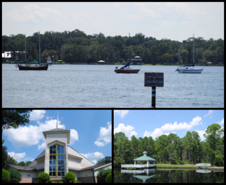
Glencoe is a census-designated place (CDP) in Volusia County, Florida, United States. The population was 2,582 at the 2010 census.

<span class="mw-page-title-main">Bright, Indiana</span> Census-designated place in Indiana, United States

Bright is an unincorporated community and census-designated place (CDP) in Dearborn County, Indiana, United States. The population was 5,814 at the 2020 census.

<span class="mw-page-title-main">Maryland City, Maryland</span> Census-designated place in Maryland, United States

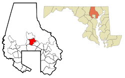
Maryland City is a census-designated place (CDP) in Anne Arundel County, Maryland, United States. The population was 16,093 at the 2010 census. It is located east of Laurel, just over the border with Prince George's County, and it has a Laurel ZIP Code. Maryland City mostly consists of an older, compact housing development and is adjacent to Fort Meade army base. A large newer development on the north side of Maryland Route 198 is known as Russett and is included within the Maryland City CDP.

<span class="mw-page-title-main">South Gate, Maryland</span> Former census-designated place in Maryland, United States

South Gate was a census-designated place (CDP) in Anne Arundel County, Maryland, United States, for the 2000 census, at which time its population was 28,672. It was added primarily to the Glen Burnie CDP for the 2010 census.

<span class="mw-page-title-main">Bowleys Quarters, Maryland</span> Census-designated place in Maryland, United States

Bowleys Quarters is an unincorporated community and census-designated place in Baltimore County, Maryland, United States, with a population of 6,755 at the 2010 census.

<span class="mw-page-title-main">Mays Chapel, Maryland</span> Census-designated place in Maryland, United States

Mays Chapel is an unincorporated community and census-designated place in Baltimore County, Maryland, United States. The population was 11,420 at the 2010 census.

<span class="mw-page-title-main">Perryman, Maryland</span> Census-designated place in Maryland, United States

Perryman is an unincorporated community and census-designated place (CDP) in Harford County, Maryland, United States. The population was 2,342 at the 2010 census.

<span class="mw-page-title-main">Beaverdam Lake–Salisbury Mills, New York</span> Former census-designated place in New York, United States

Beaverdam Lake-Salisbury Mills was a census-designated place (CDP) in Orange County, New York, United States. It encompassed a region in the corner of the towns of Blooming Grove, Cornwall, and New Windsor. As of the 2000 census, its population was 2,779. For the 2010 census, the area was counted as two separate CDPs: Beaver Dam Lake in the towns of Blooming Grove and New Windsor and Salisbury Mills in the towns of Blooming Grove and Cornwall. Beaverdam Lake is also the name of a lake next to the community.

West Goshen was a census-designated place (CDP) in West Goshen Township, Chester County, Pennsylvania, United States. The population was 8,472 at the 2000 census. The CDP was not delineated for the 2010 census.

<span class="mw-page-title-main">Williamstown, Pennsylvania</span> Borough in Pennsylvania, United States

Williamstown is a borough in Dauphin County, Pennsylvania, United States. The borough is 38 miles (61 km) northeast of Harrisburg. Formerly, anthracite coal mines and hosiery mills were located in the borough. The population was 1,303 at the 2020 census.

<span class="mw-page-title-main">Brandonville, Pennsylvania</span> CDP in Pennsylvania, United States

Brandonville is a census-designated place (CDP) in East Union Township, Schuylkill County, Pennsylvania, United States. The population was 217 at the 2000 census.

<span class="mw-page-title-main">Parkville, Pennsylvania</span> CDP in Pennsylvania, United States

Parkville is a census-designated place (CDP) in York County, Pennsylvania, United States. The population was 6,706 at the 2010 census.

<span class="mw-page-title-main">Pennville, Pennsylvania</span> CDP in Pennsylvania, United States

Pennville is a census-designated place (CDP) in York County, Pennsylvania, United States. The population was 1,947 at the 2010 census.

<span class="mw-page-title-main">Spry, Pennsylvania</span> CDP in Pennsylvania, United States

Spry is a census-designated place (CDP) in York County, Pennsylvania, United States. The population was 4,891 at the 2010 census.

<span class="mw-page-title-main">Susquehanna Trails, Pennsylvania</span> CDP in Pennsylvania, United States

Susquehanna Trails is a census-designated place (CDP) in York County, Pennsylvania, United States. The population was 2,264 at the 2010 census.

Elgin is an unincorporated community and census-designated place (CDP) in Lancaster County, South Carolina, United States. The population was 2,607 at the 2010 census.

<span class="mw-page-title-main">Edison, Washington</span> CDP in Washington, United States

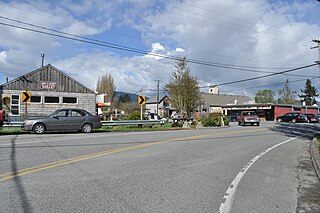
Edison is a census-designated place (CDP) in Skagit County, Washington, United States. The population was 133 at the 2010 census. It is included in the Mount Vernon–Anacortes, Washington Metropolitan Statistical Area.

<span class="mw-page-title-main">Freeport (CDP), Maine</span> Census-designated place in Maine, United States

Freeport is a census-designated place (CDP) in the town of Freeport in Cumberland County, Maine, United States. The population was 1,485 at the 2010 census. It is part of the Portland–South Portland–Biddeford, Maine Metropolitan Statistical Area.

References

  1. "US Gazetteer files: 2010, 2000, and 1990". United States Census Bureau. 2011-02-12. Retrieved 2011-04-23.
  2. "CENSUS OF POPULATION AND HOUSING (1790-2000)". U.S. Census Bureau . Retrieved 2010-07-17.
  3. "U.S. Census website". United States Census Bureau . Retrieved 2008-01-31.