Maine State Route 5

Last updated

Maine 5.svg

State Route 5

Maine State Route 5
Route of SR 5 highlighted in red
Route information
Maintained by MaineDOT
Length118.17 mi [1]  (190.18 km)
Existed1925–present
Major junctions
South endMaine 9.svg SR 9 in Old Orchard Beach
Major intersections
North endMaine 120.svg SR 120 in Andover
Location
Country United States
State Maine
Counties York, Cumberland, Oxford
Highway system
Maine 4A.svg SR 4A Maine 6.svg SR 6

State Route 5 (abbreviated SR 5) is a state highway in Maine that runs from an intersection with State Route 9 in Old Orchard Beach, to an intersection with State Route 120 in Andover.

Contents

Route description

SR 5 southbound in Saco Route 5 southbound, Saco ME.jpg
SR 5 southbound in Saco

From its southern terminus near the Pier in Old Orchard Beach, SR 5 leaves the town to the west, going towards the neighboring city of Saco. The route runs northwest from Saco, passes very briefly through a Northwest corner of Biddeford, and intersects US 202 (US 202) near the Lyman-Waterboro line. SR 5 runs concurrently with US 202 for a short distance to East Waterboro.

Between Waterboro and Cornish, SR 5 is known as the Sokokis Trail. North of Cornish, the highway follows the Saco River, crossing it at Hiram, to the town of Fryeburg. SR 5 continues north through Lovell to Bethel, where it intersects US 2. The two routes run together along the Androscoggin River to Rumford Point in the town of Rumford, where SR 5 leaves to the north. It follows parallel to the west bank of the Ellis River to the route's end in Andover.

History

As designated in 1925, SR 5 was a longer route than it is today, originally terminating in South Arm near the southern part of Lower Richardson Lake. In 1980, it was cut back to its current northern terminus in Andover at the intersection with SR 120.

In the early 1980s, Interstate 195 (I-195) was being constructed in Saco, partially over the existing alignment of SR 5. The route was shifted alongside I-195 and partially cosigned with US 1. This remains the routing today.

Junction list

CountyLocation [1] mi [1] kmDestinationsNotes
York Old Orchard Beach 0.000.00Maine 9.svg SR 9 (Grand Avenue)
0.200.32West plate.svg
Maine 98.svg
To plate.svg
US 1.svg
SR 98 west (Portland Avenue) to US 1  Scarborough
Eastern terminus of SR 98
2.263.64West plate blue.svg
I-195.svg
To plate blue.svg
I-95.svg
To plate.svg
US 1.svg
I-195 west to I-95  / US 1  Saco
Northbound access only to I-195; southern end of northbound concurrency with I-195; eastern terminus of I-195
Saco 3.034.88North plate.svg
US 1.svg
US 1 north (Portland Road) Saco
Northern end of northbound concurrency with I-195; southern end of wrong-way concurrency with US 1; Exit 2 on I-195
3.275.26West plate blue.svg
I-195.svg
To plate blue.svg
I-95.svg
To plate green.svg
Maine Turnpike sign.svg
I-195 west to I-95  / Maine Turnpike  Portland, Kittery
4.487.21South plate.svg
US 1.svg
US 1 south (Elm Street) Biddeford
South plate.svg
Maine 112.svg
To plate.svg
Maine 9.svg
SR 112 south to SR 9  Camp Ellis
Northern end of wrong-way concurrency with US 1; southern end of concurrency with SR 112
4.857.81North plate.svg
Maine 112.svg
SR 112 north (North Street) Buxton
Northern end of concurrency with SR 112
Dayton 13.3821.53Maine 35.svg SR 35  Hollis, Lyman
Lyman 16.9427.26East plate.svg
US 202.svg
North plate.svg
Maine 4.svg
US 202 east / SR 4 north
Southern end of concurrency with US 202 / SR 4
Waterboro 18.7830.22West plate.svg
US 202.svg
South plate.svg
Maine 4.svg
US 202 west / SR 4 south Alfred
Northern end of concurrency with US 202 / SR 4
Limerick 28.9746.62West plate.svg
Maine 11.svg
SR 11 west Newfield
Southern end of concurrency with SR 11
29.1246.86East plate.svg
Maine 11.svg
SR 11 east Limington
Northern end of concurrency with SR 11
29.1946.98North plate.svg
Maine 160.svg
SR 160 north Parsonsfield
Southern terminus of SR 160
Cornish 37.8960.98West plate.svg
Maine 25.svg
SR 25 west (Maple Street)
Southern end of concurrency with SR 5
38.5662.06East plate.svg
Maine 25.svg
SR 25 east (Main Street) Standish
Northern end of concurrency with SR 5
38.8762.56South plate.svg
Maine 117.svg
SR 117 south (Grange Hall Road) Limington, Standish
Southern end of concurrency with SR 117
Cumberland Baldwin 40.6065.34South plate.svg
Maine 113.svg
SR 113 south (Pequawket Trail) Steep Falls, Standish
Southern end of concurrency with SR 113
Oxford Hiram 45.2672.84North plate.svg
Maine 117.svg
SR 117 north (Main Street)
Northern end of concurrency with SR 117
Brownfield 51.7783.32Maine 160.svg SR 160 (Depot Street / Main Street) Denmark, Brownfield
Fryeburg 58.8294.66West plate.svg
US 302.svg
North plate.svg
Maine 113.svg
US 302 west / SR 113 north Conway NH
Northern end of concurrency with SR 113; southern end of concurrency with US 302
59.2495.34East plate.svg
US 302.svg
US 302 east Sebago Area, Portland
Northern end of concurrency with US 302
Lovell 68.39110.06South plate.svg
Maine 93.svg
SR 93 south Sweden
Northern terminus of SR 93
Albany Township 82.45132.69South plate.svg
Maine 35.svg
SR 35 south North Waterford, Norway, Waterford
Southern end of concurrency with SR 35
Bethel 95.14153.11End plate.svg
Maine 35.svg
SR 35 ends
West plate.svg
US 2.svg
US 2 west (West Bethel Road) Gorham NH, Gilead
Southern end of concurrency with US 2; northern terminus of SR 35
95.44153.60South plate.svg
Maine 26.svg
SR 26 south Bethel, South Paris
Southern end of concurrency with SR 26
96.04154.56 Androscoggin River
Newry 101.26162.96 Bear River
101.32163.06North plate.svg
Maine 26.svg
SR 26 north (Bear River Road) Upton, Errol NH
Northern end of concurrency with SR 26
Rumford 107.51173.02East plate.svg
US 2.svg
US 2 east Rumford
Northern end of concurrency with US 2
Andover 118.17190.18East plate.svg
Maine 120.svg
SR 120 east (Elm Street) – South Arm, Rumford
Western terminus of SR 120
1.000 mi = 1.609 km; 1.000 km = 0.621 mi

Former auxiliary route

Maine 5A.svg

State Route 5A

Location Lovell
Length2.1 mi (3.4 km)
Existed1960–2003

State Route 5A was a short 2.1-mile (3.4 km) loop off Route 5 in Lovell. It functioned as an eastern bypass of downtown and connected to SR 5 at both ends. It was designated in 1960 and was removed from the route logs in 2003. It is now an unnumbered road.

Related Research Articles

<span class="mw-page-title-main">Interstate 195 (Maine)</span> Highway in Maine

Interstate 195 (I-195), also known as the Saco Industrial Spur, is a short auxiliary Interstate Highway running 2.41 miles (3.88 km) in eastern York County, Maine. The highway, located entirely in the city of Saco, is a nominally east–west route that provides access to Downtown Saco and the resort town of Old Orchard Beach from Interstate 95. The western terminus of I-195 is at a trumpet interchange with the Maine Turnpike in central Saco. The route has numbered interchanges with Industrial Park Road, U.S. Route 1, and Maine State Route 5 before terminating at an at-grade intersection with SR 5 near the border between Saco and Old Orchard Beach.

<span class="mw-page-title-main">New Hampshire Route 11</span>

New Hampshire Route 11 is a 108.223-mile-long (174.168 km) east–west state highway in New Hampshire, running completely across the central part of the state. Its western terminus is at the Vermont state line in Charlestown, where it continues west as Vermont Route 11. The eastern terminus is at the Maine state line in Rochester, where it crosses the border with U.S. Route 202 and continues as Maine State Route 11.

<span class="mw-page-title-main">Interstate 95 in Maine</span> Section of Interstate Highway in Maine, United States

Interstate 95 (I-95) in the US state of Maine is a 303-mile-long (488 km) highway running from the New Hampshire state line in Kittery, to the Canadian border in Houlton. It is the only two-digit Interstate Highway in Maine. In 2004, the highway's route between Portland and Gardiner was changed so that it encompasses the entire Maine Turnpike, a toll road running from Kittery to Augusta.

<span class="mw-page-title-main">Maine State Route 25</span> Highway in Maine

State Route 25 (SR 25) is part of the system of numbered highways in Maine. It runs for 42.4 miles (68.2 km) across the south central part of the state. SR 25 begins at the New Hampshire border near Porter, where it continues west as New Hampshire Route 25 (NH 25). Its eastern terminus is in downtown Portland at the intersection of Park Avenue and State Street. Administratively, it shares a terminus with SR 22 and SR 77.

<span class="mw-page-title-main">New Hampshire Route 9</span> State highway in New Hampshire, United States

New Hampshire Route 9 is a 109.910-mile-long (176.883 km) state highway located in southern New Hampshire. It runs across the state from west to east and is a multi-state route with Vermont and Maine, part of 1920s-era New England Interstate Route 9.

<span class="mw-page-title-main">Maine State Route 3</span>

State Route 3 is a 120.67-mile (194.20 km) long state highway located in southern Maine. It is a major interregional highway, connecting the Interstate 95 corridor to the Atlantic coast. The western terminus is at SR 8, SR 11 and SR 27 in Augusta and the eastern terminus is at SR 102 and SR 198 in Mount Desert. Major cities and towns along the length of SR 3 include Augusta, Belfast, Ellsworth, and Bar Harbor.

<span class="mw-page-title-main">Maine State Route 4</span>

State Route 4 is a 168.85-mile (271.74 km) long state highway located in southern and western Maine. It is a major interregional route and the first such route to be designated in the state. The southern terminus is at the New Hampshire border in South Berwick, where it connects to New Hampshire Route 4, and the northern terminus is at Haines Landing on Mooselookmeguntic Lake in Rangeley. Major cities and towns along the length of SR 4 include Sanford, Gorham, Windham, Auburn and Farmington.

<span class="mw-page-title-main">Connecticut Route 177</span>

Route 177 is a state highway in central Connecticut, running from Plainville to Canton.

<span class="mw-page-title-main">U.S. Route 4 in New Hampshire</span>

U.S. Route 4 in the state of New Hampshire runs for 106.8 miles (171.9 km) across the central and southern part of the state, stretching from Lebanon on the Connecticut River border with Vermont southeast to Portsmouth on the eastern coast.

<span class="mw-page-title-main">Maine State Route 98</span>

State Route 98 (SR 98) is a short state highway in southwestern Maine. It is a 2.8-mile-long (4.5 km) connection between the city of Saco and Old Orchard Beach between U.S. Route 1 (US 1) and SR 5/SR 9. SR 98 is signed as an east–west highway although its orientation is more northwest-to-southeast.

<span class="mw-page-title-main">Maine State Route 161</span>

State Route 161 (SR 161) is part of Maine's system of numbered state highways. It runs 86 miles (138 km) from Fort Fairfield to Allagash. It begins at the Fort Fairfield - Andover Border Crossing along the Canada–US border to Dickey Road near the confluence of the Allagash and Saint John rivers.

<span class="mw-page-title-main">Maine State Route 112</span>

State Route 112 (SR 112) is part of Maine's system of numbered state highways, running from SR 9 in Saco to SR 114 in Gorham. The 26-mile-long (42 km) route runs in a C-shape and is signed as north–south.

<span class="mw-page-title-main">Maine State Route 117</span>

State Route 117 is part of Maine's system of numbered state highways, running from SR 112 in Saco to SR 219 in Turner.

<span class="mw-page-title-main">Maine State Route 17</span>

State Route 17 is part of Maine's system of numbered state highways, located in the south central part of the state. It is a major regional route running for 131.21 miles (211.16 km) from an intersection with State Route 4 in Oquossoc to an intersection with U.S. Route 1 and U.S. Route 1A in Rockland.

<span class="mw-page-title-main">Maine State Route 32</span>

State Route 32 is part of Maine's system of numbered state highways, located in the southern coastal part of the state. It runs 58.39 miles (93.97 km) from an intersection with SR 130 in Bristol north to Windsor where it ends at U.S. Route 202 (US 202), SR 100, and SR 137 Business.

<span class="mw-page-title-main">Maine State Route 69</span>

State Route 69 (SR 69) is part of Maine's system of numbered state highways, located in the central coastal region of the state. It runs 34.86 miles (56.10 km) from SR 11 and SR 100 in Pittsfield to US 1A in Winterport. SR 69 is signed east-west, but follows a northwest-to-southeast routing.

<span class="mw-page-title-main">Maine State Route 160</span>

State Route 160 is part of Maine's system of numbered state highways, located in the southwestern part of the state. It is a north–south highway running 32.64 miles (52.53 km) from an intersection with State Route 5 in Limerick to an intersection with State Route 117 in Denmark.

<span class="mw-page-title-main">Maine State Route 219</span>

State Route 219 is part of Maine's system of numbered state highways, located in the western central part of the state. It runs for 35.1 miles (56.5 km) from the town center of Greenwood to an intersection with State Route 133 in Wayne.

<span class="mw-page-title-main">Maine State Route 120</span>

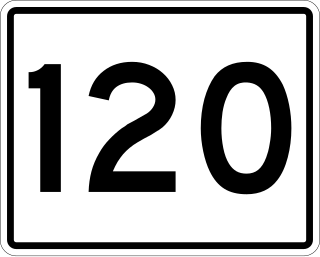
State Route 120 (SR 120) is a state route in the U.S. state of Maine that runs from SR 5 in Andover to the U.S. Route 2 (US 2) and Lincoln Avenue intersection in Rumford. SR 120 runs through the towns of Roxbury and Mexico as well.

<span class="mw-page-title-main">Maine State Route 108</span>

State Route 108 (SR 108) is part of Maine's system of numbered state highways, located in Oxford and Androscoggin counties. Its western terminus is in Rumford, at the intersection with U.S. Route 2 (US 2). Its eastern terminus is at Turner, at the intersection with SR 219.

References

  1. 1 2 3 "MaineDOT Public Map Viewer". Maine Department of Transportation . Retrieved June 11, 2017.
Template:Attached KML/Maine State Route 5
KML is not from Wikidata