Lovell, Maine

Last updated

Lovell, Maine
Public Library, Lovell, ME.jpg
Charlotte Hobbs Memorial Library
USA Maine location map.svg
Red pog.svg
Lovell, Maine
Location within the state of Maine
Coordinates: 44°11′9″N70°53′33″W / 44.18583°N 70.89250°W / 44.18583; -70.89250
Country United States
State Maine
County Oxford
Incorporated1800
Named for Captain John Lovewell
Area
[1]
  Total47.89 sq mi (124.03 km2)
  Land43.15 sq mi (111.76 km2)
  Water4.74 sq mi (12.28 km2)
Elevation
463 ft (141 m)
Population
 (2020)
  Total1,104
  Density26/sq mi (9.9/km2)
Time zone UTC-5 (Eastern (EST))
  Summer (DST) UTC-4 (EDT)
ZIP code
04051
Area code 207
FIPS code 23-41365
GNIS feature ID0582568

Lovell is a town in Oxford County, Maine, United States. The population was 1,104 at the 2020 census. [2] Lovell is the site of Kezar Lake, a resort area.

Contents

History

Main Street in 1907 Main Street, Center Lovell, ME.jpg
Main Street in 1907

In 1774, the Massachusetts General Court granted New Suncook Plantation to the officers and soldiers (or their heirs) who fought on May 8, 1725, during Father Rale's War against the Sokokis Abenaki Indians at Pequawket (now Fryeburg). First settled in 1777, the community had 85 inhabitants by 1790. New Suncook Plantation would be incorporated as a town on November 15, 1800, renamed after Captain John Lovewell, the fallen expedition leader. [3]

The Kezar River provided water power for industry. In the 19th century, mills produced spools, long lumber, shooks, axe handles, ox goads, carriages, sleighs, harness, cabinet work and coffins, and boots and shoes. Good soil helped farms prosper. Following the Civil War, the Portland and Ogdensburg Railroad connected to Fryeburg, and tourists discovered the beauty of Kezar Lake. Inns and hotels opened, and the town remains a summer resort. [4]

Geography

According to the United States Census Bureau, the town has a total area of 47.89 square miles (124.03 km2), of which 43.15 square miles (111.76 km2) is land and 4.74 square miles (12.28 km2) is water. [1] Lovell is drained by the Kezar River, a tributary of the Saco River. Kezar Lake is a significant lake within the town.

Lovell is crossed by State Route 5. It borders the towns of Stoneham to the north, Waterford to the east, Sweden to the southeast, Fryeburg to the southwest, and Stow to the west.

Kezar Lake

Kezar Lake
Pier & Beach at Farrington's, Center Lovell, ME.jpg
Pier and beach at Farrington's Hotel in c.1920
USA Maine relief location map.svg
Red pog.svg
Kezar Lake
Location Oxford County, Maine
Coordinates 44°11′N70°54′W / 44.183°N 70.900°W / 44.183; -70.900 [5]
Primary inflows Great Brook [6]
Mill Brook [7]
Primary outflows Kezar Outlet [6]
Basin  countriesUnited States
Max. length7 mi (11 km) [6]
Max. width1 mi (1.6 km) [6]
Surface area2,665 acres (1,078 ha) [8]
Max. depth155 feet (47 m) [7]
Water volume87,835  acre⋅ft (108,343,000 m3) [8]
Surface elevation377 ft (115 m) [5]

Kezar Lake serves as a good habitat for smallmouth bass, white perch, chain pickerel, rainbow smelt, lake trout, and land-locked Atlantic salmon. There is a public boat launch area at the northern end of the lake in North Lovell, and another at the narrows south of Center Lovell. [7]

Climate

This climatic region is typified by large seasonal temperature differences, with warm to hot (and often humid) summers and cold (sometimes severely cold) winters. According to the Köppen Climate Classification system, Lovell has a humid continental climate, abbreviated "Dfb" on climate maps. [9]

Demographics

Historical population
CensusPop.Note
1810 365
1820 43017.8%
1830 69762.1%
1840 94135.0%
1850 1,19326.8%
1860 1,33912.2%
1870 1,018−24.0%
1880 1,0775.8%
1890 853−20.8%
1900 693−18.8%
1910 668−3.6%
1920 575−13.9%
1930 64512.2%
1940 6470.3%
1950 640−1.1%
1960 588−8.1%
1970 6073.2%
1980 76726.4%
1990 88815.8%
2000 9749.7%
2010 1,14017.0%
2020 1,104−3.2%
U.S. Decennial Census [10]

2010 census

As of the census [11] of 2010, there were 1,140 people, 477 households, and 339 families living in the town. The population density was 26.4 inhabitants per square mile (10.2/km2). There were 1,227 housing units at an average density of 28.4 per square mile (11.0/km2). The racial makeup of the town was 97.4% White, 0.4% African American, 0.3% Native American, 0.4% Asian, 0.1% Pacific Islander, 0.1% from other races, and 1.5% from two or more races. Hispanic or Latino of any race were 0.9% of the population.

There were 477 households, of which 28.1% had children under the age of 18 living with them, 59.7% were married couples living together, 8.4% had a female householder with no husband present, 2.9% had a male householder with no wife present, and 28.9% were non-families. 25.4% of all households were made up of individuals, and 11.5% had someone living alone who was 65 years of age or older. The average household size was 2.39 and the average family size was 2.83.

The median age in the town was 49.8 years. 21.9% of residents were under the age of 18; 4.7% were between the ages of 18 and 24; 15.6% were from 25 to 44; 38.3% were from 45 to 64; and 19.5% were 65 years of age or older. The gender makeup of the town was 48.7% male and 51.3% female.

2000 census

As of the census [12] of 2000, there were 974 people, 393 households, and 275 families living in the town. The population density was 22.6 inhabitants per square mile (8.7/km2). There were 1,218 housing units at an average density of 28.2 per square mile (10.9/km2). The racial makeup of the town was 98.97% White, 0.10% African American, 0.21% Asian, 0.10% from other races, and 0.62% from two or more races. Hispanic or Latino of any race were 0.92% of the population.

There were 393 households, out of which 29.0% had children under the age of 18 living with them, 58.5% were married couples living together, 6.4% had a female householder with no husband present, and 29.8% were non-families. 23.2% of all households were made up of individuals, and 8.4% had someone living alone who was 65 years of age or older. The average household size was 2.48 and the average family size was 2.92.

In the town, the population was spread out, with 24.0% under the age of 18, 5.0% from 18 to 24, 25.8% from 25 to 44, 29.7% from 45 to 64, and 15.5% who were 65 years of age or older. The median age was 43 years. For every 100 females, there were 102.5 males. For every 100 females age 18 and over, there were 107.9 males.

The median income for a household in the town was $33,365, and the median income for a family was $40,833. Males had a median income of $29,375 versus $22,279 for females. The per capita income for the town was $17,089. About 8.7% of families and 12.4% of the population were below the poverty line, including 13.1% of those under age 18 and 9.8% of those age 65 or over.

Town Libraries

With approximately 1,100 residents Lovell, Maine has two publicly funded libraries. The Charlotte Hobbs Memorial Library and the Lewis Dana Hill Memorial Library.

Charlotte Hobbs Memorial Library

The Charlotte Hobbs Memorial Library was opened in 1908 as the Lovell Public Library. In 1969 the Library Club dedicated Lovell Public Library to Charlotte Hobbs after her death. [13] In 1899 the Women's Library Club of Lovell was founded by Mrs. Frank Swett and Miss Susan Walker, this was done due to the Maine State Library sending trunks of books as a traveling library. In 1901 the Women's Library Club of Lovell was officially incorporated. Charlotte Hobbs was born in Lovell, Maine in 1879. She graduated Wellesley College in 1902, returning to Lovell after to teach, tutor, collect historical materials, and wanted to create a public library for the town. She was the town historian and served as the Lovell Public Library Librarian for more than 50 years. She put on and ran drama productions that helped raise funding for the Lovell Public Library. The dramas helped raise the funds to buy the land and construct the library building. The lot was purchased in 1906 after a fire destroyed the existing building, in 1908 the building was completed and the Lovell Public Library opened. Charlotte Hobbs was able to celebrate the 50th anniversary of the library she helped build in 1951. In 1975 renovations were able to be completed and paid for by the Charlotte Hobbs's legacy. In 1976 the fundraising changed from drama series to an Arts & Artisan Fair that continues to run annually. 2001 the Charlotte Hobbs Memorial Library celebrated their 100-year anniversary of incorporation. The next round of funds for renovations and expansions were raised with the help of author, Stephen King, who did a fan reading. In 2010 the newly renovated and expanded building reopened its doors.

The Charlotte Hobbs Memorial Library hosts many events, such as Author Talks, where they have many well-known authors speak to their community.

The Charlotte Hobbs Memorial Library has a collection size of 16,456 volumes and circulates over 21,000 transactions annually. The current director is Jennifer Dupree and the library is opened 6 days a week all year long. [14]

Lewis Dana Hill Memorial Library

The Lewis Dana Hill Memorial library is a small library that is located in the old one-room schoolhouse in North Lovell, Maine. [15]

The North Lovell Library was originally founded and opened in 1945, it was located across the street from the current location, in a room in the Kezar Lake Grange Hall and was a focal for the summer residents that came to the lake. In 1966 the one-room schoolhouse was purchased and the North Lovell Library was moved. [16]

The North Lovell Library was renamed the Lewis Dana Hill Memorial Library after Lewis Dana Hill who was a summer resident of Lovell for more than 50 years. He was a Harvard graduate and frequented the library throughout his summers in Lovell.

The library is funded through public funds and many library fundraisers. There is an annual Fourth of July Book and Yard Sale, community breakfasts, and author lecture talks.

The Lewis Dana Hill Memorial Library functions similarly to when it was opened. There are no library cards needed, it is open to the public without it. Materials are checked out and managed using card catalog systems and sorted using the Dewey Decimal System. The one room is sectioned based on the materials. There is a small children's section with stacks close to floor level for children to easily browse. WiFi was installed due to resident requests, but remains the only "newly modern" update to the library. The community residents enjoy sitting at the library to read their materials.

The Lewis Dana Hill Memorial Library contains 9,250 volumes and circulates approximately 1,800 transaction. The current director is Dennis Hodge. The Lewis Dana Hill Memorial Library is open two days a week in the off-season, when the population grows in the summer they are opened three days with expanded hours. [17]

Sites of interest

Notable people

Related Research Articles

<span class="mw-page-title-main">Oxford County, Maine</span> County in Maine, United States

Oxford County is a county in the state of Maine, United States. As of the 2020 Census, the county had a population of 57,777. Its county seat is the town of Paris. The county was formed on March 4, 1805, by the Massachusetts General Court in the Maine District from northerly portions of York and Cumberland counties. It borders the Canadian province of Quebec. Part of Oxford County is included in the Lewiston-Auburn, Maine metropolitan New England City and Town Area while a different part of Oxford County is included in the Portland-South Portland-Biddeford, Maine metropolitan New England City and Town Area.

<span class="mw-page-title-main">Standish, Maine</span> Town in the state of Maine, United States

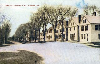
Standish is a town in Cumberland County, Maine, United States. The population was 10,244 at the 2020 census. It includes the villages of Standish Corner, Sebago Lake Village and Steep Falls, and the localities known as Richville, Elmwood, Standish Neck and Two Trails. Standish is part of the Portland-South Portland-Biddeford, Maine metropolitan statistical area.

<span class="mw-page-title-main">Readfield, Maine</span> Town in the state of Maine, United States

Readfield is a town in Kennebec County, Maine, United States. The population was 2,597 at the 2020 census. Readfield is home to the Kents Hill School, a preparatory school, Maranacook Community Schools, public schools for the district, a few summer camps, and the annual Readfield Heritage Days. A popular recreation spot in central Maine, the town contains nine lakes and ponds, including Maranacook Lake, and is part of the Winthrop Lakes Region. The town of Readfield was previously named Pond Town. Readfield is included in the Augusta, Maine micropolitan and included in the Lewiston-Auburn, Maine metropolitan New England City and Town Area.

<span class="mw-page-title-main">Andover, Maine</span> Town in the state of Maine, United States

Andover is a town in Oxford County, Maine, United States. The population was 752 at the 2020 census. Set among mountains and crossed by the Appalachian Trail, Andover is home to the Lovejoy Covered Bridge and is the site of the Andover Earth Station.

<span class="mw-page-title-main">Denmark, Maine</span> Town in the state of Maine, United States

Denmark is a town in Oxford County, Maine, United States. The population was 1,197 at the 2020 census. A number of ponds and lakes are located within the town.

<span class="mw-page-title-main">Hiram, Maine</span> Town in the state of Maine, United States

Hiram is a town in Oxford County, Maine, United States. The population was 1,609 at the 2020 census. It includes the villages of Hiram, East Hiram, South Hiram and Durgintown. Located among the rugged and unspoiled Western Maine Mountains, Hiram is part of the Portland-South Portland-Biddeford, Maine metropolitan New England city and town area.

<span class="mw-page-title-main">Paris, Maine</span> Town in Maine, United States

Paris is a town in and the county seat of Oxford County, Maine, United States. Paris is included in the Lewiston-Auburn, Maine metropolitan New England City and town area. The population was 5,179 at the 2020 census. The census-designated place of South Paris is located within the town. Because the U.S. Post Office refers to the entire town as South Paris, the town as a whole is commonly referred to as South Paris. The main exception is the area known as Paris Hill, which is a scenic historic district popular with tourists. On May 30, 2019, the town declared itself to be a second amendment sanctuary.

<span class="mw-page-title-main">Porter, Maine</span> Town in the state of Maine, United States

Porter is a town in Oxford County, Maine, United States. It is included in the Portland-South Portland-Biddeford, Maine metropolitan New England City and Town Area. Porter includes Porter village and part of Kezar Falls. The population was 1,600 at the 2020 census.

Sweden is a town in Oxford County, Maine, United States. The population was 406 at the 2020 census. Set among hills, forests and ponds, Sweden includes the village of East Sweden.

<span class="mw-page-title-main">Waterford, Maine</span> Town in the state of Maine, United States

Waterford is a town in Oxford County, Maine, United States. Waterford is included in the Lewiston-Auburn, Maine metropolitan New England city and town area. The population was 1,570 at the 2020 census. It is a recreation area noted for historic architecture and scenery.

<span class="mw-page-title-main">Limerick, Maine</span> Town in Maine, United States

Limerick is a town in York County, Maine, United States. It is part of the Portland–South Portland–Biddeford, Maine metropolitan statistical area. The population was 3,188 at the 2020 census.

<span class="mw-page-title-main">Parsonsfield, Maine</span> Town in the state of Maine, United States

Parsonsfield is a town in York County, Maine, United States. The population was 1,791 at the 2020 census. Parsonsfield includes the villages of Kezar Falls, Parsonsfield, and North, East and South Parsonsfield. It is part of the Portland–South Portland–Biddeford, Maine metropolitan statistical area.

<span class="mw-page-title-main">Wakefield, New Hampshire</span> Town in New Hampshire, United States

Wakefield is a town in Carroll County, New Hampshire, United States. The population was 5,201 at the 2020 census. The town includes the villages of Wakefield Corner, East Wakefield, North Wakefield, Sanbornville, Union, Woodman and Province Lake. Wakefield Corner, popular with tourists, is a picturesque hilltop village of antique buildings. The state of Maine forms the eastern border of Wakefield.

<span class="mw-page-title-main">Conway, New Hampshire</span> Town in New Hampshire, United States

Conway is a town in Carroll County, New Hampshire, United States. It is the most populous community in the county, with a population of 9,822 at the 2020 census, down from 10,115 at the 2010 census. The town is on the southeastern edge of the White Mountain National Forest. There are five villages in the town: Conway, North Conway, Center Conway, Redstone and Kearsarge. Additionally, it shares a portion of the village of Intervale with the neighboring town of Bartlett.

<span class="mw-page-title-main">Oakland, Maine</span> Town in the state of Maine, United States

Oakland is a town in Kennebec County in the U.S. state of Maine. The population was 6,230 at the 2020 census. Oakland is 4 miles (6 km) west of Waterville and approximately 18 miles (29 km) north of Augusta, the state capital. Waterville and Augusta are service centers for Oakland, and many Oakland residents commute to jobs in those areas.

<span class="mw-page-title-main">Bridgton, Maine</span> Town in Maine, United States 04009

Bridgton is a town in Cumberland County, Maine, United States. The population was 5,418 at the 2020 census. A resort area in Maine's Lakes Region, Bridgton is home to Bridgton Academy, a private preparatory school, and the Four on the Fourth Road Race.

<span class="mw-page-title-main">Wilton, Maine</span> Town in Maine, United States

Wilton is a town in Franklin County, Maine, United States. The population was 3,835 at the 2020 census. Situated beside Wilson Pond, the former mill town is today primarily a recreation area.

Fryeburg is a census-designated place (CDP) in the town of Fryeburg in Oxford County, Maine, United States. The population was 1,444 at the 2020 census.

<span class="mw-page-title-main">Fryeburg, Maine</span> Town in the state of Maine, United States

Fryeburg is a town in Oxford County, Maine, United States. The population was 3,369 at the 2020 census. Fryeburg is home to Fryeburg Academy, a semi-private preparatory school, and the International Musical Arts Institute. The town is also site of the Fryeburg Fair, which each October attracts approximately 300,000 visitors.

<span class="mw-page-title-main">Norway, Maine</span> Town in Maine, United States

Norway is a town in Oxford County, Maine, United States. Norway was included in the Lewiston-Auburn, Maine metropolitan New England city and town area. The population was 5,077 at the 2020 census. It is home to Pennesseewassee Lake, a freshwater lake and recreation area.

References

  1. 1 2 "US Gazetteer files 2010". United States Census Bureau . Retrieved December 16, 2012.
  2. "Census - Geography Profile: Lovell town, Oxford County, Maine" . Retrieved January 21, 2022.
  3. Coolidge, Austin J.; John B. Mansfield (1859). A History and Description of New England. Boston, Massachusetts. pp. 198–199.{{cite book}}: CS1 maint: location missing publisher (link)
  4. "George J. Varney, "History of Lovell, Maine" (1886)" . Retrieved March 29, 2008.[ dead link ]
  5. 1 2 U.S. Geological Survey Geographic Names Information System: Kezar Lake
  6. 1 2 3 4 The Maine Atlas and Gazetteer (Thirteenth ed.). Freeport, Maine: DeLorme Mapping Company. 1988. p. 10. ISBN   0-89933-035-5.
  7. 1 2 3 "Kezar Lake" (PDF). Maine Department of Inland Fisheries and Game. State of Maine. Retrieved May 11, 2016.
  8. 1 2 Maine Depts. of Environmental Protection and Inland Fisheries & Wildlife (August 4, 2005). "Maine Lakes: Morphometry and Geographic Information". Senator George J. Mitchell Center for Environmental and Watershed Research, The University of Maine. Archived from the original on September 3, 2006. Retrieved July 31, 2008.
  9. Climate Summary for Lovell, Maine
  10. "Census of Population and Housing". Census.gov. Retrieved June 4, 2015.
  11. "U.S. Census website". United States Census Bureau . Retrieved December 16, 2012.
  12. "U.S. Census website". United States Census Bureau . Retrieved January 31, 2008.
  13. Hobbs Memorial Library
  14. Library Information- Charlotte Hobbs Memorial Library
  15. North Lovell, Maine Lewis Dana Hill Memorial Library
  16. Sun Journal "Lewis Dana Hill Memorial Library Heart of the North Lovell Community"
  17. Library Information- Lewis Dana Hill Memorial Library
  18. 'Death of Hon. Moses Kilgore,' Sturgeon Bay Republican, October 16, 1890, pg. 1

Further reading

44°07′36″N70°53′30″W / 44.12667°N 70.89167°W / 44.12667; -70.89167