South Oxford, Maine

Last updated
South Oxford, Maine
AlbanyTwpME TownHouse.jpg
USA Maine location map.svg
Red pog.svg
South Oxford, Maine
Location within the state of Maine
Coordinates: 44°19′57″N70°50′44″W / 44.33250°N 70.84556°W / 44.33250; -70.84556
Country United States
State Maine
County Oxford
Area
  Total95.7 sq mi (247.8 km2)
  Land94.9 sq mi (245.9 km2)
  Water0.7 sq mi (1.9 km2)
Elevation
1,660 ft (506 m)
Population
 (2020)
  Total591
  Density6.2/sq mi (2.4/km2)
Time zone UTC-5 (Eastern (EST))
  Summer (DST) UTC-4 (EDT)
Area code 207
FIPS code 23-71755
GNIS feature ID582736 [1]
Beryl from Albany Township. This locality has produced beryl crystals up to 18 feet long. Beryl-213222.jpg
Beryl from Albany Township. This locality has produced beryl crystals up to 18 feet long.

South Oxford is an unorganized territory located in Oxford County, Maine, United States. The population was 591 at the 2020 census. [2] The unorganized territory encompasses the areas designated under state law as Albany Township, Mason Township, and Batchelder's Grant. Albany and Mason were formerly incorporated as towns. Albany disincorporated in 1937 while Mason disincorporated in 1935.

Contents

Most of the unorganized territory lies within the White Mountain National Forest.

Geography

According to the United States Census Bureau, the unorganized territory has a total area of 95.7 square miles (247.8 km2), of which 94.9 square miles (245.9 km2) is land and 0.7 square mile (1.9 km2) (0.76%) is water.

Demographics

Historical population
CensusPop.Note
1970 184
1980 34889.1%
1990 45530.7%
2000 51513.2%
2010 57912.4%
2020 5912.1%
U.S. Decennial Census [3]

At the 2000 census there were 515 people, 206 households, and 138 families living in the unorganized territory. The population density was 5.4 inhabitants per square mile (2.1/km2). There were 463 housing units at an average density of 4.9 per square mile (1.9/km2). The racial makeup of the unorganized territory was 96.70% White, 1.17% Native American, 0.39% Asian, 0.39% from other races, and 1.36% from two or more races. Hispanic or Latino of any race were 0.78%. [4]

Of the 206 households 31.1% had children under the age of 18 living with them, 55.8% were married couples living together, 5.8% had a female householder with no husband present, and 33.0% were non-families. 21.4% of households were one person and 9.2% were one person aged 65 or older. The average household size was 2.50 and the average family size was 2.88.

The age distribution was 25.0% under the age of 18, 6.0% from 18 to 24, 29.9% from 25 to 44, 27.6% from 45 to 64, and 11.5% 65 or older. The median age was 38 years. For every 100 females, there were 108.5 males. For every 100 females age 18 and over, there were 106.4 males.

The median household income was $40,750 and the median family income was $50,000. Males had a median income of $30,250 versus $19,297 for females. The per capita income for the unorganized territory was $19,425. About 9.1% of families and 15.5% of the population were below the poverty line, including 19.3% of those under age 18 and 17.6% of those age 65 or over.

Related Research Articles

<span class="mw-page-title-main">South Aroostook, Maine</span> Unorganized territory in Maine, United States

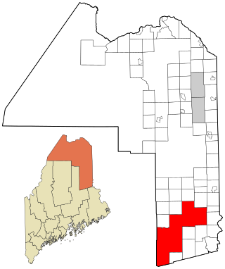
South Aroostook is an unorganized territory in Aroostook County, Maine, United States. The population was 579 at the 2020 census.

<span class="mw-page-title-main">Square Lake, Maine</span> Unorganized territory in Maine, United States

Square Lake is an unorganized territory in Aroostook County, Maine, United States. The population was 706 at the 2020 census.

<span class="mw-page-title-main">East Central Franklin, Maine</span> Unorganized territory in Maine, United States

East Central Franklin is an unorganized territory in Franklin County, Maine, United States. The population was 805 at the 2020 census.

Milton is an unorganized territory (township) in Oxford County, Maine, United States. The population was 150 at the 2020 census. The township was formerly a plantation that surrendered its organization in 1939.

North Oxford is an unorganized territory in Oxford County, Maine, United States. The population was 16 at the 2020 census.

East Central Penobscot is an unorganized territory in Penobscot County, Maine, United States. The population was 308 at the 2020 census.

Kingman is an unorganized territory (township) in Penobscot County, Maine, United States. The population was 137 at the 2020 census.

Prentiss is an unorganized territory (township) in Penobscot County, Maine, United States. The township was named for Henry Prentiss, an early landowner. The population was 169 at the 2020 census.

North Central Cass is an unorganized territory in Cass County, Minnesota, United States. The population was 24 at the 2000 census. It is part of the Brainerd Micropolitan Statistical Area.

Northwest Roseau is an unorganized territory in Roseau County, Minnesota, United States. The population was 18 at the 2000 census.

Birch Lake is an unorganized territory in Saint Louis County, Minnesota, United States, located north of Babbitt, and south of Ely and Morse Township. The population was 648 at the 2000 census.

Dark River is an unorganized territory in Saint Louis County, Minnesota, United States, located north of Chisholm and Balkan Township. The population was 68 at the 2000 census.

Heikkala Lake is an unorganized territory in Saint Louis County, Minnesota, United States. The population was 322 at the 2000 census.

Leander Lake is an unorganized territory in Saint Louis County, Minnesota, United States, located near Britt and Great Scott Township. The population was 119 at the 2000 census.

Linwood Lake is an unorganized territory in Saint Louis County, Minnesota, United States. The population was 54 at the 2000 census.

Mud Hen Lake is an unorganized territory in Saint Louis County, Minnesota, United States. The population was 320 at the 2000 census.

Northwest St. Louis is an unorganized territory in Saint Louis County, Minnesota, United States. The population was 306 at the 2000 census.

Tikander Lake is an unorganized territory in Saint Louis County, Minnesota, United States. The population was 783 at the 2000 census.

Effie is an unorganized territory in Itasca County, Minnesota, United States. The population was 203 at the 2010 census.

References

  1. "Unorganized Territory of South Oxford". Geographic Names Information System . United States Geological Survey, United States Department of the Interior . Retrieved 2020-07-07.
  2. "Census - Geography Profile: South Oxford UT, Oxford County, Maine" . Retrieved March 19, 2022.
  3. "Census of Population and Housing". Census.gov. Retrieved June 4, 2015.
  4. "U.S. Census website". United States Census Bureau . Retrieved 2008-01-31.