Appomattox County is a United States county located in the Piedmont region and near the center of the Commonwealth of Virginia. The county is part of the Lynchburg, VA Metropolitan Statistical Area, and its county seat is the town of Appomattox.
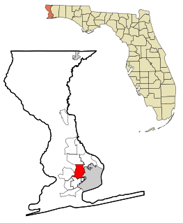
Brent is a census-designated place (CDP) in Escambia County, Florida, United States. The population was 21,804 at the 2010 census. It is a principal city of the Pensacola-Ferry Pass-Brent Metropolitan Statistical Area. The community is named after Francis Celestino Brent, who played an integral role in the development of Pensacola.
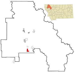
Lakeside is an unincorporated area and census-designated place (CDP) in Flathead County, Montana, United States. The population was 2,669 at the 2010 census, up from 1,679 in 2000.

Lower Allen is a census-designated place (CDP) in Lower Allen Township, Cumberland County, Pennsylvania, United States. The population was 6,694 at the 2010 census. It is part of the Harrisburg–Carlisle Metropolitan Statistical Area.

Madison Heights is a census-designated place (CDP) in Amherst County, Virginia, United States. The population was 11,285 at the 2010 census. It is part of the Lynchburg Metropolitan Statistical Area.

Bensley is a census-designated place (CDP) in Chesterfield County, Virginia, United States. It is an inner suburb of Richmond, Virginia. The population was 5,819 at the 2010 census. Bensley Community building is inside of Bensley park. The community building is outside of Bensley, setting in walking distance of the CDP. The community is an old village with no active government. The community is over 100 years old. A new police substation in the village is next to the old Bensley Bermuda Rescue Squad, near DuPont Spruance.

Chester is a census-designated place (CDP) in Chesterfield County, Virginia, United States. The population was 20,987 at the 2010 census.

Lincolnia is a census-designated place (CDP) in Fairfax County, Virginia, United States. The population was 22,828 at the 2010 census, an increase of over 44% from 2000.

Merrifield is a census-designated place (CDP) in Fairfax County, Virginia, United States. The population was 15,212 at the 2010 census.

Newington is a census-designated place (CDP) in Fairfax County, Virginia, United States. The population was 12,943 at the 2010 census. The 2010 census showed a significant decrease after half the population was split off to the newly created Newington Forest CDP.

North Springfield is a census-designated place (CDP) in Fairfax County, Virginia, United States. The population was 7,274 at the 2010 census.

Oakton is a census-designated place (CDP) in Fairfax County, Virginia, United States. The population was 34,166 at the 2010 census. Located in Northern Virginia, its center is 16 miles (26 km) west of Washington, D.C.

Lake Monticello, a private gated community, is a census-designated place (CDP) in Fluvanna County, Virginia, United States. The population was 9,920 at the 2010 census, an increase of over 44% from 2000. The community is centered on a lake of the same name, which is formed by a dam on a short tributary of the nearby Rivanna River. Lake Monticello is part of the Charlottesville Metropolitan Statistical Area. Lake Monticello was developed in the 1960s as a summer vacation home community but quickly evolved into a bedroom community of Charlottesville, and to a smaller extent of Richmond. It also has a sizable retirement age population.

Chamberlayne is a census-designated place (CDP) in Henrico County, Virginia, United States. The population was 5,456 at the 2010 census.

East Highland Park is a census-designated place (CDP) in Henrico County, Virginia, in the United States. The population was 14,796 at the 2010 census.
Lakeside is a census-designated place (CDP) in Henrico County, Virginia, United States. It is an inner suburb of Richmond, Virginia. The population was 11,849 at the 2010 census.

Laurel is a census-designated place (CDP) in Henrico County, Virginia. The population was 16,713 at the 2010 United States Census. It is the county seat of Henrico County.

Montrose is a census-designated place (CDP) in Henrico County, Virginia, United States. The population was 7,993 at the 2010 census.

Yorkshire is a census-designated place (CDP) in Prince William County, Virginia, United States. It is an annex of Manassas, Virginia. The population was 6,732 at the 2000 census.

Pamplin City is a town in Appomattox and Prince Edward counties in the U.S. state of Virginia. The population was 219 at the 2010 census.