
Jersey City is the second-most populous city in the U.S. state of New Jersey, after Newark. It is the county seat of Hudson County as well as the county's largest city. The 2020 United States census showed that the city's population was 292,449, ranking as the 71st-most-populous incorporated place in the nation. The 2020 census represents an increase of 18.1% from the 2010 United States Census, when the city's population stood at 247,597.
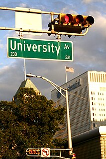
University Heights is a neighborhood in Newark in Essex County, New Jersey, United States. It is named because of the location of four academic institutions within its boundaries — Rutgers University, the New Jersey Institute of Technology (NJIT), the New Jersey Medical School (Rutgers), and Essex County College. In total, the schools enroll approximately 35,000 degree-seeking students.

Sursum Corda is a small neighborhood located in Washington, D.C., bounded by North Capitol Street on the east, K Street NW to the south, New Jersey Avenue NW to the west, and New York Avenue NW to the north.

Willets Point, also known locally as the Iron Triangle, is an industrial neighborhood within Corona, in the New York City borough of Queens. Located east of Citi Field near the Flushing River, it is known for its automobile shops and junkyards, and had a population of 10 people in 2011.

Newport is a 600-acre (2.4 km2) master-planned, mixed-use community in Downtown Jersey City, New Jersey, United States, consisting of retail, residential, office, and entertainment facilities. The neighborhood is situated on the Hudson Waterfront on what had been the yards of Erie Railroad's Pavonia Terminal, located opposite Lower Manhattan and the neighborhood of Tribeca in New York City. Redevelopment of the neighborhood began in 1986 as a $10 billion project led by real-estate tycoon Samuel J. LeFrak and his firm The LeFrak Organization.
Oakland City Center is an office, shopping and hotel complex in Downtown Oakland, Oakland, California. The complex is the product of a redevelopment project begun in the late 1950s. It covers twelve city blocks between Broadway on the east, Martin Luther King Jr. Way on the west, Frank H. Ogawa Plaza on 14th Street on the north side of the complex and the Oakland Convention Center and Marriott Hotel extend south to 10th Street. An hourly parking garage is located beneath the complex's shopping mall. The mall features an upscale fitness and racquet club, in addition to numerous take-out restaurants and other stores. The complex is served by the 12th Street/Oakland City Center BART station.

Greenville is the southernmost section of Jersey City in Hudson County, New Jersey, United States.
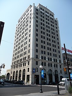
Journal Square is a business district, residential area, and transportation hub in Jersey City, New Jersey, which takes its name from the newspaper Jersey Journal whose headquarters were located there from 1911 to 2013. The "square" itself is at the intersection of Kennedy Boulevard and Bergen Avenue. The broader area extends to and includes Bergen Square, McGinley Square, India Square, the Five Corners and parts of the Marion Section. Many local, state, and federal agencies serving Hudson County maintain offices in the district.

The Boston Planning & Development Agency (BPDA), formerly the Boston Redevelopment Authority (BRA), is a Massachusetts public agency that serves as the municipal planning and development agency for Boston, working on both housing and commercial developments.

Navy Yard, also known as Near Southeast, is a neighborhood on the Anacostia River in Southeast Washington, D.C. Navy Yard is bounded by Interstate 695 to the north and east, South Capitol Street to the west, and the Anacostia River to the south. Approximately half of its area is occupied by the Washington Navy Yard, which gives the neighborhood its name. The neighborhood is located in D.C.'s Ward 6, currently represented by Charles Allen. It is served by the Navy Yard – Ballpark Metro station on the Green Line.

Bayfront is an urban redevelopment project in Jersey City, New Jersey.
Bergen-Lafayette is a section of Jersey City, New Jersey.

The Hilltop is the eastern section of the Journal Square district of Jersey City, New Jersey. The name is a reflection of its location atop Bergen Hill, the southern portion of the Hudson Palisades, on either side of the cut, or excavated ravine, through which the Port Authority Trans Hudson rapid transit system travels, offering some streets views of Downtown Jersey City, the New York Skyline, and the Upper New York Bay.
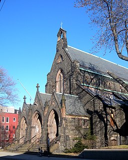
Bergen Hill the name given to the emergence of the Hudson Palisades along the Bergen Neck peninsula in Hudson County, New Jersey and the inland neighborhood of Jersey City where they rise from the coastal plain at the Upper New York Bay. The name is taken from the original 17th-century New Netherland settlement of Bergen, which in Dutch means hills.

The Bergen Section of Jersey City, New Jersey is the neighborhood on either side of Kennedy Boulevard between Saint Peter's College/ McGinley Square and Communipaw Avenue in the Bergen-Lafayette section of the city. The name Bergen, used throughout Hudson County, is taken from the original Bergen, New Netherland settlement at Bergen Square.

Downtown East Village more commonly known as simply East Village, is a mixed-use neighbourhood within the eastern portions of downtown Calgary, Alberta, Canada. It is contained within the city's Rivers District. Containing the earliest-settled land in the Calgary area - Fort Calgary - East Village was for years a mixture of high-rise residential, commercial, and industrial development. Much of the parkland currently surrounding Fort Calgary was industrial as recently as the 1960s. Construction of the city's light rail transit Blue Line, coupled with the closure of 8th Avenue at Macleod Trail in the early 1980s by construction of the massive Calgary Municipal Building, resulted in East Village being "cut off," figuratively speaking, from the rest of downtown. As a result, it became home to many rundown properties and vacant lots over the years, and a severe crime problem.

Weequahic is a neighborhood in the city of Newark in Essex County, New Jersey, United States. Part of the South Ward, it is separated from Clinton Hill by Hawthorne Avenue on the north, and bordered by the township of Irvington on the west, Newark Liberty International Airport and Dayton on the east, and Hillside Township and the city of Elizabeth on the south. There are many well maintained homes and streets. Part of the Weequahic neighborhood has been designated a historic district; major streets are Lyons Avenue, Bergen Street, and Chancellor Avenue.
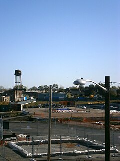
Canal Crossing is a New Urbanism project on the eastern side of Jersey City, New Jersey between Jackson Hill in Greenville/Bergen-Lafayette and Liberty State Park. The approximately 111 acre area, previously designated for industrial and distribution uses has been re-zoned for transit-oriented residential and commercial use and the construction of a neighborhood characterized as a sustainable community. The name is inspired by the Morris Canal, which once traversed the district in a general north and south alignment. The brownfield site must first undergo remediation of toxic waste, much of it left by PPG Industries The redevelopment plans call for 7,000 housing units, mainly "mid-rise" buildings, and a greenway along the former canal, directly south of the 17-acre Berry Lane Park.

Jackson Hill is a neighborhood in the Bergen-Lafayette and Greenville sections of Jersey City, New Jersey. It is part of the city's Ward F. The neighborhood is situated on Bergen Hill which also lends its name to the Bergen Hill Historic District just north of Communipaw Avenue.
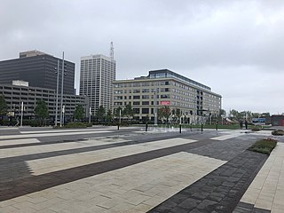
Mulberry Commons is a public park in Newark, New Jersey. It was first proposed in 2005 to be the centerpiece of 22-acre (8.9 ha) of the city's Downtown surrounded by Gateway Center, Newark Penn Station, Government Center and Prudential Center, a 19,000 seat arena which opened in 2007. The city had acquired the deed to the park land in conjunction with the construction of the arena, but the project had not been further developed.


