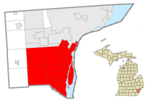
Melvindale, Michigan

Last updated
Melvindale, Michigan
City of Melvindale
Oakwood Blvd & Hanna St, Melvindale, Michigan (2014-02-23).jpg
Oakwood Boulevard and Hanna Street
Motto: 
The Little City with a Big Heart
Melvindale, MI location.png
Location within Wayne County
USA Michigan location map.svg
Red pog.svg
Melvindale
Location within the state of Michigan
Usa edcp location map.svg
Red pog.svg
Melvindale
Location within the United States
Coordinates: 42°16′54″N83°10′55″W / 42.28167°N 83.18194°W / 42.28167; -83.18194
Country Flag of the United States.svg United States
State Flag of Michigan.svg  Michigan
County Wayne
Incorporated1924 (village)
1933 (city)
Government
  Type Mayor–council
   Mayor Wheeler Marsee
Area
[1]
  Total2.75 sq mi (7.13 km2)
  Land2.73 sq mi (7.06 km2)
  Water0.02 sq mi (0.06 km2)
Elevation
587 ft (179 m)
Population
 (2020)
  Total12,851
  Density4,712.50/sq mi (1,819.58/km2)
Time zone UTC-5 (EST)
  Summer (DST) UTC-4 (EDT)
ZIP code(s)
48122
Area code 313
FIPS code 26-52940 [2]
GNIS feature ID0632086 [3]
Website melvindale.org

Melvindale is a city in Wayne County of the U.S. state of Michigan. At the 2020 census, the city population was 12,851. [4]

Contents

History

Melvindale began as the unincorporated settlement of Oakwood Heights in the northwestern part of Ecorse Township in the early 1920s. [5] The subdivision was designed to house workers from the nearby Ford River Rouge Plant in the city of Dearborn. The city was named after one of the original developers of the settlement, Melvin Wilkinson. [5] The eastern part of Oakwood Heights was annexed by the city of Detroit in 1922, and the remainder was incorporated as the village of Melvindale the same year. In 1933, the village incorporated as a city.

Geography

According to the United States Census Bureau, the city has a total area of 2.76 square miles (7.15 km2), of which 2.72 square miles (7.04 km2) is land and 0.04 square miles (0.10 km2) is water. [6]

Melvindale serves an important role for railroad traffic in Metro Detroit. The Norfolk Southern Railway Oakwood Yard, located along its Detroit District, divides the city into northwest and southeast sides. The Canadian National Railway Dearborn Subdivision serves as the city's western boundary, and the Conrail Shared Assets Lincoln Secondary, serving as a direct route between Detroit and Toledo, Ohio for CSX Transportation trains, passes through industrial areas in the far southeast corner of the city, which is also the location of the remnants of the Conrail Lincoln Yard.

Demographics

Historical population
CensusPop.Note
1930 4,053
1940 4,76417.5%
1950 9,48399.1%
1960 13,08938.0%
1970 13,8625.9%
1980 12,322−11.1%
1990 11,216−9.0%
2000 10,735−4.3%
2010 10,715−0.2%
2020 12,85119.9%
U.S. Decennial Census [7]

2020 census

As of the census [8] of 2020, there were 12,851 people living in Melvindale, this was an increase from the city's population of 10,715 in the 2010 census, and the first time since the 1970 census that the city's recorded population increased. The population density was 4,673.1 inhabitants per square mile (1,804.3/km2).

2010 census

As of the census [8] of 2010, there were 10,715 people, 4,420 households, and 2,601 families living in the city. The population density was 3,939.3 inhabitants per square mile (1,521.0/km2). There were 4,918 housing units at an average density of 1,808.1 per square mile (698.1/km2). The racial makeup of the city was 76.8% White (66.6% non-Hispanic white), 11.3% African American, 0.7% Native American, 0.8% Asian, 6.4% from other races, and 3.9% from two or more races. Hispanic or Latino of any race were 18.3% of the population.

There were 4,420 households, of which 31.2% had children under the age of 18 living with them, 34.4% were married couples living together, 17.9% had a female householder with no husband present, and 6.5% had a male householder with no wife present. 35.5% of all households were made up of individuals, and 11% had someone living alone who was 65 years of age or older. The average household size was 2.42 and the average family size was 3.17.

The median age in the city was 36.5 years. 24.7% of residents were under the age of 18; 9.8% were between the ages of 18 and 24; 27.2% were from 25 to 44; 26.6% were from 45 to 64; and 11.8% were 65 years of age or older. The gender makeup of the city was 48.1% male and 51.9% female.

2000 census

As of the census [2] of 2000, there were 10,735 people, 4,499 households, and 2,694 families living in the city. The population density was 3,876.9 inhabitants per square mile (1,496.9/km2). There were 4,760 housing units at an average density of 1,719.0 per square mile (663.7/km2). The racial makeup of the city was 87.40% White, 5.26% African American, 0.75% Native American, 1.29% Asian, 0.04% Pacific Islander, 2.39% from other races, and 2.88% from two or more races. Hispanic or Latino of any race were 8.90% of the population.

There were 4,499 households, out of which 28.6% had children under the age of 18 living with them, 39.6% were married couples living together, 14.8% had a female householder with no husband present, and 40.1% were non-families. 34.5% of all households were made up of individuals, and 12.7% had someone living alone who was 65 years of age or older. The average household size was 2.38 and the average family size was 3.07.

In the city, the population was spread out, with 24.4% under the age of 18, 9.0% from 18 to 24, 31.6% from 25 to 44, 21.5% from 45 to 64, and 13.5% who were 65 years of age or older. The median age was 36 years. For every 100 females, there were 96.1 males. For every 100 females age 18 and over, there were 94.5 males.

The median income for a household in the city was $37,954, and the median income for a family was $46,759. Males had a median income of $38,048 versus $28,026 for females. The per capita income for the city was $19,011. About 7.6% of families and 11.4% of the population were below the poverty line, including 13.3% of those under age 18 and 9.2% of those age 65 or over.

Education

Melvindale-Northern Allen Park Public Schools serves Melvindale. Melvindale High School is the district's high school.

In 2005 the Roman Catholic Archdiocese of Detroit announced that St. Mary Magdalen Elementary School in Melvindale would close. [9]

Notable people

Related Research Articles

<span class="mw-page-title-main">Baraga, Michigan</span> Village in Michigan, United States

Baraga is a village in Baraga County in the U.S. state of Michigan. The population was 1,883 at the 2020 census. The village is named after Bishop Frederic Baraga.

<span class="mw-page-title-main">Athens, Michigan</span> Village in Michigan, United States

Athens is a village in Calhoun County in the U.S. state of Michigan. The population was 936 at the 2020 census. The village is located in southern Athens Township, and is part of the Battle Creek, Michigan Metropolitan Statistical Area. It was settled in 1831.

<span class="mw-page-title-main">Jonesville, Michigan</span> City in Michigan, United States

Jonesville is a city in Hillsdale County in the U.S. state of Michigan. The population was 2,176 at the 2020 census.
<span class="mw-page-title-main">Elkton, Michigan</span> Village in Michigan, United States

Elkton is a village in Huron County in the U.S. state of Michigan. The population was 796 at the 2020 census. The village is within Oliver Township, along the Pinnebog River. It was incorporated in 1897.

<span class="mw-page-title-main">Luther, Michigan</span> Village in Michigan, United States

Luther is a village in Lake County in the U.S. state of Michigan. The population was 332 at the 2020 census. The village is on the boundary between Newkirk Township on the west and Ellsworth Township on the east, with about half of the village in each. It is the site of Hillsdale College's G.H. Gordon Biological Research Station.

<span class="mw-page-title-main">Detroit Beach, Michigan</span> Census-designated place in Michigan, United States

Detroit Beach is an unincorporated community and census-designated place (CDP) in Monroe County in the U.S. state of Michigan. The population was 1,957 at the 2020 census. The CDP is located within Frenchtown Charter Township, and as an unincorporated community, Detroit Beach has no legal autonomy of its own.
<span class="mw-page-title-main">Brandon Township, Michigan</span> Charter township in Michigan, United States

Brandon Charter Township is a charter township of Oakland County in the U.S. state of Michigan. The population was 15,384 at the 2020 census.

<span class="mw-page-title-main">Lake Angelus, Michigan</span> City in Michigan, United States

Lake Angelus is a city in Oakland County in the U.S. state of Michigan. An affluent northern suburb of Detroit, Lake Angelus is located about 35 miles (56 km) north of downtown Detroit. With a population of 287 as of the 2020 census, Lake Angelus is the second-smallest city in Michigan, behind Omer; it also has one of the highest per capita incomes of any community in the state.

<span class="mw-page-title-main">Ortonville, Michigan</span> Village in Michigan, United States

Ortonville is a village in north Oakland County in the U.S. state of Michigan. The village is within Brandon Township, although some development near the village lies within adjacent Oakland County, Groveland township and Lapeer County, Hadley township. The population was 1,291 as of the 2021 Census estimate. Ortonville lies on the northern edge of Metro Detroit and is approximately 41 miles north of Downtown Detroit.

<span class="mw-page-title-main">Pleasant Ridge, Michigan</span> City in Michigan, United States

Pleasant Ridge is a city in Oakland County in the U.S. state of Michigan. An inner-ring suburb of Detroit on the Woodward Corridor, Pleasant Ridge is located roughly 11 miles (17.7 km) northwest of downtown Detroit. As of the 2020 census, the city had a population of 2,627.

<span class="mw-page-title-main">Sylvan Lake, Michigan</span> City in Michigan, United States

Sylvan Lake is a city in Oakland County in the U.S. state of Michigan. A northern suburb of Detroit, Sylvan Lake is located roughly 26 miles (41.8 km) from downtown Detroit, and borders Pontiac to the east. As of the 2010 census, the city had a population of 1,720. With a land area of 0.51 square miles (1.32 km2), Sylvan Lake is the fourth-smallest city by land area in the state after Clarkston, Petersburg, and neighboring Keego Harbor.

<span class="mw-page-title-main">Clarkston, Michigan</span> City in Michigan, United States

Clarkston is a city in Oakland County, Michigan, United States. A northern suburb of Detroit, located about 34 mi (55 km) northwest of downtown Detroit, Clarkston is surrounded by Independence Township, but administered independently since its incorporation in 1992. At the 2020 census, the city had a population of 928. With a total land area of 0.44 square miles (1.14 km2), Clarkston is the smallest city by land area in the state of Michigan.

<span class="mw-page-title-main">Zilwaukee, Michigan</span> City in Michigan, United States

Zilwaukee is a city in Saginaw County in the U.S. state of Michigan. The 2020 census places the population at 1,534. The city is adjacent to and was created from Zilwaukee Township. It is the home of the Zilwaukee Bridge.

<span class="mw-page-title-main">Yale, Michigan</span> City in Michigan, United States

Yale is a city in St. Clair County in the U.S. state of Michigan. The population was 1,955 at the 2010 census. Yale is considered unofficially as the Bologna Capital of the world, in part due to its Yale Bologna Festival, which began in 1989. Yale bologna is sold in grocery stores throughout the area. Yale is also home to the Yale Airport which is just south of town on Brockway Rd.

<span class="mw-page-title-main">Bangor, Michigan</span> City in Michigan, United States

Bangor is a city in Van Buren County in the U.S. state of Michigan. The population was 1,885 at the 2010 census. The city is located in the northeast corner of Bangor Township, but is politically independent.

<span class="mw-page-title-main">Allen Park, Michigan</span> City in Michigan, United States

Allen Park is a city in Wayne County in the U.S. state of Michigan. As of the 2020 Census, the population was 28,638.
<span class="mw-page-title-main">River Rouge, Michigan</span> City in Michigan, United States

River Rouge is a city in Wayne County in the U.S. state of Michigan. The population was 7,224 at the 2020 census.

<span class="mw-page-title-main">Mesick, Michigan</span> Village in Michigan, United States

Mesick is a village in Wexford County in the U.S. state of Michigan. The population was 397 at the 2020 census. The majority of the village is located within Springville Township with a very small portion extending east into Antioch Township.
<span class="mw-page-title-main">Lincoln Park, Michigan</span> City in Michigan, United States

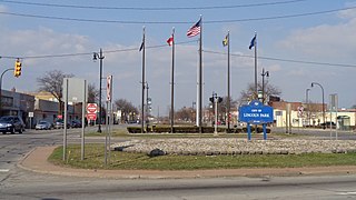
Lincoln Park is a city in Wayne County in the U.S. state of Michigan. The population was 38,144 at the 2010 census, down from 40,008 at the 2000 census. With a population density of 6,476.1/sq mi (2,500.4/km2) at the 2010 census, Lincoln Park is the second most-densely populated municipality in the state after Hamtramck.
<span class="mw-page-title-main">Prairie du Sac, Wisconsin</span> Village in Wisconsin, United States

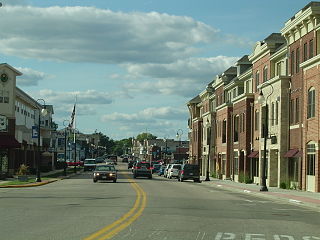
Prairie du Sac is a village in Sauk County, Wisconsin, United States. The population was 4,420 at the 2020 census. The village is surrounded by the Town of Prairie du Sac, the Wisconsin River, and the village of Sauk City; together, Prairie du Sac and Sauk City are referred to as Sauk Prairie.

References

  1. "2020 U.S. Gazetteer Files". United States Census Bureau. Retrieved May 21, 2022.
  2. 1 2 "U.S. Census website". United States Census Bureau . Retrieved 2008-01-31.
  3. "US Board on Geographic Names". United States Geological Survey. 2007-10-25. Retrieved 2008-01-31.
  4. "Race, Hispanic or Latino, Age, and Housing Occupancy: 2010 Census Redistricting Data (Public Law 94-171) Summary File (QT-PL), Melvindale city, Michigan". United States Census Bureau . Retrieved September 7, 2011.
  5. 1 2 City of Melvindale website, About Melvindale webpage, accessed 18 October 2011
  6. "US Gazetteer files 2010". United States Census Bureau. Archived from the original on 2012-07-02. Retrieved 2012-11-25.
  7. "Census of Population and Housing". Census.gov. Retrieved June 4, 2015.
  8. 1 2 "U.S. Census website". United States Census Bureau . Retrieved 2021-08-13.
  9. "15 Catholic Schools To Close In Metro Detroit Archived 2005-08-31 at the Wayback Machine ." WDIV-TV . March 17, 2005. Retrieved on November 4, 2011.