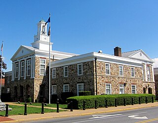
Darkesville is an unincorporated community in Berkeley County, West Virginia, United States. Established in 1791, Darkesville has been nationally recognized as a historic district.
Nellysford is a census-designated place (CDP) in Nelson County, Virginia, United States. The population as of the 2010 Census was 1,076. It is home to the Wintergreen golf course at Stoney Creek. Its zip code is 22958.

Camp Springs is an unincorporated community in Campbell County, Kentucky, United States, ten miles southeast of Cincinnati, Ohio. During the mid-19th century, the area was settled by German immigrants from the Rhine River wine districts.

Locust Dale is an unincorporated community in Madison County, Virginia, United States.
Madison Mills is an unincorporated community located in Madison County, Virginia, United States.
Wolftown is an unincorporated community located in Madison County, Virginia.

Gladstone is an unincorporated community in Nelson County, Virginia, United States.
Midway Mills is an unincorporated community in Nelson County, Virginia, United States. Midway, now called Midway Mills, was established on June 6, 1774, by Dr. William Cabell,, and was the first European settlement in Nelson County. It was named Midway because it was midway between Richmond and Lynchburg along the James River. The area, at that time part of "Old Albemarle County", was later divided into the counties of Albemarle, Amherst, Buckingham, Nelson, and Fluvanna between 1741 and 1809.
Shipman is a census-designated place (CDP) in Nelson County, Virginia, United States. The population as of the 2010 Census was 507.
Wintergreen is a census-designated place (CDP) in Augusta and Nelson counties, Virginia, United States, located near Wintergreen Resort. The population as of the 2010 Census was 165.

Dyke is an unincorporated community in Greene County, Virginia, United States.
Woodmont is an unincorporated community in Washington County, Maryland, United States. Western Maryland Railroad Right-of-Way, Milepost 126 to Milepost 160 was listed on the National Register of Historic Places in 1980.
Buffalo Springs is an unincorporated community in Mecklenburg County, Virginia. It lies at an elevation of 364 feet. Located at Buffalo Springs is the Buffalo Springs Historical Archeological District, listed on the National Register of Historic Places in 1998. The name, Buffalo Springs, specifically refers to a natural spring found in the area.
Hamburg is an unincorporated community in Page County in the U.S. state of Virginia.
Maurertown is a census-designated place (CDP) in Shenandoah County, Virginia, United States. The population as of the 2010 Census was 770.
Quicksburg is an unincorporated community in Shenandoah County, in the U.S. state of Virginia.
Deatonville is an unincorporated community located in Amelia County, in the U.S. state of Virginia.
Salem, Page County is an unincorporated community in Page County, in the U.S. state of Virginia.

Kents Store is an unincorporated community in Fluvanna County, in the U.S. state of Virginia.
New Hope is a census-designated place (CDP) in Augusta County, Virginia, United States. The population as of the 2010 Census was 797.