Warren County, Virginia

Last updated

Warren County
Warren County Courthouse cropped.JPG
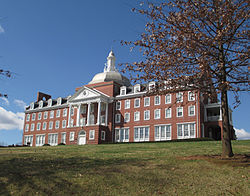
Warren County Courthouse in Front Royal, Virginia
Flag of Warren County, Virginia.png
Warren Seal Va.png
Logo of Warren County, Virginia.png
Map of Virginia highlighting Warren County.svg
Location within the U.S. state of Virginia
Virginia in United States.svg
Virginia's location within the U.S.
Coordinates: 38°55′N78°13′W / 38.91°N 78.21°W / 38.91; -78.21
CountryFlag of the United States.svg United States
StateFlag of Virginia.svg  Virginia
Founded1836
Named for Joseph Warren
Seat Front Royal
Largest townFront Royal
Area
  Total217 sq mi (560 km2)
  Land213 sq mi (550 km2)
  Water3.3 sq mi (9 km2)  1.5%
Population
 (2020)
  Total40,727
  Density190/sq mi (72/km2)
Time zone UTC−5 (Eastern)
  Summer (DST) UTC−4 (EDT)
Congressional district 6th
Website www.warrencountyva.net

Warren County is a U.S. county located in the Commonwealth of Virginia. The 2020 census places Warren County within the Washington-Arlington-Alexandria, DC-VA-MD-WV Metropolitan Statistical Area with a population of 40,727. [1] The county was established in 1836. The county seat is Front Royal. [2]

Contents

History

By 1672 the entire Shenandoah Valley was claimed for hunting by the Iroquois Confederation following the Beaver Wars. Some bands of the Shawnee settled in the area as client groups to the Iroquois and alternately to the Cherokee after 1721. The Iroquois formally sold their entire claim east of the Alleghenies to the Virginia Colony at the Treaty of Lancaster in 1744. [3] Warren County was established in 1836 from Frederick and Shenandoah counties. [4] :33 At that time the county had a population of 7,000 people, a quarter of which were enslaved. [4] :289 Wedding records show marriages of people born in the 1770s marrying in the 1800s who head households of four to eight "free colored" so the early demographics of the population are unclear. [5] :823–824 Joist Hite lead the Sixteen Families into the Lower Shenandoah Valley. [6] Some consider that group the first European settlers of the area, others believe different claims. [6] :ix Either way, Presbyterians of Scotch-Irish lineage and Quakers followed. [7]

Rail service was established in 1854 with the construction of the Alexandria, Orange and Manassas Gap Railroad between Manassas and Riverton. This line was soon extended to Strasburg in time to become a factor in the Battle of Front Royal on May 23, 1862, and throughout the Civil War. Lumber, agriculture, manufacturing and grain mills provided employment in the region for decades after the Civil War. The county is named for Joseph Warren. During the Civil War the Battle of Front Royal took place in the county on May 23, 1862. [8] :368 On September 23, 1864, William Thomas Overby and five others of then Lt. Col. John S. Mosby's 43rd Virginia Battalion of Partisan Rangers were captured by cavalry troops under the command of then Brig. Gen. George A. Custer in Front Royal out of uniform and were executed as spies. [9]

2019 Warren County Economic Development Authority Executive Director Jennifer McDonald Scandal

In 2017, questions were raised about the validity of an alleged $40 million economic development deal that had been brought to the community by Curt Tran, the owner of a company called IT Federal, over the redevelopment of the Avtex Superfund site. [10]

In 2018, Warren County Economic Development Authority executive director Jennifer McDonald was charged with filing false police reports about an alleged rock-throwing incident that she claimed had occurred at her home. [11]

In 2019, McDonald and other parties were embroiled in a massive financial scandal that some observers have characterized as the largest embezzlement scheme in the history of the state of Virginia. [12] The fraud scheme, which involved the alleged embezzlement of $21 million in county funds through fictitious development schemes and insider deals, was uncovered by the Virginia State Police Bureau of Criminal Investigation's Culpeper field office.

The Virginia State Police launched a probe into the business practices of McDonald in conjunction with the Front Royal Police Department and the Federal Bureau of Investigation. [12]

Sheriff McEathron, who had been indicted after it was revealed he was McDonald's business partner, committed suicide. [13]

Jennifer McDonald was charged with 32 felony counts for her role in the scheme. [14] 14 current and former municipal officials were indicted and faced criminal charges, including the entire Warren County board of supervisors as well as the former Warren County Attorney and the head of the Warren County schools division. [12] [15] These charges were later dropped as the judge ruled there was no basis for the allegations. [16]

Geography

Warren.svg
Warren
Warren and adjacent counties

According to the U.S. Census Bureau, the county has a total area of 217 square miles (560 km2), of which 213 square miles (550 km2) is land and 3.3 square miles (8.5 km2) (1.5%) is water. [17] The highest point is Hogback Mountain in Shenandoah National Park, along the border with Rappahannock County.

Adjacent counties

National protected areas

Demographics

Historical population
CensusPop.Note
1840 5,627
1850 6,60717.4%
1860 6,442−2.5%
1870 5,716−11.3%
1880 7,39929.4%
1890 8,28011.9%
1900 8,8376.7%
1910 8,589−2.8%
1920 8,8523.1%
1930 8,340−5.8%
1940 11,35236.1%
1950 14,80130.4%
1960 14,655−1.0%
1970 15,3014.4%
1980 21,20038.6%
1990 26,14223.3%
2000 31,58420.8%
2010 37,57519.0%
2020 40,7278.4%
U.S. Decennial Census [18]
1790–1960 [19] 1900–1990 [20]
1990–2000 [21] 2010 [22] 2020 [23]

2020 census

Warren County, Virginia - Demographic Profile
(NH = Non-Hispanic)
Race / EthnicityPop 2010 [22] Pop 2020 [23] % 2010% 2020
White alone (NH)33,34533,83188.74%83.07%
Black or African American alone (NH)1,7091,7224.55%4.23%
Native American or Alaska Native alone (NH)1031300.27%0.32%
Asian alone (NH)3504620.93%1.13%
Pacific Islander alone (NH)7130.02%0.03%
Some Other Race alone (NH)352550.09%0.63%
Mixed Race/Multi-Racial (NH)7081,9011.88%4.67%
Hispanic or Latino (any race)1,3182,4133.51%5.92%
Total37,57540,727100.00%100.00%

Note: the US Census treats Hispanic/Latino as an ethnic category. This table excludes Latinos from the racial categories and assigns them to a separate category. Hispanics/Latinos can be of any race.

2000 Census

As of the census [24] of 2000, there were 31,584 people, 12,087 households, and 8,521 families residing in the county. The population density was 148 inhabitants per square mile (57/km2). There were 13,299 housing units at an average density of 62 units per square mile (24 units/km2). The demographics of the county is (2000) 92.71% White, 4.83% Black or African American, 0.27% Native American, 0.43% Asian, 0.02% Pacific Islander, 0.46% from other races, and 1.29% from two or more races. 1.56% of the population were Hispanic or Latino of any race.

There were 12,087 households, out of which 32.80% had children under the age of 18 living with them, 55.60% were married couples living together, 10.00% had a female householder with no husband present, and 29.50% were non-families. 24.00% of all households were made up of individuals, and 8.80% had someone living alone who was 65 years of age or older. The average household size was 2.57 and the average family size was 3.04.

In the county, the population was spread out, with 25.60% under the age of 18, 7.60% from 18 to 24, 30.60% from 25 to 44, 23.90% from 45 to 64, and 12.30% who were 65 years of age or older. The median age was 37 years. For every 100 females, there were 96.70 males. For every 100 females aged 18 and over, there were 94.90 males.

The median income for a household in the county was $42,422, and the median income for a family was $50,487. Males had a median income of $37,182 versus $25,506 for females. The per capita income for the county was $19,841. About 6.00% of families and 8.50% of the population were below the poverty line, including 8.70% of those under age 18 and 10.40% of those age 65 or over.

Economy

For many years, Avtex Fibers (formerly known as the American Viscose Corporation from 1910 to 1976), was the county's largest employer and taxpayer. [25] At its height, it employed over 800 residents throughout Front Royal and Warren County.

Towards the late 1980s, however, the company's main plant in Front Royal was forced to close as a result of numerous environmental violations, which eventually resulted in the site being declared a Superfund site. [26] The county, reeling from the sudden loss of jobs and tax revenue, established the Warren County Economic Development Authority (WCEDA) to stimulate and diversify its economy as well as the economy of Town of Front Royal, its county seat. The purpose of the WCEDA is to foster and stimulate industry and economic development within Warren County and the town of Front Royal. [27]

Top employers

According to the county's comprehensive annual financial reports, the top employers by number of employees in the county are the following.

EmployerEmployees
(2021) [28]
Warren County School Board750–1,000
Family Dollar Services 250–499
Valley Health System–WMH250–499
Axalta Coating Systems (DuPont)250–499
Walmart 250–499
Warren County Government250–499
Sysco Northeast Redistribution 250–499
Randolph-Macon Academy 250–499
UPS Customer Center 250–499

Transportation

I-66 in Warren County 2018-10-18 13 08 15 View east along Interstate 66 from the overpass for Sulphur Springs Road (Virginia State Route 842) in Reliance, Warren County, Virginia.jpg
I-66 in Warren County

Major highways

Education

Sonner Hall at Randolph-Macon Academy Sonner Hall RMC 20150328.jpg
Sonner Hall at Randolph-Macon Academy

College

Public schools

  • Skyline High School (9–12)
  • Warren County High School (9–12)
  • Warren County Middle School [31] (6–8)
  • Skyline Middle School [32] (6–8)
  • A.S. Rhodes Elementary School [33] (K–5)
  • E. Wilson Morrison Elementary School [34] (K–5)
  • Hilda J. Barbour Elementary School [35] (PreK–5)
  • Leslie Fox Keyser Elementary School [36] (K–5)
  • Ressie Jefferies Elementary School [37] (K–5)

Preparatory school

Communities

Town

Census-designated places

Other unincorporated communities

Politics

Prior to 1952, the county was dominated by the Democratic Party like most counties in Virginia, but between then and 1976, it was a swing county. Since 1980, it has become consistently Republican.

United States presidential election results for Warren County, Virginia [38]
Year Republican Democratic Third party
No.%No.%No.%
2020 14,06966.53%6,60331.22%4752.25%
2016 11,77365.58%5,16928.80%1,0095.62%
2012 9,86959.10%6,45238.64%3772.26%
2008 8,87955.06%6,99743.39%2501.55%
2004 8,60061.13%5,24137.25%2271.61%
2000 6,33556.73%4,31338.63%5184.64%
1996 4,65748.25%3,81439.52%1,18112.24%
1992 4,31944.64%3,55436.73%1,80318.63%
1988 4,70061.86%2,76936.44%1291.70%
1984 5,01665.73%2,55133.43%640.84%
1980 3,86155.79%2,59737.53%4626.68%
1976 2,98545.80%3,22149.42%3114.77%
1972 3,71869.40%1,50828.15%1312.45%
1968 2,29743.37%1,51328.57%1,48628.06%
1964 1,88642.96%2,49456.81%100.23%
1960 1,84249.52%1,85049.73%280.75%
1956 2,00358.83%1,32238.83%802.35%
1952 1,88857.90%1,36241.77%110.34%
1948 1,01640.92%1,29151.99%1767.09%
1944 76142.32%1,03457.51%30.17%
1940 49126.79%1,33873.00%40.22%
1936 42626.56%1,17473.19%40.25%
1932 36724.93%1,09674.46%90.61%
1928 56444.27%71055.73%00.00%
1924 15016.89%69978.72%394.39%
1920 29328.34%72069.63%212.03%
1916 21426.52%58372.24%101.24%
1912 12216.49%57177.16%476.35%

Notable people

See also

Related Research Articles

<span class="mw-page-title-main">Frederick County, Virginia</span> County in Virginia, United States

Frederick County is located in the Commonwealth of Virginia. As of the 2020 census, the population was 91,419. Its county seat is Winchester. The county was formed in 1743 by the splitting of Orange County. It is Virginia's northernmost county. Frederick County is included in the Winchester, VA-WV Metropolitan Statistical Area, which is also included in the Washington-Baltimore-Northern Virginia, DC-MD-VA-WV-PA Combined Statistical Area.

<span class="mw-page-title-main">Waynesboro, Virginia</span> Independent city in Virginia, United States

Waynesboro is an independent city in the Commonwealth of Virginia. It is a principal city of the Staunton-Waynesboro Metropolitan Statistical Area. Waynesboro is located in the Shenandoah Valley and is surrounded by Augusta County. As of the 2020 census, the population was 22,196.

<span class="mw-page-title-main">Shenandoah County, Virginia</span> County in Virginia, United States

Shenandoah County is a county located in the Commonwealth of Virginia. As of the 2020 United States Census, the population was 44,186. Its county seat is Woodstock. It is part of the Shenandoah Valley region of Virginia.

<span class="mw-page-title-main">Rockingham County, Virginia</span> County in Virginia, United States

Rockingham County is a county located in the U.S. state of Virginia. As of the 2020 census, the population was 83,757. Its county seat is the independent city of Harrisonburg.

<span class="mw-page-title-main">Richmond County, Virginia</span> County in Virginia, United States

Richmond County is a county located on the Northern Neck in the U.S. state of Virginia. As of the 2020 census, the population sits at 8,923. Its county seat is Warsaw. The rural county should not be confused with the large city and state capital Richmond, Virginia. It was formed in 1692 when the first Rappahannock County was divided to form Richmond County and Essex County.

<span class="mw-page-title-main">Rappahannock County, Virginia</span> County in Virginia, United States

Rappahannock County is a county located in the northern Piedmont region of the Commonwealth of Virginia, US, adjacent to Shenandoah National Park. As of the 2020 Census, the population was 7,348. Its county seat is Washington. The name "Rappahannock" comes from the Algonquian word lappihanne, meaning "river of quick, rising water" or "where the tide ebbs and flows." The county is included in the Washington-Arlington-Alexandria, DC-VA-MD-WV Metropolitan Statistical Area.

<span class="mw-page-title-main">Pulaski County, Virginia</span> County in Virginia, United States

Pulaski County is a county located in the southwestern part of the U.S. state of Virginia. As of the 2020 census, the population was 33,800. Its county seat is Pulaski. Pulaski County is part of the Blacksburg–Christiansburg, VA Metropolitan Statistical Area.

<span class="mw-page-title-main">Page County, Virginia</span> County in Virginia, United States

Page County is located in the Commonwealth of Virginia. As of the 2020 census, the population was 23,709. Its county seat is Luray. Page County was formed in 1831 from Shenandoah and Rockingham counties and was named for John Page, Governor of Virginia from 1802 to 1805.

<span class="mw-page-title-main">Northumberland County, Virginia</span> County in Virginia, United States

Northumberland County is a county located in the Commonwealth of Virginia. At the 2020 census, the population was 11,839. Its county seat is Heathsville. The county is located on the Northern Neck and is part of the Northern Neck George Washington Birthplace AVA winemaking appellation.

<span class="mw-page-title-main">Middlesex County, Virginia</span> County in Virginia, United States

Middlesex County is a county located on the Middle Peninsula in the U.S. state of Virginia. As of the 2020 census, the population was 10,625. Its county seat is Saluda.

<span class="mw-page-title-main">Madison County, Virginia</span> County in Virginia, United States

Madison County is a county located in the Commonwealth of Virginia. As of the 2020 census, the population was 13,837. Its county seat is Madison.

<span class="mw-page-title-main">King George County, Virginia</span> County in Virginia, United States

King George County is a county located in the Commonwealth of Virginia. As of the 2020 census, the population sits at 26,723. Its county seat is the town of King George.

<span class="mw-page-title-main">Fauquier County, Virginia</span> County in Virginia, United States

Fauquier County is a county in the Commonwealth of Virginia. As of the 2020 census, the population was 72,972. The county seat is Warrenton.

<span class="mw-page-title-main">Essex County, Virginia</span> County in Virginia, United States

Essex County is a county located in the Middle Peninsula in the U.S. state of Virginia; the peninsula is bordered by the Rappahannock River on the north and King and Queen County on the south. As of the 2020 census, the population was 10,599. Its county seat is Tappahannock.

<span class="mw-page-title-main">Culpeper County, Virginia</span> County in Virginia, United States

Culpeper County is a county located along the borderlands of the northern and central region of the Commonwealth of Virginia. As of the 2020 United States Census, the population was 52,552. Its county seat and only incorporated community is Culpeper.

<span class="mw-page-title-main">Middletown, Virginia</span> Town in Virginia, United States

Middletown is a town in Frederick County, Virginia, United States, in the northern Shenandoah Valley. The population was 1,265 at the 2010 census, up from 1,015 at the 2000 census.

<span class="mw-page-title-main">New Market, Virginia</span> Town in Virginia, United States

New Market is a town in Shenandoah County, Virginia, United States. Founded as a small crossroads trading town in the Shenandoah Valley, it has a population of 2,155 as of the most recent 2020 U.S. census. The north–south U.S. 11 and the east–west U.S. 211 pass near it and cross Massanutten Mountain at the town's titular gap.

<span class="mw-page-title-main">Front Royal, Virginia</span> Town in Virginia, United States

Front Royal is the only incorporated town in Warren County, Virginia, United States. The population was 15,011 at the 2020 census. It is the county seat of Warren County.

<span class="mw-page-title-main">Bolivar, West Virginia</span> Town in West Virginia, United States

Bolivar is a town in Jefferson County, West Virginia, United States. The population was 1,072 at the 2020 census. The town is named for South American revolutionary leader Simón Bolívar. Located in West Virginia's Eastern Panhandle, it is part of the northwestern fringes of the Washington metropolitan area.

<span class="mw-page-title-main">Charles Town, West Virginia</span> City in West Virginia, United States

Charles Town is a city in and the county seat of Jefferson County, West Virginia, United States. The population was 6,534 at the 2020 census. The city is named for its founder Charles Washington, youngest brother of President George Washington. It is part of the northwestern fringes of the Washington metropolitan area.

References

  1. "Warren County, Virginia". United States Census Bureau . Retrieved January 30, 2022.
  2. "Find a County". National Association of Counties. Retrieved June 7, 2011.
  3. Hofstra, Warren (2005). The Planting of New Virginia: Settlement and Landscape in the Shenandoah Valley. Baltimore, MD: The Johns Hopkins University Press. pp. 10–12. ISBN   0801882710.
  4. 1 2 Wayland, John Walter (1969). A History of Shenandoah County, Virginia. Genealogical. p. 894.
  5. Heinegg, Paul (2005). Free African Americans of North Carolina, Virginia, and South Carolina from the Colonial Period to about 1820, Volume 2. Genealogical.
  6. 1 2 Kemp Cartmell, Thomas (1909). Shenandoah Valley Pioneers and Their Descendants: A History of Frederick County, Virginia (illustrated) from Its Formation in 1738 to 1908. Eddy. p. 587.
  7. Presbyterians:
    Kemp Cartmell, Thomas (1909). Shenandoah Valley Pioneers and Their Descendants: A History of Frederick County, Virginia (illustrated) from Its Formation in 1738 to 1908. Eddy. p. 587.:ix
    Quakers:
    Kretzschmar, William A. (September 15, 1993). Handbook of the Linguistic Atlas of the Middle and South Atlantic States. University of Chicago Press. p. 454.:334
  8. Forman, Sam (November 21, 2011). Dr. Joseph Warren: The Boston Tea Party, Bunker Hill, and the Birth of American Liberty. Pelican. p. 400.
  9. Executions:
    Simson, Jay W. (November 11, 2008). Custer and the Front Royal Executions of 1864. McFarland. p. 211.:1
    Boyle, William E. (Spring 1994). "Under the Black Flag: Execution and Retaliation in Mosby's Confederacy". Military Law Review. 144.:155
  10. Casey, Dan. "CASEY: Scandals rock northern Shenandoah Valley town", The Roanoke Times , Virginia, April 27, 2019.
  11. Gully, Josh. "EDA Director Charged With Filing False Police Reports"
  12. 1 2 3 McCaslin, John (September 24, 2019). "Warren County's top officials indicted in Front Royal embezzlement scam". The Rappahannock News. online. Retrieved September 26, 2019.
  13. Bria Llyod. ", Local DVM , May 28, 2019.
  14. Gully, Josh. ", Northern Virginia Daily , Virginia, October 28, 2019.
  15. Olivo, Antonio (September 24, 2019). "Millions of dollars are missing. The sheriff is dead. A small Virginia town wants answers". The Washington Post. Internet. Retrieved September 26, 2019.
  16. Carey, Julie. NBC4 Washington , Virginia, October 28, 2019.
  17. "US Gazetteer files: 2010, 2000, and 1990". United States Census Bureau. February 12, 2011. Retrieved April 23, 2011.
  18. "Census of Population and Housing from 1790-2000". US Census Bureau . Retrieved January 24, 2022.
  19. "Historical Census Browser". University of Virginia Library. Retrieved January 5, 2014.
  20. "Population of Counties by Decennial Census: 1900 to 1990". United States Census Bureau. Retrieved January 5, 2014.
  21. "Census 2000 PHC-T-4. Ranking Tables for Counties: 1990 and 2000" (PDF). United States Census Bureau. Archived (PDF) from the original on March 27, 2010. Retrieved January 5, 2014.
  22. 1 2 "P2 HISPANIC OR LATINO, AND NOT HISPANIC OR LATINO BY RACE - 2010: DEC Redistricting Data (PL 94-171) - Warren County, Virginia". United States Census Bureau .
  23. 1 2 "P2 HISPANIC OR LATINO, AND NOT HISPANIC OR LATINO BY RACE - 2020: DEC Redistricting Data (PL 94-171) - Warren County, Virginia". United States Census Bureau .
  24. "U.S. Census website". United States Census Bureau . Retrieved May 14, 2011.
  25. "Board Of Supervisors Reacts To EDA Allegations". County of Warren website. Warren County Board of Supervisors. Retrieved November 26, 2019.
  26. Ayres, B. Drummond Jr. (November 21, 1989). "Jobs Are Lost in Plant Shutdown, but So Is Foul-Smelling Air". The New York Times. Retrieved January 14, 2017.
  27. "Bylaws of the Industrial Development Authority of the Town of Front Royal and the County of Warren, Virginia" (PDF). WCEDA.com. Warren County Economic Development Agency. December 20, 1994. Archived (PDF) from the original on October 9, 2022. Retrieved September 26, 2019.
  28. "County of Warren, Virginia, Annual Comprehensive Financial Report, for the Year Ended June 30, 2021" (PDF). Government of Warren County, Virginia. April 22, 2022. p. Table 15. Archived from the original (PDF) on September 24, 2022.
  29. "Front Royal Area Transit". Archived from the original on October 9, 2007. Retrieved February 17, 2017.
  30. Page County Transit Archived January 13, 2009, at the Wayback Machine
  31. "Welcome to Warren County Middle School" . Retrieved February 17, 2017.
  32. "Home - Skyline Middle School".
  33. "Welcome to A.S. Rhodes Elementary" . Retrieved February 17, 2017.
  34. "Welcome to E. Wilson Morrison Elementary" . Retrieved February 17, 2017.
  35. "Welcome to Hilda J. Barbour Elementary" . Retrieved February 17, 2017.
  36. "Welcome to Leslie Fox Keyser Elementary" . Retrieved February 17, 2017.
  37. "Welcome to Ressie Jeffries Elementary". Archived from the original on October 9, 2006. Retrieved February 17, 2017.
  38. Leip, David. "Dave Leip's Atlas of U.S. Presidential Elections". uselectionatlas.org. Retrieved December 8, 2020.
  39. Genealogical and Memorial Encyclopedia of the State of Maryland: A Record of the Achievements of Her People in the Making of a Commonwealth and the Founding of a Nation, Volume 2. American Historical Society, Inc. 1919. pp. 439–442.
  40. Richardson, Robert (1870). Memoirs of Alexander Campbell: Embracing a View of the Origin, Progress and Principles of the Religious Reformation which He Advocated. J.B. Lippincott & Company. p.  376 . Retrieved May 14, 2018.

38°55′N78°13′W / 38.91°N 78.21°W / 38.91; -78.21