
West Virginia is a state in the Southern United States. It is bordered by Pennsylvania to the north and east, Maryland to the east and northeast, Virginia to the southeast, Kentucky to the southwest, and Ohio to the northwest. West Virginia is the 10th-smallest state by area and ranks as the 12th-least populous state, with a population of 1,793,716 residents. The capital and largest city is Charleston which has a population of 49,055.
Hamilton County is a county in the U.S. state of New York. As of the 2020 census, the population was 5,107, making it the least populous county in New York. With an area nearly the size of Delaware, it is the least densely populated county east of the Mississippi River. Its county seat is Lake Pleasant. The county was created in 1816 and organized in 1847.

San Bernardino County, officially the County of San Bernardino, is a county located in the southern portion of the U.S. state of California, and is located within the Inland Empire area. As of the 2020 U.S. Census, the population was 2,181,654, making it the fifth-most populous county in California and the 14th-most populous in the United States. The county seat is San Bernardino.

Mono County is a county located in the east central portion of the U.S. state of California. As of the 2020 census, the population was 13,195, making it the fourth-least populous county in California. The county seat is Bridgeport. The county is located east of the Sierra Nevada between Yosemite National Park and Nevada. The only incorporated town in the county is Mammoth Lakes, which is located at the foot of Mammoth Mountain. Other locations, such as June Lake, are also famous as skiing and fishing resorts. Located in the middle of the county is Mono Lake, a vital habitat for millions of migratory and nesting birds. The lake is located in a wild natural setting, with pinnacles of tufa arising out of the salty and alkaline lake. Also located in Mono County is Bodie, the official state gold rush ghost town, which is now a California State Historic Park.
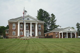
Mineral County is a county in the U.S. state of West Virginia. It is part of the Cumberland, MD-WV Metropolitan Statistical Area. As of the 2020 census, the population was 26,938. Its county seat is Keyser. The county was founded in 1866.

Giles County is a county located in the U.S. state of Virginia on the West Virginia state line. As of the 2020 census, the population was 16,787. Its county seat is Pearisburg.

Cumberland County is a county located in the Commonwealth of Virginia, United States. As of the 2020 census, the population was 9,675. Its county seat is Cumberland.

Johnson County is a county located in the U.S. state of Tennessee. As of the 2020 census, the population was 17,948. Its county seat is Mountain City. It is the state's northeasternmost county, sharing borders with Virginia and North Carolina.

Campbell County is a county in the U.S. state of Tennessee. It is located on the state's northern border in East Tennessee. As of the 2020 census, its population was 39,272. Its county seat is Jacksboro. Campbell County is included in the Knoxville metropolitan statistical area.
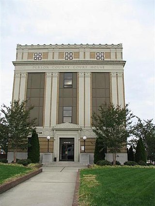
Person County is a county located in the U.S. state of North Carolina. The population was 39,097 as of the 2020 census. The county seat is Roxboro.

Catawba County is a county in the U.S. state of North Carolina. As of the 2020 census, the population was 160,610. Its county seat is Newton, and its largest city is Hickory.

Haymarket is a town in Prince William County, Virginia, United States. The population was 1,552 as of the 2020 census.

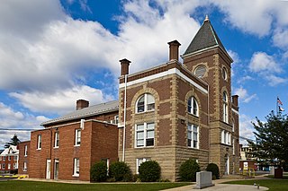
Pulaski is a town in Pulaski County, Virginia, United States. The population was 9,086 at the 2010 census. It is the county seat of Pulaski County.

Western Maryland, also known as the Maryland Panhandle, is the portion of the U.S. state of Maryland that typically consists of Washington, Allegany, and Garrett counties. The region is bounded by Preston County, West Virginia, to the west, the Mason–Dixon line (Pennsylvania) to the north, and the Potomac River and West Virginia to the south. At one point, at the town of Hancock, the northern and southern boundaries are separated by just 1.8 miles, the narrowest stretch in the state.

The United States census of 1800 was the second census conducted in the United States. It was conducted on August 4, 1800. It showed that 5,308,483 people were living in the United States, of whom 893,602 were enslaved. The 1800 census included the new District of Columbia. The census for the following states were lost: Georgia, Kentucky, New Jersey, Tennessee, and Virginia.

Concord is a census-designated place (CDP) in Appomattox and Campbell counties in the U.S. state of Virginia. The population as of the 2010 census was 1,458.

Bull Run Mountain Estates is a census-designated place in Prince William County, Virginia. The population as of the 2010 Census was 1,261. It is located along the east slope of the Bull Run Mountains, between Haymarket and Aldie.

Piney Mountain is a census-designated place in Albemarle County, Virginia. The population as of the 2010 Census was 1,130.
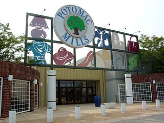
Potomac Mills is a census-designated place in Prince William County, Virginia. The population as of the 2010 Census was 5,614. It consists of the Potomac Mills mall and surrounding residential and commercial area, adjoining Dale City and Lake Ridge.


