Misquamicut, Rhode Island

Last updated

Misquamicut, Rhode Island
Andrea Hotel, facing the beach, Misquamicut, R.I (62874).jpg
Andrea Hotel, c.1930s
USA Rhode Island location map.svg
Red pog.svg
Misquamicut, Rhode Island
Location in the state of Rhode Island
Usa edcp location map.svg
Red pog.svg
Misquamicut, Rhode Island
Misquamicut, Rhode Island (the United States)
Coordinates: 41°19′26″N71°49′19″W / 41.32389°N 71.82194°W / 41.32389; -71.82194
CountryUnited States
State Rhode Island
County Washington
Area
[1]
  Total1.25 sq mi (3.23 km2)
  Land1.17 sq mi (3.04 km2)
  Water0.07 sq mi (0.19 km2)
Elevation
3 ft (1 m)
Population
 (2020) [2]
  Total434
  Density369.99/sq mi (142.89/km2)
Time zone UTC-5 (Eastern (EST))
  Summer (DST) UTC-4 (EDT)
ZIP code
02891
Area code 401
FIPS code 44-46000 [3]
GNIS feature ID1217591 [4]

Misquamicut is a census-designated place and fire district in southern Washington County, Rhode Island. It is part of the town of Westerly. [5] The population was listed as 390 in 2010. [6]

Contents

Name

Misquamicut is a Narragansett word meaning "Red Fish Place" or "Salmon Place". [7]

History

The district was once known as Pleasant View. The land was purchased from Chief Sosoa of the Montauks in 1661. The name was changed from Pleasant View to Misquamicut in 1928. The area suffered a series of devastating hurricanes that wiped out beach homes, hotels, and other structures in 1938, 1944, and 1954. A portion of the oceanfront became Misquamicut State Beach in 1959. [8]

1940s postcard Atlantic Beach Amusement Center at night, Atlantic Beach, R.I (87483).jpg
1940s postcard

Atlantic Beach Park is a privately operated amusement center with 12 acres (49,000 m2) of land and buildings within the Misquamicut section of beachfront. [9] [10] [11] It lies south of Misquamicut State Beach [12] and north of Winnapaug Pond, a source of Rhode Island quahogs and bay scallops.

This section of Misquamicut was originally called "Atlantic Beach Casino". [13] It retains a carousel with antique band organ, [14] [15] rides, bumper cars, a game room, and an ice cream stand. [16] More recently, miniature golf, go-carts, a batting cage, water slides, and a gift shop have been added. [17]

Geography

According to the U.S. Census Bureau, Misquamicut has a total area of 1.25 mi2 (3.23 km2), of which 1.17 mi2 (3.04 km2) is land and 0.075 mi2 (0.19 km2), or 6.0%, is water. [18]

Demographics

Historical population
CensusPop.Note
2010 390
2020 43411.3%
U.S. Decennial Census [19]

2020 census

The 2020 United States census counted 434 people, 254 households, and 120 families in Misquamicut. The population density was 370.0 per square mile (142.9/km2). There were 869 housing units at an average density of 740.8 per square mile (286.0/km2). [20] [21] The racial makeup was 96.54% (419) white or European American (96.31% non-Hispanic white), 0.0% (0) black or African-American, 0.69% (3) Native American or Alaska Native, 0.46% (2) Asian, 0.0% (0) Pacific Islander or Native Hawaiian, 0.23% (1) from other races, and 2.07% (9) from two or more races. [22] Hispanic or Latino of any race was 1.15% (5) of the population. [23]

Of the 254 households, 10.6% had children under the age of 18; 40.6% were married couples living together; 28.3% had a female householder with no spouse or partner present. 47.2% of households consisted of individuals and 24.8% had someone living alone who was 65 years of age or older. [20] The average household size was 1.8 and the average family size was 2.2. [24] The percent of those with a bachelor’s degree or higher was estimated to be 44.2% of the population. [25]

6.0% of the population was under the age of 18, 2.5% from 18 to 24, 11.3% from 25 to 44, 35.3% from 45 to 64, and 44.9% who were 65 years of age or older. The median age was 63.7 years. For every 100 females, the population had 109.7 males. [20] For every 100 females ages 18 and older, there were 107.1 males. [20]

The 2016-2020 5-year American Community Survey estimates show that the median household income was $74,375 (with a margin of error of +/- $47,378) and the median family income was $118,214 (+/- $26,394). Females had a median income of $45,536 (+/- $27,563). [26] The median income for those above 16 years old was $47,500 (+/- $32,404). [27] Approximately, 10.0% of families and 8.2% of the population were below the poverty line, including 53.8% of those under the age of 18 and 0.0% of those ages 65 or over. [28] [29]

The ancestry was 36% Italian, 23.6% Irish, 20.9% English, 10.6% German, 4.7% Polish, 3.4% French, and 2.2% Scottish. [20]

Related Research Articles

<span class="mw-page-title-main">Warwick, Rhode Island</span> City in Rhode Island, United States

Warwick is a city in Kent County, Rhode Island, United States, and is the third largest city in the state with a population of 82,823 at the 2020 census. Warwick is located approximately 12 miles (19 km) south of downtown Providence, Rhode Island, 63 miles (101 km) southwest of Boston, Massachusetts, and 171 miles (275 km) northeast of New York City.

<span class="mw-page-title-main">Melville, Rhode Island</span> CDP in Rhode Island, United States

Melville is a census-designated place (CDP) in the towns of Middletown and Portsmouth in Newport County, Rhode Island, United States. It lies along the shore of Narragansett Bay. The population of the CDP was 1,320 at the 2010 census. The CDP is named after Admiral George Wallace Melville. Past names for the area include Portsmouth Grove and Bradford.

<span class="mw-page-title-main">Newport East, Rhode Island</span> CDP in Rhode Island, United States

Newport East is a census-designated place (CDP) in the town of Middletown, Newport County, Rhode Island, United States. The CDP encompasses the portion of the urban area of the city of Newport that extends beyond the municipal boundaries. The population of the CDP was 11,769 at the 2010 census.

<span class="mw-page-title-main">Cumberland Hill, Rhode Island</span> Census-designated place in Rhode Island, United States

Cumberland Hill is a census-designated place (CDP) in the town of Cumberland, in Providence County, Rhode Island, United States. The population was 7,934 at the 2010 census.

<span class="mw-page-title-main">Greenville, Rhode Island</span> Census-designated place in Rhode Island, United States

Greenville is a village and census-designated place (CDP) in the town of Smithfield in Providence County, Rhode Island, United States. The population was 8,658 at the 2010 census. The CDP is centered on the village of Greenville but also encompasses the nearby villages of West Greenville and Spragueville, as well as the Mountaindale Reservoir and beach.

<span class="mw-page-title-main">Harrisville, Rhode Island</span> Census-designated place in Rhode Island, United States

Harrisville is a census-designated place (CDP) and village in the town of Burrillville in Providence County, Rhode Island, United States. The population was 1,605 at the 2010 census. Much of the community composes a historic district listed on the National Register of Historic Places. The village was named after nineteenth century manufacturer Andrew Harris. Previously, the village was named Rhodesville, after Captain William Rhodes, an eighteenth century privateer.

<span class="mw-page-title-main">Valley Falls, Rhode Island</span> Village and census-designated place in Rhode Island, US

Valley Falls is a village and census-designated place (CDP) in the town of Cumberland, Providence County, Rhode Island, United States. The population was 12,094 at the 2020 census.

<span class="mw-page-title-main">Ashaway, Rhode Island</span> Village and CDP in Hopkinton, Rhode Island, US

Ashaway is an unincorporated village and census-designated place (CDP) in the town of Hopkinton, Rhode Island, USA. It is a principal village of Hopkinton, along with Hope Valley, although it is the smaller of the two. The population was 1,485 at the 2010 census. The name Ashaway is derived from the American Indian name for the river that runs through the village, the Ashawague or Ashawaug, which means "land in the middle" or "land between" in the Niantic and Mohegan languages. The name "Ashawague River" appears as late as 1832 on the Findley map of Rhode Island published in Philadelphia.

<span class="mw-page-title-main">Bradford, Rhode Island</span> CDP in Rhode Island, United States

Bradford is a census-designated place (CDP) and historic district in the towns of Westerly and Hopkinton in Washington County, Rhode Island, United States. The population was 1,406 at the 2010 census. The Bradford Village Historic District was listed on the National Register of Historic Places in 1996 as a 224-acre (91 ha) area including 149 contributing buildings, one other contributing site, and one other contributing structure. The CDP as defined by the United States Census Bureau is located only in Westerly.

<span class="mw-page-title-main">Hope Valley, Rhode Island</span> Census-designated place in Rhode Island, United States

Hope Valley is a village and census-designated place (CDP) in the town of Hopkinton, Rhode Island, United States. The population of the CDP was 1,612 at the 2010 census. Hope Valley is the largest village in Hopkinton, and the town's principal commercial center. While the village of Hope Valley is located in Hopkinton, its ZIP Code, 02832, extends into the neighboring town of Richmond.

<span class="mw-page-title-main">Narragansett, Rhode Island</span> Town in Rhode Island, United States

Narragansett is a town in Washington County, Rhode Island, United States. The population was 14,532 at the 2020 census. However, during the summer months the town's population more than doubles to near 34,000. The town of Narragansett occupies a narrow strip of land running along the eastern bank of the Pettaquamscutt River to the shore of Narragansett Bay. It was separated from South Kingstown in 1888 and incorporated as a town in 1901.

<span class="mw-page-title-main">Narragansett Pier, Rhode Island</span> CDP in Rhode Island, United States

Narragansett Pier is an unincorporated village and a census-designated place (CDP) in the town of Narragansett in Washington County, Rhode Island, United States. The population was 3,409 at the 2010 census.

<span class="mw-page-title-main">Wakefield-Peacedale, Rhode Island</span> CDP in Rhode Island, United States

Wakefield-Peacedale is a census-designated place (CDP) in the town of South Kingstown in Washington County, Rhode Island, United States that includes the villages of Peace Dale and Wakefield. The population was 8,487 at the 2010 census.

<span class="mw-page-title-main">Westerly (CDP), Rhode Island</span> CDP in Rhode Island, United States

Westerly is a census-designated place (CDP) in the town of Westerly in Washington County, Rhode Island, United States. The population was 17,682 at the 2000 census. The CDP includes the majority of the town of Westerly's population, with only the rural eastern and coastal southern portions of towns excluded.

<span class="mw-page-title-main">Westerly, Rhode Island</span> Town in Rhode Island

Westerly is a town on the southwestern coastline of Washington County, Rhode Island, United States, first settled by English colonists in 1661 and incorporated as a municipality in 1669. It is a beachfront community on the south shore of the state with a population of 23,359 as of the 2020 census.

<span class="mw-page-title-main">Kingston, Rhode Island</span> Census-designated place in Rhode Island, United States

Kingston is a village and a census-designated place within the town of South Kingstown in Washington County, Rhode Island, United States, and the site of the main campus of the University of Rhode Island. The population was 6,974 at the 2010 census. Much of the village center is listed on the National Register of Historic Places as Kingston Village Historic District. It was originally known as Little Rest.

Watch Hill is an affluent coastal neighborhood and census-designated place in the town of Westerly, Rhode Island. The population was 154 at the 2010 census. It sits at the most-southwestern point in Rhode Island. It came to prominence in the late 19th and early 20th century as an exclusive summer resort, with wealthy families building sprawling Victorian-style "cottages" along the peninsula. Watch Hill is characterized by The New York Times as a community "with a strong sense of privacy and of discreetly used wealth," in contrast with "the overpowering castles of the very rich" in nearby Newport.

<span class="mw-page-title-main">Quonochontaug, Rhode Island</span> Village in Rhode Island, United States

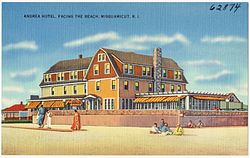
Quonochontaug is a village in Washington County, Rhode Island, United States. It is composed of three small beach communities, and is part of Charlestown.

<span class="mw-page-title-main">Weekapaug, Rhode Island</span> Census-designated place in Rhode Island, United States

Weekapaug is a census-designated place in southern Washington County, Rhode Island, part of the town of Westerly, Rhode Island. The population was 425 at the 2010 census.

<span class="mw-page-title-main">Harmony, Rhode Island</span> Census-designated place in Rhode Island, United States

Harmony is a village and census-designated place in Providence County, Rhode Island, in the town of Glocester, located on U.S. Route 44. As of the 2010 census, it had a population of 985.

References

  1. "ArcGIS REST Services Directory". United States Census Bureau. Retrieved October 12, 2022.
  2. "Census Population API". United States Census Bureau. Retrieved October 12, 2022.
  3. "U.S. Census website". United States Census Bureau . Retrieved July 19, 2020.
  4. "US Board on Geographic Names". United States Geological Survey . Retrieved July 19, 2020.
  5. U.S. Geological Survey Geographic Names Information System: Misquamicut, Rhode Island
  6. "Population and Housing Unit Counts: Rhode Island" (PDF). U.S. Census Bureau. p. 11. Retrieved September 1, 2014.
  7. Francis Joseph O'Brien, Jr. (Moondancer) and Julianne Jennings (Strong Woman), An Introduction to the Narragansett Language: A Study of Roger Williams' A Key into the Language of America. Newport, Rhode Island: Aquidneck Indian Council, 2001, PP. 131, 136; https://www.scribd.com/doc/299109237/Introduction-to-the-Narragansett-Language , accessed September 29th, 2017
  8. "Misquamicut State Beach History". State of Rhode Division of Parks & Recreation. Retrieved September 1, 2014.
  9. "Your Kids Will Have A Blast At This Miniature Amusement Park In Rhode Island Made Just For Them". www.onlyinyourstate.com. March 26, 2019. Retrieved July 19, 2020.
  10. "Rhode Island's Classic Carousels: A Seaside Tour". www.wsj.com. September 1, 2017. Retrieved July 19, 2020.
  11. "Amusement Parks In Rhode Island: A Huffington Post Travel Guide". www.huffpost.com. December 6, 2017. Retrieved July 19, 2020.
  12. Tobyne, Dan (June 15, 2016). Beachcomber's Guide to the Northeast. Down East Books. ISBN   9781608934041 via Google Books.
  13. Gentile, Donald L.; Gordon, Bernard L. (April 12, 2010). Misquamicut. Arcadia Publishing. ISBN   9781439637579 via Google Books.
  14. "Atlantic Beach Park". WESTERLY RI. February 26, 2016.
  15. "National Carousel Association - The Atlantic Beach Park Carousel - Atlantic Beach Park Carousel". carousels.org.
  16. "The 7 Best Beaches in Rhode Island". www.afar.com. March 20, 2019. Retrieved July 19, 2019.
  17. "Things to Do in Misquamicut, Rhode Island". www.traveltips.usatoday.com. Retrieved July 19, 2020.
  18. "US Gazetteer files: 2019". United States Census Bureau . Retrieved July 19, 2020.
  19. "Census of Population and Housing". Census.gov. Retrieved June 4, 2016.
  20. 1 2 3 4 5 "US Census Bureau, Table DP1: PROFILE OF GENERAL POPULATION AND HOUSING CHARACTERISTICS". data.census.gov. Retrieved December 29, 2023.
  21. Bureau, US Census. "Gazetteer Files". Census.gov. Retrieved December 30, 2023.
  22. "US Census Bureau, Table P1: RACE". data.census.gov. Retrieved December 29, 2023.
  23. "US Census Bureau, Table P2: HISPANIC OR LATINO, AND NOT HISPANIC OR LATINO BY RACE". data.census.gov. Retrieved December 29, 2023.
  24. "US Census Bureau, Table S1101: HOUSEHOLDS AND FAMILIES". data.census.gov. Retrieved December 29, 2023.
  25. "US Census Bureau, Table S1501: EDUCATIONAL ATTAINMENT". data.census.gov. Retrieved December 29, 2023.
  26. "US Census Bureau, Table S1903: MEDIAN INCOME IN THE PAST 12 MONTHS (IN 2020 INFLATION-ADJUSTED DOLLARS)". data.census.gov. Retrieved December 29, 2023.
  27. "US Census Bureau, Table S2001: EARNINGS IN THE PAST 12 MONTHS (IN 2020 INFLATION-ADJUSTED DOLLARS)". data.census.gov. Retrieved December 29, 2023.
  28. "US Census Bureau, Table S1701: POVERTY STATUS IN THE PAST 12 MONTHS". data.census.gov. Retrieved December 29, 2023.
  29. "US Census Bureau, Table S1702: POVERTY STATUS IN THE PAST 12 MONTHS OF FAMILIES". data.census.gov. Retrieved December 29, 2023.