| Moolock Mountain | |
|---|---|
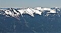
 East aspect, seen from South Bessemer Mountain | |
| Highest point | |
| Elevation | 4,965 ft (1,513 m) [1] |
| Prominence | 925 ft (282 m) [1] |
| Parent peak | Bessemer Mountain (5,166 ft) [2] |
| Isolation | 1.81 mi (2.91 km) [2] |
| Coordinates | 47°32′51″N121°38′31″W / 47.547367°N 121.641897°W [1] |
| Geography | |
 Moolock Mountain Location in Washington  Moolock Mountain Moolock Mountain (the United States) | |
| Country | United States |
| State | Washington |
| County | King |
| Parent range | Cascade Range |
| Topo map | USGS Mount Si |
| Climbing | |
| Easiest route | hiking |
Moolock Mountain is a 4,965-foot-elevation (1,513-meter) summit located in King County of Washington state. [1] It is situated at the western edge of the Cascade Range, on land managed by Mount Baker-Snoqualmie National Forest. Moolock Mountain is more notable for its large, steep rise above local terrain than for its absolute elevation. The nearest higher neighbor is line parent Bessemer Mountain, 1.8 mi (2.9 km) to the northeast, and Green Mountain is 2.5 miles to the southwest. Precipitation runoff from this mountain drains into tributaries of the North and Middle Forks of the Snoqualmie River. This unofficially named peak rises immediately southeast above Lake Moolock, which is officially named. [3] Moolock, or moolack, is a Chinook Jargon word meaning "elk." [4] [5]