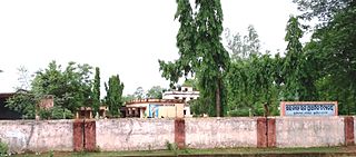
Mullipallam is a panchayat village in Vadipatti Taluka of Madurai district, Tamil Nadu, India, with a total of 2173 families residing.

Kannavam is a Village in Thalassery Taluk in Kannur District of Kerala State, India. It comes under Chittaripparamba Panchayat. It is located 37 km (23 mi) south east of District headquarters Kannur, 13 km (8.1 mi) east of Kuthuparamba and 466 km (290 mi) from State capital Thiruvananthapuram
Eyyal is a village in Thrissur District in the state of Kerala, India. Archeologists have unearthed a collection of old Roman coins in 1946. These coins date from 123 BC to 117 AD. These coins currently exhibited in the Archeological Museum of Thrissur.
Madlur is a village in the Belgaum district of Karnataka State, India. The village is famous for its history and its also called Siddhabhoomi. The place was once ruled by the Chalukyas. The ancient village is rich with the architecture of the Chalukyas. The Historical name of the place is Shreerangapur. Shree Shiddeshwar temple and Koranar Bhavi are the major attractions. Other major attractions are Marakumb Kola and lake Maagani.
Puritipenta is located in Gajapathinagaram Mandal/Tehsil of Vizianagaram District in Andhra Pradesh State, India.
Kheri Shilla is a village in Makrana tehsil in Nagaur district, Rajasthan state of India. It is 7 km from Gachhipura. Other names for Kheri Shella are Mundelo Ki kheri and Guda Kheri, and the latest name of is Devnagari Kheri Sheela.
Manakawad is a village in Dharwad district of Karnataka, India.
Boraj Tawaran is a village in the Udaipur district of Rajasthan, India. It comes under the Malpur gram panchayat, in Salumber block. The village is located 8 km east of Salumber. It is also known as Boraj Tanwaran or Boraj Tavraan. Salumbar is nearest town to Boraj Tawaran village. Around 1700 CE, a Thakur of the Tanwar clan moved to Salumber during the rule of Rawat Kesari Singh Chundawat. In 1876, his descendant Thakur Tej Singh Tanwar was granted the jagir of the present-day village site to Rawat Jodh Singh Chundawat.

Mujagada is a large village located near Bhanjanagar of Ganjam district in Orissa. It is located 89 kilometres (55 mi) north of district headquarters, Chhatrapur, and 159 kilometres (99 mi) from the state capital Bhubaneswar. Asika, Hinjilicut, Phulabani, and Berhampur are nearby. Oriya is the local language here. The main occupation of this village is agriculture.
Dighalgram is a village located in Mohammad Bazar Block of Birbhum district, West Bengal with total 1360 families residing. The Dighalgram village has population of 6284 of which 3194 are males while 3090 are females as per Population Census 2011.
Harpur Kalan is a small village of 1269 families located in Majorganj, Sitamarhi, Bihar, India. The Harpur Kalan village has a population of 5510 of which 2990 are males while 2520 are females as per Population Census 2011. In Harpur Kalan village the population of children between the ages of 0-6 is 1027, which makes up 18.64% of the total population. The average sex ratio of Harpur Kalan village is 843, lower than the Bihar state average of 918. The child sex ratio for Harpur Kalan as per census is 824, lower than the Bihar average of 935.
Deengli is a village in Rajgarh, Churu, Rajasthan, India. As per 2011 Census of India, the village has population of 2197 of which 1144 are males while 1053 are females. It comes under ‘’’Sulkhnia chhotta’’’ Panchayath. It belongs to Bikaner Division. As per constitution of India and Panchyati Raaj Act, Deengli village is administrated by Sarpanch who is elected representative of village. It is located 65 km towards East from District headquarters Churu. 230 km from State capital Jaipur. The most famous place in Deengli is Net Dada JI temple.
Kava is a village in Idar, India. The population in this village is close to 2500. Shrimati J. P Patel High School is the main high school. This village is surrounded by Arvalli Girimala. As per constitution of India and Panchayati Raaj Act, Kava village is administrated by Sarpanch, who is the elected representative of village. Currently, Sarpanch of Kava is Amitbhai Patel.
Mulgram is a village in Hooghly district, West Bengal, India. The village is 20 meters above sea level. Its post office is in Boinchi, its police station is in Pandua. Its pincode is 712134 and Bengali is the local language. The village is surrounded by the village named Bhonpur. Inchhura, etc. It's 4 km apart from region's main town Boinchi.
Piragram is a village in Hooghly district, West Bengal, India. The village is 15 meters abover sea-level. Its post office is in Roy-Jamna, its police station is in Pandua. Its pincode is 712134 and Bengali is the local language. The village is surrounded by the village named Roy-Jamna, Mulgram. Inchhura, etc.
Chamundery Ranawatan is a large village located in Bali of Pali district, Rajasthan with total 1616 families residing. The Chamunderi Rana Watan village has population of 7854 of which 4007 are males while 3847 are females as per Population Census 2011.
Puduvoyal is a village panchayat located in the Thiruvallur district of Indian state of Tamil Nadu.

Makaji Meghpar is a village and former chiefdom of Hardhrol Jadeja chieftains in the Jamnagar district of Gujarat, India. It was founded in 1754 by Makanji Jadeja of Dhrol State. Gujarati writer Harilal Upadhyay was from the village. The people are mainly Jadeja Rajputs with some Brahmins, Patels and Dalits.
Nauhatta is a large village in Nauhatta Block in Saharsa District of Bihar state, India. It belongs to Kosi Division. It is located 20 km towards North from District headquarters Saharsa. 165 km from State capital Patna. It comes under Mahisi constituency. The village had a population of 25,347 of which 13,124 were male while 12,223 were females as per Population Census 2011.
Akorhi is a village in Aurangabad district in the Indian state of Bihar.


