Mount Olive, North Carolina | |
---|---|
Motto: "We Value Hometown Tradition" | |
Coordinates: 35°11′59″N78°03′58″W / 35.19972°N 78.06611°W | |
Country | United States |
State | North Carolina |
Counties | Wayne, Duplin |
Area | |
• Total | 2.74 sq mi (7.09 km2) |
• Land | 2.74 sq mi (7.09 km2) |
• Water | 0.00 sq mi (0.00 km2) |
Elevation | 164 ft (50 m) |
Population (2020) | |
• Total | 4,198 |
• Density | 1,533.24/sq mi (591.92/km2) |
Time zone | UTC-5 (Eastern (EST)) |
• Summer (DST) | UTC-4 (EDT) |
ZIP code | 28365 |
Area code | 919 |
FIPS code | 37-45100 [3] |
GNIS feature ID | 2406209 [2] |
Website | www |
Mount Olive is a town in Duplin and Wayne counties in the U.S. state of North Carolina. The population was 4,589 at the 2010 census. [4] It is included in the Goldsboro, North Carolina Metropolitan Statistical Area. The town is home to the Mt. Olive Pickle Company and the University of Mount Olive.
The Mount Olive High School (Former), Mount Olive Historic District, Perry-Cherry House, Southerland-Burnette House, former United States Post Office, and Vernon are listed on the National Register of Historic Places. [5]
Mount Olive is located in southern Wayne County with a small portion of the town extending south into Duplin County.
U.S. Route 117, a four-lane highway, runs along the western edge of Mount Olive, leading north 14 miles (23 km) to Goldsboro and south 15 miles (24 km) to Warsaw. North Carolina Highway 55, which crosses US 117 at the northern end of town, leads east 31 miles (50 km) to Kinston and west 17 miles (27 km) to Newton Grove.
According to the United States Census Bureau, the town of Mount Olive has a total area of 2.7 square miles (6.9 km2), all land. [4]
Census | Pop. | Note | %± |
---|---|---|---|
1890 | 393 | — | |
1900 | 617 | 57.0% | |
1910 | 1,071 | 73.6% | |
1920 | 2,297 | 114.5% | |
1930 | 2,685 | 16.9% | |
1940 | 2,929 | 9.1% | |
1950 | 3,732 | 27.4% | |
1960 | 4,673 | 25.2% | |
1970 | 4,914 | 5.2% | |
1980 | 4,876 | −0.8% | |
1990 | 4,582 | −6.0% | |
2000 | 4,567 | −0.3% | |
2010 | 4,589 | 0.5% | |
2020 | 4,198 | −8.5% | |
U.S. Decennial Census [6] |
Race | Number | Percentage |
---|---|---|
White (non-Hispanic) | 1,463 | 34.85% |
Black or African American (non-Hispanic) | 2,060 | 49.07% |
Native American | 14 | 0.33% |
Asian | 14 | 0.33% |
Other/Mixed | 112 | 2.67% |
Hispanic or Latino | 535 | 12.74% |
As of the 2020 United States census, there were 4,198 people, 1,803 households, and 985 families residing in the town.
As of the census [3] of 2000, there were 4,567 people, 1,770 households, and 1,125 families residing in the town. The population density was 1,819.3 inhabitants per square mile (702.4/km2). There were 2,012 housing units at an average density of 801.5 per square mile (309.5/km2). The racial makeup of the town was 82.98% White, 12.30% African American, 0.15% Native American, 0.15% Asian, 0.11% Pacific Islander, 1.34% from other races, and 0.96% from two or more races. Hispanic or Latino of any race were 3.17% of the population.
There were 1,770 households, out of which 25.9% had children under the age of 18 living with them, 36.8% were married couples living together, 22.9% had a female householder with no husband present, and 36.4% were non-families. 32.3% of all households were made up of individuals, and 15.8% had someone living alone who was 65 years of age or older. The average household size was 2.38 and the average family size was 3.01.
In the town, the population was spread out, with 22.9% under the age of 18, 14.0% from 18 to 24, 22.8% from 25 to 44, 21.1% from 45 to 64, and 19.2% who were 65 years of age or older. The median age was 38 years. For every 100 females, there were 77.3 males. For every 100 females age 18 and over, there were 71.5 males.
The median income for a household in the town was $23,984, and the median income for a family was $31,176. Males had a median income of $26,814 versus $19,224 for females. The per capita income for the town was $12,184. About 16.4% of families and 22.8% of the population were below the poverty line, including 29.6% of those under age 18 and 21.6% of those age 65 or over.
Between 2010 and 2012, as many as 3,000 Haitians have settled in and around Mount Olive. The newcomers' lure: the Butterball turkey processing plant and a handful of other meat producers within commuting distance of Mount Olive.
Jim Johnson, a professor at the Kenan-Flagler Business School at University of North Carolina at Chapel Hill, said the new wave of Haitians in Eastern North Carolina is the classic immigrant labor story. "The jobs at Butterball are what we can call 3D: dirty, difficult and dangerous," Johnson said. "Nobody wants to do them, and the immigrants fill the gap." [8]
The Mt. Olive Pickle Company, established in 1926, is located on the corner of Cucumber and Vine streets. [9]
The North Carolina Pickle Festival is held the last full weekend of April each year. The annual celebration is put on by both the community of Mount Olive and the Mt. Olive Pickle Company. [10]
On New Year's Eve, the Mt. Olive Pickle Company celebrates in unusual fashion by dropping a three-foot pickle down a flagpole into a pickle tank. However, instead of midnight local time, the drop takes place at 7 p.m. [11] The event first took place on New Year's Eve 1999.
Mount Olive is part of the Atlantic coastal plain. [12]
Education in Mount Olive is administered by the Wayne County Public Schools system & Duplin County Schools located in the town include Carver Elementary School and Mount Olive Middle School. On the outskirts of town is Southern Wayne High School in Dudley and North Duplin Jr & Sr High School. Higher education is offered through Wayne Community College in Goldsboro and the private, liberal arts institution University of Mount Olive.
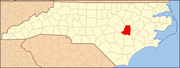
Wayne County is a county located in the U.S. state of North Carolina. As of the 2020 census, the population was 117,333. Its county seat is Goldsboro, and it is home to Seymour Johnson Air Force Base.
Lenoir County is a county in the U.S. state of North Carolina. As of the 2020 census, its population was 55,122. Its county seat is Kinston, located on the Neuse River, across which the county has its territory.
Greene County is a county located in the U.S. state of North Carolina. As of the 2020 census, the population was 20,451. Its county seat is Snow Hill.
Edgecombe County is a county located in the U.S. state of North Carolina. As of the 2020 census, the population was 48,900. Its county seat is Tarboro.
Duplin County is a county located in the U.S. state of North Carolina. As of the 2020 census, the population was 48,715. Its county seat is Kenansville.
Beulaville is a town located in Duplin County, North Carolina, United States. As of the 2020 census, the population was 1,116. At the previous census in 2010, the population was 1,296. The community lies within the Limestone Creek Township.
Calypso is a town in Duplin County, North Carolina, United States. As of the 2020 census, the population was 327. At the previous census in 2010, the population was 538.
Kenansville is a town in Duplin County, North Carolina, United States. Its population was 770 at the 2020 census. It is the county seat of Duplin County. The town was named for James Kenan, a member of the North Carolina Senate. Liberty Hall, his early 1800s era historic home, is located within Kenansville.
Warsaw is a town in Duplin County, North Carolina, United States. The population was 3,054 at the 2010 census.
Hookerton is a town in Greene County, North Carolina, United States. The population was 409 at the 2010 census. It is geographically located southeast of Snow Hill on North Carolina Highway 123. The town is part of the Greenville Metropolitan Area.
Brogden is a census-designated place (CDP) in Wayne County, North Carolina, United States. The population was 2,510 in 2020. It is included in the Goldsboro, North Carolina Metropolitan Statistical Area.
Elroy is a town in Wayne County, North Carolina, United States. In 2007, the estimated population was 3,905. It is included in the Goldsboro, North Carolina Metropolitan Statistical Area.
Eureka is a town in Wayne County, North Carolina, United States. The population was 197 at the 2010 census. It is included in the Goldsboro, North Carolina Metropolitan Statistical Area.
Fremont is a town in Wayne County, North Carolina, United States. The population was 1,255 at the 2010 census. It is included in the Goldsboro, North Carolina Metropolitan Statistical Area.
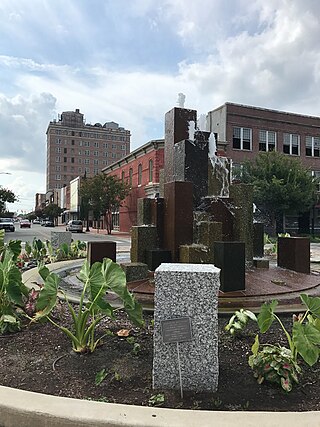
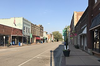
Goldsboro, originally Goldsborough, is a city in and the county seat of Wayne County, North Carolina, United States. The population was 33,657 at the 2020 census. It is the principal city of and is included in the Goldsboro, North Carolina Metropolitan Statistical Area. The nearby town of Waynesboro was founded in 1787, and Goldsboro was incorporated in 1847. It is the county seat of Wayne County.
Mar-Mac is a census-designated place (CDP) in Wayne County, North Carolina, United States. The population was 3,011 at the 2007 census. It is included in the Goldsboro, North Carolina Metropolitan Statistical Area.
Pikeville is a town in Wayne County, North Carolina, United States. The population was 678 at the 2010 census. It is included in the Goldsboro, North Carolina Metropolitan Statistical Area. It is notable for being the home of Collier Motors, an automobile sales and service business established in 1955 that has remained an American Motors (AMC) dealership.
Seven Springs is a town in Wayne County, North Carolina, United States. It lies next to the Neuse River. The 2012 population was estimated at 111. It is included in the Goldsboro, North Carolina Metropolitan Statistical Area.
Walnut Creek is a village in Wayne County, North Carolina, United States. The population was 835 in 2010. It is included in the Goldsboro, North Carolina Metropolitan Statistical Area.
Faison is a town primarily in Duplin County, North Carolina, with a small portion extending into Sampson County. As of the 2020 census, the population was 784. At the previous census in 2010, the population was 961.