Museum Street (York)

Last updated

Museum Street
Museum Street, York.jpg
The western end of Museum Street, showing Lendal Bridge and the route down to St Leonard's Landing
Museum Street (York)
Location within York
Former name(s)
  • Footloose Lane
  • Back Lendal
Location York, United Kingdom
Coordinates 53°57′39″N1°05′10″W / 53.9609°N 1.0860°W / 53.9609; -1.0860 Coordinates: 53°57′39″N1°05′10″W / 53.9609°N 1.0860°W / 53.9609; -1.0860
North east end
Major
junctions
Lendal
South west end

Museum Street is a road in the city centre of York, in England.

Contents

History

The area covered by the street lay partly within the walls of Roman Eboracum, and entirely within the current Mediaeval York city walls. [1] It emerged as a narrow lane running immediately south-east of the boundary wall of St Leonard's Hospital. It was first recorded in the 1260s as Ffotlesgayle, or "Footloose Lane", possibly referring to people resident at the hospital who were unable to walk easily. The section north-east of Lendal later became known as "Finkle Street", a name which has since been reused for a different street in the city centre. By the 18th-century, the entire length of the street was known as Back Lendal. It became increasingly important, as St Leonard's Landing lay at its south-western end, from which the Lendal Ferry ran across the River Ouse. [2] [3] [4]

In 1782, the street was widened, the wall of the hospital and part of the building being demolished, but the construction of a new terrace on the north-west side again restricted its width. In 1830, the Yorkshire Museum was opened to the north of the former hospital, and the grounds became the Museum Gardens, with the main access from Back Lendal. In 1846, it was widened with the demolition of the terrace erected in 1782, and around this time, the Museum Chambers concert hall was constructed. By 1852, the road had become known as "Museum Street". In 1863, the Lendal Ferry was replaced by a new Lendal Bridge, accessed by a gentle ramp from the street, although its old route down to St Leonard's Landing also survives. [2] [3]

Architecture

Looking east along the street, from Lendal Museum Street, York - DSC07870.JPG
Looking east along the street, from Lendal

The street runs north-east, starting by the River Ouse at Lendal Bridge, or alternatively at St Leonard's Landing, where it meets Dame Judi Dench Walk. On its north-west side lie firstly Lendal Tower, the neighbouring 18th-century Lendal Hill House, and then a former engine house for the city's waterworks, built in 1836. These adjoin a short section of the York city walls, at the other end of which is a lodge building and the main entrance to the Museum Gardens. Next are the remains of St Leonard's Hospital, then Library Square, onto which the York Library faces, followed by 2-4 Museum Street, two listed buildings. The street ends at its junction with Blake Street, Duncombe Place and St Leonard's Place. [2] [5]

Notable buildings on the south-east side of the street include 1 Museum Street, built as the city's register office, now its main tourist information centre, and Thomas's of York, a pub built about 1700; and on the other side of Lendal, Club Chambers and River House, two large Victorian buildings near the river. [2] [5] [6]

Related Research Articles

<span class="mw-page-title-main">Clifton, York</span> Suburb of the City of York, Yorkshire, England

Clifton is a suburb of York in the unitary authority of the City of York, in the north of England about 1+12 miles from the city centre. The A19, passes north out of York through Clifton.

<span class="mw-page-title-main">Eboracum</span> Ancient Roman city in present-day York, England

Eboracum was a fort and later a city in the Roman province of Britannia. In its prime it was the largest town in northern Britain and a provincial capital. The site remained occupied after the decline of the Western Roman Empire and ultimately developed into the present-day city York, occupying the same site in North Yorkshire, England.

<span class="mw-page-title-main">Bridges of York</span> Bridges over the Ouse and Foss in York, England

There are nine bridges across the River Ouse and sixteen smaller bridges and passages across the narrower River Foss within the city of York, England.

<span class="mw-page-title-main">St Mary's Abbey, York</span> Scheduled monument ruin in York, England

The Abbey of St Mary is a ruined Benedictine abbey in York, England and a scheduled monument.

<span class="mw-page-title-main">Bootham</span> Street and area of York, England

Bootham is a street in the city of York, in England, leading north out of the city centre. It is also the name of the small district surrounding the street.

<span class="mw-page-title-main">York city walls</span> Grade I listed urban defence in England

York has, since Roman times, been defended by walls of one form or another. To this day, substantial portions of the walls remain, and York has more miles of intact wall than any other city in England. They are known variously as York City Walls, the Bar Walls and the Roman walls. The walls are generally 13 feet (4m) high and 6 feet (1.8m) wide.

<span class="mw-page-title-main">History of York</span> History of the city of York, England

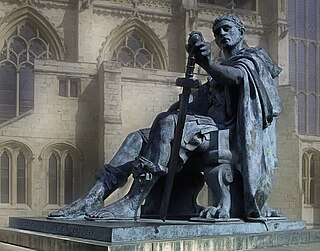
The history of York, England, as a city dates to the beginning of the first millennium AD but archaeological evidence for the presence of people in the region of York dates back much further to between 8000 and 7000 BC. As York was a town in Roman times, its Celtic name is recorded in Roman sources ; after 400, Angles took over the area and adapted the name by folk etymology to Old English Eoforwīc or Eoforīc, which means "wild-boar town" or "rich in wild-boar". The Vikings, who took over the area later, in turn adapted the name by folk etymology to Norse Jórvík meaning "wild-boar bay", 'jór' being a contraction of the Old Norse word for wild boar, 'jǫfurr'. The modern Welsh name is Efrog.

<span class="mw-page-title-main">York Museum Gardens</span> Botanic gardens in York, North Yorkshire, England

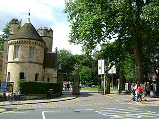
The York Museum Gardens are botanic gardens in the centre of York, England, beside the River Ouse. They cover an area of 10 acres (4.0 ha) of the former grounds of St Mary's Abbey, and were created in the 1830s by the Yorkshire Philosophical Society along with the Yorkshire Museum which they contain.

<span class="mw-page-title-main">Holgate, York</span> Suburb of York, North Yorkshire, England

Holgate is a suburb of York in England. It is located about 1 mile west of Micklegate Bar in the city walls. Holgate is also the name of an electoral ward in the City of York unitary authority. The ward is currently bounded by the River Ouse from Scarborough Bridge to Ouse Acres on its northern boundary. Carr Lane and Ouse Acres on one side, and the intersection of York Road and Acomb Road on the other, make up its western boundary. The remainder of the southern boundary follows Moorgate and Holgate Beck to the East Coast Main Line railway which completes the eastern boundary as far as the River Ouse/Scarborough Bridge.

<span class="mw-page-title-main">York City Rowing Club</span> Rowing club in York, England

York City Rowing Club is a rowing club by the River Ouse in York, England. It has over 200 members, of all ages. The boathouse is on the west bank of the river next to Lendal Bridge and in Memorial Gardens. The club has modern buildings but is three years older than the oldest coastal rowing club in Britain, Dover; it is 25 years younger than the oldest non-academic rowing club, Leander. The reach of canalised river it enjoys is unusually long – over 20 mi (32 km).

<span class="mw-page-title-main">Lendal Tower</span> Medieval tower in York, England

Lendal Tower is a medieval tower that formed part of the city defences of York, England. It is located on the east bank of the River Ouse at the point where the river enters the walled city from the north-west. The building was used as a waterworks from 1616 until 1846 after which it was converted into offices. It has since been turned into rental accommodation.

<span class="mw-page-title-main">Lendal</span> Street in York, England

Lendal is a street in the city centre of York, in England.

<span class="mw-page-title-main">Coney Street</span> Street in York, England

Coney Street is a major shopping street in the city centre of York, in England. The street runs north-west from the junction of Spurriergate and Market Street, to St Helen's Square. New Street leads off the north-east side of the street, as does a snickelway leading to the Judge's Court hotel, while several snickelways lead from the south-west side down to the River Ouse, including Blanshard's Lane, and paths leading to City Screen.

<span class="mw-page-title-main">Skeldergate</span> Street in York, England

Skeldergate is a street in the city centre of York, in England. The street is now primarily residential, with many of its warehouse buildings having been converted into apartments.

<span class="mw-page-title-main">Duncombe Place</span> Street in York, England

Duncombe Place is a street in the city centre of York, in England.

<span class="mw-page-title-main">St Leonard's Place</span> Street in York, England

St Leonard's Place is a street in the city centre of York, in England.

<span class="mw-page-title-main">Spurriergate</span> Street in York, England

Spurriergate is a short street in the city centre of York, in England.

<span class="mw-page-title-main">Gillygate</span> Street in York, England

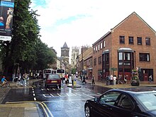
Gillygate is a street in York, in England, immediately north of the city centre.

<span class="mw-page-title-main">Marygate</span> Street in York, England

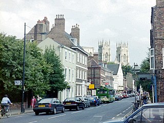
Marygate is a street in York, England, running just north of the city centre. Built in the Middle Ages, it gets its name from St Mary's Abbey and the Viking word "gata," meaning street. The area where the street lies was outside the walls of the Roman city of Eboracum, and represented the northern limit of the settlement; to the north, the land was used only for burials. The street runs south-west, from Bootham, down to the River Ouse.

<span class="mw-page-title-main">River House, York</span>

River House is a historic building in the city centre of York, in England.

References

  1. "Character area 4: Museum Gardens and Exhibition Square". City of York Council. Retrieved 17 September 2020.
  2. 1 2 3 4 An Inventory of the Historical Monuments in City of York, Volume 5, Central. London: HMSO. 1981. Retrieved 7 August 2020.
  3. 1 2 A History of the County of York: the City of York. London: Victoria County History. 1961. Retrieved 7 August 2020.
  4. Sheahan, J. J.; Whellan, T. (1855). History and Topography of the City of York. Beverley: John Green. p. 224.
  5. 1 2 Pevsner, Nikolaus (1995). Yorkshire: York and the East Riding. Yale University Press. p. 226. ISBN   0300095937.
  6. "Visitor Information". Visit York. Retrieved 17 September 2020.