National Register of Historic Places listings in Box Elder County, Utah

Last updated

Location of Box Elder County in Utah Map of Utah highlighting Box Elder County.svg
Location of Box Elder County in Utah

This is a list of the National Register of Historic Places listings in Box Elder County, Utah.

Contents

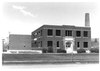
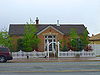
This is intended to be a complete list of the properties and districts on the National Register of Historic Places in Box Elder County, Utah, United States. Latitude and longitude coordinates are provided for many National Register properties and districts; these locations may be seen together in a map. [1]

There are 43 properties and districts listed on the National Register in the county. Another 4 sites in the county were once listed, but have since been removed.


    This National Park Service list is complete through NPS recent listings posted August 11, 2023. [2]

Map all coordinates using: OpenStreetMap

Current listings

[3] Name on the Register [4] ImageDate listed [5] Location City or townDescription
1 George and Mabel Anderson House
George and Mabel Anderson House George Anderson House Brigham City Utah.jpeg
George and Mabel Anderson House
October 15, 2014
(#14000862)
63 North 200 East
41°30′43″N112°00′46″W / 41.5119°N 112.0127°W / 41.5119; -112.0127 (George and Mabel Anderson House)
Brigham City
2 Martin Anderson House
Martin Anderson House Martin Anderson House Brigham City Utah.jpg
Martin Anderson House
January 23, 2003
(#02001735)
105 North 300 West
41°30′48″N112°01′12″W / 41.513333°N 112.02°W / 41.513333; -112.02 (Martin Anderson House)
Brigham City
3 Bear River High School Science Building
Bear River High School Science Building Bear River Science Building.pdf
Bear River High School Science Building
April 1, 1985
(#85000797)
1450 South Main Street
41°43′33″N112°09′43″W / 41.725833°N 112.161944°W / 41.725833; -112.161944 (Bear River High School Science Building)
Garland
4 Box Elder County Courthouse
Box Elder County Courthouse Box Elder County Courthouse.jpeg
Box Elder County Courthouse
April 7, 1988
(#88000399)
1 North Main Street
41°30′38″N112°00′51″W / 41.510556°N 112.014167°W / 41.510556; -112.014167 (Box Elder County Courthouse)
Brigham City
5 Box Elder Stake Tabernacle
Box Elder Stake Tabernacle BE Tabernacle.jpg
Box Elder Stake Tabernacle
May 14, 1971
(#71000840)
Main Street between 2nd and 3rd South streets
41°30′20″N112°00′51″W / 41.505556°N 112.014167°W / 41.505556; -112.014167 (Box Elder Stake Tabernacle)
Brigham City
6 Brigham City Carnegie Library
Brigham City Carnegie Library Carnegie Library Brigham City Utah.jpeg
Brigham City Carnegie Library
October 25, 1984
(#84000143)
26 East Forest Street
41°30′39″N112°00′51″W / 41.510833°N 112.014167°W / 41.510833; -112.014167 (Brigham City Carnegie Library)
Brigham City
7 Brigham City Fire Station/City Hall
Brigham City Fire Station/City Hall Brigham City Hall.jpeg
Brigham City Fire Station/City Hall
April 7, 1988
(#88000389)
6 North Main Street
41°30′39″N112°00′53″W / 41.510833°N 112.014722°W / 41.510833; -112.014722 (Brigham City Fire Station/City Hall)
Brigham City
8 Brigham City Historic District June 5, 2023
(#100008770)
Roughly bounded by 700 South, 500 East, 500 North and 300 and 500 West Sts.
41°30′36″N112°00′57″W / 41.5101°N 112.0157°W / 41.5101; -112.0157 (Brigham City Historic District)
Brigham City
9 Brigham City Mercantile and Manufacturing Association Mercantile Store
Brigham City Mercantile and Manufacturing Association Mercantile Store Brigham City Mercantile.jpeg
Brigham City Mercantile and Manufacturing Association Mercantile Store
January 24, 1990
(#89000453)
5 North Main Street
41°30′39″N112°00′56″W / 41.510833°N 112.015556°W / 41.510833; -112.015556 (Brigham City Mercantile and Manufacturing Association Mercantile Store)
Brigham City
10 Central Pacific Railroad Grade Historic District
Central Pacific Railroad Grade Historic District Central Pacific Trestle 29, facing north, 86.jpg
Central Pacific Railroad Grade Historic District
May 15, 1987
(#87000699)
87-mile (140 km) segment between the Umbria Junction 9 miles (14 km) east of the Nevada border, around the northern end of Great Salt Lake, to the Golden Spike National Historical Park
41°33′44″N113°20′40″W / 41.562278°N 113.344444°W / 41.562278; -113.344444 (Central Pacific Railroad Grade Historic District)
Park Valley
11 Alma Compton House
Alma Compton House Compton House Brigham City Utah.jpeg
Alma Compton House
April 7, 1988
(#88000381)
142 South 100 East
41°30′25″N112°00′49″W / 41.506944°N 112.013611°W / 41.506944; -112.013611 (Alma Compton House)
Brigham City
12 Corinne Methodist Episcopal Church
Corinne Methodist Episcopal Church Corinne church.jpg
Corinne Methodist Episcopal Church
May 14, 1971
(#71000842)
Corner of Colorado Street and 4000 West
41°32′51″N112°06′40″W / 41.5475°N 112.111111°W / 41.5475; -112.111111 (Corinne Methodist Episcopal Church)
Corinne
13 Cutler Hydroelectric Power Plant Historic District
Cutler Hydroelectric Power Plant Historic District Cutler Power Plant Beaver Dam Utah.jpeg
Cutler Hydroelectric Power Plant Historic District
April 20, 1989
(#89000280)
Off State Route 30 at the Bear River
41°50′06″N112°03′08″W / 41.835°N 112.052222°W / 41.835; -112.052222 (Cutler Hydroelectric Power Plant Historic District)
Beaver Dam
14 Elberta Theatre
Elberta Theatre Elberta Theatre Brigham City Utah.jpeg
Elberta Theatre
October 17, 1991
(#91001544)
53 South Main Street
41°30′33″N112°00′52″W / 41.509167°N 112.014444°W / 41.509167; -112.014444 (Elberta Theatre)
Brigham City
15 Alfred and Marie Fawson House
Alfred and Marie Fawson House Fawson House Brigham City Utah.jpeg
Alfred and Marie Fawson House
January 27, 2003
(#02001736)
64 South 100 West
41°30′33″N112°01′02″W / 41.509167°N 112.017222°W / 41.509167; -112.017222 (Alfred and Marie Fawson House)
Brigham City
16 Peter and Anna Christena Forsgren House
Peter and Anna Christena Forsgren House Forsgren House Brigham City Utah.jpeg
Peter and Anna Christena Forsgren House
January 23, 2003
(#02001737)
59 South 100 East
41°30′33″N112°00′47″W / 41.509167°N 112.013056°W / 41.509167; -112.013056 (Peter and Anna Christena Forsgren House)
Brigham City
17 Fryer Hotel
Fryer Hotel Fryer Hotel Deweyville Utah.jpeg
Fryer Hotel
April 7, 1988
(#88000379)
3274 West 11300 North
41°42′56″N112°05′46″W / 41.715556°N 112.096111°W / 41.715556; -112.096111 (Fryer Hotel)
Deweyville
18 Garland Carnegie Library
Garland Carnegie Library Carnegie Library Garland Utah.jpeg
Garland Carnegie Library
October 25, 1984
(#84000146)
86 West Factory Street
41°44′29″N112°09′46″W / 41.741389°N 112.162778°W / 41.741389; -112.162778 (Garland Carnegie Library)
Garland
19 William and Nettie Glover House
William and Nettie Glover House Glover House Brigham City Utah.jpeg
William and Nettie Glover House
December 28, 2000
(#00001587)
106 West 100 North
41°30′48″N112°01′01″W / 41.513333°N 112.016944°W / 41.513333; -112.016944 (William and Nettie Glover House)
Brigham City
20 Golden Spike National Historic Site
Golden Spike National Historic Site GoldenSpike UP119.JPG
Golden Spike National Historic Site
October 15, 1966
(#66000080)
6200 North 22300 West
41°36′31″N112°33′20″W / 41.608611°N 112.555556°W / 41.608611; -112.555556 (Golden Spike National Historic Site)
Promontory
21 Granary of the Relief Society
Granary of the Relief Society RS Granary Brigham City Utah.jpeg
Granary of the Relief Society
January 24, 1990
(#89000455)
100 North 400 East
41°30′46″N112°00′29″W / 41.5128°N 112.0081°W / 41.5128; -112.0081 (Granary of the Relief Society)
Brigham City
22 Hampton's Ford Stage Stop and Barn
Hampton's Ford Stage Stop and Barn Hampton's Ford Stage Stop.jpg
Hampton's Ford Stage Stop and Barn
August 12, 1971
(#71000841)
3605 West Bigler Road
41°47′14″N112°06′18″W / 41.7872°N 112.105°W / 41.7872; -112.105 (Hampton's Ford Stage Stop and Barn)
Collinston Now the Old Barn Community Theatre
23 Hogup Cave (42BO36)
Hogup Cave (42BO36) Fremont-style moccasin, Hogup Cave, Utah, 420 AD, hide and sinew - Natural History Museum of Utah - DSC07380.JPG
Hogup Cave (42BO36)
May 8, 1986
(#86001016)
Address Restricted [6]
Park Valley A cave showing signs of human occupation from about 6500 BC to AD 1470
24 Holmgren Farmstead
Holmgren Farmstead Holmgren Farmstead Tremonton Utah.jpeg
Holmgren Farmstead
April 5, 2001
(#01000319)
460 North 300 East
41°42′59″N112°09′31″W / 41.7164°N 112.1586°W / 41.7164; -112.1586 (Holmgren Farmstead)
Tremonton
25 Christian and Annie Holst House
Christian and Annie Holst House Holst House Brigham City Utah.jpeg
Christian and Annie Holst House
January 27, 2003
(#02001738)
495 South 200 East
41°30′04″N112°00′42″W / 41.5011°N 112.0117°W / 41.5011; -112.0117 (Christian and Annie Holst House)
Brigham City
26 Hotel Brigham
Hotel Brigham Hotel Brigham Brigham City Utah.jpeg
Hotel Brigham
October 17, 1991
(#91001543)
13 and 17 West Forest Street
41°30′37″N112°00′55″W / 41.5103°N 112.0153°W / 41.5103; -112.0153 (Hotel Brigham)
Brigham City
27 Howard Hotel
Howard Hotel Howard Hotel Brigham City Utah.jpeg
Howard Hotel
October 7, 1994
(#94001209)
35 South Main Street
41°30′35″N112°00′53″W / 41.5097°N 112.0147°W / 41.5097; -112.0147 (Howard Hotel)
Brigham City
28 Nels and Minnie Jenson House
Nels and Minnie Jenson House Jenson House Brigham City Utah.jpeg
Nels and Minnie Jenson House
December 28, 2000
(#00001588)
136 East 100 South
41°30′28″N112°00′45″W / 41.5078°N 112.0125°W / 41.5078; -112.0125 (Nels and Minnie Jenson House)
Brigham City
29 Jeppson-Reeder House
Jeppson-Reeder House Jeppson-Reeder House Brigham City Utah.jpeg
Jeppson-Reeder House
February 27, 2003
(#03000082)
631 North Main Street
41°31′25″N112°00′55″W / 41.5236°N 112.0153°W / 41.5236; -112.0153 (Jeppson-Reeder House)
Brigham City
30 Knudson Brothers Building
Knudson Brothers Building Knudson Bros Bldg Brigham City Utah.jpeg
Knudson Brothers Building
July 16, 1992
(#92000893)
63 South Main Street
41°30′34″N112°00′52″W / 41.5094°N 112.0144°W / 41.5094; -112.0144 (Knudson Brothers Building)
Brigham City
31 Jonathan and Jennie Knudson House
Jonathan and Jennie Knudson House Knudson House Brigham City Utah.jpeg
Jonathan and Jennie Knudson House
December 28, 2000
(#00001583)
48 South 100 East
41°30′32″N112°00′49″W / 41.5089°N 112.0136°W / 41.5089; -112.0136 (Jonathan and Jennie Knudson House)
Brigham City
32 Lower Bear River Archeological Discontiguous District February 13, 1986
(#86000249)
Address Restricted [6]
Brigham City
33 Mountain States Telephone and Telegraph Building
Mountain States Telephone and Telegraph Building Mountain States Telephone Building Brigham City Utah.jpeg
Mountain States Telephone and Telegraph Building
December 27, 1996
(#96001530)
20 East 100 South
41°30′28″N112°00′52″W / 41.5078°N 112.0144°W / 41.5078; -112.0144 (Mountain States Telephone and Telegraph Building)
Brigham City
34 Oregon Short Line Depot
Oregon Short Line Depot Oregon Short Line Depot Brigham City Utah.jpeg
Oregon Short Line Depot
July 16, 1992
(#92000891)
800 West and Forest Street
41°30′37″N112°01′43″W / 41.5103°N 112.0286°W / 41.5103; -112.0286 (Oregon Short Line Depot)
Brigham City
35 Plymouth School
Plymouth School Plymouth School.pdf
Plymouth School
April 9, 1986
(#86000733)
135 South Main Street
41°52′31″N112°08′45″W / 41.8753°N 112.1458°W / 41.8753; -112.1458 (Plymouth School)
Plymouth
36 A. N. Tanner House
A. N. Tanner House Tanner House 3 - Grouse Creek Utah.jpg
A. N. Tanner House
February 11, 1982
(#82004107)
Grouse Creek Road
41°42′09″N113°53′30″W / 41.7026°N 113.8917°W / 41.7026; -113.8917 (A. N. Tanner House)
Grouse Creek
37 Thompson-Hansen House
Thompson-Hansen House Thompson-Hansen House Brigham City Utah.jpeg
Thompson-Hansen House
December 23, 1994
(#94001474)
120 North Main Street
41°30′54″N112°00′51″W / 41.515°N 112.0142°W / 41.515; -112.0142 (Thompson-Hansen House)
Brigham City
38 Transcontinental Railroad Grade
Transcontinental Railroad Grade Trestle on the Transcontinental Railroad Grade.jpg
Transcontinental Railroad Grade
December 8, 1994
(#94001423)
Roughly from 6 miles (9.7 km) west of Corinne running approximately 13 miles (21 km) along State Route 83
41°36′55″N112°20′41″W / 41.6153°N 112.3448°W / 41.6153; -112.3448 (Transcontinental Railroad Grade)
Corinne
39 Tremonton Historic District April 26, 2021
(#100006013)
Roughly bounded by 600 South, 400 West, 800 North, and 300 East
41°42′42″N112°09′58″W / 41.7118°N 112.1661°W / 41.7118; -112.1661 (Tremonton Historic District)
Tremonton
40 Union Block
Union Block Union Block Brigham City Utah.jpeg
Union Block
October 17, 1991
(#91001545)
57 South Main Street
41°30′32″N112°00′52″W / 41.5089°N 112.0144°W / 41.5089; -112.0144 (Union Block)
Brigham City
41 Washakie LDS Ward Chapel
Washakie LDS Ward Chapel LDS Chapel Washakie Utah.jpeg
Washakie LDS Ward Chapel
June 3, 1998
(#98000641)
Along Samaria Lake Canal
41°56′38″N112°13′06″W / 41.9439°N 112.2183°W / 41.9439; -112.2183 (Washakie LDS Ward Chapel)
Washakie
42 William L. and Mary Watkins House
William L. and Mary Watkins House Watkins House Brigham City Utah.jpeg
William L. and Mary Watkins House
May 2, 2001
(#01000471)
74 North 100 East
41°30′44″N112°00′47″W / 41.5122°N 112.0131°W / 41.5122; -112.0131 (William L. and Mary Watkins House)
Brigham City
43 Willard Historic District
Willard Historic District George Mason House in the Willard Historic District.jpg
Willard Historic District
June 25, 1974
(#74001933)
Roughly bounded by 200 West, 200 North, 100 East, and 200 South streets
41°24′33″N112°02′09″W / 41.4092°N 112.0358°W / 41.4092; -112.0358 (Willard Historic District)
Willard

Former listings

[3] Name on the RegisterImageDate listedDate removedLocationCity or townDescription
1 Box Elder Flouring Mill
Box Elder Flouring Mill Flouring Mill Brigham City Utah.jpeg
Box Elder Flouring Mill
January 24, 1990
(#89000452)
August 15, 2023327 East 200 North
41°30′55″N112°00′32″W / 41.515278°N 112.008889°W / 41.515278; -112.008889 (Box Elder Flouring Mill)
Brigham City
2 Box Elder High School Gymnasium
Box Elder High School Gymnasium Box Elder HS Gym Brigham City Utah.jpeg
Box Elder High School Gymnasium
April 1, 1985
(#85000796)
August 27, 201318 N. 400 East
41°30′39″N112°00′29″W / 41.510833°N 112.008056°W / 41.510833; -112.008056 (Box Elder High School Gymnasium)
Brigham City Box Elder School District demolished this building in 2011.
3 Planing Mill of Brigham City Mercantile and Manufacturing Association
Planing Mill of Brigham City Mercantile and Manufacturing Association Planing Mill Brigham City Utah.jpeg
Planing Mill of Brigham City Mercantile and Manufacturing Association
January 24, 1990
(#89000454)
March 26, 2018547 E. Forest St.
41°30′39″N112°00′21″W / 41.510833°N 112.005833°W / 41.510833; -112.005833 (Planing Mill of Brigham City Mercantile and Manufacturing Association)
Brigham City A surviving building of the Brigham City Co-op.
4 Southern Pacific Railroad: Ogden-Lucin Cut-Off Trestle
Southern Pacific Railroad: Ogden-Lucin Cut-Off Trestle Lucin Cutoff aerial.jpg
Southern Pacific Railroad: Ogden-Lucin Cut-Off Trestle
April 14, 1972
(#72001257)
October 23, 201830 miles (48 km) west of Ogden at the northern arm of the Great Salt Lake
41°13′08″N112°41′30″W / 41.2188°N 112.6916°W / 41.2188; -112.6916 (Southern Pacific Railroad: Ogden-Lucin Cut-Off Trestle)
Ogden

See also

Related Research Articles

<span class="mw-page-title-main">National Register of Historic Places listings in Daggett County, Utah</span>

This is a list of the National Register of Historic Places listings in Daggett County, Utah.

<span class="mw-page-title-main">National Register of Historic Places listings in Carbon County, Utah</span>

This is a list of the National Register of Historic Places listings in Carbon County, Utah.

<span class="mw-page-title-main">National Register of Historic Places listings in Davis County, Utah</span>

This is a list of the National Register of Historic Places listings in Davis County, Utah.

<span class="mw-page-title-main">National Register of Historic Places listings in Beaver County, Utah</span>

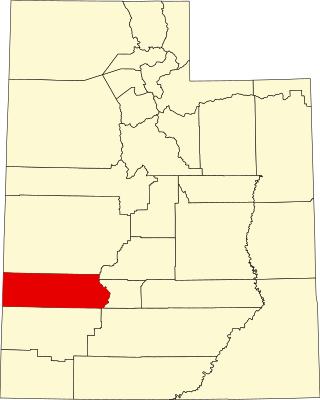
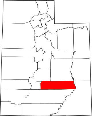
This is a list of the National Register of Historic Places listings in Beaver County, Utah.

<span class="mw-page-title-main">National Register of Historic Places listings in Emery County, Utah</span>

This is a list of the National Register of Historic Places listings in Emery County, Utah.

<span class="mw-page-title-main">National Register of Historic Places listings in Grand County, Utah</span>

This is a list of the National Register of Historic Places listings in Grand County, Utah.

<span class="mw-page-title-main">National Register of Historic Places listings in Garfield County, Utah</span>

This is a list of the National Register of Historic Places listings in Garfield County, Utah.

<span class="mw-page-title-main">National Register of Historic Places listings in Iron County, Utah</span>

This is a list of the National Register of Historic Places listings in Iron County, Utah.

<span class="mw-page-title-main">National Register of Historic Places listings in Juab County, Utah</span>

This is a list of the National Register of Historic Places listings in Juab County, Utah.

<span class="mw-page-title-main">National Register of Historic Places listings in Rich County, Utah</span>

This is a list of the National Register of Historic Places listings in Rich County, Utah.

<span class="mw-page-title-main">National Register of Historic Places listings in Morgan County, Utah</span>

This is a list of the National Register of Historic Places listings in Morgan County, Utah.

<span class="mw-page-title-main">National Register of Historic Places listings in Kane County, Utah</span>

This is a list of the National Register of Historic Places listings in Kane County, Utah.

<span class="mw-page-title-main">National Register of Historic Places listings in Millard County, Utah</span>

This is a list of the National Register of Historic Places listings in Millard County, Utah.

<span class="mw-page-title-main">National Register of Historic Places listings in Tooele County, Utah</span>

This is a list of the National Register of Historic Places listings in Tooele County, Utah.

<span class="mw-page-title-main">National Register of Historic Places listings in Sevier County, Utah</span>

This is a list of the National Register of Historic Places listings in Sevier County, Utah.

<span class="mw-page-title-main">National Register of Historic Places listings in San Juan County, Utah</span>

This is a list of the National Register of Historic Places listings in San Juan County, Utah.

<span class="mw-page-title-main">National Register of Historic Places listings in Wayne County, Utah</span>

This is a list of the National Register of Historic Places listings in Wayne County, Utah.

<span class="mw-page-title-main">National Register of Historic Places listings in Uintah County, Utah</span>

This is a list of the National Register of Historic Places listings in Uintah County, Utah.

<span class="mw-page-title-main">National Register of Historic Places listings in Utah County, Utah</span>

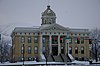
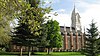
This is a list of the National Register of Historic Places listings in Utah County, Utah.

This is a list of the National Register of Historic Places listings in Zion National Park.

References

  1. The latitude and longitude information provided in this table was derived originally from the National Register Information System, which has been found to be fairly accurate for about 99% of listings. Some locations in this table may have been corrected to current GPS standards.
  2. National Park Service, United States Department of the Interior, "National Register of Historic Places: Weekly List Actions", retrieved August 11, 2023.
  3. 1 2 Numbers represent an alphabetical ordering by significant words. Various colorings, defined here, differentiate National Historic Landmarks and historic districts from other NRHP buildings, structures, sites or objects.
  4. "National Register Information System". National Register of Historic Places . National Park Service. April 24, 2008.
  5. The eight-digit number below each date is the number assigned to each location in the National Register Information System database, which can be viewed by clicking the number.
  6. 1 2 Some listings on the NRHP are highly sensitive sites and may be subject to looting or vandalism. The NRHP lists this site as "Address Restricted."

Commons-logo.svg Media related to National Register of Historic Places in Box Elder County, Utah at Wikimedia Commons