National Register of Historic Places listings in East Providence, Rhode Island

Last updated

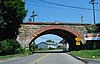
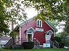
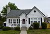
This is a list of Registered Historic Places in East Providence, Rhode Island .

Contents: Counties in Rhode Island

Bristol | Kent | Newport | Providence | Washington


    This National Park Service list is complete through NPS recent listings posted February 9, 2024. [1]
Map all coordinates using: OpenStreetMap
[2] Name on the Register [3] ImageDate listed [4] Location City or townDescription
1 Bicknell–Armington Lightning Splitter House
Bicknell-Armington Lightning Splitter House Bicknell--Armington Lightning Splitter House East Providence RI 2012.jpg
Bicknell–Armington Lightning Splitter House
November 28, 1980
(#80000085)
3591 Pawtucket Ave.
41°46′36″N71°21′47″W / 41.776667°N 71.363056°W / 41.776667; -71.363056 (Bicknell–Armington Lightning Splitter House)
East Providence
2 Boston and Providence Railroad Bridge
Boston and Providence Railroad Bridge East Providence Arch Bridge.jpg
Boston and Providence Railroad Bridge
November 28, 1980
(#80000086)
Spans the Ten Mile River
41°50′05″N71°21′45″W / 41.834722°N 71.3625°W / 41.834722; -71.3625 (Boston and Providence Railroad Bridge)
East Providence
3 Bridgham Farm
Bridgham Farm Bridgham Farm.jpg
Bridgham Farm
November 28, 1980
(#80000087)
120, 148, 150, and 160 Pleasant St.
41°50′13″N71°20′38″W / 41.836944°N 71.343889°W / 41.836944; -71.343889 (Bridgham Farm)
East Providence
4 Carpenter, Lakeside, and Springvale Cemeteries
Carpenter, Lakeside, and Springvale Cemeteries Lakeside Cemetery East Providence RI.jpg
Carpenter, Lakeside, and Springvale Cemeteries
November 28, 1980
(#80000091)
Newman and Pawtucket Aves.
41°50′33″N71°21′09″W / 41.8425°N 71.3525°W / 41.8425; -71.3525 (Carpenter, Lakeside, and Springvale Cemeteries)
East Providence
5 Crescent Park Looff Carousel
Crescent Park Looff Carousel Crescent Park Carousel, East Providence, RI.jpg
Crescent Park Looff Carousel
April 21, 1976
(#76000045)
Riverside Park
41°45′24″N71°21′34″W / 41.756594°N 71.359431°W / 41.756594; -71.359431 (Crescent Park Looff Carousel)
East Providence Restored 1895 carousel features some of Charles I.D. Looff's finest workmanship
6 Nathaniel Daggett House
Nathaniel Daggett House Nathaniel Daggett House front view 2013.jpg
Nathaniel Daggett House
November 28, 1980
(#80000092)
74 Roger Williams Ave.
41°50′16″N71°21′46″W / 41.837778°N 71.362778°W / 41.837778; -71.362778 (Nathaniel Daggett House)
East Providence
7 James Dennis House
James Dennis House James Dennis House East Providence RI 2012.jpg
James Dennis House
November 28, 1980
(#80000095)
3120 Pawtucket Ave.
41°47′21″N71°21′53″W / 41.789167°N 71.364722°W / 41.789167; -71.364722 (James Dennis House)
East Providence
8 District 6 Schoolhouse
District 6 Schoolhouse District 6 Schoolhouse East Providence RI 2012.jpg
District 6 Schoolhouse
November 28, 1980
(#80000096)
347 Willett Ave
41°46′23″N71°21′19″W / 41.773056°N 71.355278°W / 41.773056; -71.355278 (District 6 Schoolhouse)
East Providence
9 Elm Tree Plat Historic District
Elm Tree Plat Historic District 22 Elinora.jpeg
Elm Tree Plat Historic District
November 19, 2015
(#15000829)
Charlotte & Elinora Sts., Fenner, Harvey & Willett Aves.
41°46′13″N71°21′10″W / 41.7702°N 71.3528°W / 41.7702; -71.3528 (Elm Tree Plat Historic District)
East Providence
10 Little Neck Cemetery
Little Neck Cemetery LittleNeckCemetery-7255.jpg
Little Neck Cemetery
November 28, 1980
(#80000100)
Off Read St.
41°45′59″N71°21′18″W / 41.766389°N 71.355°W / 41.766389; -71.355 (Little Neck Cemetery)
East Providence
11 Newman Cemetery
Newman Cemetery Newman Cemetery East Providence RI 2012.JPG
Newman Cemetery
November 28, 1980
(#80000002)
Newman and Pawtucket Aves.
41°50′22″N71°21′04″W / 41.839444°N 71.351111°W / 41.839444; -71.351111 (Newman Cemetery)
East Providence
12 Newman Congregational Church
Newman Congregational Church Newman Congregational Church East Providence RI 2012.jpg
Newman Congregational Church
November 28, 1980
(#80000003)
100 Newman Ave.
41°50′28″N71°21′03″W / 41.841111°N 71.350833°W / 41.841111; -71.350833 (Newman Congregational Church)
East Providence
13 Oddfellow's Hall
Oddfellow's Hall Oddfellows' Hall, East Providence, RI 2012.jpg
Oddfellow's Hall
November 28, 1980
(#80000004)
63-67 Warren Ave.
41°49′01″N71°22′56″W / 41.816944°N 71.382222°W / 41.816944; -71.382222 (Oddfellow's Hall)
East Providence
14 Phillipsdale Historic District
Phillipsdale Historic District Phillipsdale National Register Historic District.jpg
Phillipsdale Historic District
September 15, 2011
(#11000675)
Roughly bounded by Seekonk River, Roger Williams Ave. & Ruth Ave.
41°50′52″N71°21′55″W / 41.847778°N 71.365278°W / 41.847778; -71.365278 (Phillipsdale Historic District)
East Providence
15 Pomham Rocks Light Station
Pomham Rocks Light Station Pomham Rocks Light in East Providence, Rhode Island.jpg
Pomham Rocks Light Station
July 9, 1979
(#79000001)
Riverside Rd.
41°46′40″N71°22′13″W / 41.777778°N 71.370278°W / 41.777778; -71.370278 (Pomham Rocks Light Station)
East Providence
16 Richmond Paper Company Mill Complex
Richmond Paper Company Mill Complex EastProvidenceRI RichmondPaperCompanyMillComplex.jpg
Richmond Paper Company Mill Complex
November 1, 2006
(#06000974)
310 Bourne Ave.
41°50′31″N71°22′14″W / 41.841944°N 71.370556°W / 41.841944; -71.370556 (Richmond Paper Company Mill Complex)
East Providence
17 Rose Land Park Plat Historic District
Rose Land Park Plat Historic District 9 Florence.jpeg
Rose Land Park Plat Historic District
November 19, 2015
(#15000830)
Florence St., Roseland Ct., Dartmouth, Princeton & Willett Aves.
41°46′09″N71°21′03″W / 41.7692°N 71.3507°W / 41.7692; -71.3507 (Rose Land Park Plat Historic District)
East Providence
18 Rumford Chemical Works and Mill House Historic District
Rumford Chemical Works and Mill House Historic District Rumford Complex RI.jpg
Rumford Chemical Works and Mill House Historic District
November 28, 1980
(#80000007)
N. Broadway, Newman, and Greenwood Aves.
41°50′22″N71°21′16″W / 41.839444°N 71.354444°W / 41.839444; -71.354444 (Rumford Chemical Works and Mill House Historic District)
East Providence
19 Rumford Historic District
Rumford Historic District Bridgham Memorial Library Rumford hist dist.jpg
Rumford Historic District
November 28, 1980
(#80000008)
Pleasant St. and Greenwood and Pawtucket Aves
41°49′50″N71°20′55″W / 41.830556°N 71.348611°W / 41.830556; -71.348611 (Rumford Historic District)
East Providence
20 St. Mary's Episcopal Church
St. Mary's Episcopal Church St. Mary's Episcopal Church East Providence RI 2012.jpg
St. Mary's Episcopal Church
November 28, 1980
(#80000009)
83 Warren Ave.
41°49′01″N71°22′54″W / 41.816944°N 71.381667°W / 41.816944; -71.381667 (St. Mary's Episcopal Church)
East Providence
21 Squantum Association
Squantum Association Squantum from Nun 22 Providence River.jpg
Squantum Association
November 28, 1980
(#80000010)
947 Veterans Memorial Parkway
41°47′24″N71°22′25″W / 41.79°N 71.373611°W / 41.79; -71.373611 (Squantum Association)
East Providence
22 Phillip Walker House
Phillip Walker House Philip Walker House in East Providence RI.jpg
Phillip Walker House
June 24, 1972
(#72000006)
432 W. Massasoit Ave.
41°49′49″N71°21′50″W / 41.830278°N 71.363889°W / 41.830278; -71.363889 (Phillip Walker House)
East Providence
23 Whitcomb Farm
Whitcomb Farm EastProvidenceRI WhitcombFarm.jpg
Whitcomb Farm
November 28, 1980
(#80000013)
36 Willett Ave.
41°46′37″N71°21′45″W / 41.776944°N 71.3625°W / 41.776944; -71.3625 (Whitcomb Farm)
East Providence
24 World War I Memorial
World War I Memorial World War I Memorial, Taunton Street, East Providence 2012-2.jpg
World War I Memorial
October 19, 2001
(#01000466)
Junction of Taunton Ave. and Weldon St.
41°49′10″N71°22′15″W / 41.819444°N 71.370833°W / 41.819444; -71.370833 (World War I Memorial)
East Providence

See also

Related Research Articles

<span class="mw-page-title-main">National Register of Historic Places listings in Bristol County, Rhode Island</span>

This is a list of the National Register of Historic Places listings in Bristol County, Rhode Island.

<span class="mw-page-title-main">National Register of Historic Places listings in Newport County, Rhode Island</span>

This is a list of the National Register of Historic Places listings in Newport County, Rhode Island.

<span class="mw-page-title-main">National Register of Historic Places listings in Providence County, Rhode Island</span>

This is a list of the National Register of Historic Places listings in Providence County, Rhode Island.

<span class="mw-page-title-main">National Register of Historic Places listings in Washington County, Rhode Island</span>

This is a list of the National Register of Historic Places listings in Washington County, Rhode Island.

<span class="mw-page-title-main">National Register of Historic Places listings in Providence, Rhode Island</span>

This is a list of the National Register of Historic Places listings in Providence, Rhode Island.

<span class="mw-page-title-main">National Register of Historic Places listings in Pawtucket, Rhode Island</span>

This is a list of the National Register of Historic Places listings in Pawtucket, Rhode Island.

List of Registered Historic Places in Bristol, Rhode Island, which has been transferred from and is an integral part of National Register of Historic Places listings in Bristol County, Rhode Island

This is a list of Registered Historic Places in Little Compton, Rhode Island, which has been transferred from and is an integral part of National Register of Historic Places listings in Newport County, Rhode Island.

This is a list of Registered Historic Places in Westerly, Rhode Island.

This is a list of Registered Historic Places in Burrillville, Rhode Island.

This is a list of Registered Historic Places in Central Falls, Rhode Island.

This is a list of Registered Historic Places in Cranston, Rhode Island.

This is a list of Registered Historic Places in Cumberland, Rhode Island.

This is a list of Registered Historic Places in Foster, Rhode Island.

This is a list of Registered Historic Places in Glocester, Rhode Island.

This is a list of Registered Historic Places in Lincoln, Rhode Island.

This is a list of Registered Historic Places in North Providence, Rhode Island.

This is a list of Registered Historic Places in North Smithfield, Rhode Island.

This is a list of Registered Historic Places in Smithfield, Rhode Island.

<span class="mw-page-title-main">National Register of Historic Places listings in Woonsocket, Rhode Island</span>

This is a list of National Register of Historic Places listings in Woonsocket, Rhode Island.

References

  1. National Park Service, United States Department of the Interior, "National Register of Historic Places: Weekly List Actions", retrieved February 9, 2024.
  2. Numbers represent an alphabetical ordering by significant words. Various colorings, defined here, differentiate National Historic Landmarks and historic districts from other NRHP buildings, structures, sites or objects.
  3. "National Register Information System". National Register of Historic Places . National Park Service. March 13, 2009.
  4. The eight-digit number below each date is the number assigned to each location in the National Register Information System database, which can be viewed by clicking the number.