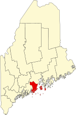
[3] Name on the Register [4] Image Date listed [5] Location City or town Description 1 Ebenezer Alden House Ebenezer Alden House April 28, 1975 (# 75000100 Off State Route 131 44°12′44″N 69°16′03″W / 44.2122°N 69.2675°W / 44.2122; -69.2675 (Ebenezer Alden House ) Union 2 Allen's Island Upload image December 15, 1983 (# 83003646 In Muscongus Bay [6] 43°52′16″N 69°18′42″W / 43.8711°N 69.3117°W / 43.8711; -69.3117 (Allen's Island ) St. George 3 American Boathouse Upload image February 19, 1982 (# 82000761 Atlantic Ave. 44°12′40″N 69°03′48″W / 44.2111°N 69.0633°W / 44.2111; -69.0633 (American Boathouse ) Camden 4 American Eagle (schooner) American Eagle (schooner) December 4, 1991 (# 91002064 Rockland Harbor 44°06′32″N 69°06′32″W / 44.1089°N 69.1089°W / 44.1089; -69.1089 (American Eagle (schooner) Rockland National Historic Landmark 5 Joe Amesbury Place Upload image March 11, 1982 (# 82000760 Address Restricted North Haven 6 Beechnut Hut Historic District Beechnut Hut Historic District July 10, 2003 (# 03000617 316 Beech Hill Rd. 44°10′07″N 69°06′15″W / 44.1686°N 69.1042°W / 44.1686; -69.1042 (Beechnut Hut Historic District ) Rockport 7 Blackjack (friendship sloop) Upload image October 5, 2020 (# 100005650 Rockland Harbor at 75 Mechanic St. 44°05′36″N 69°06′14″W / 44.0932°N 69.1039°W / 44.0932; -69.1039 (Blackjack (friendship sloop) Rockland 8 Bortz-Lewis Site Upload image March 11, 1982 (# 82000762 Address Restricted North Haven 9 Browns Head Light Station Browns Head Light Station January 27, 1983 (# 83000460 Browns Head 44°06′42″N 68°54′35″W / 44.1117°N 68.9097°W / 44.1117; -68.9097 (Browns Head Light Station ) Vinalhaven 10 Bull Rock Upload image March 11, 1982 (# 82000763 Address Restricted North Haven 11 Benjamin Burton Garrison Site Upload image September 9, 1983 (# 83000461 Address Restricted Cushing 12 Cabot I Site Upload image March 11, 1982 (# 82000764 Address Restricted North Haven 13 Camden Great Fire Historic District Camden Great Fire Historic District January 9, 2007 (# 06001221 Elm and Main Sts. 44°12′35″N 69°03′57″W / 44.2097°N 69.0658°W / 44.2097; -69.0658 (Camden Great Fire Historic District ) Camden 14 Camden Opera House Block Camden Opera House Block December 29, 1986 (# 86003539 Off U.S. Route 1 44°12′32″N 69°04′01″W / 44.2089°N 69.0669°W / 44.2089; -69.0669 (Camden Opera House Block ) Camden 15 Camden Amphitheater and Public Library Camden Amphitheater and Public Library February 27, 2013 (# 13000285 55 Main St. 44°12′41″N 69°03′51″W / 44.2115°N 69.0642°W / 44.2115; -69.0642 (Camden Amphitheater and Public Library ) Camden 16 Camden Yacht Club Camden Yacht Club January 11, 1980 (# 80000378 Bay View St. 44°12′26″N 69°03′43″W / 44.2072°N 69.0619°W / 44.2072; -69.0619 (Camden Yacht Club ) Camden 17 Chestnut Street Historic District Chestnut Street Historic District March 22, 1991 (# 91000325 Chestnut St. from Elm to Beacon Ave., including parts of Penobscot, Pleasant and Wood Sts., and Dillingham Pt. 44°12′13″N 69°03′43″W / 44.2036°N 69.0619°W / 44.2036; -69.0619 (Chestnut Street Historic District ) Camden 18 The Common The Common November 7, 2007 (# 07001151 Between Common and Burkett Rds. 44°12′41″N 69°16′30″W / 44.2114°N 69.275°W / 44.2114; -69.275 (The Common ) Union 19 Conway House Conway House December 23, 1969 (# 69000010 Conway Rd. 44°12′01″N 69°04′52″W / 44.2003°N 69.0811°W / 44.2003; -69.0811 (Conway House ) Camden 20 Crocker Site Upload image March 11, 1982 (# 82000765 Address Restricted North Haven 21 Curtis Island Light Curtis Island Light May 17, 1973 (# 73000263 3.8 miles from Camden Harbor in Penobscot Bay 44°12′07″N 69°03′03″W / 44.2019°N 69.0508°W / 44.2019; -69.0508 (Curtis Island Light ) Camden 22 Dunn & Elliot Sail Loft Upload image March 13, 2020 (# 100005096 54 Water St. 44°04′26″N 69°11′08″W / 44.0738°N 69.1856°W / 44.0738; -69.1856 (Dunn & Elliot Sail Loft ) Thomaston 23 Farnsworth Homestead Farnsworth Homestead May 25, 1973 (# 73000241 21 Elm St. 44°06′11″N 69°06′39″W / 44.1031°N 69.1108°W / 44.1031; -69.1108 (Farnsworth Homestead ) Rockland 24 Finnish Congregational Church and Parsonage Finnish Congregational Church and Parsonage June 24, 1994 (# 94000639 Eastern side of State Route 131 , 0.9 miles south of its junction with U.S. Route 1 44°04′18″N 69°09′43″W / 44.0717°N 69.1619°W / 44.0717; -69.1619 (Finnish Congregational Church and Parsonage ) South Thomaston 25 Gaunt Neck Site Complex Upload image December 28, 2005 (# 05001467 Address Restricted 43°58′59″N 69°18′20″W / 43.9831°N 69.3056°W / 43.9831; -69.3056 (Gaunt Neck Site Complex ) Cushing 26 Georges River Canal Georges River Canal March 5, 1970 (# 70000048 Upper Falls of the Georges River in Warren to the Union town line, extending to Quantabacook Pond in Searsmont 44°15′N 69°15′W / 44.25°N 69.25°W / 44.25; -69.25 (Georges River Canal ) Appleton , Union , and Warren 27 Goose Rocks Light Station Goose Rocks Light Station January 21, 1988 (# 87002267 East Entrance to the Fox Islands Thorofare 44°08′07″N 68°49′52″W / 44.1353°N 68.8311°W / 44.1353; -68.8311 (Goose Rocks Light Station ) North Haven 28 Grace Bailey (two-masted schooner) Grace Bailey (two-masted schooner) October 1, 1990 (# 90001466 Camden Harbor 44°12′36″N 69°03′50″W / 44.21°N 69.0639°W / 44.21; -69.0639 (Grace Bailey (two-masted schooner) Camden National Historic Landmark 29 Gooden Grant House Upload image December 18, 2013 (# 13000926 1 Head Harbor 44°01′27″N 68°37′07″W / 44.0242°N 68.6186°W / 44.0242; -68.6186 (Gooden Grant House ) Isle au Haut 30 Gushee Family House Gushee Family House October 8, 1998 (# 98001235 2868 Sennebec Rd. 44°17′13″N 69°14′54″W / 44.2869°N 69.2483°W / 44.2869; -69.2483 (Gushee Family House ) Appleton 31 Herald Building Upload image December 24, 2020 (# 100005940 10 Bay View St. 44°12′34″N 69°03′51″W / 44.2094°N 69.0643°W / 44.2094; -69.0643 (Herald Building ) Camden 32 Heron Neck Light Station Heron Neck Light Station January 21, 1988 (# 87002266 Heron Neck on Greens Island 44°01′31″N 68°51′45″W / 44.0253°N 68.8625°W / 44.0253; -68.8625 (Heron Neck Light Station ) Vinalhaven 33 High Street Historic District High Street Historic District January 5, 1989 (# 88001843 Roughly High St. between Main St. and Sherman Point Rd.; also the junction of Main St. and Atlantic Ave. 44°12′58″N 69°03′40″W / 44.2161°N 69.0611°W / 44.2161; -69.0611 (High Street Historic District ) Camden Main and Atlantic intersection represents a boundary increase September 24, 1999 34 Indian Island Light Station Indian Island Light Station March 23, 1988 (# 87002539 Indian Island in Rockport Harbor 44°09′55″N 69°03′42″W / 44.1653°N 69.0617°W / 44.1653; -69.0617 (Indian Island Light Station ) Rockport 35 Isaac H. Evans (schooner) Isaac H. Evans (schooner) December 4, 1991 (# 91002061 Rockland Harbor 44°06′32″N 69°06′32″W / 44.1089°N 69.1089°W / 44.1089; -69.1089 (Isaac H. Evans (schooner) Rockland National Historic Landmark 36 Isle Au Haut Light Station Isle Au Haut Light Station January 21, 1988 (# 87002265 Robinson Point 44°03′53″N 68°39′07″W / 44.0647°N 68.6519°W / 44.0647; -68.6519 (Isle Au Haut Light Station ) Isle Au Haut 37 J. & E. Riggin (schooner) J. & E. Riggin (schooner) December 4, 1991 (# 91002062 Rockland Harbor 44°06′26″N 69°06′23″W / 44.1072°N 69.1064°W / 44.1072; -69.1064 (J. & E. Riggin (schooner) Rockland National Historic Landmark 38 Thomas King Inscription Upload image May 7, 1979 (# 79000152 Address Restricted Cushing 39 Knox County Courthouse Knox County Courthouse April 18, 1977 (# 77000075 62 Union St. 44°06′14″N 69°06′43″W / 44.1039°N 69.1119°W / 44.1039; -69.1119 (Knox County Courthouse ) Rockland 40 Land's End Historic District Land's End Historic District September 8, 2011 (# 11000633 Marshall Point & Cottage Rds., Lentine & Land's End Lns. 43°55′16″N 69°15′19″W / 43.9211°N 69.2553°W / 43.9211; -69.2553 (Land's End Historic District ) Saint George 41 Lermond Mill Lermond Mill December 27, 1984 (# 84000499 Payson Rd. 44°12′51″N 69°13′28″W / 44.2142°N 69.2244°W / 44.2142; -69.2244 (Lermond Mill ) Union 42 Lewis R. French (schooner) Lewis R. French (schooner) December 4, 1991 (# 82005263 Camden Harbor 44°12′37″N 69°03′46″W / 44.2104°N 69.0627°W / 44.2104; -69.0627 (Lewis R. French (schooner) Camden National Historic Landmark 43 Main Street Historic District Main Street Historic District June 7, 1978 (# 78000182 Main St. from Limerock to Winter Sts.; also 428-497 Main St. 44°06′14″N 69°06′34″W / 44.103889°N 69.109444°W / 44.103889; -69.109444 (Main Street Historic District ) Rockland Second set of addresses represents a boundary increase, listed January 4, 2012 44 Marshall Point Light Station Marshall Point Light Station March 23, 1988 (# 87002262 Marshall Point in Port Clyde Harbor 43°55′02″N 69°15′42″W / 43.917222°N 69.261667°W / 43.917222; -69.261667 (Marshall Point Light Station ) Port Clyde 45 Matinicus Rock Light Station Matinicus Rock Light Station March 14, 1988 (# 88000149 Matinicus Rock 43°47′06″N 68°51′16″W / 43.785°N 68.854444°W / 43.785; -68.854444 (Matinicus Rock Light Station ) Matinicus Isle 46 Joseph and Hannah Maxcy Homestead Joseph and Hannah Maxcy Homestead July 28, 2004 (# 04000743 630 S. Union Rd. 44°11′47″N 69°15′50″W / 44.196389°N 69.263889°W / 44.196389; -69.263889 (Joseph and Hannah Maxcy Homestead ) Union 47 Megunticook Golf Club Megunticook Golf Club July 22, 1993 (# 93000636 212 Calderwood Ln. 44°11′03″N 69°03′49″W / 44.184167°N 69.063611°W / 44.184167; -69.063611 (Megunticook Golf Club ) Rockport Misspelled "Mequnticook" in the National Register listing. 48 Mercantile (schooner) Mercantile (schooner) December 4, 1991 (# 82005265 Camden Harbor 44°12′38″N 69°03′46″W / 44.210556°N 69.062778°W / 44.210556; -69.062778 (Mercantile (schooner) Camden 49 Miller's Garage Miller's Garage February 21, 2023 (# 100008495 25 Rankin St. 44°06′34″N 69°06′42″W / 44.1094°N 69.1116°W / 44.1094; -69.1116 (Miller's Garage ) Rockland 50 Mt. Battie Tower Mt. Battie Tower December 31, 2018 (# 100003259 At summit loop of Mt. Battie Rd. 44°13′23″N 69°04′08″W / 44.2231°N 69.0690°W / 44.2231; -69.0690 (Mt. Battie Tower ) Camden 51 Mosquito Island House Mosquito Island House September 29, 1983 (# 83000462 South of St. George on Mosquito Island 43°55′21″N 69°13′22″W / 43.9225°N 69.222778°W / 43.9225; -69.222778 (Mosquito Island House ) St. George 52 Mullen's Cove Upload image March 30, 1984 (# 84001382 Address Restricted North Haven 53 Murch Family House Upload image March 25, 1993 (# 93000205 Southeastern side of Calderwood Neck, 2 miles northeast of North Haven Rd. 44°06′00″N 68°49′05″W / 44.1°N 68.818056°W / 44.1; -68.818056 (Murch Family House ) Vinalhaven 54 Norumbega Norumbega July 12, 1974 (# 74000174 High St. 44°13′04″N 69°03′26″W / 44.217778°N 69.057222°W / 44.217778; -69.057222 (Norumbega ) Camden 55 Norumbega Carriage House Upload image February 19, 1982 (# 82000766 High St. 44°13′00″N 69°03′25″W / 44.216667°N 69.056944°W / 44.216667; -69.056944 (Norumbega Carriage House ) Camden 56 Olson House Olson House August 31, 1995 (# 93001114 Eastern side of Hathorn Point Rd. 43°58′54″N 69°16′09″W / 43.981667°N 69.269167°W / 43.981667; -69.269167 (Olson House ) South Cushing vicinity Andrew Wyeth spent 30 summers at the house and is buried on the grounds. National Historic Landmark designation June 23, 2011. 57 Owls Head Light Station Owls Head Light Station January 18, 1978 (# 78000183 Northeast of Owls Head on W. Penobscot Bay 44°05′30″N 69°02′41″W / 44.091667°N 69.044722°W / 44.091667; -69.044722 (Owls Head Light Station ) Owls Head 58 Pleasant River Grange No. 492 Upload image October 8, 1999 (# 99001190 Round Island Rd., 0.15 miles east of its junction with N. Haven Rd. 44°04′33″N 68°50′20″W / 44.075833°N 68.838889°W / 44.075833; -68.838889 (Pleasant River Grange No. 492 ) Vinalhaven 59 Rankin Block Rankin Block November 7, 1978 (# 78000184 600-610 Main St. 44°06′32″N 69°06′38″W / 44.108889°N 69.110556°W / 44.108889; -69.110556 (Rankin Block ) Rockland 60 Rockland Breakwater Rockland Breakwater April 11, 2003 (# 03000203 South of Jameson Point 44°06′14″N 69°04′41″W / 44.103889°N 69.078056°W / 44.103889; -69.078056 (Rockland Breakwater ) Rockland 61 Rockland Breakwater Lighthouse Rockland Breakwater Lighthouse March 20, 1981 (# 81000067 Rockland Harbor 44°06′14″N 69°04′40″W / 44.103889°N 69.077778°W / 44.103889; -69.077778 (Rockland Breakwater Lighthouse ) Rockland 62 Rockland Public Library Rockland Public Library July 10, 1979 (# 79000153 Union St. 44°06′19″N 69°06′45″W / 44.105278°N 69.1125°W / 44.105278; -69.1125 (Rockland Public Library ) Rockland 63 Rockland Railroad Station Rockland Railroad Station February 7, 1978 (# 78000327 Union St. 44°06′03″N 69°06′41″W / 44.100833°N 69.111389°W / 44.100833; -69.111389 (Rockland Railroad Station ) Rockland 64 Rockland Residential Historic District Rockland Residential Historic District April 15, 1987 (# 86003513 Roughly bounded by Granite, Union, Masonic, Broad, Limerock, and Broadway Sts. 44°06′18″N 69°06′53″W / 44.105°N 69.114722°W / 44.105; -69.114722 (Rockland Residential Historic District ) Rockland 65 Rockland Turntable and Engine House Rockland Turntable and Engine House June 24, 1993 (# 90001953 Park St. west of the Rockland railroad station 44°06′04″N 69°07′23″W / 44.101111°N 69.123056°W / 44.101111; -69.123056 (Rockland Turntable and Engine House ) Rockland 66 Rockport Historic District Rockport Historic District May 28, 1976 (# 76000099 Irregular pattern along Pascal Ave. from Russell, Union, and Winter Sts. on the north to School St. on the south 44°11′08″N 69°04′28″W / 44.185556°N 69.074444°W / 44.185556; -69.074444 (Rockport Historic District ) Rockport 67 Rockport Historic Kiln Area Rockport Historic Kiln Area January 26, 1970 (# 70000090 On the western side of the mouth of the Goose River at its confluence with Rockport Harbor 44°11′11″N 69°04′27″W / 44.186389°N 69.074167°W / 44.186389; -69.074167 (Rockport Historic Kiln Area ) Rockport 68 Saddleback Ledge Light Station Saddleback Ledge Light Station March 14, 1988 (# 88000158 Saddleback Ledge at Isle Au Haut Bay 44°00′51″N 68°43′36″W / 44.014167°N 68.726667°W / 44.014167; -68.726667 (Saddleback Ledge Light Station ) Vinalhaven 69 Sail Loft Sail Loft October 28, 1977 (# 77000076 Off State Route 131 43°57′55″N 69°12′36″W / 43.965278°N 69.21°W / 43.965278; -69.21 (Sail Loft ) Tenants Harbor 70 Security Trust Building Security Trust Building January 20, 1978 (# 78000185 Elm and Main Sts. 44°06′13″N 69°06′35″W / 44.103611°N 69.109722°W / 44.103611; -69.109722 (Security Trust Building ) Rockland 71 Singhi Double House Upload image March 28, 2019 (# 100003589 198-200 Broadway 44°06′17″N 69°07′04″W / 44.1046°N 69.1177°W / 44.1046; -69.1177 (Singhi Double House ) Rockland Apparently incorrectly listed in Rockport. 72 Spite House Spite House August 13, 1974 (# 74000175 Deadman's Point 44°10′31″N 69°03′18″W / 44.175278°N 69.055°W / 44.175278; -69.055 (Spite House ) Rockport 73 Star of Hope Lodge Upload image February 19, 1982 (# 82000767 Maine St. 44°02′52″N 68°49′59″W / 44.047778°N 68.833056°W / 44.047778; -68.833056 (Star of Hope Lodge ) Vinalhaven 74 Stephen Taber (schooner) Stephen Taber (schooner) July 30, 1984 (# 84001386 Rockland Harbor 44°06′20″N 69°06′27″W / 44.1056°N 69.1075°W / 44.1056; -69.1075 (Stephen Taber (schooner) Rockland National Historic Landmark 75 Strand Theatre Strand Theatre December 2, 2004 (# 04001284 345 Main St. 44°06′10″N 69°06′33″W / 44.102778°N 69.109167°W / 44.102778; -69.109167 (Strand Theatre ) Rockland 76 Surprise (schooner) Surprise (schooner) June 14, 1991 (# 91000771 Camden Harbor 44°12′38″N 69°03′48″W / 44.210556°N 69.063333°W / 44.210556; -69.063333 (Surprise (schooner) Camden 77 Tenants Harbor Light Station Tenants Harbor Light Station November 20, 1987 (# 87002026 Southern Island 43°57′43″N 69°11′18″W / 43.961944°N 69.188333°W / 43.961944; -69.188333 (Tenants Harbor Light Station ) Tenants Harbor 78 Thomaston Historic District Thomaston Historic District May 2, 1974 (# 74000176 Runs along US 1 between Wadsworth St. and State Route 131 44°04′38″N 69°10′54″W / 44.077222°N 69.181667°W / 44.077222; -69.181667 (Thomaston Historic District ) Thomaston 79 George Thorndike House George Thorndike House January 11, 1983 (# 83000463 State Route 73 44°03′21″N 69°07′23″W / 44.055857°N 69.123017°W / 44.055857; -69.123017 (George Thorndike House ) South Thomaston 80 Tillson Farm Barn Tillson Farm Barn December 18, 1990 (# 90001902 Warrenton Rd. southeast of its junction with Commercial St. 44°07′49″N 69°05′23″W / 44.130278°N 69.089722°W / 44.130278; -69.089722 (Tillson Farm Barn ) Glen Cove 81 Gen. Davis Tillson House Gen. Davis Tillson House January 11, 1983 (# 83000464 157 Talbot Ave. 44°06′34″N 69°07′19″W / 44.109444°N 69.121944°W / 44.109444; -69.121944 (Gen. Davis Tillson House ) Rockland 82 Tolman Cemetery Tolman Cemetery October 12, 2017 (# 100001741 39 Lake Ave. 44°07′33″N 69°07′14″W / 44.125827°N 69.120629°W / 44.125827; -69.120629 (Tolman Cemetery ) Rockland 83 Turner Farm II Upload image March 11, 1982 (# 82000768 Address Restricted North Haven 84 Turner Farm Site Upload image March 26, 1976 (# 76000100 Address Restricted North Haven 85 Union Church of Vinalhaven Upload image July 19, 1984 (# 84001388 E. Main St. 44°02′54″N 68°49′52″W / 44.048333°N 68.831111°W / 44.048333; -68.831111 (Union Church of Vinalhaven ) Vinalhaven 86 Union Meeting House (Appleton) Upload image October 8, 2014 (# 14000836 2875 Sennebec Rd. 44°17′15″N 69°14′51″W / 44.2875°N 69.2475°W / 44.2875; -69.2475 (Union Meeting House (Appleton) ) Appleton 87 Union Town House (Former) Union Town House (Former) December 31, 2001 (# 01001419 128 Town House Rd. 44°12′47″N 69°16′30″W / 44.213056°N 69.275°W / 44.213056; -69.275 (Union Town House (Former) ) Union 88 US Post Office-Camden Main US Post Office-Camden Main September 25, 1986 (# 86002960 Chestnut St. 44°12′31″N 69°03′53″W / 44.208611°N 69.064722°W / 44.208611; -69.064722 (US Post Office-Camden Main ) Camden 89 Victory Chimes (Schooner) Victory Chimes (Schooner) June 24, 1996 (# 93000637 North End Shipyard, Rockland Harbor 44°06′41″N 69°06′14″W / 44.111389°N 69.103889°W / 44.111389; -69.103889 (Victory Chimes (Schooner) Rockland National Historic Landmark 90 The Vinalhaven Galamander Upload image July 1, 1970 (# 70000049 Bandstand Park 44°02′53″N 68°49′53″W / 44.047919°N 68.831251°W / 44.047919; -68.831251 (The Vinalhaven Galamander ) Vinalhaven 91 Vinalhaven Public Library Upload image January 5, 1989 (# 88003014 Carver St. 44°02′55″N 68°49′55″W / 44.048611°N 68.831944°W / 44.048611; -68.831944 (Vinalhaven Public Library ) Vinalhaven 92 Moses Webster House Moses Webster House April 1, 1998 (# 98000309 Atlantic Ave., 0.05 miles east of the junction of Main St. and Atlantic Ave. 44°02′51″N 68°49′53″W / 44.0475°N 68.831389°W / 44.0475; -68.831389 (Moses Webster House ) Vinalhaven 93 Wharf House Upload image October 16, 1991 (# 91001508 Southeast of the junction of Main and Smith Sts. 44°07′37″N 68°52′16″W / 44.126944°N 68.871111°W / 44.126944; -68.871111 (Wharf House ) North Haven 94 Whitehead Lifesaving Station Upload image October 12, 1988 (# 88001839 Southern side of Whitehead Island 43°58′43″N 69°07′57″W / 43.978611°N 69.1325°W / 43.978611; -69.1325 (Whitehead Lifesaving Station ) Sprucehead 95 Whitehead Light Station Whitehead Light Station March 14, 1988 (# 88000154 Eastern side of Whitehead Island 43°58′47″N 69°07′30″W / 43.979722°N 69.125°W / 43.979722; -69.125 (Whitehead Light Station ) Tenants Harbor 96 Whitney Farm Whitney Farm March 17, 2015 (# 15000087 215 Whitney Rd. 44°19′44″N 69°13′50″W / 44.329°N 69.2305°W / 44.329; -69.2305 (Whitney Farm ) Appleton Extends into Searsmont in Waldo County 97 Timothy and Jane Williams House Timothy and Jane Williams House December 21, 2005 (# 05001441 34 Old County Rd. 44°06′09″N 69°08′34″W / 44.1025°N 69.142778°W / 44.1025; -69.142778 (Timothy and Jane Williams House ) Rockland