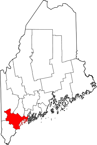
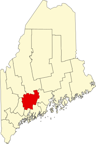
[3] Name on the Register [4] Image Date listed [5] Location City or town Description 1 Archeological Site No. 29-64 Upload image February 22, 1982 (# 82000782 Address Restricted Islesboro 2 Archeological Site No. 39.1 Upload image August 1, 1994 (# 94000759 Address Restricted Searsmont 3 Bayside Historic District Bayside Historic District December 30, 1996 (# 96001477 Roughly bounded by Penobscot Bay , Clinton Ave., George St., and Bay View Park 44°22′48″N 68°58′09″W / 44.38°N 68.969167°W / 44.38; -68.969167 (Bayside Historic District ) Bayside 4 Belfast Commercial Historic District Belfast Commercial Historic District April 4, 1980 (# 80000257 Main St. between Church and Cross Sts. 44°25′34″N 69°00′27″W / 44.426111°N 69.0075°W / 44.426111; -69.0075 (Belfast Commercial Historic District ) Belfast 5 Belfast Historic District Belfast Historic District August 21, 1986 (# 86002733 Roughly bounded by High, Grove, Elm, Congress, Main, Market, and Imrose; also 59-63 Anderson St; also 121 High St. 44°25′25″N 69°00′23″W / 44.423611°N 69.006389°W / 44.423611; -69.006389 (Belfast Historic District ) Belfast Anderson St. addresses and High St. address each represent boundary increases April 02, 1993, and December 28, 1995 6 Belfast National Bank Belfast National Bank April 23, 1973 (# 73000148 Main and Beaver Sts. 44°25′32″N 69°00′26″W / 44.425556°N 69.007222°W / 44.425556; -69.007222 (Belfast National Bank ) Belfast 7 Black Horse Tavern Black Horse Tavern February 11, 1982 (# 82000783 Searsport Ave. 44°25′44″N 68°59′02″W / 44.428889°N 68.983889°W / 44.428889; -68.983889 (Black Horse Tavern ) Belfast 8 Camp NEOFA Upload image March 22, 2024 (# 100010083 213 Trotting Park Road 44°23′07″N 69°16′14″W / 44.3852°N 69.2705°W / 44.3852; -69.2705 (Camp NEOFA ) Montville 9 Carver Memorial Library Carver Memorial Library October 14, 1993 (# 93001113 Northeastern corner of the junction of Union and Mortland Sts. 44°27′38″N 68°55′23″W / 44.460556°N 68.923056°W / 44.460556; -68.923056 (Carver Memorial Library ) Searsport 10 Hezekiah Chase House Hezekiah Chase House January 31, 1978 (# 78000202 U.S. Route 202 44°36′49″N 69°19′58″W / 44.613611°N 69.332778°W / 44.613611; -69.332778 (Hezekiah Chase House ) Unity 11 Christ Church Christ Church March 26, 1992 (# 92000276 Off the western side of Main Rd. south of Dark Harbor 44°15′26″N 68°54′45″W / 44.2571°N 68.9125°W / 44.2571; -68.9125 (Christ Church ) Dark Harbor 12 Church Street Historic District Church Street Historic District November 28, 1978 (# 78000331 Irregular pattern along Church St. from High to Franklin Sts. 44°25′23″N 69°00′14″W / 44.423056°N 69.003889°W / 44.423056; -69.003889 (Church Street Historic District ) Belfast 13 Cobe Estate Cobe Estate October 20, 1983 (# 83003684 North of Northport on Bluff Rd. 44°22′27″N 68°58′07″W / 44.374167°N 68.968611°W / 44.374167; -68.968611 (Cobe Estate ) Northport 14 College Club Inn College Club Inn April 14, 2000 (# 00000377 190 W. Main St. 44°26′40″N 68°56′07″W / 44.444444°N 68.935278°W / 44.444444; -68.935278 (College Club Inn ) Searsport 15 Dark Harbor Shop Upload image September 28, 2017 (# 100001677 515 Pendleton Point Rd. 44°15′41″N 68°54′49″W / 44.261482°N 68.913599°W / 44.261482; -68.913599 (Dark Harbor Shop ) Islesboro 16 Drexel Estate Upload image March 21, 1985 (# 85000613 The Bluff 44°20′37″N 68°52′50″W / 44.343611°N 68.880556°W / 44.343611; -68.880556 (Drexel Estate ) Islesboro 17 East Main Street Historic District East Main Street Historic District December 13, 1991 (# 91001815 U.S. Route 1 between Black Rd. and Navy St. 44°27′27″N 68°54′53″W / 44.4575°N 68.914722°W / 44.4575; -68.914722 (East Main Street Historic District ) Searsport 18 Farwell Brothers Store Farwell Brothers Store December 30, 2019 (# 100004828 37 Gordon Hill Rd. 44°34′43″N 69°16′33″W / 44.5786°N 69.2758°W / 44.5786; -69.2758 (Farwell Brothers Store ) Thorndike 19 First Church of Belfast First Church of Belfast November 7, 1976 (# 76000115 Church St. 44°25′28″N 69°00′27″W / 44.424444°N 69.0075°W / 44.424444; -69.0075 (First Church of Belfast ) Belfast 20 Fort Knox State Park Fort Knox State Park October 1, 1969 (# 69000023 U.S. Route 1 near Prospect 44°33′53″N 68°48′34″W / 44.564722°N 68.809444°W / 44.564722; -68.809444 (Fort Knox State Park ) Prospect 21 Fort Point Light Station Fort Point Light Station March 23, 1988 (# 87002269 Fort Point Rd. 44°28′01″N 68°48′45″W / 44.466944°N 68.8125°W / 44.466944; -68.8125 (Fort Point Light Station ) Stockton Springs 22 Fort Pownall Memorial Fort Pownall Memorial October 28, 1969 (# 69000028 Southeast of Stockton Springs on Fort Point 44°28′05″N 68°48′46″W / 44.468056°N 68.812778°W / 44.468056; -68.812778 (Fort Pownall Memorial ) Stockton Springs 23 Frankfort Dam Frankfort Dam February 12, 2003 (# 03000018 South of the junction of U.S. Route 1A and the north branch of Marsh Stream 44°36′33″N 68°52′24″W / 44.609167°N 68.873333°W / 44.609167; -68.873333 (Frankfort Dam ) Frankfort 24 Free Will Baptist Church and Cemetery Upload image September 27, 1988 (# 88000891 Church Rd. 44°21′11″N 68°53′41″W / 44.353056°N 68.894722°W / 44.353056; -68.894722 (Free Will Baptist Church and Cemetery ) North Islesboro 25 Georges River Canal Upload image March 5, 1970 (# 70000048 Upper Falls on the Georges River in Warren to the Union town line, extending to Quantabacook Pond in Searsmont 44°15′N 69°15′W / 44.25°N 69.25°W / 44.25; -69.25 (Georges River Canal ) Searsmont Also extends into Knox County 26 Greer's Corner School Upload image October 16, 1991 (# 91001513 Southeastern corner of Back Belmont and Lincolnville Rd. 44°22′28″N 69°07′48″W / 44.374444°N 69.13°W / 44.374444; -69.13 (Greer's Corner School ) Belmont Corner 27 Grindle Point Light Station Grindle Point Light Station March 13, 1987 (# 87000427 Ferry Rd. 44°16′53″N 68°56′36″W / 44.281389°N 68.943333°W / 44.281389; -68.943333 (Grindle Point Light Station ) Islesboro 28 Hardscrabble Farm Upload image March 17, 1994 (# 94000181 Eastern side of Maine State Route 131 , 0.5 miles (0.80 km) south of its junction with State Route 173 44°21′13″N 69°11′56″W / 44.3535°N 69.1989°W / 44.3535; -69.1989 (Hardscrabble Farm ) Searsmont 29 Hayford Block Hayford Block August 29, 1977 (# 77000087 47 Church St. 44°25′31″N 69°00′27″W / 44.425278°N 69.0075°W / 44.425278; -69.0075 (Hayford Block ) Belfast 30 Nathan G. Hichborn House Nathan G. Hichborn House April 7, 1988 (# 88000392 Church St. 44°29′25″N 68°51′29″W / 44.490278°N 68.858056°W / 44.490278; -68.858056 (Nathan G. Hichborn House ) Stockton Springs 31 Islesboro Free Library Upload image January 5, 1989 (# 88003018 Main Rd. 44°18′09″N 68°54′04″W / 44.3025°N 68.901111°W / 44.3025; -68.901111 (Islesboro Free Library ) Islesboro 32 Keen Hall Keen Hall June 26, 2017 (# 100001242 1 Main St. 44°31′43″N 69°17′48″W / 44.528640°N 69.296789°W / 44.528640; -69.296789 (Keen Hall ) Freedom 33 Ebenezer Knowlton House Upload image January 11, 2002 (# 01001433 Choate Rd. 44°22′44″N 69°16′03″W / 44.378889°N 69.2675°W / 44.378889; -69.2675 (Ebenezer Knowlton House ) Montville 34 Lincolnville Center Meeting House Lincolnville Center Meeting House July 21, 1983 (# 83000475 State Route 173 44°17′55″N 69°06′33″W / 44.298611°N 69.109167°W / 44.298611; -69.109167 (Lincolnville Center Meeting House ) Lincolnville Center 35 (Former) Maine Central Railroad Depot Upload image August 5, 2009 (# 09000595 31 State Route 7 44°33′05″N 69°07′17″W / 44.551389°N 69.121389°W / 44.551389; -69.121389 ((Former) Maine Central Railroad Depot ) Brooks 36 Marsh School Upload image April 23, 2013 (# 13000188 930 Bangor Rd. 44°33′04″N 68°51′53″W / 44.5511°N 68.8646°W / 44.5511; -68.8646 (Marsh School ) Prospect 37 Masonic Temple Masonic Temple April 26, 1973 (# 73000246 High St. (U.S. Route 1 ) 44°25′34″N 69°00′24″W / 44.426111°N 69.006667°W / 44.426111; -69.006667 (Masonic Temple ) Belfast 38 Capt. John McGilvery House Capt. John McGilvery House December 29, 1983 (# 83003685 E. Main St. 44°27′31″N 68°55′00″W / 44.458611°N 68.916667°W / 44.458611; -68.916667 (Capt. John McGilvery House ) Searsport 39 Capt. William McGilvery House Capt. William McGilvery House December 29, 1983 (# 83003686 E. Main St. 44°27′33″N 68°54′52″W / 44.459167°N 68.914444°W / 44.459167; -68.914444 (Capt. William McGilvery House ) Searsport 40 Mill at Freedom Falls Mill at Freedom Falls April 19, 2012 (# 12000228 South side of Mill St., 125 feet (38 m) west of Pleasant St. 44°31′41″N 69°17′49″W / 44.528114°N 69.297027°W / 44.528114; -69.297027 (Mill at Freedom Falls ) Freedom 41 Moody Farm Upload image October 31, 2002 (# 02001269 Junction of State Route 173 and Lawry Rd. 44°21′33″N 69°08′56″W / 44.359167°N 69.148889°W / 44.359167; -69.148889 (Moody Farm ) Searsmont 42 Montville Town House Upload image April 24, 2012 (# 12000227 418 Center Rd. 44°26′47″N 69°14′46″W / 44.446258°N 69.246238°W / 44.446258; -69.246238 (Montville Town House ) Montville 43 Mortland Family Farm Upload image October 24, 1991 (# 91001510 Eastern side of Mortland Rd. north of Searsport 44°28′38″N 68°55′21″W / 44.477222°N 68.9225°W / 44.477222; -68.9225 (Mortland Family Farm ) Searsport 44 Mount Waldo Granite Works Mount Waldo Granite Works March 15, 1974 (# 74000194 on the slopes of Mount Waldo 44°35′26″N 68°53′01″W / 44.5905°N 68.8836°W / 44.5905; -68.8836 (Mount Waldo Granite Works ) Frankfort 45 Capt. John P. Nichols House Capt. John P. Nichols House January 4, 1983 (# 83000476 U.S. Route 1 44°27′28″N 68°54′56″W / 44.457778°N 68.915556°W / 44.457778; -68.915556 (Capt. John P. Nichols House ) Searsport 46 Old Post Office Upload image June 19, 1973 (# 73000149 Main St. (State Route 173 ) 44°23′31″N 69°18′26″W / 44.391944°N 69.307222°W / 44.391944; -69.307222 (Old Post Office ) Liberty 47 James G. Pendleton House James G. Pendleton House March 10, 1995 (# 95000218 81 W. Main St. 44°27′10″N 68°55′59″W / 44.452778°N 68.933056°W / 44.452778; -68.933056 (James G. Pendleton House ) Searsport 48 Penobscot Marine Museum Penobscot Marine Museum July 1, 1970 (# 70000088 Church St. 44°27′36″N 68°55′31″W / 44.46°N 68.925278°W / 44.46; -68.925278 (Penobscot Marine Museum ) Searsport 49 Philler Cottage Upload image April 11, 1985 (# 85000726 Main Rd., Dark Harbor 44°15′31″N 68°54′45″W / 44.258611°N 68.9125°W / 44.258611; -68.9125 (Philler Cottage ) Islesboro 50 Pilley House Upload image September 15, 2022 (# 100008124 11 Moosehead Trail 44°33′17″N 69°07′23″W / 44.5548°N 69.1231°W / 44.5548; -69.1231 (Pilley House ) Brooks 51 Primrose Hill Historic District Upload image October 3, 1973 (# 73000150 High and Anderson Sts. 44°25′16″N 69°00′44″W / 44.421111°N 69.012222°W / 44.421111; -69.012222 (Primrose Hill Historic District ) Belfast 52 Privateer Brigantine DEFENCE Shipwreck Site Upload image March 18, 1975 (# 75000205 Buried in Stockton Springs Harbor Stockton Springs Ship wrecked during the 1779 Penobscot Expedition . 53 Searsport Historic District Searsport Historic District July 27, 1979 (# 79000168 Main St. 44°27′30″N 68°55′33″W / 44.458333°N 68.925833°W / 44.458333; -68.925833 (Searsport Historic District ) Searsport 54 Seven Star Grange, No. 73 Upload image November 18, 2011 (# 11000817 696 Bangor Rd. 44°39′46″N 69°15′26″W / 44.662772°N 69.257267°W / 44.662772; -69.257267 (Seven Star Grange, No. 73 ) Troy 55 Springdale Farm Springdale Farm April 24, 2000 (# 00000374 Horseback Rd., 0.5 miles (0.80 km) south of Troy Rd. 44°40′59″N 69°21′57″W / 44.683056°N 69.365833°W / 44.683056; -69.365833 (Springdale Farm ) Burnham 56 Stockton Springs Community Church Stockton Springs Community Church June 20, 1985 (# 85001266 20 Church St. 44°29′28″N 68°51′29″W / 44.491111°N 68.858056°W / 44.491111; -68.858056 (Stockton Springs Community Church ) Stockton Springs 57 George S. Tiffany Cottage Upload image October 16, 1989 (# 89001700 Off Main Rd. 44°14′57″N 68°55′22″W / 44.249167°N 68.922778°W / 44.249167; -68.922778 (George S. Tiffany Cottage ) Dark Harbor 58 Tranquility Grange No. 344 Upload image April 11, 2002 (# 02000350 1 mile (1.6 km) north of the junction of State Routes 52 and 173 44°18′21″N 69°05′52″W / 44.305833°N 69.097778°W / 44.305833; -69.097778 (Tranquility Grange No. 344 ) Lincolnville Center 59 Troy Meeting House Troy Meeting House November 18, 2011 (# 11000818 514 Bangor Rd. 44°39′54″N 69°14′23″W / 44.664992°N 69.239697°W / 44.664992; -69.239697 (Troy Meeting House ) Troy 60 George Ulmer House Upload image October 4, 2006 (# 06000922 3 S. Cobbtown Rd. 44°17′55″N 69°00′14″W / 44.298611°N 69.003889°W / 44.298611; -69.003889 (George Ulmer House ) Lincolnville 61 Union Hall Union Hall March 20, 1986 (# 86000478 3 Reservoir St. 44°27′34″N 68°55′28″W / 44.459444°N 68.924444°W / 44.459444; -68.924444 (Union Hall ) Searsport 62 Union School Upload image March 25, 1993 (# 93000203 Eastern side of Mt. Ephraim Rd., 0.2 miles (0.32 km) north of its junction with U.S. Route 1 44°27′38″N 68°55′43″W / 44.460556°N 68.928611°W / 44.460556; -68.928611 (Union School ) Searsport 63 Village School Village School June 27, 2014 (# 14000363 69 School Street 44°36′45″N 69°20′15″W / 44.6124°N 69.3376°W / 44.6124; -69.3376 (Village School ) Unity 64 Paul and Lucena Webster Summer House Upload image December 26, 2023 (# 100009660 142 Lighthouse Road 44°27′58″N 68°49′06″W / 44.4662°N 68.8182°W / 44.4662; -68.8182 (Paul and Lucena Webster Summer House ) Stockton Springs 65 James P. White House James P. White House April 24, 1973 (# 73000245 1 Church St. 44°25′15″N 69°00′02″W / 44.420833°N 69.000556°W / 44.420833; -69.000556 (James P. White House ) Belfast 66 Whitney Farm Whitney Farm March 17, 2015 (# 15000087 215 Whitney Rd. 44°19′44″N 69°13′50″W / 44.329°N 69.2305°W / 44.329; -69.2305 (Whitney Farm ) Appleton Extends into Searsmont ; farmstead is in Appleton. 67 Winterport Congregational Church Upload image April 24, 1973 (# 73000151 Alternate U.S. Route 1 44°38′09″N 68°50′49″W / 44.635833°N 68.846944°W / 44.635833; -68.846944 (Winterport Congregational Church ) Winterport 68 Winterport Historic District Winterport Historic District October 3, 1975 (# 75000112 Irregular pattern along Main, Elm, Cushing, Lebanon, Commercial, Dean, and Water Sts. 44°38′10″N 68°50′53″W / 44.636111°N 68.848056°W / 44.636111; -68.848056 (Winterport Historic District ) Winterport