National Register of Historic Places listings in Knox County, Nebraska

Last updated

Location of Knox County in Nebraska Map of Nebraska highlighting Knox County.svg
Location of Knox County in Nebraska

This is a list of the National Register of Historic Places listings in Knox County, Nebraska.

Contents

This is intended to be a complete list of the properties and districts on the National Register of Historic Places in Knox County, Nebraska, United States. The locations of National Register properties and districts for which the latitude and longitude coordinates are included below, may be seen in a map. [1]

There are 15 properties and districts listed on the National Register in the county, and one former listing.


    This National Park Service list is complete through NPS recent listings posted May 27, 2022. [2]

Map all coordinates using: OpenStreetMap  
Download coordinates as: KML

Current listings

[3] Name on the RegisterImageDate listed [4] Location City or townDescription
1 Argo Hotel
Argo Hotel Argo Hotel from SW 1.jpg
Argo Hotel
May 5, 1999
(#99000478)
211 Kansas St.
42°43′54″N97°29′49″W / 42.731667°N 97.496944°W / 42.731667; -97.496944 (Argo Hotel)
Crofton
2 The Commercial Hotel
The Commercial Hotel Verdigre Commercial Hotel from SW 1.JPG
The Commercial Hotel
April 5, 1990
(#90000563)
117 Main St.
42°36′00″N98°02′00″W / 42.6°N 98.033333°W / 42.6; -98.033333 (The Commercial Hotel)
Verdigre
3 Congregational Church and Manse
Congregational Church and Manse Congregational Church on the Santee Reservation.jpg
Congregational Church and Manse
March 16, 1972
(#72000753)
Santee Sioux Reservation
42°50′19″N97°50′46″W / 42.838611°N 97.846111°W / 42.838611; -97.846111 (Congregational Church and Manse)
Santee
4 Episcopal Church
Episcopal Church Most Merciful Savior, Santee, from SE 1.JPG
Episcopal Church
March 16, 1972
(#72000754)
On the Missouri River in the Santee Sioux Reservation
42°50′27″N97°50′15″W / 42.84085°N 97.83763°W / 42.84085; -97.83763 (Episcopal Church)
Santee
5 Gross State Aid Bridge
Gross State Aid Bridge Gross State Aid Bridge from SW 3.JPG
Gross State Aid Bridge
June 29, 1992
(#92000773)
County road 885 Rd over Verdigris Creek, 3.5 miles north and 0.2 miles west of Verdigre
42°39′16″N98°02′34″W / 42.654444°N 98.042778°W / 42.654444; -98.042778 (Gross State Aid Bridge)
Verdigre
6 Knox County Courthouse
Knox County Courthouse Knox County Courthouse (Nebraska) courtroom 1.JPG
Knox County Courthouse
July 5, 1990
(#90000972)
Main St. between Brazile and Bridge Sts.
42°36′32″N97°52′37″W / 42.608889°N 97.876944°W / 42.608889; -97.876944 (Knox County Courthouse)
Center
7 Niobrara River Bridge
Niobrara River Bridge Niobrara State Park bridge from W.JPG
Niobrara River Bridge
November 12, 1992
(#92001576)
Over the Niobrara River 1.3 miles northwest of Niobrara
42°46′00″N98°02′55″W / 42.766667°N 98.048611°W / 42.766667; -98.048611 (Niobrara River Bridge)
Niobrara
8 Ponca Agency Archeological District July 12, 2006
(#06000555)
Address Restricted
Niobrara
9 Ponca Fort Site April 3, 1973
(#73001066)
Hilltop in Section 29, Township 33 North, Range 7 West [5]
42°48′29″N98°09′50″W / 42.808056°N 98.163833°W / 42.808056; -98.163833 (Ponca Fort Site)
Verdel University of Nebraska excavations in the 1930s showed this site to be Arikara-affiliated and to date from circa 1790 to 1802 [6]
10 Ponca Tribal Self-Help Community Building Historic District
Ponca Tribal Self-Help Community Building Historic District Ponca Tribe Community buildings Pow Wow circle 2.JPG
Ponca Tribal Self-Help Community Building Historic District
March 13, 2003
(#03000106)
88915 521 Avenue; [7] approximately 3 miles southeast of Niobrara
42°42′50″N98°04′30″W / 42.71381°N 98.07495°W / 42.71381; -98.07495 (Ponca Tribal Self-Help Community Building Historic District)
Niobrara
11 Rad Sladkovsky
Rad Sladkovsky Pishelville ZCBJ 3.JPG
Rad Sladkovsky
June 29, 1982
(#82003193)
At Pishelville, northwest of Verdigre
42°43′34″N98°12′41″W / 42.72619°N 98.21152°W / 42.72619; -98.21152 (Rad Sladkovsky)
Verdigre
12 St. Rose of Lima Catholic Church and School Complex
St. Rose of Lima Catholic Church and School Complex Crofton, NE St. Rose of Lima from E 1.JPG
St. Rose of Lima Catholic Church and School Complex
March 21, 2011
(#11000106)
1302-1316 W. 5th St. [8]
42°43′45″N97°30′03″W / 42.72922°N 97.50085°W / 42.72922; -97.50085 (St. Rose of Lima Catholic Church and School Complex)
Crofton
13 Winnetoon Jail
Winnetoon Jail Winnetoon jail from SW.JPG
Winnetoon Jail
February 27, 1995
(#95000094)
Junction of 1st St. and Sherman Ave.
42°30′52″N97°57′43″W / 42.514444°N 97.961944°W / 42.514444; -97.961944 (Winnetoon Jail)
Winnetoon
14 Winnetoon Public School March 13, 2020
(#100005053)
308 Jones St.
42°30′54″N97°57′49″W / 42.5150°N 97.9637°W / 42.5150; -97.9637 (Winnetoon Public School)
Winnetoon
15 Z.C.B.J. Opera House
Z.C.B.J. Opera House ZCBJ Opera House from SW.JPG
Z.C.B.J. Opera House
July 6, 1988
(#88000946)
4th Ave. and Main
42°35′48″N98°02′00″W / 42.596778°N 98.033333°W / 42.596778; -98.033333 (Z.C.B.J. Opera House)
Verdigre

Former listings

[3] Name on the RegisterImageDate listedDate removedLocationCity or townDescription
1 Pospeshil Theatre
Pospeshil Theatre Pospeshil Theatre nom 1 - Bloomfield Nebraska.jpg
Pospeshil Theatre
September 28, 1988
(#88000935)
March 25, 2019123 Broadway
42°35′53″N97°38′44″W / 42.598056°N 97.645556°W / 42.598056; -97.645556 (Pospeshil Theatre)
Bloomfield Burned down; Bloomfield library was built in 2000 on former site [9]

See also

Related Research Articles

National Register of Historic Places listings in Licking County, Ohio

This is a list of the National Register of Historic Places listings in Licking County, Ohio.

National Register of Historic Places listings in Knox County, Ohio

This is a list of the National Register of Historic Places listings in Knox County, Ohio.

National Register of Historic Places listings in Coshocton County, Ohio

This is a list of the National Register of Historic Places listings in Coshocton County, Ohio.

National Register of Historic Places listings in Montgomery County, Kansas

This is a list of the National Register of Historic Places listings in Montgomery County, Kansas.

National Register of Historic Places listings in Big Horn County, Wyoming

This is a list of the National Register of Historic Places listings in Big Horn County, Wyoming.

National Register of Historic Places listings in Converse County, Wyoming

This is a list of the National Register of Historic Places listings in Converse County, Wyoming.

National Register of Historic Places listings in Geary County, Kansas

This is a list of the National Register of Historic Places listings in Geary County, Kansas.

National Register of Historic Places listings in Rice County, Kansas

This is a list of the National Register of Historic Places listings in Rice County, Kansas.

National Register of Historic Places listings in Larimer County, Colorado 511 s. royal in coppell tx 75019

This is a list of the National Register of Historic Places listings in Larimer County, Colorado.

National Register of Historic Places listings in Weld County, Colorado

This is a list of the National Register of Historic Places listings in Weld County, Colorado.

National Register of Historic Places listings in Scotts Bluff County, Nebraska

This is a list of the National Register of Historic Places listings in Scotts Bluff County, Nebraska.

National Register of Historic Places listings in Richardson County, Nebraska

This is a list of the National Register of Historic Places listings in Richardson County, Nebraska.

National Register of Historic Places listings in Cass County, Nebraska

This is a list of the National Register of Historic Places listings in Cass County, Nebraska.

National Register of Historic Places listings in Burleigh County, North Dakota

This is a list of the National Register of Historic Places listings in Burleigh County, North Dakota.

National Register of Historic Places listings in Greene County, Indiana

This is a list of the National Register of Historic Places listings in Greene County, Indiana.

National Register of Historic Places listings in Knox County, Indiana

This is a list of the National Register of Historic Places listings in Knox County, Indiana.

National Register of Historic Places listings in Pike County, Indiana

This is a list of the National Register of Historic Places listings in Pike County, Indiana.

National Register of Historic Places listings in Carter County, Missouri

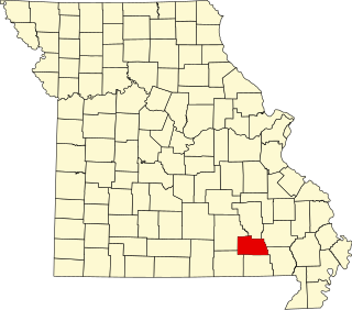
This is a list of the National Register of Historic Places listings in Carter County, Missouri.

National Register of Historic Places listings in Shannon County, Missouri

This is a list of the National Register of Historic Places listings in Shannon County, Missouri.

National Register of Historic Places listings in Holt County, Nebraska

This is a list of the National Register of Historic Places listings in Holt County, Nebraska. It is intended to be a complete list of the properties and districts on the National Register of Historic Places in Holt County, Nebraska, United States. The locations of National Register properties and districts for which the latitude and longitude coordinates are included below, may be seen in an online map.

References

  1. The latitude and longitude information provided in this table was derived originally from the National Register Information System, which has been found to be fairly accurate for about 99% of listings. Some locations in this table may have been corrected to current GPS standards.
  2. National Park Service, United States Department of the Interior, "National Register of Historic Places: Weekly List Actions", retrieved May 27, 2022.
  3. 1 2 Numbers represent an alphabetical ordering by significant words. Various colorings, defined here, differentiate National Historic Landmarks and historic districts from other NRHP buildings, structures, sites or objects.
  4. The eight-digit number below each date is the number assigned to each location in the National Register Information System database, which can be viewed by clicking the number.
  5. Howard, James H. "Known Village Sites of the Ponca". Plains Anthropologist 15.48 (1970): 109-134: 125.
  6. Wood, W. Raymond. "Historical and Archeological Evidence for Arikara Visits to the Central Plains". Plains Anthropologist 4 (1955): 27-39: 34.
  7. "Culture Department". Ponca Tribe of Nebraska. Retrieved 2013-05-28.
  8. The National Park Service announcement has the address as South 5th St. Per the church website, the actual address is West 5th St.
  9. Koertje, Norma."Bloomfield Public Library". Nebraska Library Quarterly. 2000-06-25. Archived 2008-11-21 from original. Retrieved 2010-02-19.