National Register of Historic Places listings in Peoria County, Illinois

Last updated

Location of Peoria County in Illinois Map of Illinois highlighting Peoria County.svg
Location of Peoria County in Illinois

This is a list of the National Register of Historic Places listings in Peoria County, Illinois.

Contents

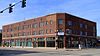
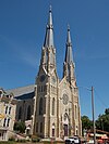
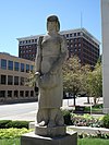
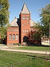
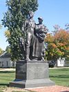
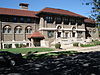
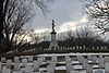
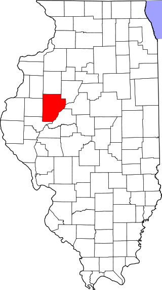
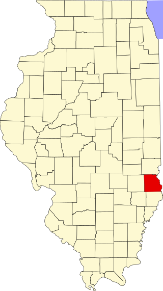
This is intended to be a complete list of the properties and districts on the National Register of Historic Places in Peoria County, Illinois, United States. Latitude and longitude coordinates are provided for many National Register properties and districts; these locations may be seen together in a map. [1]

There are 36 properties and districts listed on the National Register in the county.


    This National Park Service list is complete through NPS recent listings posted April 26, 2024. [2]

Current listings

[3] Name on the RegisterImageDate listed [4] Location City or townDescription
1 Central National Bank Building
Central National Bank Building Central National Bank Building.JPG
Central National Bank Building
December 18, 1978
(#78003450)
103 SW Adams St.
40°41′27″N89°35′20″W / 40.690833°N 89.588889°W / 40.690833; -89.588889 (Central National Bank Building)
Peoria
2 Christ Church of Lower Kickapoo
Christ Church of Lower Kickapoo ChristChurchLimestone.jpg
Christ Church of Lower Kickapoo
February 10, 1983
(#83000333)
West of Norwood on Christ Church Rd.
40°42′25″N89°43′00″W / 40.706944°N 89.716667°W / 40.706944; -89.716667 (Christ Church of Lower Kickapoo)
Norwood
3 Cumberland Presbyterian Church
Cumberland Presbyterian Church Cumberland Presbyterian Church Busey Bank.JPG
Cumberland Presbyterian Church
March 18, 1980
(#80001401)
405 N. Monson St.
40°41′33″N89°35′46″W / 40.6925°N 89.596111°W / 40.6925; -89.596111 (Cumberland Presbyterian Church)
Peoria
4 Downtown Peoria Historic District
Downtown Peoria Historic District Peoria - Downtown from Caterpillar, Courthouse Square, First National Bank and Savings Tower.jpg
Downtown Peoria Historic District
December 10, 2018
(#100002825)
Roughly between N William Kumpf Blvd., Perry Ave., Fulton, Fayette & Water Sts.
40°41′34″N89°35′26″W / 40.6928°N 89.5905°W / 40.6928; -89.5905 (Downtown Peoria Historic District)
Peoria
5 Judge Flanagan Residence
Judge Flanagan Residence John C. Flanagan House.JPG
Judge Flanagan Residence
September 5, 1975
(#75000670)
942 NE Glen Oak Ave.
40°42′14″N89°35′07″W / 40.703889°N 89.585278°W / 40.703889; -89.585278 (Judge Flanagan Residence)
Peoria
6 Judge Jacob Gale House
Judge Jacob Gale House Judge Jacob Gale House.JPG
Judge Jacob Gale House
March 19, 1982
(#82002591)
403 NE Jefferson St.
40°41′46″N89°35′08″W / 40.696111°N 89.585556°W / 40.696111; -89.585556 (Judge Jacob Gale House)
Peoria
7 Grand Army of the Republic Memorial Hall
Grand Army of the Republic Memorial Hall Grand Army Memorial Hall.JPG
Grand Army of the Republic Memorial Hall
July 13, 1976
(#76000723)
416 Hamilton Boulevard
40°41′40″N89°35′21″W / 40.694444°N 89.589167°W / 40.694444; -89.589167 (Grand Army of the Republic Memorial Hall)
Peoria
8 Grand View Drive
Grand View Drive Peoria Grandview Drive 2008.JPG
Grand View Drive
September 27, 1996
(#96000399)
Roughly bounded by N. Prospect Rd., the Illinois River bluffs, Adams St., and the Grand View Dr. W. right of way
40°44′30″N89°33′52″W / 40.741667°N 89.564444°W / 40.741667; -89.564444 (Grand View Drive)
Peoria and Peoria Heights
9 Illinois Waterway Project Office
Illinois Waterway Project Office AERIAL VIEW OF PROJECT OFFICE. LOOKING WEST. - Illinois Waterway, Project Office, 257 Grant Street, Peoria, Peoria County, IL HAER IL-164-C-14.tif
Illinois Waterway Project Office
March 10, 2004
(#04000168)
257 Grant St.
40°42′16″N89°33′58″W / 40.704444°N 89.566111°W / 40.704444; -89.566111 (Illinois Waterway Project Office)
Peoria
10 International Harvester Building
International Harvester Building International Harvester Building Peoria.JPG
International Harvester Building
November 15, 2005
(#05001254)
1301-1309 SW Washington St.
40°40′53″N89°36′14″W / 40.681389°N 89.603889°W / 40.681389; -89.603889 (International Harvester Building)
Peoria
11 Jubilee College
Jubilee College Jubilee College.JPG
Jubilee College
January 4, 1972
(#72000465)
Northwest of Kickapoo on U.S. Route 150 and Interstate 74
40°49′38″N89°46′40″W / 40.827222°N 89.777778°W / 40.827222; -89.777778 (Jubilee College)
Kickapoo
12 Kickapoo Building
Kickapoo Building KickapooBldg.jpg
Kickapoo Building
December 31, 2013
(#13001005)
726 W. Main St.
40°41′48″N89°35′40″W / 40.69673°N 89.594377°W / 40.69673; -89.594377 (Kickapoo Building)
Peoria
13 Lincoln Branch Peoria Public Library
Lincoln Branch Peoria Public Library Image Lincoln Branch Peoria Public Library.jpeg
Lincoln Branch Peoria Public Library
May 28, 2014
(#14000256)
1312 W. Lincoln Ave.
40°40′53″N89°36′52″W / 40.681337°N 89.614528°W / 40.681337; -89.614528 (Lincoln Branch Peoria Public Library)
Peoria Part of the Illinois Carnegie Libraries MPS
14 Madison Theatre
Madison Theatre Madison Theatre.JPG
Madison Theatre
November 21, 1980
(#80001402)
502 Main St.
40°41′39″N89°35′29″W / 40.694167°N 89.591389°W / 40.694167; -89.591389 (Madison Theatre)
Peoria
15 Marquette Apartments
Marquette Apartments Marquette Apartments - Peoria Illinois.jpg
Marquette Apartments
December 27, 2016
(#16000901)
701 Main St.
40°41′45″N89°35′39″W / 40.695756°N 89.594140°W / 40.695756; -89.594140 (Marquette Apartments)
Peoria
16 North Side Historic District
North Side Historic District Cathedral of St. Mary Peoria Illinois.jpg
North Side Historic District
November 21, 1983
(#83003588)
Roughly bounded by Perry, Caroline, Madison, and Fayette Sts.
40°41′57″N89°35′02″W / 40.699167°N 89.583889°W / 40.699167; -89.583889 (North Side Historic District)
Peoria
17 Peace and Harvest
Peace and Harvest Peace and Harvest Harvest.JPG
Peace and Harvest
February 16, 1994
(#87002527)
Northwestern corner of the junction of Main and Jefferson Sts. [5]
40°41′35″N89°35′21″W / 40.693056°N 89.589167°W / 40.693056; -89.589167 (Peace and Harvest)
Peoria
18 Peoria Automobile Club
Peoria Automobile Club Shore Acres Chillicothe IL 17 Feb 13.JPG
Peoria Automobile Club
August 4, 1995
(#95000984)
100 Park Boulevard
40°54′12″N89°29′24″W / 40.903333°N 89.49°W / 40.903333; -89.49 (Peoria Automobile Club)
Chillicothe
19 Peoria City Hall
Peoria City Hall Peoria City Hall.JPG
Peoria City Hall
February 6, 1973
(#73000715)
419 Fulton St.
40°41′32″N89°35′33″W / 40.692222°N 89.5925°W / 40.692222; -89.5925 (Peoria City Hall)
Peoria
20 Peoria Cordage Company
Peoria Cordage Company Peoria Cordage Company Corner View.JPG
Peoria Cordage Company
March 19, 1982
(#82002592)
1506 SW Washington St. [6]
40°40′47″N89°36′19″W / 40.67972°N 89.60527°W / 40.67972; -89.60527 (Peoria Cordage Company)
Peoria
21 Peoria Mineral Springs
Peoria Mineral Springs Image springs no longer open to the public on this property.jpeg
Peoria Mineral Springs
March 5, 1982
(#82002593)
701 W. 7th Ave.
40°41′45″N89°36′18″W / 40.695833°N 89.605°W / 40.695833; -89.605 (Peoria Mineral Springs)
Peoria
22 Peoria State Hospital
Peoria State Hospital Peoria State Hospital.jpg
Peoria State Hospital
February 17, 1982
(#82002590)
Ricketts Ave. near U.S. Route 24
40°38′04″N89°39′32″W / 40.634444°N 89.658889°W / 40.634444; -89.658889 (Peoria State Hospital)
Bartonville
23 Peoria Warehouse Historic District
Peoria Warehouse Historic District Image The Mill, located in Peoria Warehouse District.jpeg
Peoria Warehouse Historic District
September 17, 2014
(#14000621)
Roughly along Adams, May, Oak, Persimmon, State, Walnut & Washington Sts.
40°41′08″N89°35′52″W / 40.685503°N 89.597874°W / 40.685503; -89.597874 (Peoria Warehouse Historic District)
Peoria
24 Peoria Waterworks
Peoria Waterworks Peoria Waterworks Main Building.JPG
Peoria Waterworks
March 18, 1980
(#80001403)
Lorentz Ave.
40°43′28″N89°33′08″W / 40.724444°N 89.552222°W / 40.724444; -89.552222 (Peoria Waterworks)
Peoria
25 Pere Marquette Hotel
Pere Marquette Hotel Pere Marquette Hotel.JPG
Pere Marquette Hotel
August 12, 1982
(#82002594)
501 Main St.
40°41′37″N89°35′31″W / 40.693611°N 89.591944°W / 40.693611; -89.591944 (Pere Marquette Hotel)
Peoria
26 Pettingill-Morron House
Pettingill-Morron House Pettingill-Morron House.JPG
Pettingill-Morron House
April 2, 1976
(#76000724)
1212 W. Moss Ave.
40°41′39″N89°36′41″W / 40.694167°N 89.611389°W / 40.694167; -89.611389 (Pettingill-Morron House)
Peoria Charles Ulricson, architect
27 The Pioneers
The Pioneers Pioneers.jpg
The Pioneers
May 4, 2001
(#01000117)
Central Park, N,. Magnolia St.
40°46′45″N89°58′22″W / 40.779167°N 89.972778°W / 40.779167; -89.972778 (The Pioneers)
Elmwood
28 Pleasant Grove School
Pleasant Grove School 1856 Pleasant Grove School Peoria County 2015.jpg
Pleasant Grove School
May 19, 1994
(#94000435)
0.6 miles west of Eden Rd. on Pleasant Grove Rd.
40°40′41″N89°50′43″W / 40.678056°N 89.845278°W / 40.678056; -89.845278 (Pleasant Grove School)
Eden
29 John C. Proctor Recreation Center
John C. Proctor Recreation Center John C Proctor Recreation Center Peoria.JPG
John C. Proctor Recreation Center
September 6, 1979
(#79000860)
300 S. Allen St.
40°41′07″N89°36′58″W / 40.685278°N 89.616111°W / 40.685278; -89.616111 (John C. Proctor Recreation Center)
Peoria
30 Rock Island Depot and Freight House
Rock Island Depot and Freight House Peoria, IL train station.jpg
Rock Island Depot and Freight House
December 22, 1978
(#78001180)
32 Liberty St.
40°41′17″N89°35′20″W / 40.688056°N 89.588889°W / 40.688056; -89.588889 (Rock Island Depot and Freight House)
Peoria River Station
31 Springdale Cemetery
Springdale Cemetery Springdale Cemetery, Peoria, Illinois.JPG
Springdale Cemetery
December 10, 2004
(#04001303)
3014 N. Prospect Rd.
40°43′24″N89°34′30″W / 40.723445°N 89.575076°W / 40.723445; -89.575076 (Springdale Cemetery)
Peoria
32 U.S. Post Office and Courthouse
U.S. Post Office and Courthouse US Dist C Ill Peoria.jpg
U.S. Post Office and Courthouse
October 24, 2012
(#12000878)
100 NE Monroe St.
40°41′42″N89°35′30″W / 40.69489°N 89.591733°W / 40.69489; -89.591733 (U.S. Post Office and Courthouse)
Peoria
33 Washington C. Wear House
Washington C. Wear House Washington C. wear House.jpg
Washington C. Wear House
August 19, 1993
(#93000838)
1 mile south and 0.4 miles west of the junction of Illinois Routes 90 and 91
40°54′55″N89°45′53″W / 40.915278°N 89.764722°W / 40.915278; -89.764722 (Washington C. Wear House)
Princeville
34 West Bluff Historic District
West Bluff Historic District Francis W Little House I (Modified).jpg
West Bluff Historic District
December 17, 1976
(#76000725)
Randolph, High, and Moss Sts., east of Western St.
40°41′49″N89°36′31″W / 40.696944°N 89.608611°W / 40.696944; -89.608611 (West Bluff Historic District)
Peoria
35 YWCA Building
YWCA Building YWCA Building Peoria IL 9-27-2012 5-19-006.JPG
YWCA Building
May 17, 2007
(#07000147)
301 NE Jefferson
40°41′40″N89°35′16″W / 40.694444°N 89.587778°W / 40.694444; -89.587778 (YWCA Building)
Peoria
36 Zion Episcopal Church April 15, 2024
(#100010213)
205 East Van Buren Street
40°50′16″N89°52′58″W / 40.8377°N 89.8827°W / 40.8377; -89.8827 (Zion Episcopal Church)
Brimfield

See also

Related Research Articles

<span class="mw-page-title-main">National Register of Historic Places listings in Adams County, Illinois</span>

This is a list of the National Register of Historic Places listings in Adams County, Illinois.

<span class="mw-page-title-main">National Register of Historic Places listings in Whiteside County, Illinois</span>

This is a list of the National Register of Historic Places listings in Whiteside County, Illinois.

<span class="mw-page-title-main">National Register of Historic Places listings in Fulton County, Illinois</span>

This is a list of the National Register of Historic Places listings in Fulton County, Illinois.

<span class="mw-page-title-main">National Register of Historic Places listings in Madison County, Illinois</span>

This is a list of the National Register of Historic Places listings in Madison County, Illinois.

<span class="mw-page-title-main">National Register of Historic Places listings in LaSalle County, Illinois</span>

This is a list of the National Register of Historic Places listings in LaSalle County, Illinois.

<span class="mw-page-title-main">National Register of Historic Places listings in Jersey County, Illinois</span>

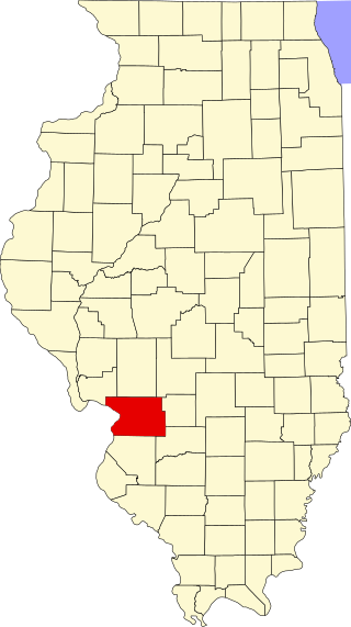
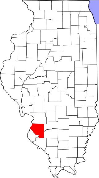
This is a list of the National Register of Historic Places listings in Jersey County, Illinois.

<span class="mw-page-title-main">National Register of Historic Places listings in Pike County, Illinois</span>

This is a list of the National Register of Historic Places listings in Pike County, Illinois.

<span class="mw-page-title-main">National Register of Historic Places listings in Randolph County, Illinois</span>

This is a list of the National Register of Historic Places listings in Randolph County, Illinois.

<span class="mw-page-title-main">National Register of Historic Places listings in St. Clair County, Illinois</span>

This is a list of the National Register of Historic Places listings in St. Clair County, Illinois.

<span class="mw-page-title-main">National Register of Historic Places listings in Greene County, Illinois</span>

This is a list of the National Register of Historic Places listings in Greene County, Illinois.

<span class="mw-page-title-main">National Register of Historic Places listings in Jackson County, Illinois</span>

This is a list of the National Register of Historic Places listings in Jackson County, Illinois.

<span class="mw-page-title-main">National Register of Historic Places listings in Kankakee County, Illinois</span>

This is a list of the National Register of Historic Places listings in Kankakee County, Illinois.

<span class="mw-page-title-main">National Register of Historic Places listings in Kendall County, Illinois</span>

This is a list of the National Register of Historic Places listings in Kendall County, Illinois.

<span class="mw-page-title-main">National Register of Historic Places listings in White County, Illinois</span>

This is a list of the National Register of Historic Places listings in White County, Illinois.

<span class="mw-page-title-main">National Register of Historic Places listings in Monroe County, Illinois</span>

This is a list of the National Register of Historic Places listings in Monroe County, Illinois.

<span class="mw-page-title-main">National Register of Historic Places listings in Alexander County, Illinois</span>

This is a list of the National Register of Historic Places listings in Alexander County, Illinois.

<span class="mw-page-title-main">National Register of Historic Places listings in Gallatin County, Illinois</span>

This is a list of the National Register of Historic Places listings in Gallatin County, Illinois.

<span class="mw-page-title-main">National Register of Historic Places listings in Edgar County, Illinois</span>

This is a list of the National Register of Historic Places listings in Edgar County, Illinois.

<span class="mw-page-title-main">National Register of Historic Places listings in Crawford County, Illinois</span>

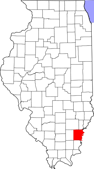
This is a list of the National Register of Historic Places listings in Crawford County, Illinois.

<span class="mw-page-title-main">National Register of Historic Places listings in Calhoun County, Illinois</span>

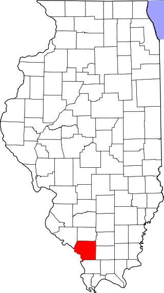
This is a list of the National Register of Historic Places listings in Calhoun County, Illinois.

References

  1. The latitude and longitude information provided in this table was derived originally from the National Register Information System, which has been found to be fairly accurate for about 99% of listings. Some locations in this table may have been corrected to current GPS standards.
  2. National Park Service, United States Department of the Interior, "National Register of Historic Places: Weekly List Actions", retrieved April 26, 2024.
  3. Numbers represent an alphabetical ordering by significant words. Various colorings, defined here, differentiate National Historic Landmarks and historic districts from other NRHP buildings, structures, sites or objects.
  4. The eight-digit number below each date is the number assigned to each location in the National Register Information System database, which can be viewed by clicking the number.
  5. Sunderland, Glenn W. National Register of Historic Places Inventory/Nomination: Peace and Harvest . National Park Service, 1993-07-28, 1.
  6. Kenyon, Leslie H., and Larry D. Davis. National Register of Historic Places Inventory/Nomination: Peoria Cordage Company. National Park Service, 1981-04-14, 1.